Crouchie Wood

Wood, Forest in Roxburghshire

Scotland

Crouchie Wood

Footpath  coming  out  of  Natural  Wood  onto  farmland The footpath then becomes a track to fields. Looking toward Hunthill Farm
Footpath coming out of Natural Wood onto farmland Credit: Martin Dawes

Crouchie Wood is a dense forest located in Roxburghshire, a historic county in the Scottish Borders region of Scotland. This picturesque woodland covers a vast area and offers a serene and tranquil environment for nature enthusiasts and outdoor adventurers alike.

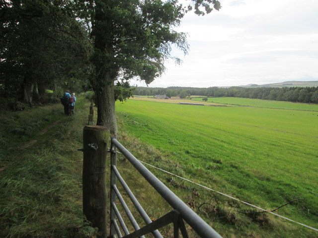
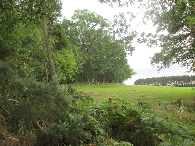
The forest is home to a diverse range of plant and animal species, making it a haven for wildlife lovers. The towering trees, including oak, beech, and pine, create a dense canopy that provides shelter for numerous bird species, such as woodpeckers, owls, and various songbirds. Visitors can often spot roe deer, squirrels, and rabbits roaming freely among the undergrowth.

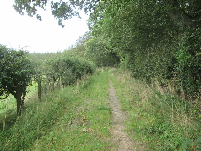
Crouchie Wood offers various walking trails that wind their way through the enchanting forest, allowing visitors to immerse themselves in its natural beauty. These paths cater to all levels of fitness and provide an opportunity to explore the different habitats within the woodland. As visitors venture deeper into the forest, they will discover babbling brooks, hidden glens, and breathtaking viewpoints from which they can admire the surrounding countryside.

The forest is also a popular destination for outdoor activities such as cycling and horseback riding. Its extensive network of paths and bridleways provides an excellent opportunity for riders to explore the forest on horseback or for cyclists to test their skills on the various terrains.

Crouchie Wood is easily accessible, with ample parking available nearby. It is a cherished natural gem in Roxburghshire, offering a peaceful retreat for those seeking solace in nature's embrace.

If you have any feedback on the listing, please let us know in the comments section below.

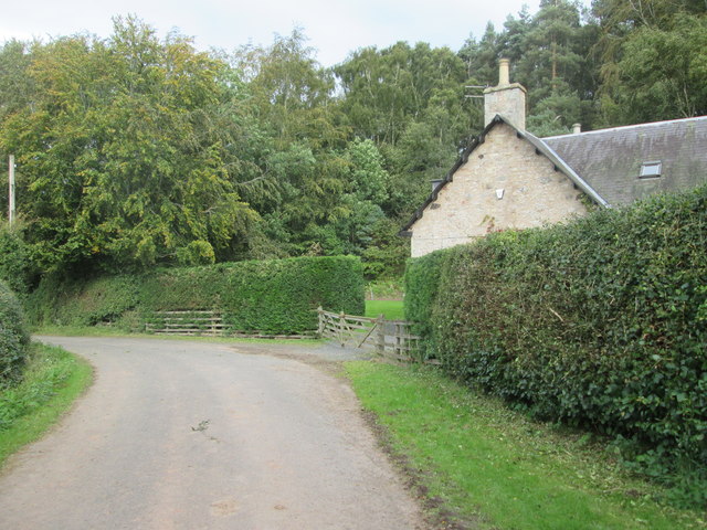
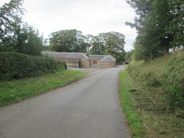
Crouchie Wood Images

Images are sourced within 2km of 55.482287/-2.5228005 or Grid Reference NT6721. Thanks to Geograph Open Source API. All images are credited.

Footpath  coming  out  of  Natural  Wood  onto  farmland The footpath then becomes a track to fields. Looking toward Hunthill Farm
Footpath coming out of Natural Wood onto farmland
The footpath then becomes a track to fields. Looking toward Hunthill Farm
Field  and  edge  of  Natural  Wood
Field and edge of Natural Wood
Footpath  back  into  Natural  Wood
Footpath back into Natural Wood
Over  field  to  Hunthill  Farm From track from Natural Wood
Over field to Hunthill Farm
From track from Natural Wood
Lane  and  Coach  House The footpath from Hunthill through the woods comes out on to the lane here
Lane and Coach House
The footpath from Hunthill through the woods comes out on to the lane here
Howden  Farm  buildings  alongside  road
Howden Farm buildings alongside road
Stripwood, Howden A long strip between Howden and Hunthill. A track runs down this one.
Stripwood, Howden
A long strip between Howden and Hunthill. A track runs down this one.
Hilltop arable Ormistonleys Strip runs to the right of a field growing winter cereals. The land here is quite high, over 200m and there is evidence of small scale coal mining here. Often altitude and coal measures is a combination which leads to very poor farmland, but not here.
Hilltop arable
Ormistonleys Strip runs to the right of a field growing winter cereals. The land here is quite high, over 200m and there is evidence of small scale coal mining here. Often altitude and coal measures is a combination which leads to very poor farmland, but not here.
Stripwood, Hunthill A beech wood beside a minor road. The fence surrounds a covered reservoir.
Stripwood, Hunthill
A beech wood beside a minor road. The fence surrounds a covered reservoir.
On the road near Howden farm The country lane to Scraesburgh on the E side of Jedburgh on a November morning.
On the road near Howden farm
The country lane to Scraesburgh on the E side of Jedburgh on a November morning.
Woodland path, Howden The path goes to the drive at Hunthill and is part of the Jedburgh East Circular walk.
Woodland path, Howden
The path goes to the drive at Hunthill and is part of the Jedburgh East Circular walk.
Path below Hunthill The path here crosses the Howden Burn which is little more than a field drain at this point, but increases in size as it flows round NE to turn SW and eventually join the Jed Water.
Path below Hunthill
The path here crosses the Howden Burn which is little more than a field drain at this point, but increases in size as it flows round NE to turn SW and eventually join the Jed Water.
Hunthill Farm Often farms in Scotland are known just by their name without 'Farm' being added, but in this case the word is included, since Hunthill (the estate house) is nearby.
Hunthill Farm
Often farms in Scotland are known just by their name without 'Farm' being added, but in this case the word is included, since Hunthill (the estate house) is nearby.
Lion gatepost, Hunthill One of two stone lions rampant surmounting gateposts on the drive to Hunthill.  Each is holding a shield bearing arms - this is the one on the E side.
Lion gatepost, Hunthill
One of two stone lions rampant surmounting gateposts on the drive to Hunthill. Each is holding a shield bearing arms - this is the one on the E side.
Lion gatepost, Hunthill (2) One of two stone lions rampant surmounting gateposts on the drive to Hunthill.  Each is holding a shield bearing arms - this is the one on the W side.
Lion gatepost, Hunthill (2)
One of two stone lions rampant surmounting gateposts on the drive to Hunthill. Each is holding a shield bearing arms - this is the one on the W side.
Track in Natural Wood Natural Wood lies between Hunthill and Over Thickside Farm in an area of woodlands and strip woods amongst the arable fields and pastures. The track is on the route of the Jedburgh East Circular walk and gave quite soft going in places on the wet ground.
Track in Natural Wood
Natural Wood lies between Hunthill and Over Thickside Farm in an area of woodlands and strip woods amongst the arable fields and pastures. The track is on the route of the Jedburgh East Circular walk and gave quite soft going in places on the wet ground.
Barley, near Netherwells
Service station on Edinburgh Road (A68), Jedburgh
Show me another place!

Crouchie Wood is located at Grid Ref: NT6721 (Lat: 55.482287, Lng: -2.5228005)

Unitary Authority: The Scottish Borders

Police Authority: The Lothians and Scottish Borders

What 3 Words

///ethic.tactical.cobble. Near Jedburgh, Scottish Borders

Related Wikis

Hartrigge House

Hartrigge House or Stewartfield House was a country house in Jedburgh in the Scottish Borders. Its first owner was in 1614 and it was rebuilt in 1854....

Jedburgh railway station

Jedburgh railway station served the town of Jedburgh, Scottish Borders, Scotland from 1856 to 1964 on the Jedburgh Railway. == History == The station opened...

Jedburgh

Jedburgh (; Scottish Gaelic: Deadard; Scots: Jeddart or Jethart) is a town and former royal burgh in the Scottish Borders and the traditional county town...

Canongate Bridge

The Canongate Bridge is a pedestrian bridge in the Scottish Borders town of Jedburgh. It was built as the town's main bridge over the Jed Water in the...

Nearby Amenities

Located within 500m of 55.482287,-2.5228005
The data included in this document is from www.openstreetmap.org. The data is made available under ODbL.

Have you been to Crouchie Wood?

Leave your review of Crouchie Wood below (or comments, questions and feedback).