Brankinentum Wood

Wood, Forest in Aberdeenshire

Scotland

Brankinentum Wood

Clyan's dam - Reflections
Clyan's dam - Reflections Credit: Doug Mortimer

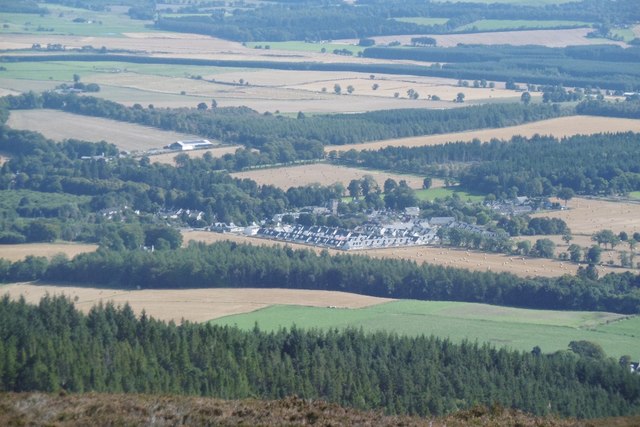
Brankinentum Wood is a picturesque woodland located in Aberdeenshire, Scotland. Situated near the small village of Brankinentum, this woodland covers an expansive area of approximately 500 acres. The wood is renowned for its natural beauty and diverse range of flora and fauna.

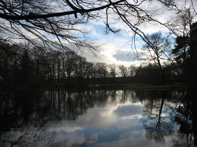
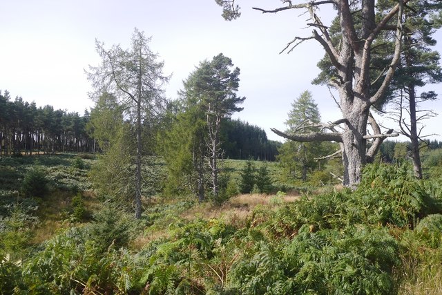
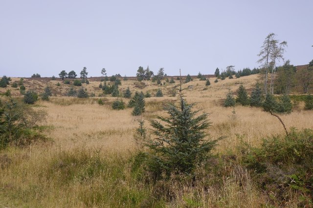
The wood is predominantly made up of native Scottish trees, including oak, birch, and pine, which create a stunning canopy that provides shade and a peaceful atmosphere. The forest floor is covered in a lush carpet of ferns, mosses, and wildflowers, adding to the enchanting ambiance of the wood.

Brankinentum Wood is home to an array of wildlife, making it a haven for nature enthusiasts. Visitors may spot red squirrels, roe deer, and a variety of bird species, including woodpeckers and owls. The wood also boasts a small stream that meanders through its heart, providing a habitat for amphibians such as frogs and newts.

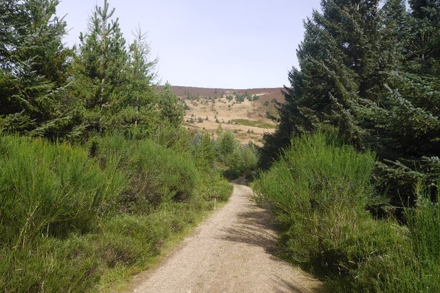
For those who enjoy outdoor activities, Brankinentum Wood offers several walking trails that wind through its enchanting landscape. These trails are well-maintained and suitable for all levels of fitness, providing an opportunity to explore the wood's hidden gems and discover its natural wonders.

The wood is open to the public year-round, providing visitors with the chance to experience the changing seasons and the breathtaking beauty they bring. Whether it be a leisurely stroll, a picnic amidst nature, or a wildlife-spotting adventure, Brankinentum Wood offers a tranquil escape from the hustle and bustle of everyday life.

If you have any feedback on the listing, please let us know in the comments section below.

Brankinentum Wood Images

Images are sourced within 2km of 57.228028/-2.5558882 or Grid Reference NJ6615. Thanks to Geograph Open Source API. All images are credited.

Clyan's dam - Reflections
14 and 15 Monymusk Square Terraced cottages facing the village green at Monymusk.  They were built around 1840 and the mock-Tudor gables were added around 1890.
14 and 15 Monymusk Square
Terraced cottages facing the village green at Monymusk. They were built around 1840 and the mock-Tudor gables were added around 1890.
Monymusk war memorial... ...at the centre of the village green.  This side of the monument lists the 11 men who fell in World War II.  In the right background is the A-listed Monymusk Parish Church.
Monymusk war memorial...
...at the centre of the village green. This side of the monument lists the 11 men who fell in World War II. In the right background is the A-listed Monymusk Parish Church.
Pitfichie Castle
Pitfichie Castle
Logging road, Pitfichie Forest The road runs the length of the forest and is waymarked as the "white" route. The full route runs around Cairn William.
Logging road, Pitfichie Forest
The road runs the length of the forest and is waymarked as the "white" route. The full route runs around Cairn William.
Pitfichie Forest The road runs along the eastern side of the woodland and goes up and down a bit.  The view is through an area of young trees towards Green Hill.
Pitfichie Forest
The road runs along the eastern side of the woodland and goes up and down a bit. The view is through an area of young trees towards Green Hill.
Logging road, Pitfichie Forest An older pine, perhaps from a time when Bogmore was a less formal woodland with scattered trees and moorland.
Logging road, Pitfichie Forest
An older pine, perhaps from a time when Bogmore was a less formal woodland with scattered trees and moorland.
Bogmore Land around the Pitmunie Burn has not been formally replanted.  There are still some old pines here.
Bogmore
Land around the Pitmunie Burn has not been formally replanted. There are still some old pines here.
Scots pines, Pitfichie Forest Eastern slopes of Cairn William.
Scots pines, Pitfichie Forest
Eastern slopes of Cairn William.
Cleared area, Pitfichie Forest Self seeded spruce dot a hillside which has been clear felled and left.
Cleared area, Pitfichie Forest
Self seeded spruce dot a hillside which has been clear felled and left.
Logging road, Pitfichie Forest Climbing to the col south of Cairn William. The view down the hill is towards a dun slope where there has been some clear felling in the past.
Logging road, Pitfichie Forest
Climbing to the col south of Cairn William. The view down the hill is towards a dun slope where there has been some clear felling in the past.
Col, Cairn William A view over to Millstone Hill and Mither Tap on Benachie from the mountain bike path on Cairn William.
Col, Cairn William
A view over to Millstone Hill and Mither Tap on Benachie from the mountain bike path on Cairn William.
Mountain bike track, Cairn William The path, used by bikes in ascent so fine to walk along too, uses granite bedrock and boulders for trail features.
Mountain bike track, Cairn William
The path, used by bikes in ascent so fine to walk along too, uses granite bedrock and boulders for trail features.
Cairn William There is a lot of exposed granite near the summit of Cairn William. It is used by a mountain bike track along the ridge.
Cairn William
There is a lot of exposed granite near the summit of Cairn William. It is used by a mountain bike track along the ridge.
Summit, Cairn William Bare granite and a triangulation pillar. The views are very fine.
Summit, Cairn William
Bare granite and a triangulation pillar. The views are very fine.
Path off Cairn William The tape banners mark the route for a hill race which was held from Monymusk later in the day.
Path off Cairn William
The tape banners mark the route for a hill race which was held from Monymusk later in the day.
Summit, Cairn William View past the triangulation pillar towards Mither Tap on Benachie.
Summit, Cairn William
View past the triangulation pillar towards Mither Tap on Benachie.
Monymusk The village, with new houses mirroring the 19th century developments, seen from the summit of Cairn William.
Monymusk
The village, with new houses mirroring the 19th century developments, seen from the summit of Cairn William.
Show me another place!

Brankinentum Wood is located at Grid Ref: NJ6615 (Lat: 57.228028, Lng: -2.5558882)

Unitary Authority: Aberdeenshire

Police Authority: North East

What 3 Words

///tides.wins.overcomes. Near Sauchen, Aberdeenshire

Nearby Locations

Brankinentum Wood Pitmunie

Related Wikis

Nearby Amenities

Located within 500m of 57.228028,-2.5558882
Power: pole
Lat/Long: 57.2244693/-2.551661
Power: pole
Lat/Long: 57.224356/-2.55287
Power: pole
Lat/Long: 57.2242427/-2.5541217
Power: pole
Lat/Long: 57.224134/-2.5553478
Power: pole
Lat/Long: 57.2242045/-2.5564457
Power: pole
Lat/Long: 57.2242785/-2.5575522
Power: pole
Lat/Long: 57.2243479/-2.5586288
Power: pole
Lat/Long: 57.2244277/-2.5596968
Power: pole
Lat/Long: 57.2244959/-2.5607648
Power: pole
Lat/Long: 57.2305344/-2.5497482
Power: pole
Lat/Long: 57.2304545/-2.5508579
The data included in this document is from www.openstreetmap.org. The data is made available under ODbL.

Have you been to Brankinentum Wood?

Leave your review of Brankinentum Wood below (or comments, questions and feedback).