Chapel

Settlement in Fife

Scotland

Chapel

Trigpoint, Keir Brae
Trigpoint, Keir Brae Credit: Becky Williamson

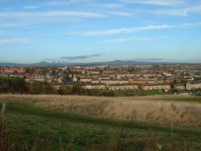
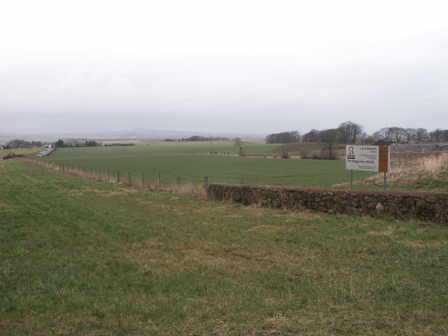
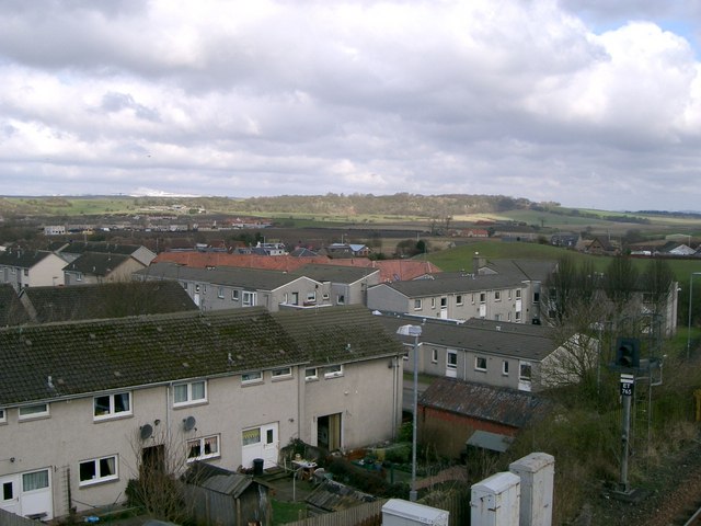
Chapel is a small village located in the northeastern part of Fife, Scotland. Situated approximately 5 miles northwest of the town of Cupar, Chapel is nestled amidst the picturesque countryside of the region. The village is surrounded by rolling hills, lush green fields, and charming farmland, offering residents and visitors a tranquil and idyllic setting.

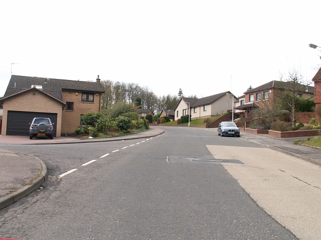
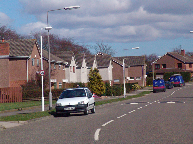
Chapel is a close-knit community with a population of around 500 people. The village is known for its friendly and welcoming atmosphere, providing a peaceful and safe environment for its inhabitants. The residents of Chapel take great pride in their village, and its well-maintained streets and gardens reflect this sense of community spirit.

In terms of amenities, Chapel offers a range of facilities to cater to the needs of its residents. These include a local primary school, a village hall, and a post office. The village also has a small convenience store, ensuring that daily essentials are easily accessible to the local population.

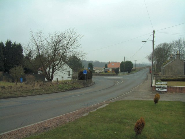
For outdoor enthusiasts, Chapel is an excellent base to explore the beautiful surrounding countryside. The village is surrounded by numerous walking and cycling trails, offering breathtaking views of the Fife countryside. Additionally, the nearby Lomond Hills Regional Park provides ample opportunities for outdoor activities such as hiking, birdwatching, and picnicking.

Overall, Chapel is a charming and peaceful village that offers residents a high quality of life amidst the stunning natural beauty of Fife.

If you have any feedback on the listing, please let us know in the comments section below.
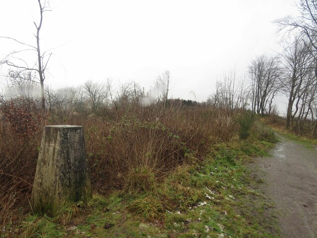
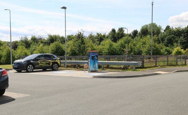
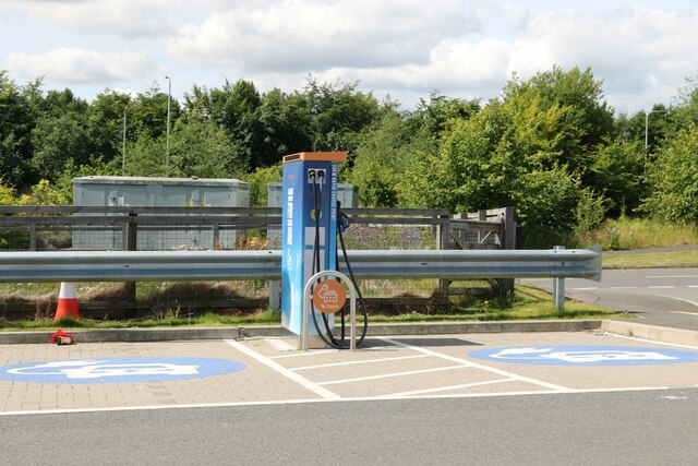
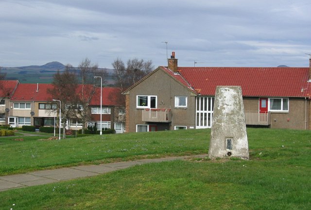
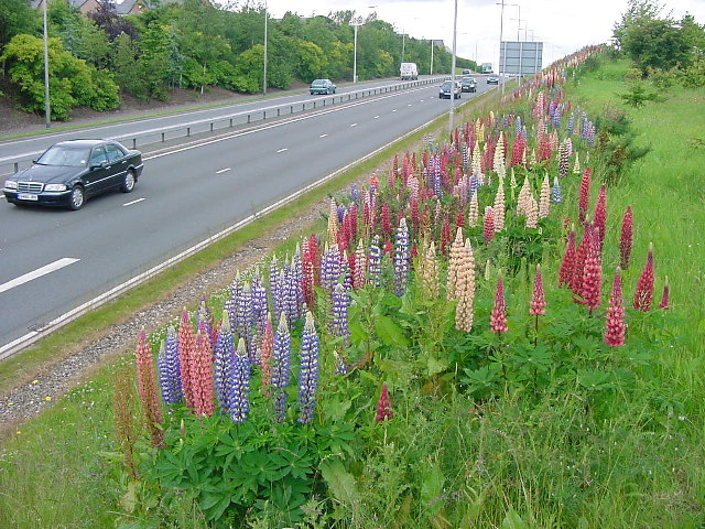
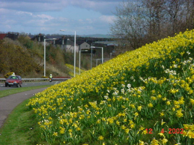
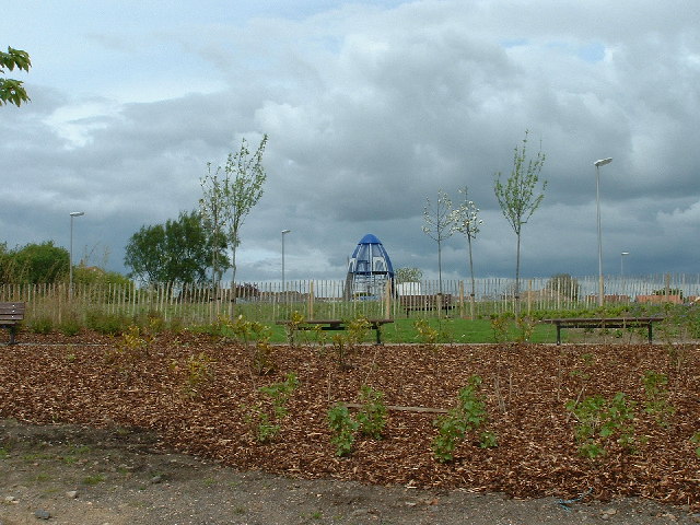
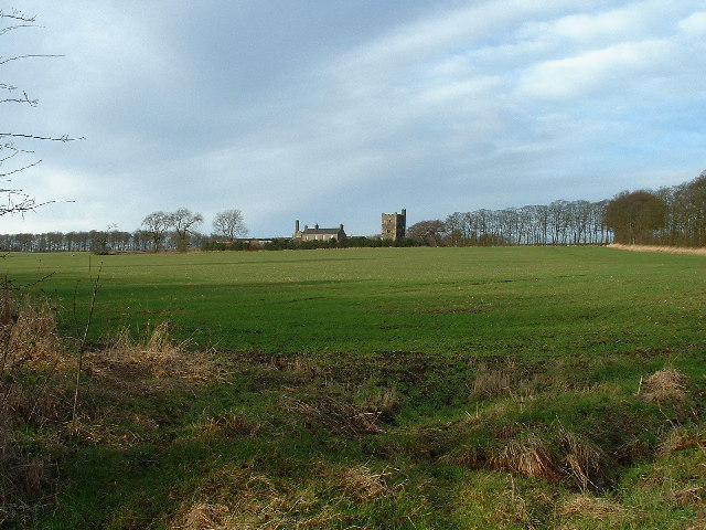
Chapel Images

Images are sourced within 2km of 56.131576/-3.2050758 or Grid Reference NT2593. Thanks to Geograph Open Source API. All images are credited.

Trigpoint, Keir Brae
Electric vehicle charging point In the car park of the Spiral Weave, Kirkcaldy. This one also offers an airline for inflating tyres.
The vehicle with 'St Andrews Shuttle' on its side is an airport taxi.
Electric vehicle charging point
In the car park of the Spiral Weave, Kirkcaldy. This one also offers an airline for inflating tyres. The vehicle with 'St Andrews Shuttle' on its side is an airport taxi.
Electric vehicle charging point In the car park of the Spiral Weave, Kirkcaldy. This one also offers an airline for inflating tyres.
Electric vehicle charging point
In the car park of the Spiral Weave, Kirkcaldy. This one also offers an airline for inflating tyres.
Chapel, Kirkcaldy Once this was Bogie Mains farm, that's when the pillar would have been built. It survived the big housing expansion on the north west of Kirkcaldy and now sits on its hill top just by a bus stop.
Chapel, Kirkcaldy
Once this was Bogie Mains farm, that's when the pillar would have been built. It survived the big housing expansion on the north west of Kirkcaldy and now sits on its hill top just by a bus stop.
Kirkcaldy : Chapel : A910: Lupins flowering The second season of the lupins flowering. These were planted as part of the road dualling. They provide a burst of colour during June. It will be interesting to see how long they flower and if they naturalise.
Kirkcaldy : Chapel : A910: Lupins flowering
The second season of the lupins flowering. These were planted as part of the road dualling. They provide a burst of colour during June. It will be interesting to see how long they flower and if they naturalise.
Kirkcaldy : Wester Bogie Road : Daffodils 300,000 daffodils in full bloom, planted in November 2001. Planted at a density of 30 bulbs per metre square, to give this intense effect.
Kirkcaldy : Wester Bogie Road : Daffodils
300,000 daffodils in full bloom, planted in November 2001. Planted at a density of 30 bulbs per metre square, to give this intense effect.
Kirkcaldy : Templehall Millennium Park A new community park created by  the efforts of the local community. On the site of Kirkcaldy High School part of the site was sold off for housing. The park includes a wildlife garden, a fruit garden (the trees in the picture are apple) and a play area with climbing structure.
Kirkcaldy : Templehall Millennium Park
A new community park created by the efforts of the local community. On the site of Kirkcaldy High School part of the site was sold off for housing. The park includes a wildlife garden, a fruit garden (the trees in the picture are apple) and a play area with climbing structure.
Kirkcaldy : Torbain Farm from Torbain Road looking towards the Tower at the Farm. The Tower is a schedule B listed monument.
Kirkcaldy : Torbain Farm
from Torbain Road looking towards the Tower at the Farm. The Tower is a schedule B listed monument.
Kirkcaldy: Rabbit Braes from Bennochy Road, looking over the big field at Rabbit Braes, to Templehall and the Lomond Hills in the background. Kirkcaldy like this part of Fife is a series of hill ridges, the underlying rock is old red sandstone. The fields here are remnant of the Bogie Mains Farm.
Kirkcaldy: Rabbit Braes
from Bennochy Road, looking over the big field at Rabbit Braes, to Templehall and the Lomond Hills in the background. Kirkcaldy like this part of Fife is a series of hill ridges, the underlying rock is old red sandstone. The fields here are remnant of the Bogie Mains Farm.
Dunvegan Ave by Raith Modern housing on the former grounds of the old Raith House.
Dunvegan Ave by Raith
Modern housing on the former grounds of the old Raith House.
Dothan Farm Viewed from the north
Dothan Farm
Viewed from the north
Clunie roundabout Mini roundabout at Clunie road junction, viewed from the south
Clunie roundabout
Mini roundabout at Clunie road junction, viewed from the south
The Begg Farm OCCS Looking east from near Dothan Farm, The Begg Farm is not really a farm anymore but an open cast coal pit.  <span class="nowrap"><a title="http://www.ihbrown.com/CoalMining.aspx" rel="nofollow ugc noopener" href="http://www.ihbrown.com/CoalMining.aspx">Link</a><img style="margin-left:2px;" alt="External link" title="External link - shift click to open in new window" src="https://s1.geograph.org.uk/img/external.png" width="10" height="10"/></span>
The Begg Farm OCCS
Looking east from near Dothan Farm, The Begg Farm is not really a farm anymore but an open cast coal pit. LinkExternal link
Duddingston Drive Duddingston Drive on the Dunnikier estate. All the streets are named after golf courses.
Duddingston Drive
Duddingston Drive on the Dunnikier estate. All the streets are named after golf courses.
Field and trees A view across the square showing that it covers both forestry and arable land.
Field and trees
A view across the square showing that it covers both forestry and arable land.
The road to Raith To Bankhead of Raith, that is, not to the Raith Rovers' football stadium.
The road to Raith
To Bankhead of Raith, that is, not to the Raith Rovers' football stadium.
Access road This is the access road to the extensive open cast coal mine which occupies most of this grid square. The Begg Farm is on the top right of the picture.<a href="https://www.geograph.org.uk/photo/142736">NT2494 : The Begg Farm OCCS</a>
Access road
This is the access road to the extensive open cast coal mine which occupies most of this grid square. The Begg Farm is on the top right of the picture.NT2494 : The Begg Farm OCCS
Old quarry in the woods These woods run parallel to the A92 and just a few hundred metres away. A pleasant short walk. This is an old quarry now overgrown with trees.
Old quarry in the woods
These woods run parallel to the A92 and just a few hundred metres away. A pleasant short walk. This is an old quarry now overgrown with trees.
Show me another place!

Chapel is located at Grid Ref: NT2593 (Lat: 56.131576, Lng: -3.2050758)

Unitary Authority: Fife

Police Authority: Fife

What 3 Words

///date.exam.diplomas. Near Kirkcaldy, Fife

Nearby Locations

Chapel Newliston

Related Wikis

A921 road

The A921 road is a road that connects Kirkcaldy with the M90 motorway in Fife, Scotland. Before 1990, the road was classed as the A92. == References ==

Battle of Raith

The Battle of Raith was the theory of E. W. B. Nicholson, librarian at the Bodleian Library, Oxford. He was aware of the poem Y Gododdin in the Book of...

Kirkcaldy High School

Kirkcaldy High School is a 6-year co-educational comprehensive state school in Kirkcaldy, Fife, Scotland. == History == The school was established in 1582...

Cardenden

Cardenden ( ) is a Scottish town located on the south bank of the River Ore in the parish of Auchterderran, Fife. It is approximately four miles (six kilometres...

Nearby Amenities

Located within 500m of 56.131576,-3.2050758
Crossing
Crossing: traffic_signals
Crossing Island: no
Tactile Paving: yes
Lat/Long: 56.1329305/-3.2041262
Turning Circle
Lat/Long: 56.1348526/-3.2085814
Turning Circle
Lat/Long: 56.1340304/-3.2090751
Chapel
Is In: Kirkcaldy
Place: suburb
Lat/Long: 56.1318589/-3.2070517
Traffic Calming: cushion
Lat/Long: 56.1286841/-3.2015819
Crossing
Crossing: zebra
Tactile Paving: no
Lat/Long: 56.1346824/-3.1993484
Crossing
Button Operated: yes
Crossing: traffic_signals
Crossing Ref: toucan
Kerb: flush
Tactile Paving: yes
Traffic Signals Sound: yes
Lat/Long: 56.1332288/-3.2013111
Crossing
Crossing: traffic_signals
Crossing Ref: toucan
Kerb: flush
Tactile Paving: yes
Lat/Long: 56.1333289/-3.2011908
Bus Stop
John Smith Business Park
Bus: yes
Naptan AtcoCode: 6500K1545
Naptan Bearing: W
Naptan CommonName: John Smith Business Park
Naptan Indicator: opp
Naptan Landmark: MGT
Naptan NaptanCode: 34347263
Naptan Street: John Smith Business Park
Public Transport: platform
Ref: 34347263
Lat/Long: 56.136046/-3.2051217
Bus Stop
Sainsburys
Bench: no
Bin: no
Bus: yes
Lit: yes
Naptan AtcoCode: 6500K1069
Naptan Bearing: W
Naptan CommonName: Sainsburys
Naptan Indicator: opp
Naptan Landmark: Sainsburys
Naptan NaptanCode: 34327272
Naptan Street: Chapel Level
Public Transport: platform
Ref: 34327272
Shelter: no
Tactile Paving: no
Lat/Long: 56.1332147/-3.1985272
Bus Stop
Fife Central Retail Park
Bench: yes
Bus: yes
Naptan AtcoCode: 6500K1564
Naptan Bearing: E
Naptan CommonName: Fife Central Retail Park
Naptan Indicator: Eastbound
Naptan Landmark: Next
Naptan NaptanCode: 34347273
Naptan Street: Fife Central Retail Park
Public Transport: platform
Ref: 34347273
Shelter: yes
Lat/Long: 56.1344321/-3.2004207
Crossing
Crossing: marked
Lat/Long: 56.1344368/-3.1992777
Mini Roundabout
Lat/Long: 56.1345118/-3.1996298
Bus Stop
Chapel Roundabout
Bench: yes
Bin: yes
Bus: yes
Lit: yes
Naptan AtcoCode: 6500K1034
Naptan Bearing: E
Naptan CommonName: Chapel Roundabout
Naptan Indicator: Adj
Naptan Landmark: Chapel Roundabout
Naptan NaptanCode: 34327282
Naptan Street: Chapel Level
Public Transport: platform
Ref: 34327282
Shelter: yes
Tactile Paving: no
Lat/Long: 56.1334201/-3.2019963
Bus Stop
Chapel Turning Circle
Naptan AtcoCode: 6500K0001
Naptan Bearing: S
Naptan CommonName: Chapel Turning Circle
Naptan Indicator: adj
Naptan Landmark: Chapel Village
Naptan NaptanCode: 34327278
Naptan Street: Chapel Place
Ref: 34327278
Shelter: yes
Lat/Long: 56.1331144/-3.2054509
Crossing
Crossing: uncontrolled
Crossing Island: no
Crossing Ref: zebra
Tactile Paving: yes
Lat/Long: 56.1283882/-3.200314
Bus Stop
Tummel Drive
Bench: yes
Naptan AtcoCode: 6500K0036
Naptan Bearing: E
Naptan CommonName: Tummel Drive
Naptan Indicator: adj 113
Naptan Landmark: House No. 113
Naptan NaptanCode: 34327239
Naptan Street: Tummel Drive
Ref: 34327239
Shelter: yes
Lat/Long: 56.1321501/-3.19785
Bus Stop
Broom Gardens
Bench: no
Bus: yes
Naptan AtcoCode: 6500K0039
Naptan Bearing: N
Naptan CommonName: Broom Gardens
Naptan Indicator: adj
Naptan Landmark: Broom Gardens
Naptan NaptanCode: 34327264
Naptan Street: Broom Road
Public Transport: platform
Ref: 34327264
Shelter: no
Lat/Long: 56.1326266/-3.2004281
Bus Stop
Broom Gardens
Bench: no
Bus: yes
Check Date Shelter: 2022-06-23
Naptan AtcoCode: 6500K0038
Naptan Bearing: S
Naptan CommonName: Broom Gardens
Naptan Indicator: opp
Naptan Landmark: Broom Gardens
Naptan NaptanCode: 34327254
Naptan Street: Broom Road
Public Transport: platform
Ref: 34327254
Shelter: no
Lat/Long: 56.1325527/-3.2002647
Bus Stop
Chapel Roundabout
Bench: yes
Bus: yes
Naptan AtcoCode: 6500K1033
Naptan Bearing: W
Naptan CommonName: Chapel Roundabout
Naptan Indicator: Opp
Naptan Landmark: Chapel Roundabout
Naptan NaptanCode: 34327276
Naptan Street: Chapel Level
Public Transport: platform
Ref: 34327276
Shelter: yes
Lat/Long: 56.1331976/-3.2018602
Recycling
Recycling Type: container
Lat/Long: 56.1306907/-3.2050853
Traffic Calming: cushion
Lat/Long: 56.129444/-3.2071457
Bicycle Parking
Bicycle Parking: stands
Capacity: 8
Covered: yes
Lat/Long: 56.1345228/-3.2021245
Crossing
Crossing: marked
Lat/Long: 56.1348721/-3.200955
Bensons for Beds
Brand: Bensons for Beds
Brand Wikidata: Q4890299
Shop: bed
Lat/Long: 56.1349205/-3.2020756
Shop: vacant
Lat/Long: 56.134939/-3.201738
Wren Kitchens
Brand: Wren Kitchens
Brand Wikidata: Q8037744
Brand Wikipedia: en:Wren Kitchens
Contact Website: https://www.wrenkitchens.com/showrooms/kirkcaldy
Shop: kitchen
Lat/Long: 56.1349516/-3.2013861
Sofology
Brand: Sofology
Brand Wikidata: Q5014159
Shop: furniture
Website: https://www.sofology.co.uk/stores/kirkcaldy
Lat/Long: 56.1349808/-3.2009621
Power: pole
Lat/Long: 56.1308749/-3.2127156
Crossing
Crossing: marked
Lat/Long: 56.1343518/-3.1996031
Telephone
Booth: KX100
Covered: booth
Operator: BT
Lat/Long: 56.1320325/-3.1971574
Post Box
Collection Times: Mo-Fr 09:00; Sa 07:00
Operator: Royal Mail
Operator Wikidata: Q638098
Post Box Type: pillar
Ref: KY2 154D
Royal Cypher: scottish_crown
Lat/Long: 56.1320306/-3.1971244
Crossing
Crossing: zebra
Lat/Long: 56.1343788/-3.200671
Crossing
Crossing: zebra
Lat/Long: 56.1343305/-3.2006616
Crossing
Crossing: marked
Lat/Long: 56.1344909/-3.2008914
Fast Food
Greggs
Addr City: Kirkcaldy
Addr Housenumber: 1E
Addr Place: Fife Central Retail Park
Addr Postcode: KY2 6QL
Addr Street: Chapel Park
Brand: Greggs
Brand Wikidata: Q3403981
Brand Wikipedia: en:Greggs
Cuisine: sandwich;bakery
Diet Vegan: yes
Fhrs Id: 1015259
Source Addr: FHRS Open Data
Takeaway: yes
Lat/Long: 56.1344641/-3.2015879
Cafe
Costa
Addr City: Kirkcaldy
Addr Housenumber: 1A
Addr Place: Fife Central Retail Park
Addr Postcode: KY2 6QL
Addr Street: Chapel Park
Brand: Costa
Brand Wikidata: Q608845
Brand Wikipedia: en:Costa Coffee
Cuisine: coffee_shop
Fhrs Id: 1030760
Takeaway: yes
Lat/Long: 56.1344459/-3.2019059
Power: pole
Lat/Long: 56.131286/-3.2128948
Power: pole
Lat/Long: 56.1314669/-3.2118541
Power: pole
Lat/Long: 56.1313473/-3.211433
Generator Method: photovoltaic
Generator Output Electricity: yes
Generator Source: solar
Generator Type: solar_photovoltaic_panel
Power: generator
Lat/Long: 56.1273591/-3.2051987
Generator Method: photovoltaic
Generator Output Electricity: yes
Generator Source: solar
Generator Type: solar_photovoltaic_panel
Power: generator
Lat/Long: 56.1273514/-3.20511
Generator Method: photovoltaic
Generator Output Electricity: yes
Generator Source: solar
Generator Type: solar_photovoltaic_panel
Power: generator
Lat/Long: 56.1279981/-3.2050627
Generator Method: photovoltaic
Generator Output Electricity: yes
Generator Source: solar
Generator Type: solar_photovoltaic_panel
Power: generator
Lat/Long: 56.1280454/-3.2050667
Generator Method: photovoltaic
Generator Output Electricity: yes
Generator Source: solar
Generator Type: solar_photovoltaic_panel
Power: generator
Lat/Long: 56.1281079/-3.2034966
Generator Method: photovoltaic
Generator Output Electricity: yes
Generator Source: solar
Generator Type: solar_photovoltaic_panel
Power: generator
Lat/Long: 56.1281014/-3.2034335
Generator Method: photovoltaic
Generator Output Electricity: yes
Generator Source: solar
Generator Type: solar_photovoltaic_panel
Power: generator
Lat/Long: 56.1275205/-3.2033015
Generator Method: photovoltaic
Generator Output Electricity: yes
Generator Source: solar
Generator Type: solar_photovoltaic_panel
Power: generator
Lat/Long: 56.12747/-3.2033134
Generator Method: photovoltaic
Generator Output Electricity: yes
Generator Source: solar
Generator Type: solar_photovoltaic_panel
Power: generator
Lat/Long: 56.1274667/-3.2032287
Generator Method: photovoltaic
Generator Output Electricity: yes
Generator Source: solar
Generator Type: solar_photovoltaic_panel
Power: generator
Lat/Long: 56.1275216/-3.2032306
Generator Method: photovoltaic
Generator Output Electricity: yes
Generator Source: solar
Generator Type: solar_photovoltaic_panel
Power: generator
Lat/Long: 56.1277762/-3.2023713
Generator Method: photovoltaic
Generator Output Electricity: yes
Generator Source: solar
Generator Type: solar_photovoltaic_panel
Power: generator
Lat/Long: 56.1277302/-3.2023914
Generator Method: photovoltaic
Generator Output Electricity: yes
Generator Source: solar
Generator Type: solar_photovoltaic_panel
Power: generator
Lat/Long: 56.1284194/-3.2065968
Generator Method: photovoltaic
Generator Output Electricity: yes
Generator Source: solar
Generator Type: solar_photovoltaic_panel
Power: generator
Lat/Long: 56.128305/-3.2065411
Generator Method: photovoltaic
Generator Output Electricity: yes
Generator Source: solar
Generator Type: solar_photovoltaic_panel
Power: generator
Lat/Long: 56.1283089/-3.2064733
Generator Method: photovoltaic
Generator Output Electricity: yes
Generator Source: solar
Generator Type: solar_photovoltaic_panel
Power: generator
Lat/Long: 56.1283593/-3.2061862
Generator Method: photovoltaic
Generator Output Electricity: yes
Generator Source: solar
Generator Type: solar_photovoltaic_panel
Power: generator
Lat/Long: 56.1283263/-3.206214
Generator Method: photovoltaic
Generator Output Electricity: yes
Generator Source: solar
Generator Type: solar_photovoltaic_panel
Power: generator
Lat/Long: 56.1280131/-3.206428
Generator Method: photovoltaic
Generator Output Electricity: yes
Generator Source: solar
Generator Type: solar_photovoltaic_panel
Power: generator
Lat/Long: 56.1280121/-3.2063497
Traffic Calming: cushion
Lat/Long: 56.1274042/-3.2064492
Generator Method: photovoltaic
Generator Output Electricity: yes
Generator Source: solar
Generator Type: solar_photovoltaic_panel
Power: generator
Lat/Long: 56.1289967/-3.2062989
Generator Method: photovoltaic
Generator Output Electricity: yes
Generator Source: solar
Generator Type: solar_photovoltaic_panel
Power: generator
Lat/Long: 56.1289627/-3.2063198
Generator Method: photovoltaic
Generator Output Electricity: yes
Generator Source: solar
Generator Type: solar_photovoltaic_panel
Power: generator
Lat/Long: 56.1291431/-3.206927
Generator Method: photovoltaic
Generator Output Electricity: yes
Generator Source: solar
Generator Type: solar_photovoltaic_panel
Power: generator
Lat/Long: 56.1291431/-3.2068557
Generator Method: photovoltaic
Generator Output Electricity: yes
Generator Source: solar
Generator Type: solar_photovoltaic_panel
Power: generator
Lat/Long: 56.1293215/-3.2061667
Generator Method: photovoltaic
Generator Output Electricity: yes
Generator Source: solar
Generator Type: solar_photovoltaic_panel
Power: generator
Lat/Long: 56.1293166/-3.2060971
Generator Method: photovoltaic
Generator Output Electricity: yes
Generator Source: solar
Generator Type: solar_photovoltaic_panel
Power: generator
Lat/Long: 56.12921/-3.2057613
Generator Method: photovoltaic
Generator Output Electricity: yes
Generator Source: solar
Generator Type: solar_photovoltaic_panel
Power: generator
Lat/Long: 56.1292022/-3.2056848
Generator Method: photovoltaic
Generator Output Electricity: yes
Generator Source: solar
Generator Type: solar_photovoltaic_panel
Power: generator
Lat/Long: 56.1286204/-3.2022627
Generator Method: photovoltaic
Generator Output Electricity: yes
Generator Source: solar
Generator Type: solar_photovoltaic_panel
Power: generator
Lat/Long: 56.1285886/-3.2022681
Generator Method: photovoltaic
Generator Output Electricity: yes
Generator Source: solar
Generator Type: solar_photovoltaic_panel
Power: generator
Lat/Long: 56.1285833/-3.2021785
Generator Method: photovoltaic
Generator Output Electricity: yes
Generator Source: solar
Generator Type: solar_photovoltaic_panel
Power: generator
Lat/Long: 56.1286151/-3.2021731
Generator Method: photovoltaic
Generator Output Electricity: yes
Generator Source: solar
Generator Type: solar_photovoltaic_panel
Power: generator
Lat/Long: 56.1285773/-3.202089
Generator Method: photovoltaic
Generator Output Electricity: yes
Generator Source: solar
Generator Type: solar_photovoltaic_panel
Power: generator
Lat/Long: 56.1286091/-3.2020835
Generator Method: photovoltaic
Generator Output Electricity: yes
Generator Source: solar
Generator Type: solar_photovoltaic_panel
Power: generator
Lat/Long: 56.128569/-3.201899
Generator Method: photovoltaic
Generator Output Electricity: yes
Generator Source: solar
Generator Type: solar_photovoltaic_panel
Power: generator
Lat/Long: 56.1286007/-3.2018936
Generator Method: photovoltaic
Generator Output Electricity: yes
Generator Source: solar
Generator Type: solar_photovoltaic_panel
Power: generator
Lat/Long: 56.1285652/-3.2018122
Generator Method: photovoltaic
Generator Output Electricity: yes
Generator Source: solar
Generator Type: solar_photovoltaic_panel
Power: generator
Lat/Long: 56.128597/-3.2018067
Generator Method: photovoltaic
Generator Output Electricity: yes
Generator Source: solar
Generator Type: solar_photovoltaic_panel
Power: generator
Lat/Long: 56.1278397/-3.2013945
Generator Method: photovoltaic
Generator Output Electricity: yes
Generator Source: solar
Generator Type: solar_photovoltaic_panel
Power: generator
Lat/Long: 56.1278715/-3.2013891
Generator Method: photovoltaic
Generator Output Electricity: yes
Generator Source: solar
Generator Type: solar_photovoltaic_panel
Power: generator
Lat/Long: 56.1276283/-3.2013347
Generator Method: photovoltaic
Generator Output Electricity: yes
Generator Source: solar
Generator Type: solar_photovoltaic_panel
Power: generator
Lat/Long: 56.1276305/-3.2012776
Traffic Calming: cushion
Lat/Long: 56.1276725/-3.2029686
Traffic Calming: cushion
Lat/Long: 56.1291259/-3.2036397
Power: pole
Lat/Long: 56.1315556/-3.2065638
Post Box
Collection Times: Mo-Fr 16:30; Sa 11:45
Operator: Royal Mail
Operator Wikidata: Q638098
Post Box Type: pillar
Ref: KY2 54
Royal Cypher: scottish_crown
Lat/Long: 56.1333353/-3.2089801
Generator Method: photovoltaic
Generator Output Electricity: yes
Generator Source: solar
Generator Type: solar_photovoltaic_panel
Power: generator
Lat/Long: 56.1326097/-3.2070083
Traffic Calming: cushion
Lat/Long: 56.1333229/-3.2068284
Generator Method: photovoltaic
Generator Output Electricity: yes
Generator Source: solar
Generator Type: solar_photovoltaic_panel
Power: generator
Lat/Long: 56.1337799/-3.2103184
Generator Method: photovoltaic
Generator Output Electricity: yes
Generator Source: solar
Generator Type: solar_photovoltaic_panel
Power: generator
Lat/Long: 56.1337437/-3.2102066
Generator Method: photovoltaic
Generator Output Electricity: yes
Generator Source: solar
Generator Type: solar_photovoltaic_panel
Power: generator
Lat/Long: 56.1337584/-3.2101273
Generator Method: photovoltaic
Generator Output Electricity: yes
Generator Source: solar
Generator Type: solar_photovoltaic_panel
Power: generator
Lat/Long: 56.1335693/-3.2100277
Generator Method: photovoltaic
Generator Output Electricity: yes
Generator Source: solar
Generator Type: solar_photovoltaic_panel
Power: generator
Lat/Long: 56.1326834/-3.2093345
Generator Method: photovoltaic
Generator Output Electricity: yes
Generator Source: solar
Generator Type: solar_photovoltaic_panel
Power: generator
Lat/Long: 56.1327185/-3.2086718
Taxi
Lat/Long: 56.134409/-3.1990031
Crossing
Crossing: marked
Lat/Long: 56.13456/-3.2013206
Crossing
Crossing: marked
Lat/Long: 56.1345735/-3.2010686
Generator Method: photovoltaic
Generator Output Electricity: yes
Generator Source: solar
Generator Type: solar_photovoltaic_panel
Power: generator
Lat/Long: 56.1322519/-3.2011738
Car Wash
Lat/Long: 56.1336967/-3.202517
Generator Method: photovoltaic
Generator Output Electricity: yes
Generator Source: solar
Generator Type: solar_photovoltaic_panel
Power: generator
Lat/Long: 56.1288903/-3.1991466
Generator Method: photovoltaic
Generator Output Electricity: yes
Generator Source: solar
Generator Type: solar_photovoltaic_panel
Power: generator
Lat/Long: 56.1288808/-3.1992159
Power: pole
Lat/Long: 56.1320584/-3.2071942
Power: pole
Lat/Long: 56.1325877/-3.2078695
Generator Method: photovoltaic
Generator Output Electricity: yes
Generator Source: solar
Generator Type: solar_photovoltaic_panel
Power: generator
Lat/Long: 56.1327629/-3.2076193
Shop: hairdresser
Lat/Long: 56.1334594/-3.2065997
Traffic Calming: cushion
Lat/Long: 56.1308662/-3.2040853
Generator Method: photovoltaic
Generator Output Electricity: yes
Generator Source: solar
Generator Type: solar_photovoltaic_panel
Power: generator
Lat/Long: 56.1319204/-3.2011719
Generator Method: photovoltaic
Generator Output Electricity: yes
Generator Source: solar
Generator Type: solar_photovoltaic_panel
Power: generator
Lat/Long: 56.1314349/-3.2018957
Generator Method: photovoltaic
Generator Output Electricity: yes
Generator Source: solar
Generator Type: solar_photovoltaic_panel
Power: generator
Lat/Long: 56.1312407/-3.2024307
Bus Stop
Chapel Road
Naptan AtcoCode: 6500K0048
Naptan Bearing: E
Naptan CommonName: Chapel Road
Naptan Indicator: Northbound
Naptan Landmark: Broom Road
Naptan NaptanCode: 34326854
Naptan Street: Chapel Road
Ref: 34326854
Lat/Long: 56.1285699/-3.2011164
Bus Stop
Glen Lyon Road
Naptan AtcoCode: 6500K1442
Naptan Bearing: NE
Naptan CommonName: Glen Lyon Road
Naptan Indicator: Adj
Naptan Landmark: Glen Lyon Road
Naptan NaptanCode: 34327265
Naptan Street: Glen Albyn Drive
Ref: 34327265
Lat/Long: 56.1329258/-3.2114055
Bus Stop
Broomside
Bus: yes
Naptan AtcoCode: 6500K0046
Naptan Bearing: N
Naptan CommonName: Broomside
Naptan Indicator: Adj
Naptan Landmark: Broomside
Naptan NaptanCode: 34326898
Naptan Street: Broom Road
Public Transport: platform
Ref: 34326898
Shelter: no
Lat/Long: 56.1297383/-3.2005746
Bus Stop
Chapel Road
Naptan AtcoCode: 6500K0049
Naptan Bearing: W
Naptan CommonName: Chapel Road
Naptan Indicator: Southbound
Naptan Landmark: Broom Road
Naptan NaptanCode: 34326848
Naptan Street: Chapel Road
Ref: 34326848
Lat/Long: 56.128471/-3.201101
Bus Stop
Huntly Crescent North
Bus: yes
Naptan AtcoCode: 6500K1425
Naptan Bearing: NW
Naptan CommonName: Huntly Crescent North
Naptan Indicator: Adj 301
Naptan Landmark: House No 301
Naptan NaptanCode: 34326879
Naptan Street: Huntly Crescent
Public Transport: platform
Ref: 34326879
Lat/Long: 56.1294275/-3.2042723
Bus Stop
Chapel Community Centre
Naptan AtcoCode: 6500K0045
Naptan Bearing: SE
Naptan CommonName: Chapel Community Centre
Naptan Indicator: Opp
Naptan Landmark: Community Centre
Naptan NaptanCode: 34326962
Naptan Street: Chapel Road
Ref: 34326962
Shelter: yes
Lat/Long: 56.1308288/-3.2039233
Bus Stop
Broom Place
Bus: yes
Naptan AtcoCode: 6500K0042
Naptan Bearing: N
Naptan CommonName: Broom Place
Naptan Indicator: Adj
Naptan Landmark: Broom Place
Naptan NaptanCode: 34326968
Naptan Street: Broom Road
Public Transport: platform
Ref: 34326968
Shelter: yes
Lat/Long: 56.131091/-3.20054
Bus Stop
Glen Lyon Road
Naptan AtcoCode: 6500K1446
Naptan Bearing: S
Naptan CommonName: Glen Lyon Road
Naptan Indicator: opp
Naptan Landmark: Glen Lyon Road
Naptan NaptanCode: 34327263
Naptan Street: Glen Albyn Drive
Ref: 34327263
Lat/Long: 56.1328896/-3.2111739
Bus Stop
Broom Place
Naptan AtcoCode: 6500K0043
Naptan Bearing: S
Naptan CommonName: Broom Place
Naptan Indicator: Opp
Naptan Landmark: Broom Place
Naptan NaptanCode: 34326956
Naptan Street: Broom Road
Ref: 34326956
Lat/Long: 56.1307238/-3.2003517
Bus Stop
Glen More Gardens
Bus: yes
Naptan AtcoCode: 6500K1441
Naptan Bearing: W
Naptan CommonName: Glen More Gardens
Naptan Indicator: Adj
Naptan Landmark: Glen More Gardens
Naptan NaptanCode: 34327274
Naptan Street: Glen Albyn Drive
Naptan Verified: no
Public Transport: platform
Ref: 34327274
Lat/Long: 56.133124/-3.208584
Redcraigs
Naptan AtcoCode: 6500K1410
Naptan Bearing: S
Naptan CommonName: Redcraigs
Naptan Indicator: Adj 252
Naptan Landmark: House No 252
Naptan NaptanCode: 34326864
Naptan Street: Ellon Road
Naptan Verified: no
Ref: 34326864
Lat/Long: 56.12899/-3.206861
Bus Stop
Chapel Community Centre
Bus: yes
Naptan AtcoCode: 6500K0044
Naptan Bearing: NW
Naptan CommonName: Chapel Community Centre
Naptan Indicator: Adj
Naptan Landmark: Community Centre
Naptan NaptanCode: 34326958
Naptan Street: Chapel Road
Naptan Verified: no
Public Transport: platform
Ref: 34326958
Lat/Long: 56.1309452/-3.2042756
Bus Stop
Huntly Crescent North
Bus: yes
Naptan AtcoCode: 6500K0047
Naptan Bearing: E
Naptan CommonName: Huntly Crescent North
Naptan Indicator: opp 273
Naptan Landmark: Bus Terminus
Naptan NaptanCode: 34326935
Naptan Street: Huntly Crescent
Public Transport: platform
Ref: 34326935
Lat/Long: 56.1298141/-3.2062473
Bus Stop
Tummel Drive
Bus: yes
Naptan AtcoCode: 6500K0037
Naptan Bearing: W
Naptan CommonName: Tummel Drive
Naptan Indicator: opp 107
Naptan Landmark: Tummel Drive
Naptan NaptanCode: 34327234
Naptan Street: Tummel Drive
Naptan Verified: no
Public Transport: platform
Ref: 34327234
Lat/Long: 56.131999/-3.198653
Bus Stop
Glen Bruar Place
Bus: yes
Naptan AtcoCode: 6500K1445
Naptan Bearing: SE
Naptan CommonName: Glen Bruar Place
Naptan Indicator: Adj 11
Naptan Landmark: House No 11
Naptan NaptanCode: 34327245
Naptan Street: Glen Albyn Drive
Naptan Verified: no
Public Transport: platform
Ref: 34327245
Lat/Long: 56.132153/-3.210532
Ellon Road
Naptan AtcoCode: 6500K1411
Naptan Bearing: S
Naptan CommonName: Ellon Road
Naptan Indicator: Adj 164
Naptan Landmark: House No 164
Naptan NaptanCode: 34326824
Naptan Street: Ellon Road
Naptan Verified: no
Ref: 34326824
Lat/Long: 56.12728/-3.206212
Blackcraigs
Naptan AtcoCode: 6500K1409
Naptan Bearing: S
Naptan CommonName: Blackcraigs
Naptan Indicator: Adj 21
Naptan Landmark: House No 21
Naptan NaptanCode: 34326843
Naptan Street: Huntly Crescent
Naptan Verified: no
Ref: 34326843
Lat/Long: 56.128153/-3.203263
Crossing
Crossing: unmarked
Crossing Island: yes
Tactile Paving: yes
Lat/Long: 56.1330561/-3.2002689
Crossing
Crossing: unmarked
Crossing Island: yes
Tactile Paving: yes
Lat/Long: 56.1330544/-3.2004004
Charging Station
Lat/Long: 56.1348066/-3.2098511
Generator Method: photovoltaic
Generator Output Electricity: yes
Generator Source: solar
Generator Type: solar_photovoltaic_panel
Power: generator
Lat/Long: 56.1344235/-3.206686
Generator Method: photovoltaic
Generator Output Electricity: yes
Generator Source: solar
Generator Type: solar_photovoltaic_panel
Power: generator
Lat/Long: 56.1338061/-3.2060086
Generator Method: photovoltaic
Generator Output Electricity: yes
Generator Source: solar
Generator Type: solar_photovoltaic_panel
Power: generator
Lat/Long: 56.1338889/-3.2077112
The data included in this document is from www.openstreetmap.org. The data is made available under ODbL.

Have you been to Chapel?

Leave your review of Chapel below (or comments, questions and feedback).