Overton Wood

Wood, Forest in Aberdeenshire

Scotland

Overton Wood

Forest roads of Bennachie
Forest roads of Bennachie Credit: Ralph Greig

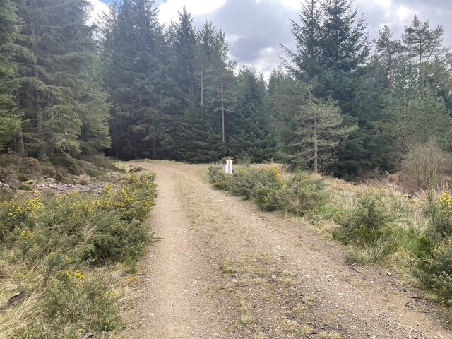
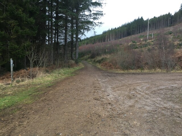
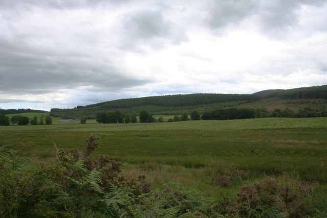
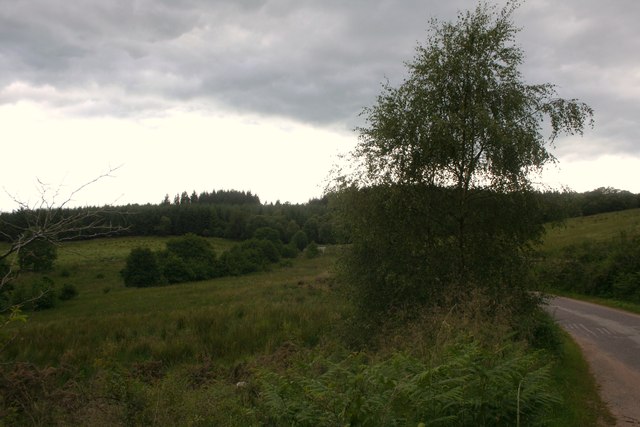
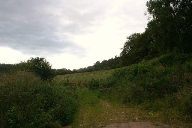
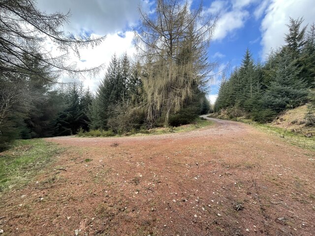
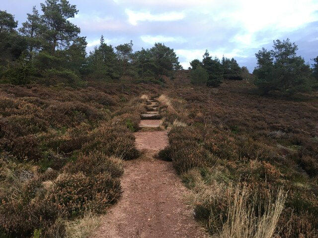
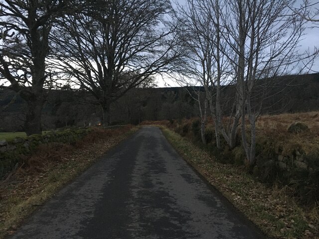
Overton Wood is a picturesque forest located in Aberdeenshire, Scotland. Covering an area of approximately 100 hectares, it is nestled within the stunning Deeside landscape, surrounded by rolling hills and lush greenery. The wood is a haven for nature lovers and outdoor enthusiasts, offering a tranquil and peaceful escape from the bustling city life.

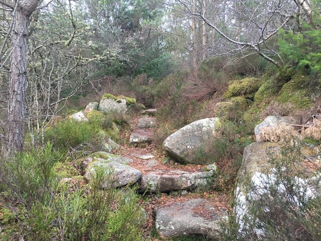
The forest is composed mainly of native broadleaf trees, such as oak, birch, and beech, which create a rich and diverse habitat for a wide range of flora and fauna. Walking through the wood, visitors can admire the vibrant colors of wildflowers and listen to the melodic songs of birds overhead. The woodland floor is carpeted with mosses, ferns, and bluebells during the spring season, creating a stunning natural tapestry.

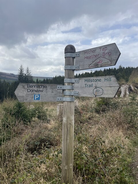
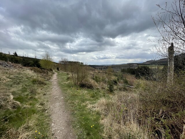
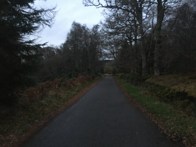
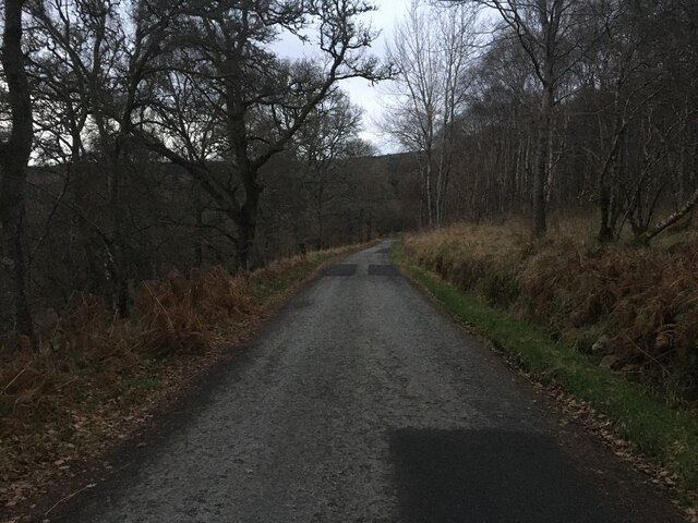
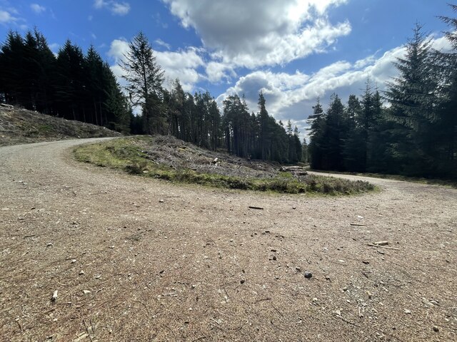
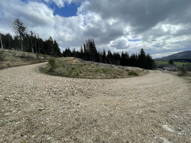
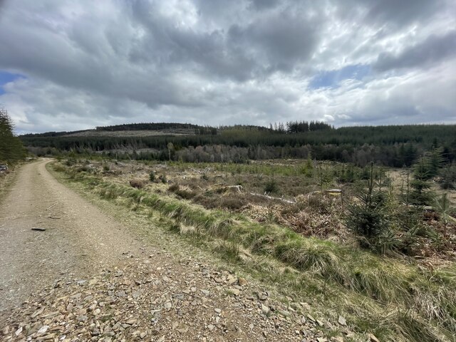
Overton Wood is also home to a variety of wildlife, including red squirrels, roe deer, and a plethora of bird species, making it an excellent spot for birdwatching and wildlife photography. The forest has several well-maintained trails and paths, allowing visitors to explore its beauty at their own pace. Whether it's a leisurely stroll or a more challenging hike, there is something for everyone to enjoy.

In addition to its natural beauty, Overton Wood has historical significance. It is believed to have been a hunting ground for the ancient Pictish people, who once inhabited the area. Archaeological evidence suggests that they used the forest for hunting and gathering resources.

Overall, Overton Wood is a true gem in Aberdeenshire, offering a unique combination of natural beauty, wildlife, and historical significance. It is a must-visit destination for those seeking a peaceful and immersive experience in the Scottish countryside.

If you have any feedback on the listing, please let us know in the comments section below.

Overton Wood Images

Images are sourced within 2km of 57.26578/-2.5728377 or Grid Reference NJ6519. Thanks to Geograph Open Source API. All images are credited.

Forest roads of Bennachie
Which way? Bennachie is a range of hills in Aberdeenshire, Scotland.It has several tops, the highest of which, Oxen Craig, has a height of 528 metres (1,732 ft). Though not particularly high, compared to other peaks within Scotland, the mountain is very prominent, owing to its isolation and the relative flatness of the surrounding terrain, and dominates the skyline from several viewpoints.
Which way?
Bennachie is a range of hills in Aberdeenshire, Scotland.It has several tops, the highest of which, Oxen Craig, has a height of 528 metres (1,732 ft). Though not particularly high, compared to other peaks within Scotland, the mountain is very prominent, owing to its isolation and the relative flatness of the surrounding terrain, and dominates the skyline from several viewpoints.
A path on Bennachie Bennachie is a range of hills in Aberdeenshire, Scotland.It has several tops, the highest of which, Oxen Craig, has a height of 528 metres (1,732 ft). Though not particularly high, compared to other peaks within Scotland, the mountain is very prominent, owing to its isolation and the relative flatness of the surrounding terrain, and dominates the skyline from several viewpoints.
A path on Bennachie
Bennachie is a range of hills in Aberdeenshire, Scotland.It has several tops, the highest of which, Oxen Craig, has a height of 528 metres (1,732 ft). Though not particularly high, compared to other peaks within Scotland, the mountain is very prominent, owing to its isolation and the relative flatness of the surrounding terrain, and dominates the skyline from several viewpoints.
Minor road at Donview
Forestry road near Donview
Path up Millstone Hill
Minor road near Tilliefoure
Meadow by the Throat Meadowland by the Don from My Lord's Throat.
Meadow by the Throat
Meadowland by the Don from My Lord's Throat.
Road to Keig The road leading ,through My Lord's Throat , to Keig.
Road to Keig
The road leading ,through My Lord's Throat , to Keig.
Through the Gates A field amongst woodland.
Through the Gates
A field amongst woodland.
Hairpin Forest Bends Bennachie is a range of hills in Aberdeenshire, Scotland.It has several tops, the highest of which, Oxen Craig, has a height of 528 metres (1,732 ft). Though not particularly high, compared to other peaks within Scotland, the mountain is very prominent, owing to its isolation and the relative flatness of the surrounding terrain, and dominates the skyline from several viewpoints.
Hairpin Forest Bends
Bennachie is a range of hills in Aberdeenshire, Scotland.It has several tops, the highest of which, Oxen Craig, has a height of 528 metres (1,732 ft). Though not particularly high, compared to other peaks within Scotland, the mountain is very prominent, owing to its isolation and the relative flatness of the surrounding terrain, and dominates the skyline from several viewpoints.
More forest hairpin bends Bennachie is a range of hills in Aberdeenshire, Scotland.It has several tops, the highest of which, Oxen Craig, has a height of 528 metres (1,732 ft). Though not particularly high, compared to other peaks within Scotland, the mountain is very prominent, owing to its isolation and the relative flatness of the surrounding terrain, and dominates the skyline from several viewpoints.
More forest hairpin bends
Bennachie is a range of hills in Aberdeenshire, Scotland.It has several tops, the highest of which, Oxen Craig, has a height of 528 metres (1,732 ft). Though not particularly high, compared to other peaks within Scotland, the mountain is very prominent, owing to its isolation and the relative flatness of the surrounding terrain, and dominates the skyline from several viewpoints.
Even more hairpin bends Bennachie is a range of hills in Aberdeenshire, Scotland.It has several tops, the highest of which, Oxen Craig, has a height of 528 metres (1,732 ft). Though not particularly high, compared to other peaks within Scotland, the mountain is very prominent, owing to its isolation and the relative flatness of the surrounding terrain, and dominates the skyline from several viewpoints.
Even more hairpin bends
Bennachie is a range of hills in Aberdeenshire, Scotland.It has several tops, the highest of which, Oxen Craig, has a height of 528 metres (1,732 ft). Though not particularly high, compared to other peaks within Scotland, the mountain is very prominent, owing to its isolation and the relative flatness of the surrounding terrain, and dominates the skyline from several viewpoints.
Forest roads around Bennachie Bennachie is a range of hills in Aberdeenshire, Scotland.It has several tops, the highest of which, Oxen Craig, has a height of 528 metres (1,732 ft). Though not particularly high, compared to other peaks within Scotland, the mountain is very prominent, owing to its isolation and the relative flatness of the surrounding terrain, and dominates the skyline from several viewpoints.
Forest roads around Bennachie
Bennachie is a range of hills in Aberdeenshire, Scotland.It has several tops, the highest of which, Oxen Craig, has a height of 528 metres (1,732 ft). Though not particularly high, compared to other peaks within Scotland, the mountain is very prominent, owing to its isolation and the relative flatness of the surrounding terrain, and dominates the skyline from several viewpoints.
Forestry Operations on Millstone Hill
Path on Millstone Hill
Minor road near Tilliefoure
Show me another place!

Overton Wood is located at Grid Ref: NJ6519 (Lat: 57.26578, Lng: -2.5728377)

Unitary Authority: Aberdeenshire

Police Authority: North East

What 3 Words

///decay.necklace.looms. Near Kemnay, Aberdeenshire

Nearby Locations

Craigton Wood Overton Wood

Related Wikis

Bennachie

Bennachie ( ben-ə-HEE; Scottish Gaelic: Beinn na Cìche) is a range of hills in Aberdeenshire, Scotland. It has several tops, the highest of which, Oxen...

Castle Forbes

Castle Forbes is a 19th-century country house in the Scottish baronial architecture style near Alford in Aberdeenshire, Scotland. The 6,000-acre (2,400...

Blairdaff

Blairdaff is a parish in Garioch, Aberdeenshire, Scotland, next to the villages of Kemnay and Monymusk. Blairdaff had a grocery store, a post office, and...

Keig

Keig ( KEEG) is a village within the local government area of Aberdeenshire Council in the North East of Scotland and is located within the Marr area of...

Lickleyhead Castle

Lickleyhead Castle is a well-restored L-plan castle, dating from around 1600, a little south of Auchleven, by the banks of the Gadie Burn, in Aberdeenshire...

Bograxie

Bograxie is a farm in Aberdeenshire, Scotland. == References ==

Gordon Way

The Gordon Way is a waymarked hiking trail in Aberdeenshire, Scotland. It runs for 11+1⁄2 miles (18.5 km) through the Bennachie Forest. The route was one...

Auchleven

Auchleven (Scottish Gaelic: Achadh Leamhan) is a village in Aberdeenshire, Scotland. Located approximately 4 miles (6 kilometres) south of Insch, 17 mi...

Nearby Amenities

Located within 500m of 57.26578,-2.5728377
Clock
Place of Tilliefoure Sundial
Display: sundial
Heritage: 2
Heritage Operator: hs
Heritage Website: http://portal.historicenvironment.scot/designation/LB16137
Listed Status: Category B
Ref Hs: LB16137
Lat/Long: 57.264579/-2.5663483
Power: pole
Lat/Long: 57.2676195/-2.5802484
Power: pole
Lat/Long: 57.2668945/-2.5803541
Power: pole
Lat/Long: 57.2663933/-2.5796562
Power: pole
Lat/Long: 57.265904/-2.5789538
Power: pole
Lat/Long: 57.2654218/-2.5782449
Power: pole
Lat/Long: 57.2649159/-2.5775426
Power: pole
Lat/Long: 57.2644325/-2.5768447
Power: pole
Lat/Long: 57.2638706/-2.5766047
Power: pole
Lat/Long: 57.2631217/-2.5763009
Power: pole
Lat/Long: 57.2624799/-2.5760323
Power: pole
Lat/Long: 57.2618608/-2.5757659
Power: pole
Lat/Long: 57.2648956/-2.5647842
The data included in this document is from www.openstreetmap.org. The data is made available under ODbL.

Have you been to Overton Wood?

Leave your review of Overton Wood below (or comments, questions and feedback).