Bogle Plantation

Wood, Forest in Berwickshire

Scotland

Bogle Plantation

Information Board at Greenknowe Tower Including reference to Walter Pringle, a Covenanter.
Information Board at Greenknowe Tower Credit: Becky Williamson

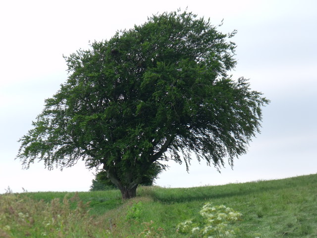
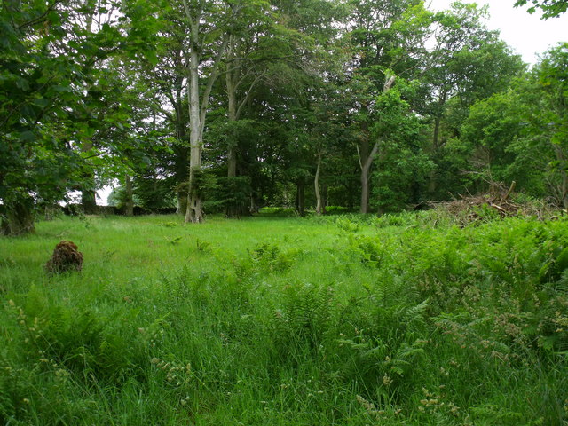
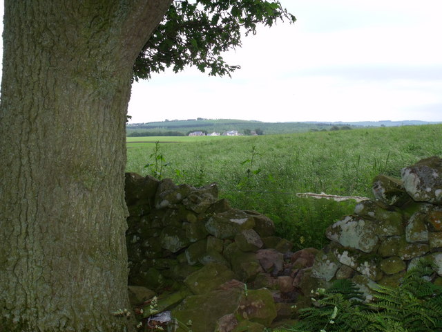
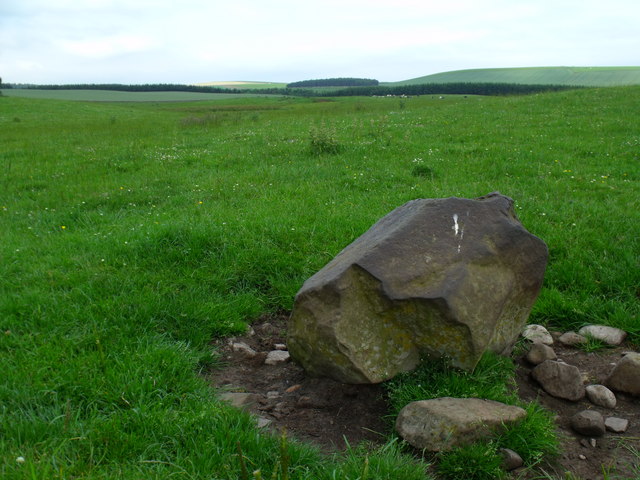
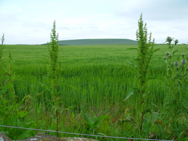
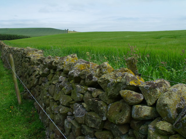
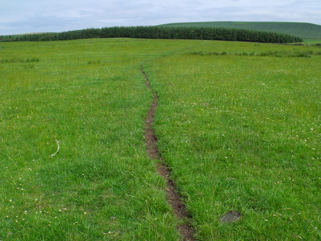
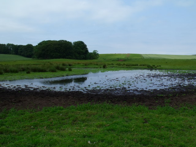
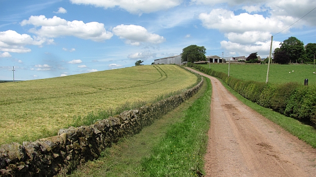
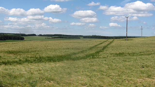
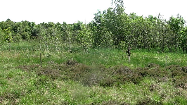
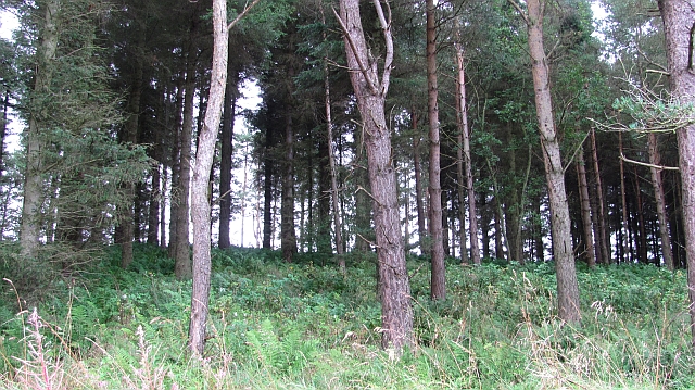
Bogle Plantation is a picturesque woodland located in the scenic region of Berwickshire, Scotland. Spread across a vast area, the plantation is an enchanting mix of dense trees, lush vegetation, and meandering paths. This woodland is renowned for its natural beauty and is a popular destination for nature enthusiasts and hikers.

The plantation primarily consists of native Scottish tree species, such as oak, birch, and pine, creating a diverse and vibrant ecosystem. The trees tower overhead, forming a dense canopy that provides shade and shelter to a variety of wildlife. The forest floor is carpeted with a rich assortment of wildflowers, ferns, and mosses, adding to the enchanting atmosphere.

Visitors to Bogle Plantation can explore the numerous well-maintained trails that wind through the woodland. These paths provide excellent opportunities for leisurely walks, jogging, or cycling amidst the tranquil surroundings. The plantation is also home to a variety of wildlife, including deer, foxes, and a wide array of bird species. Birdwatchers can delight in the chance to spot rare and migratory birds in their natural habitat.

The plantation is open to the public throughout the year, allowing visitors to experience the changing seasons and the beauty they bring to the woodland. Bogle Plantation offers a peaceful retreat from the hustle and bustle of everyday life, allowing individuals to reconnect with nature and enjoy the serenity it offers.

If you have any feedback on the listing, please let us know in the comments section below.

Bogle Plantation Images

Images are sourced within 2km of 55.685971/-2.5646739 or Grid Reference NT6443. Thanks to Geograph Open Source API. All images are credited.

Information Board at Greenknowe Tower Including reference to Walter Pringle, a Covenanter.
Information Board at Greenknowe Tower
Including reference to Walter Pringle, a Covenanter.
The east section of the nave at Gordon, St. Michael's in Berwickshire. The door on the left is the entrance below the great stained glass windows. A mighty organ and its pipes, formerly in Prestonkirk Church dominates the area.
The east section of the nave at Gordon, St. Michael's in Berwickshire.
The door on the left is the entrance below the great stained glass windows. A mighty organ and its pipes, formerly in Prestonkirk Church dominates the area.
Mature beech on fenceline south of Fairnybeds Wood This time in its summer garb!
Mature beech on fenceline south of Fairnybeds Wood
This time in its summer garb!
Beechy clearing in Fairnybeds Wood near Macks Mill
Break in dyke bounding Fairnybeds Wood north of Macks Mill This may have originated as a route for wild animals such as deer but the wool on the single strand of wire shows that sheep have been the main traffic recently.
Break in dyke bounding Fairnybeds Wood north of Macks Mill
This may have originated as a route for wild animals such as deer but the wool on the single strand of wire shows that sheep have been the main traffic recently.
A right hard stane south-east of Fairnybeds Wood Shining as if it has been used as a rubbing-post for a century or two and then as a bird-perch in the last month.
A right hard stane south-east of Fairnybeds Wood
Shining as if it has been used as a rubbing-post for a century or two and then as a bird-perch in the last month.
Sea of cereal east of Rumbleton Law  The safest place for the emblem - on the periphery amongst the other weeds?
Sea of cereal east of Rumbleton Law
The safest place for the emblem - on the periphery amongst the other weeds?
Drystane dyke swamped by barley crop
Cow path on meadowland north of Macks Mill
Pond south-east of Fairnybeds Wood near Fawside No pond is marked on the map so maybe this is a seasonal feature.
Pond south-east of Fairnybeds Wood near Fawside
No pond is marked on the map so maybe this is a seasonal feature.
Fawside Road to a hilltop farm.
Fawside
Road to a hilltop farm.
Barley, Fawside
Barley, Fawside
Silage crop, Fawside It is a busy time, catching a short dry spell to cut and collect grass for winter feed. Soon these fields will be cut.
Silage crop, Fawside
It is a busy time, catching a short dry spell to cut and collect grass for winter feed. Soon these fields will be cut.
Gordon Community Woodland A path in a rapidly growing broadleaf  woodland.
Gordon Community Woodland
A path in a rapidly growing broadleaf woodland.
Gordon Community Woodland Now rapidly growing. This is a damp area with alders. The nearby road has flood warning signs on it.
Gordon Community Woodland
Now rapidly growing. This is a damp area with alders. The nearby road has flood warning signs on it.
Cultivating, Rowantree Ground working near Gordon. The field is being prepared for growing a winter forage crop such as turnips or kale.
Cultivating, Rowantree
Ground working near Gordon. The field is being prepared for growing a winter forage crop such as turnips or kale.
Small pine wood A short steep slope is used to grow trees.
Small pine wood
A short steep slope is used to grow trees.
Barley, Fawside My second attempt to get into NT6545, the first was when it was still unvisited, but I was stopped by growing crops. Now there is no longer an access restriction, the barley has been harvested and the neighbouring silage grass fields are being grazed.

September is the time to visit those awkward grid squares, but winter crops are becoming more and more popular, and the stubble can be ploughed soon after harvest, as is the usual practice in England.
Barley, Fawside
My second attempt to get into NT6545, the first was when it was still unvisited, but I was stopped by growing crops. Now there is no longer an access restriction, the barley has been harvested and the neighbouring silage grass fields are being grazed. September is the time to visit those awkward grid squares, but winter crops are becoming more and more popular, and the stubble can be ploughed soon after harvest, as is the usual practice in England.
Show me another place!

Bogle Plantation is located at Grid Ref: NT6443 (Lat: 55.685971, Lng: -2.5646739)

Unitary Authority: The Scottish Borders

Police Authority: The Lothians and Scottish Borders

What 3 Words

///blush.pits.composts. Near Earlston, Scottish Borders

Related Wikis

Gordon (NBR) railway station

Gordon railway station served the village of Gordon, Scottish Borders, Scotland from 1863 to 1948 on the Berwickshire Railway. == History == The station...

Gordon, Scottish Borders

Gordon is a village in the Scottish Borders area of Scotland, within the historic county of Berwickshire. The village sits on the crossroads of the A6105...
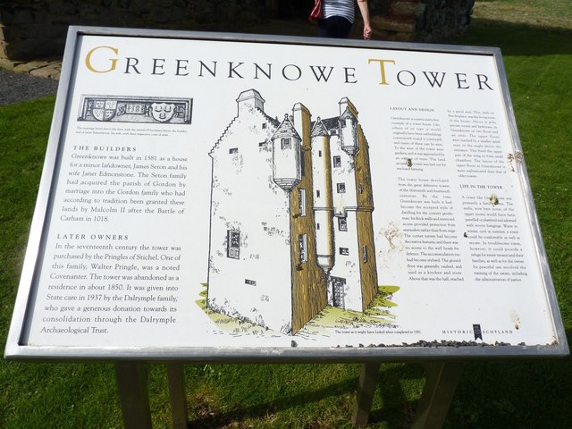
Greenknowe Tower

Greenknowe Tower is a 16th-century tower house, located just west of the village of Gordon, in the Scottish Borders. Although a roofless ruin, the stonework...

Gordon Moss

Gordon Moss is a nature reserve near Gordon, in the Scottish Borders area of Scotland, in the former Berwickshire. The moss is situated one mile west of...

Related Videos

Pinewood House, Scotland Family Vaycay Day 5

The final day of the family vaycay at Pinewood House, Scotland. If anyone has watched any of the family vaycay videos, and are ...

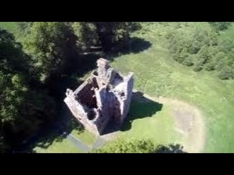
Greenknowe Tower, Scottish Borders

A gorgeous sunny autumn morning at Greenknowe Tower, the 1581 fortified house near Gordon. Built by James Seaton and his ...

Pinewood House, Scotland Family Vaycay Day 1

Pinewood House, Gordon, Scotland So one thing dad wanted to do is to make sure we all had one holiday together, with no ...

Greenknowe Tower House With Music On History Visit To Borders Scotland

Tour Scotland short 4K travel video clip, with Scottish music, of Greenknowe Tower House, a 16th century tower house, located ...

Nearby Amenities

Located within 500m of 55.685971,-2.5646739
Turning Circle
Lat/Long: 55.6818375/-2.5637766
Gordon
Historic Railway: station
Railway: site
Wikidata: Q38252077
Wikipedia: en:Gordon (NBR) railway station
Lat/Long: 55.6859559/-2.5624393
Turning Circle
Lat/Long: 55.6823244/-2.5624334
Site of Gordon Castle
Historic: archaeological_site
Wikidata: Q31107037
Lat/Long: 55.686071/-2.5650261
Location Transition: yes
Power: pole
Lat/Long: 55.6821016/-2.5664502
Generator Method: photovoltaic
Generator Output Electricity: yes
Generator Source: solar
Generator Type: solar_photovoltaic_panel
Power: generator
Lat/Long: 55.682435/-2.5627823
Generator Method: photovoltaic
Generator Output Electricity: yes
Generator Source: solar
Generator Type: solar_photovoltaic_panel
Power: generator
Lat/Long: 55.6824085/-2.5628869
Generator Method: photovoltaic
Generator Output Electricity: yes
Generator Source: solar
Generator Type: solar_photovoltaic_panel
Power: generator
Lat/Long: 55.6816683/-2.5626683
Generator Method: photovoltaic
Generator Output Electricity: yes
Generator Source: solar
Generator Type: solar_photovoltaic_panel
Power: generator
Lat/Long: 55.6821605/-2.5629969
Generator Method: photovoltaic
Generator Output Electricity: yes
Generator Source: solar
Generator Type: solar_photovoltaic_panel
Power: generator
Lat/Long: 55.681908/-2.5630693
Generator Method: photovoltaic
Generator Output Electricity: yes
Generator Source: solar
Generator Type: solar_photovoltaic_panel
Power: generator
Lat/Long: 55.6819526/-2.563878
Generator Method: photovoltaic
Generator Output Electricity: yes
Generator Source: solar
Generator Type: solar_photovoltaic_panel
Power: generator
Lat/Long: 55.6821273/-2.563426
Generator Method: photovoltaic
Generator Output Electricity: yes
Generator Source: solar
Generator Type: solar_photovoltaic_panel
Power: generator
Lat/Long: 55.6820645/-2.5634368
Generator Method: photovoltaic
Generator Output Electricity: yes
Generator Source: solar
Generator Type: solar_photovoltaic_panel
Power: generator
Lat/Long: 55.6818672/-2.5634475
Generator Method: photovoltaic
Generator Output Electricity: yes
Generator Source: solar
Generator Type: solar_photovoltaic_panel
Power: generator
Lat/Long: 55.6818112/-2.5634609
Generator Method: photovoltaic
Generator Output Electricity: yes
Generator Source: solar
Generator Type: solar_photovoltaic_panel
Power: generator
Lat/Long: 55.6817462/-2.5634851
Power: pole
Lat/Long: 55.689772/-2.5653614
Power: pole
Lat/Long: 55.689102/-2.5647862
Power: pole
Lat/Long: 55.688673/-2.5644146
Power: pole
Lat/Long: 55.688224/-2.5633661
Power: pole
Lat/Long: 55.6877864/-2.5623633
Power: pole
Lat/Long: 55.6873474/-2.5613249
Power: pole
Lat/Long: 55.6869113/-2.5603145
Power: pole
Lat/Long: 55.6862212/-2.5595255
Power: pole
Lat/Long: 55.6858037/-2.5589173
Power: pole
Lat/Long: 55.6852355/-2.5580748
Power: pole
Lat/Long: 55.6848008/-2.5574436
Power: pole
Lat/Long: 55.6887091/-2.5647964
Power: pole
Lat/Long: 55.6886561/-2.5662276
Power: pole
Lat/Long: 55.6886016/-2.5676944
Power: pole
Lat/Long: 55.6885858/-2.5684596
Power: pole
Lat/Long: 55.68855/-2.5695705
Power: pole
Lat/Long: 55.6885199/-2.5703459
The data included in this document is from www.openstreetmap.org. The data is made available under ODbL.

Have you been to Bogle Plantation?

Leave your review of Bogle Plantation below (or comments, questions and feedback).