Cowgang Plantation

Wood, Forest in Roxburghshire

Scotland

Cowgang Plantation

The ruined remains of Abbotrule Church The church had belonged to Jedburgh Abbey from the early 12th century until its abandonment in 1777. The gable walls and bellcote are all that remain together with some old headstones inside the building and in the former churchyard.
The ruined remains of Abbotrule Church Credit: Walter Baxter

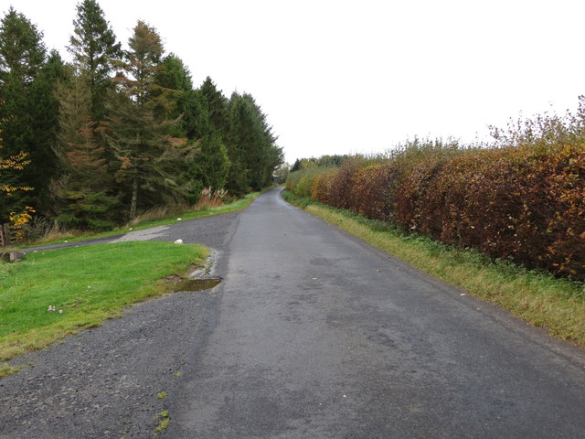
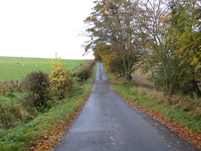
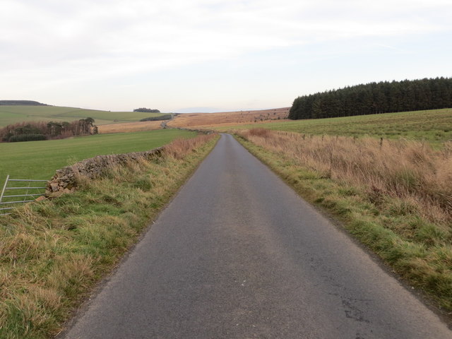
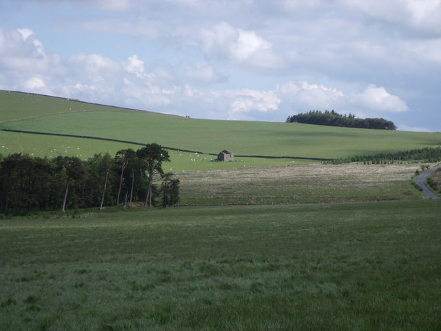
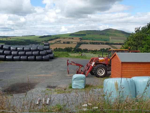
Cowgang Plantation is a picturesque woodland area located in Roxburghshire, Scotland. Situated near the village of Wood, the plantation covers a vast expanse of land, offering a serene and tranquil environment for visitors to explore.

The plantation consists mainly of native tree species, including oak, beech, and conifers, creating a diverse and lush forest. The trees are well-maintained, with their branches intertwining to form a dense canopy that provides shade and protection from the elements.

Walking through Cowgang Plantation, visitors will find themselves surrounded by an array of wildlife and plant species. The woodland is home to a variety of birds, such as woodpeckers, owls, and thrushes, making it a haven for birdwatchers. Additionally, the undergrowth is filled with vibrant wildflowers, ferns, and mosses, adding to the plantation's natural beauty.

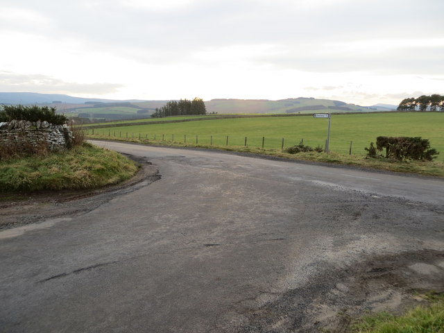
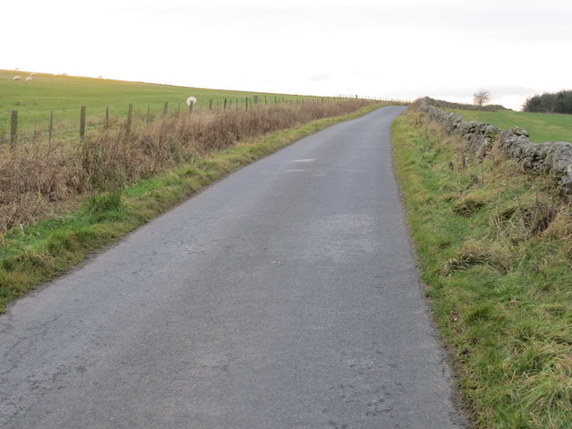
For outdoor enthusiasts, Cowgang Plantation offers a network of well-marked trails and paths, allowing visitors to explore the area at their own pace. These paths lead to scenic viewpoints and picnic areas, where visitors can take in the breathtaking views of the surrounding countryside.

The plantation is also a popular destination for nature conservationists and researchers, as it provides a valuable habitat for numerous rare and endangered species. Efforts are made to protect and preserve the plantation's biodiversity, ensuring its long-term sustainability.

Overall, Cowgang Plantation in Roxburghshire is a delightful destination for those seeking a peaceful escape into nature. With its stunning woodland, diverse wildlife, and well-maintained trails, it offers a truly immersive and enriching experience for visitors of all ages.

If you have any feedback on the listing, please let us know in the comments section below.

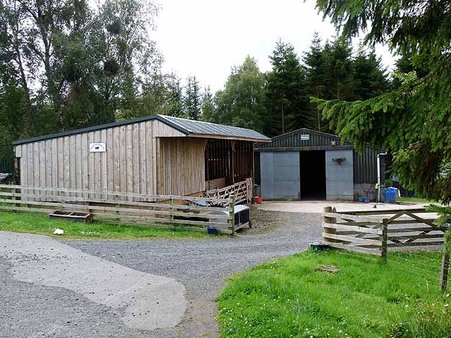
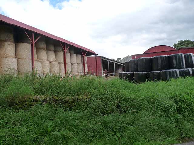
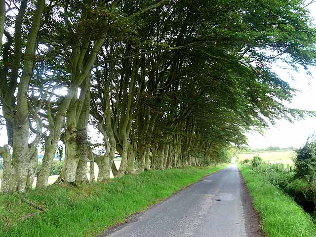
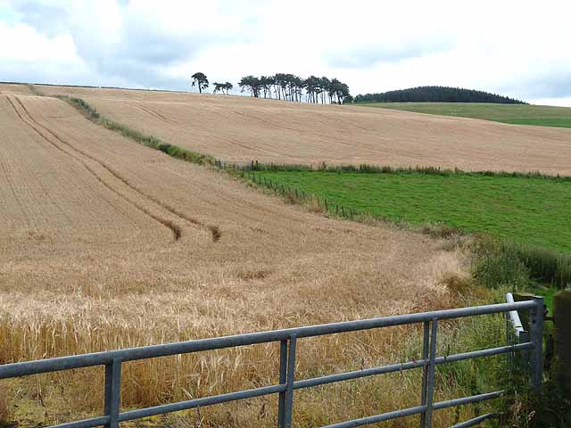
Cowgang Plantation Images

Images are sourced within 2km of 55.407092/-2.5997284 or Grid Reference NT6212. Thanks to Geograph Open Source API. All images are credited.

The ruined remains of Abbotrule Church The church had belonged to Jedburgh Abbey from the early 12th century until its abandonment in 1777. The gable walls and bellcote are all that remain together with some old headstones inside the building and in the former churchyard.
The ruined remains of Abbotrule Church
The church had belonged to Jedburgh Abbey from the early 12th century until its abandonment in 1777. The gable walls and bellcote are all that remain together with some old headstones inside the building and in the former churchyard.
Old gravestones inside the ruins of Abbotrule Church These old stones are resting against the east gable wall.
Old gravestones inside the ruins of Abbotrule Church
These old stones are resting against the east gable wall.
Old grave slabs by the ruined Abbotrule Church These stones are on the south side of the ruined church. The grave marker on the left is a hogback stone.
Old grave slabs by the ruined Abbotrule Church
These stones are on the south side of the ruined church. The grave marker on the left is a hogback stone.
Sheep at Abbotrule A large grazing field with the remains of Abbotrule Church on the right.
Sheep at Abbotrule
A large grazing field with the remains of Abbotrule Church on the right.
Gravestones by the remains of Abbotrule Church The stones are on the south side of the ruined church.
Gravestones by the remains of Abbotrule Church
The stones are on the south side of the ruined church.
The ruined remains of Abbotrule Church The church had belonged to Jedburgh Abbey from the early 12th century until its abandonment in 1777. The gable walls and bellcote are all that remain together with some old headstones inside the building and in the former churchyard. This was viewed in early December 2017. For a similar view in October 2006 see <a href="https://www.geograph.org.uk/photo/255079">NT6112 : The remains of Abbotrule Church</a>.
The ruined remains of Abbotrule Church
The church had belonged to Jedburgh Abbey from the early 12th century until its abandonment in 1777. The gable walls and bellcote are all that remain together with some old headstones inside the building and in the former churchyard. This was viewed in early December 2017. For a similar view in October 2006 see NT6112 : The remains of Abbotrule Church.
Minor road at High Fodderlee Looking north-westward.
Minor road at High Fodderlee
Looking north-westward.
Minor road at Bowshot Looking south-eastward.
Minor road at Bowshot
Looking south-eastward.
Junction of roads at Coatlaw Plantation Looking south-westward.
Junction of roads at Coatlaw Plantation
Looking south-westward.
Minor road heading towards Coatlaw Plantation Looking south-westward.
Minor road heading towards Coatlaw Plantation
Looking south-westward.
Minor road near Belling Covert Looking north-eastward.
Minor road near Belling Covert
Looking north-eastward.
Southdean Church - the interior Southdean Kirk, opened in 1876, is the latest in a line of churches which could back as far as the 8th. - 9th. century. An old story from Southdean Parish was of the Borders Reivers having a son baptised in a font which could immerse the whole body of the baby. The reiver would always request of the vicar not to baptise the boy's right arm - that would be carrying out 'some develish deeds in the future'. The reivers, when not fighting the English, fought amongst themselves. Southdean Church only opens for up to six services a year.
Southdean Church - the interior
Southdean Kirk, opened in 1876, is the latest in a line of churches which could back as far as the 8th. - 9th. century. An old story from Southdean Parish was of the Borders Reivers having a son baptised in a font which could immerse the whole body of the baby. The reiver would always request of the vicar not to baptise the boy's right arm - that would be carrying out 'some develish deeds in the future'. The reivers, when not fighting the English, fought amongst themselves. Southdean Church only opens for up to six services a year.
Kilnsike Tower ruin
Kilnsike Tower ruin
Farm yard near High Fodderlee Farm yard close, but not adjacent, to High Fodderlee Farm. The distinctive summit of Rubers Law <a href="https://www.geograph.org.uk/gridref/NT5815">NT5815</a> can be seen on the skyline beyond the valley of the Rule Water.
Farm yard near High Fodderlee
Farm yard close, but not adjacent, to High Fodderlee Farm. The distinctive summit of Rubers Law NT5815 can be seen on the skyline beyond the valley of the Rule Water.
Farm buildings at High Fodderlee This appears to be a new farm, possibly associated with a timber business.
Farm buildings at High Fodderlee
This appears to be a new farm, possibly associated with a timber business.
Barns at Ruletownhead Farm
Country road near Ruletownhead A very fine, but one-sided avenue of mature beech trees.
Country road near Ruletownhead
A very fine, but one-sided avenue of mature beech trees.
Fields of barley, near Chesters A small copse of Scots pines crowns the spur. Beyond, to the right, is the western edge of Mervinslaw and Falside Forest.
Fields of barley, near Chesters
A small copse of Scots pines crowns the spur. Beyond, to the right, is the western edge of Mervinslaw and Falside Forest.
Show me another place!

Cowgang Plantation is located at Grid Ref: NT6212 (Lat: 55.407092, Lng: -2.5997284)

Unitary Authority: The Scottish Borders

Police Authority: The Lothians and Scottish Borders

What 3 Words

///actor.clever.reforming. Near Jedburgh, Scottish Borders

Related Wikis

Abbotrule

Abbotrule is a hamlet south of the B6357 road, in the Scottish Borders area of Scotland, on Rule Burn, east of the Rule Water. Places nearby include Bedrule...

Hallrule

Hallrule is a hamlet on the B6357 road, in the Scottish Borders area of Scotland, on the Rule Water, near Abbotrule, Bedrule Bonchester Bridge, Denholm...

Fulton Tower

Fulton Tower is a ruined 16th century tower house, about 4.5 miles (7.2 km) south west of Jedburgh, Scottish Borders, Scotland, and about 2 miles (3.2...

Bonchester Bridge

Bonchester Bridge (Scots Binster Brig) is a village in Roxburghshire, within the Scottish Borders area of Scotland, lying on the Rule Water, six miles...

Southdean

Southdean is a hamlet in the Scottish Borders area of Scotland, on the A6088, by the Jed Water and in the Wauchope Forest area. Other settlements nearby...

Hobkirk

Hobkirk (Scottish Gaelic: Eaglais Ruail) is a village and civil parish in the Scottish Borders area of Scotland, by the Rule Water, south-west of Jedburgh...

Bairnkine

Bairnkine is a hamlet on the Jed Water in the Scottish Borders area of Scotland, on the A68, south of Jedburgh. Other places nearby include Abbotrule,...

Rubers Law

Rubers Law is a prominent, conical hill in the Scottish Borders area of south-east Scotland. It stands on the south bank of the River Teviot, between the...

Nearby Amenities

Located within 500m of 55.407092,-2.5997284
Westerhouses
Place: hamlet
Lat/Long: 55.407204/-2.591981
Power: pole
Lat/Long: 55.4095378/-2.6062262
Power: pole
Lat/Long: 55.4093404/-2.6055181
Power: pole
Lat/Long: 55.4090364/-2.6043645
Power: pole
Lat/Long: 55.4093317/-2.602374
Power: pole
Lat/Long: 55.4086621/-2.6020187
Power: pole
Lat/Long: 55.4080233/-2.6020367
Power: pole
Lat/Long: 55.4073669/-2.6020444
Power: pole
Lat/Long: 55.4067105/-2.6020521
Power: pole
Lat/Long: 55.4059254/-2.6020753
Power: pole
Lat/Long: 55.4085847/-2.6007312
Power: pole
Lat/Long: 55.408516/-2.599539
Power: pole
Lat/Long: 55.4084458/-2.5982901
Power: pole
Lat/Long: 55.4083844/-2.5972473
Power: pole
Lat/Long: 55.4083025/-2.5957975
Power: pole
Lat/Long: 55.4082016/-2.5939951
Power: pole
Lat/Long: 55.4081402/-2.5927694
The data included in this document is from www.openstreetmap.org. The data is made available under ODbL.

Have you been to Cowgang Plantation?

Leave your review of Cowgang Plantation below (or comments, questions and feedback).