Butterlee Brae

Wood, Forest in Roxburghshire

Scotland

Butterlee Brae

Carlin Tooth, Peel Fell and Deadwater Fell These are the respective distant summits, left to right, as viewed from the trackbed of the former Waverley Route.

This photograph was taken during the Coronavirus (COVID-19) pandemic of 2020/21/22.
Carlin Tooth, Peel Fell and Deadwater Fell Credit: James T M Towill

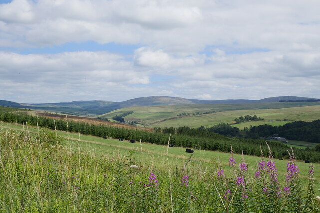
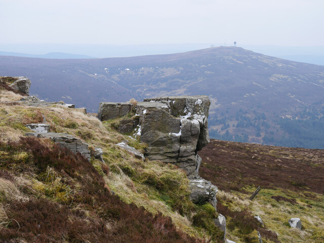
Butterlee Brae is a beautiful wood located in Roxburghshire, a historic county in the Scottish Borders region of Scotland. Situated near the village of Ancrum, this forested area covers a vast expanse of land, offering a serene and tranquil environment for visitors to explore.

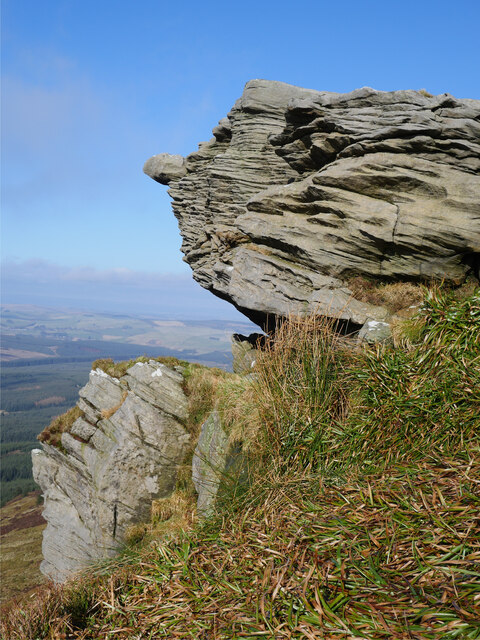
The wood is known for its diverse range of tree species, including oak, beech, birch, and pine. The lush vegetation creates a vibrant and picturesque landscape, especially during the spring and summer months when the forest is adorned with colorful wildflowers.

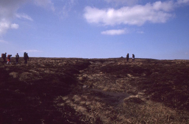
Butterlee Brae is a haven for various wildlife species, making it a popular spot for nature enthusiasts and birdwatchers. Visitors may have the chance to spot red squirrels, roe deer, and a variety of bird species, including woodpeckers and owls.

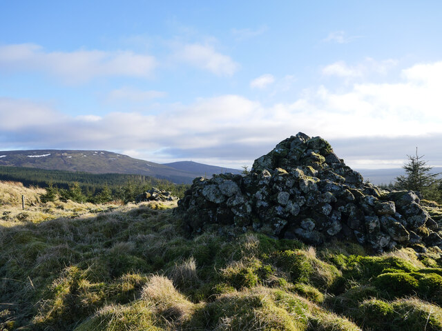
The wood offers several walking trails, providing visitors with the opportunity to immerse themselves in the natural beauty of the area. The paths are well-maintained and offer both easy strolls and more challenging hikes for those seeking a more adventurous experience.

In addition to its natural wonders, Butterlee Brae also holds historical significance. The wood is home to several archaeological sites, including ancient burial grounds and remnants of settlements from the Iron Age. These historical remnants add an extra layer of intrigue to the wood, making it an ideal destination for history enthusiasts.

Overall, Butterlee Brae is a stunning wood in Roxburghshire, offering a perfect blend of natural beauty, wildlife, and historical interest. Whether visitors are looking to relax amidst nature, go for a leisurely walk, or explore the region's rich history, Butterlee Brae has something to offer for everyone.

If you have any feedback on the listing, please let us know in the comments section below.

Butterlee Brae Images

Images are sourced within 2km of 55.302874/-2.6017458 or Grid Reference NT6101. Thanks to Geograph Open Source API. All images are credited.

Carlin Tooth, Peel Fell and Deadwater Fell These are the respective distant summits, left to right, as viewed from the trackbed of the former Waverley Route.

This photograph was taken during the Coronavirus (COVID-19) pandemic of 2020/21/22.
Carlin Tooth, Peel Fell and Deadwater Fell
These are the respective distant summits, left to right, as viewed from the trackbed of the former Waverley Route. This photograph was taken during the Coronavirus (COVID-19) pandemic of 2020/21/22.
Bound for Hartshorn Pike A glorious day across the Scottish Borders with wall-to-wall sunshine and yet the ascent of Hartshorn Pike from Wheelrig Head is in the gloom!  Eventually this cloud did lift, but for the meantime it made for atmospheric walking in this firebreak in the Wauchope Forest.

This photograph was taken during the Coronavirus (COVID-19) pandemic of 2020/21.
Bound for Hartshorn Pike
A glorious day across the Scottish Borders with wall-to-wall sunshine and yet the ascent of Hartshorn Pike from Wheelrig Head is in the gloom! Eventually this cloud did lift, but for the meantime it made for atmospheric walking in this firebreak in the Wauchope Forest. This photograph was taken during the Coronavirus (COVID-19) pandemic of 2020/21.
Rock formations at Carlin Tooth Grey sandstone rock formations at Carlin Tooth overlooking the Wauchope Forest.  

This photograph was taken during the Coronavirus (COVID-19) pandemic of 2020/21.
Rock formations at Carlin Tooth
Grey sandstone rock formations at Carlin Tooth overlooking the Wauchope Forest. This photograph was taken during the Coronavirus (COVID-19) pandemic of 2020/21.
A hag at Carlin Tooth? 'Carlin' is a very old Scots language disparaging term for a woman, hag or witch (see <span class="nowrap"><a title="https://www.scotslanguage.com/articles/view/id/5102" rel="nofollow ugc noopener" href="https://www.scotslanguage.com/articles/view/id/5102">Link</a><img style="margin-left:2px;" alt="External link" title="External link - shift click to open in new window" src="https://s1.geograph.org.uk/img/external.png" width="10" height="10"/></span> ) - is this applicable to this weathered sandstone outcrop?

This photograph was taken during the Coronavirus (COVID-19) pandemic of 2020/21.
A hag at Carlin Tooth?
'Carlin' is a very old Scots language disparaging term for a woman, hag or witch (see LinkExternal link ) - is this applicable to this weathered sandstone outcrop? This photograph was taken during the Coronavirus (COVID-19) pandemic of 2020/21.
The cloud lifts at the summit of Carlin Tooth The entire walk from Note o' the Gate on the B6357 via Wheelrig Head and Hartshorn Pike had been cloaked in thick hill cloud.  After nearly and hour at the summit, the cloud began to dissipate and warm sunshine made an appearance.  The view here is at the summit triangulation pillar and wind shelter - an ideal lunch spot.

This photograph was taken during the Coronavirus (COVID-19) pandemic of 2020/21.
The cloud lifts at the summit of Carlin Tooth
The entire walk from Note o' the Gate on the B6357 via Wheelrig Head and Hartshorn Pike had been cloaked in thick hill cloud. After nearly and hour at the summit, the cloud began to dissipate and warm sunshine made an appearance. The view here is at the summit triangulation pillar and wind shelter - an ideal lunch spot. This photograph was taken during the Coronavirus (COVID-19) pandemic of 2020/21.
Snow in a shake hole This deep shake hole still harbours a small remnant of the recent heavy snows.  

This photograph was taken during the Coronavirus (COVID-19) pandemic of 2020/21.
Snow in a shake hole
This deep shake hole still harbours a small remnant of the recent heavy snows. This photograph was taken during the Coronavirus (COVID-19) pandemic of 2020/21.
Across dense heather moorland to the valley of the Green Needle Standing in an area of shake holes combined with straggly heather and peat banks does not make for pleasant walking.  Nevertheless, the view down to the valley of the Green Needle makes the effort worthwhile.

This photograph was taken during the Coronavirus (COVID-19) pandemic of 2020/21.
Across dense heather moorland to the valley of the Green Needle
Standing in an area of shake holes combined with straggly heather and peat banks does not make for pleasant walking. Nevertheless, the view down to the valley of the Green Needle makes the effort worthwhile. This photograph was taken during the Coronavirus (COVID-19) pandemic of 2020/21.
The Wauchope Forest from Carlin Tooth A self-seeded Sitka Spruce is in the foreground whilst the Wauchope Forest sprawls below.

This photograph was taken during the Coronavirus (COVID-19) pandemic of 2020/21.
The Wauchope Forest from Carlin Tooth
A self-seeded Sitka Spruce is in the foreground whilst the Wauchope Forest sprawls below. This photograph was taken during the Coronavirus (COVID-19) pandemic of 2020/21.
Moorland pool on Hartshorn Pike A moorland pool near the summit of Hartshorn Pike.  Already, life was to be seen in these acidic waters in the form of several Whirligig Beetles.  The 'path' to Carlin Tooth follows the old fence line which can be noted to the far right of shot in the background.

This photograph was taken during the Coronavirus (COVID-19) pandemic of 2020/21.
Moorland pool on Hartshorn Pike
A moorland pool near the summit of Hartshorn Pike. Already, life was to be seen in these acidic waters in the form of several Whirligig Beetles. The 'path' to Carlin Tooth follows the old fence line which can be noted to the far right of shot in the background. This photograph was taken during the Coronavirus (COVID-19) pandemic of 2020/21.
Heading down from Hartshorn Pike A final coffee break before heading down from the summit area of Hartshorn Pike to enter the Wauchope Forest once more.  A distant Ruberslaw can be noted in this shot.  To the south, out of shot, the distant Solway Firth could be noted reflecting the low afternoon sunshine.

This photograph was taken during the Coronavirus (COVID-19) pandemic of 2020/21.
Heading down from Hartshorn Pike
A final coffee break before heading down from the summit area of Hartshorn Pike to enter the Wauchope Forest once more. A distant Ruberslaw can be noted in this shot. To the south, out of shot, the distant Solway Firth could be noted reflecting the low afternoon sunshine. This photograph was taken during the Coronavirus (COVID-19) pandemic of 2020/21.
Logging road between Wheelrig Head and Needs Law A firm forestry track approaching Needs Law.  There are several coupes being harvested in this corner of the Wauchope Forest.

This photograph was taken during the Coronavirus (COVID-19) pandemic of 2020/21.
Logging road between Wheelrig Head and Needs Law
A firm forestry track approaching Needs Law. There are several coupes being harvested in this corner of the Wauchope Forest. This photograph was taken during the Coronavirus (COVID-19) pandemic of 2020/21.
Mag and the Bairns on Needs Law A large cairn and a smaller example at the summit of Needs Law, much of which has been quarried for forestry road stone. These cairns (was there perhaps a third?) were used by shepherds in the 19th century as a reference point in foggy conditions.  In the distance, Peel Fell still holds some patches of snow whilst Deadwater Fell is to the right.

This photograph was taken during the Coronavirus (COVID-19) pandemic of 2020/21.
Mag and the Bairns on Needs Law
A large cairn and a smaller example at the summit of Needs Law, much of which has been quarried for forestry road stone. These cairns (was there perhaps a third?) were used by shepherds in the 19th century as a reference point in foggy conditions. In the distance, Peel Fell still holds some patches of snow whilst Deadwater Fell is to the right. This photograph was taken during the Coronavirus (COVID-19) pandemic of 2020/21.
By the Dry Sike A deciduous tree in the small gully of the Dry Sike in the Wauchope Forest.

This photograph was taken during the Coronavirus (COVID-19) pandemic of 2020/21.
By the Dry Sike
A deciduous tree in the small gully of the Dry Sike in the Wauchope Forest. This photograph was taken during the Coronavirus (COVID-19) pandemic of 2020/21.
Hawker Hurricane crash site on Peel Fell A view of the impact crater and aircraft remains from the crash of a Hawker Hurricane on 3 November 1941.  A small plaque mounted on wood commemorating P/O Hukum Chand Mehta who was killed in the crash overlooks the site.  As always when visiting such sites, treat them with respect.  

For further information, see <span class="nowrap"><a title="https://acia.co.uk/1941/11/03/hurricane-z3150/" rel="nofollow ugc noopener" href="https://acia.co.uk/1941/11/03/hurricane-z3150/">Link</a><img style="margin-left:2px;" alt="External link" title="External link - shift click to open in new window" src="https://s1.geograph.org.uk/img/external.png" width="10" height="10"/></span> , <span class="nowrap"><a title="https://northeastatwar.co.uk/2019/02/02/hurricane-z3150-deadwater/" rel="nofollow ugc noopener" href="https://northeastatwar.co.uk/2019/02/02/hurricane-z3150-deadwater/">Link</a><img style="margin-left:2px;" alt="External link" title="External link - shift click to open in new window" src="https://s1.geograph.org.uk/img/external.png" width="10" height="10"/></span> and <span class="nowrap"><a title="http://bharat-rakshak.com/IAF/history/ww2/veterans/1038-hcmehta.html#gsc.tab=0" rel="nofollow ugc noopener" href="http://bharat-rakshak.com/IAF/history/ww2/veterans/1038-hcmehta.html#gsc.tab=0">Link</a><img style="margin-left:2px;" alt="External link" title="External link - shift click to open in new window" src="https://s1.geograph.org.uk/img/external.png" width="10" height="10"/></span>

This photograph was taken during the Coronavirus (COVID-19) pandemic of 2020/21.
Hawker Hurricane crash site on Peel Fell
A view of the impact crater and aircraft remains from the crash of a Hawker Hurricane on 3 November 1941. A small plaque mounted on wood commemorating P/O Hukum Chand Mehta who was killed in the crash overlooks the site. As always when visiting such sites, treat them with respect. For further information, see LinkExternal link , LinkExternal link and LinkExternal link This photograph was taken during the Coronavirus (COVID-19) pandemic of 2020/21.
Propeller hub on Peel Fell The Hawker Hurricane propeller hub at the crash site of Z3150 on Peel Fell, 3 November 1941.  A small plaque mounted on wood commemorating P/O Hukum Chand Mehta who was killed in the crash overlooks the site.  As always when visiting such sites, treat them with respect.  

For further information, see <span class="nowrap"><a title="https://acia.co.uk/1941/11/03/hurricane-z3150/" rel="nofollow ugc noopener" href="https://acia.co.uk/1941/11/03/hurricane-z3150/">Link</a><img style="margin-left:2px;" alt="External link" title="External link - shift click to open in new window" src="https://s1.geograph.org.uk/img/external.png" width="10" height="10"/></span> , <span class="nowrap"><a title="https://northeastatwar.co.uk/2019/02/02/hurricane-z3150-deadwater/" rel="nofollow ugc noopener" href="https://northeastatwar.co.uk/2019/02/02/hurricane-z3150-deadwater/">Link</a><img style="margin-left:2px;" alt="External link" title="External link - shift click to open in new window" src="https://s1.geograph.org.uk/img/external.png" width="10" height="10"/></span> and <span class="nowrap"><a title="http://bharat-rakshak.com/IAF/history/ww2/veterans/1038-hcmehta.html#gsc.tab=0" rel="nofollow ugc noopener" href="http://bharat-rakshak.com/IAF/history/ww2/veterans/1038-hcmehta.html#gsc.tab=0">Link</a><img style="margin-left:2px;" alt="External link" title="External link - shift click to open in new window" src="https://s1.geograph.org.uk/img/external.png" width="10" height="10"/></span>

This photograph was taken during the Coronavirus (COVID-19) pandemic of 2020/21.
Propeller hub on Peel Fell
The Hawker Hurricane propeller hub at the crash site of Z3150 on Peel Fell, 3 November 1941. A small plaque mounted on wood commemorating P/O Hukum Chand Mehta who was killed in the crash overlooks the site. As always when visiting such sites, treat them with respect. For further information, see LinkExternal link , LinkExternal link and LinkExternal link This photograph was taken during the Coronavirus (COVID-19) pandemic of 2020/21.
Peel Fell Approaching the cairn, one of two 602m spot heights on this very boggy hill.  Like Cheviot, the high point is just over the border in England.  Celebrating the first traverse of the east-west watershed of Scotland by Dave Hewitt in 1987 with some irony as only a few of us actually walked as far as the border on this day.
Peel Fell
Approaching the cairn, one of two 602m spot heights on this very boggy hill. Like Cheviot, the high point is just over the border in England. Celebrating the first traverse of the east-west watershed of Scotland by Dave Hewitt in 1987 with some irony as only a few of us actually walked as far as the border on this day.
On the border by Jenny Storie's Stone The rotten fencepost marks the route of a former fence line running along the Scotland-England border.  In the background, Jenny Storie's Stone is the prominent angular outcrop of sandstone.

This photograph was taken during the Coronavirus (COVID-19) pandemic of 2020/21.
On the border by Jenny Storie's Stone
The rotten fencepost marks the route of a former fence line running along the Scotland-England border. In the background, Jenny Storie's Stone is the prominent angular outcrop of sandstone. This photograph was taken during the Coronavirus (COVID-19) pandemic of 2020/21.
Jenny Storie's Stone and Deadwater Fell Jenny Storie's Stone (just inside Scotland on Peel Fell) with the neighbouring Deadwater Fell (Northumberland) in the distance crowned with its communications infrastructure.

This photograph was taken during the Coronavirus (COVID-19) pandemic of 2020/21.
Jenny Storie's Stone and Deadwater Fell
Jenny Storie's Stone (just inside Scotland on Peel Fell) with the neighbouring Deadwater Fell (Northumberland) in the distance crowned with its communications infrastructure. This photograph was taken during the Coronavirus (COVID-19) pandemic of 2020/21.
Show me another place!

Butterlee Brae is located at Grid Ref: NT6101 (Lat: 55.302874, Lng: -2.6017458)

Unitary Authority: The Scottish Borders

Police Authority: The Lothians and Scottish Borders

What 3 Words

///between.entrusted.dare. Near Hawick, Scottish Borders

Related Wikis

Wauchope Forest

Wauchope Forest is a forest on the Rule Water, in the Scottish Borders area of Scotland, south of Hawick, and including the A6088, the A68 and the B6357...

Deadwater railway station

Deadwater railway station is a closed railway station situated on the border between England and Scotland at the head of the North Tyne River. The station...

Deadwater, Northumberland

Deadwater is a small settlement in Northumberland, England, about 3 miles (5 km) north west of Kielder, Northumberland, on the English side of the border...

Saughtree railway station

Saughtree railway station is a closed railway station situated a mile north of the hamlet of Saughtree and two miles from the border with England. ��2...

Saughtree

Saughtree is a hamlet in the Scottish Borders at the junction of the B6357 and an unnamed road from Kielder village in Northumberland, England. It is at...

Kielder Forest Star Camp

The Kielder Forest Star Camp is an annual star party held each autumn and spring in Kielder Forest. The five night event is based on the Kielder Campsite...

Kielder railway station

Kielder railway station is a closed railway station that served the village hamlet of Kielder, Northumberland. == History == Kielder railway station was...

Kielder

Kielder is a small, remote village in western Northumberland, England. Located at the head of Kielder Water and in the north west of Kielder Forest, the...

Nearby Amenities

Located within 500m of 55.302874,-2.6017458
Heather Knowe
Place: locality
Lat/Long: 55.2984347/-2.6030297
Butterlee Brae
Place: locality
Lat/Long: 55.3023096/-2.6048543
The data included in this document is from www.openstreetmap.org. The data is made available under ODbL.

Have you been to Butterlee Brae?

Leave your review of Butterlee Brae below (or comments, questions and feedback).