Howdenflat Plantation

Wood, Forest in East Lothian

Scotland

Howdenflat Plantation

Ordnance Survey Flush Bracket 673 This can be found on the wall of North Lodge - a private dwelling - at the entrance to the Whittingehame Estate.
For more detail see : <span class="nowrap"><a title="http://www.bench-marks.org.uk/bm23" rel="nofollow ugc noopener" href="http://www.bench-marks.org.uk/bm23">Link</a><img style="margin-left:2px;" alt="External link" title="External link - shift click to open in new window" src="https://s1.geograph.org.uk/img/external.png" width="10" height="10"/></span>
Ordnance Survey Flush Bracket 673 Credit: Peter Wood

Howdenflat Plantation is a vast woodland area located in East Lothian, Scotland. Covering an area of approximately 500 acres, it is situated near the town of Haddington and is easily accessible from the A1 road. The plantation is predominantly made up of coniferous trees, including species such as Sitka spruce and Scots pine.

The woodland is managed by the Forestry and Land Scotland, and it serves a dual purpose of commercial forestry and providing recreational opportunities for the public. The plantation is part of a larger network of woodlands that form a green corridor, contributing to the overall biodiversity of the region.

Visitors to Howdenflat Plantation can explore the numerous forest trails, which offer stunning views of the surrounding countryside and provide opportunities for walking, cycling, and wildlife spotting. The plantation is home to a variety of wildlife, including deer, squirrels, and a wide range of bird species.

In addition to its recreational value, the plantation also plays an important role in carbon capture and storage, contributing to efforts in combating climate change. The forestry management practices implemented here aim to ensure the sustainability of the woodland, with careful consideration given to ecological balance and the economic benefits derived from timber production.

Overall, Howdenflat Plantation is a significant woodland area in East Lothian, offering a tranquil and picturesque setting for outdoor enthusiasts and nature lovers alike.

If you have any feedback on the listing, please let us know in the comments section below.

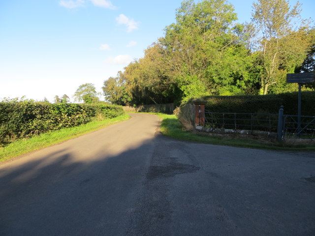
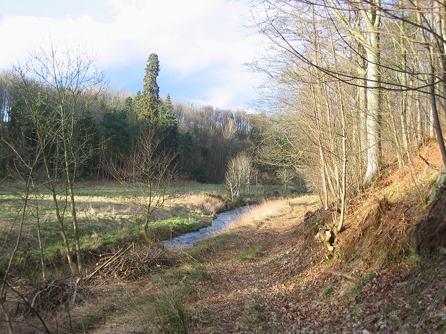
Howdenflat Plantation Images

Images are sourced within 2km of 55.948975/-2.6277279 or Grid Reference NT6073. Thanks to Geograph Open Source API. All images are credited.

Ordnance Survey Flush Bracket 673 This can be found on the wall of North Lodge - a private dwelling - at the entrance to the Whittingehame Estate.
For more detail see : <span class="nowrap"><a title="http://www.bench-marks.org.uk/bm23" rel="nofollow ugc noopener" href="http://www.bench-marks.org.uk/bm23">Link</a><img style="margin-left:2px;" alt="External link" title="External link - shift click to open in new window" src="https://s1.geograph.org.uk/img/external.png" width="10" height="10"/></span>
Ordnance Survey Flush Bracket 673
This can be found on the wall of North Lodge - a private dwelling - at the entrance to the Whittingehame Estate. For more detail see : LinkExternal link
Road at North Lodge Looking northward from the entrance to the Whittingehame Estate.
Road at North Lodge
Looking northward from the entrance to the Whittingehame Estate.
Papple Steading There is no shortage of interesting steadings in East Lothian, but Papple is unusually striking. It is described as Germanic in style, with a steep pyramid over the archway which is the access to the courtyard, stables, cattle courts and ancillary buildings. It is a Category B Listed Building, and it is in course of being redeveloped as a heritage centre telling the story of the agricultural revolution of the 18th and 19th centuries.
Papple Steading
There is no shortage of interesting steadings in East Lothian, but Papple is unusually striking. It is described as Germanic in style, with a steep pyramid over the archway which is the access to the courtyard, stables, cattle courts and ancillary buildings. It is a Category B Listed Building, and it is in course of being redeveloped as a heritage centre telling the story of the agricultural revolution of the 18th and 19th centuries.
Arable Land at Papple The buildings are at Papple Farm, in the next square.
Arable Land at Papple
The buildings are at Papple Farm, in the next square.
Road to Luggate Burn
Luggate Farm in the usual pattern, buildings with a grain dryer and its lum, and a collection of cottages that would have housed the work force in the days before mechanisation.  This is a common unit of habitation in East Lothian where villages are widely scattered away from the coal fields.
Luggate
Farm in the usual pattern, buildings with a grain dryer and its lum, and a collection of cottages that would have housed the work force in the days before mechanisation. This is a common unit of habitation in East Lothian where villages are widely scattered away from the coal fields.
Woodland edge, Whittingehame Edge of the woods around Whittingehame House.
Woodland edge, Whittingehame
Edge of the woods around Whittingehame House.
Cut timber. Whittingehame's wood awaiting a trip to the sawmill. In a welcome shelterbelt.
Cut timber.
Whittingehame's wood awaiting a trip to the sawmill. In a welcome shelterbelt.
Whittingehame Water Below Papple. Looking downstream.
Whittingehame Water
Below Papple. Looking downstream.
Papple Steading and Doocot Mid 19th century farm steading. The entrance range is in Germanic style with a pointed-arch opening to doocot in roof. The pyramid spire is topped by a decorative weathervane.
Papple Steading and Doocot
Mid 19th century farm steading. The entrance range is in Germanic style with a pointed-arch opening to doocot in roof. The pyramid spire is topped by a decorative weathervane.
Papple Farm and Steadings Mid 19th century farm and steadings. There is and engine house (chimney) adjoined to the north range. The main entrance bay has a pyramidal roof containing a doocot.
Papple Farm and Steadings
Mid 19th century farm and steadings. There is and engine house (chimney) adjoined to the north range. The main entrance bay has a pyramidal roof containing a doocot.
Whittingehame Water The steep glen of the Whittingehame Water broadens out as the river approaches Papple.
Whittingehame Water
The steep glen of the Whittingehame Water broadens out as the river approaches Papple.
Overfield - disused access The damaged 'No Thoroughfare' sign is superfluous due to dense woods.
Overfield - disused access
The damaged 'No Thoroughfare' sign is superfluous due to dense woods.
Grassland, Stoneypath Horses grazing on rolling farmland which is typical of the area.
Grassland, Stoneypath
Horses grazing on rolling farmland which is typical of the area.
Birks Plantation Birks Plantation is a long wood on mostly steep ground.
Birks Plantation
Birks Plantation is a long wood on mostly steep ground.
The engine house, Overfield In the 19th century, many farms built engine houses to power threshing machines. This one at Overfield, near Whittingehame, is a fine example and is one of thirty such steam engine houses which still survive in East Lothian. Ref : Tom Orr
The engine house, Overfield
In the 19th century, many farms built engine houses to power threshing machines. This one at Overfield, near Whittingehame, is a fine example and is one of thirty such steam engine houses which still survive in East Lothian. Ref : Tom Orr
The Whittingehame Water Flowing through thick undergrowth near Papple.
The Whittingehame Water
Flowing through thick undergrowth near Papple.
Show me another place!

Howdenflat Plantation is located at Grid Ref: NT6073 (Lat: 55.948975, Lng: -2.6277279)

Unitary Authority: East Lothian

Police Authority: The Lothians and Scottish Borders

What 3 Words

///papers.twisty.powering. Near East Linton, East Lothian

Related Wikis

Whittingehame

Whittingehame is a parish with a small village in East Lothian, Scotland, about halfway between Haddington and Dunbar, and near East Linton. The area is...

Whittingehame Tower

Whittingehame Tower, or Whittingehame Castle, is a fifteenth-century tower house about 2.5 miles (4.0 km) south of East Linton, on the west bank of Whittinghame...

Stenton

Stenton (Scots: Staneton) is a parish and village in East Lothian, Scotland. It is bounded on the north by parts of the parishes of Prestonkirk and Dunbar...

Pressmennan Lake

Pressmennan Lake is a lake in East Lothian in Scotland. It is an artificial reservoir constructed in 1819 by a Mr Nesbit who dammed the streams flowing...

Stoneypath Tower

Stoneypath Tower, is an L-plan tower house dating from the late sixteenth century, about 3.5 miles (5.6 km) south of East Linton, and east of the Whittinghame...

Garvald, East Lothian

Garvald is a village south-east of Haddington in East Lothian, Scotland. It lies on the Papana Water south of the B6370, east of Gifford. The combined...

Biel Water

The Biel Water is a river running through the Biel Estate in Biel, East Lothian. It runs for 4.5 kilometres from the Luggate Burn and the Whittinghame...

Traprain Law

Traprain Law is a hill 6 km (4 mi) east of Haddington, East Lothian, Scotland. It is the site of a hill fort or possibly oppidum, which covered at its...

Nearby Amenities

Located within 500m of 55.948975,-2.6277279
Clint cottage
Tourism: chalet
Lat/Long: 55.9489582/-2.6217519
The data included in this document is from www.openstreetmap.org. The data is made available under ODbL.

Have you been to Howdenflat Plantation?

Leave your review of Howdenflat Plantation below (or comments, questions and feedback).