Bedrule Strips

Wood, Forest in Roxburghshire

Scotland

Bedrule Strips

Farm access at Bedrule
Farm access at Bedrule Credit: Alan Reid

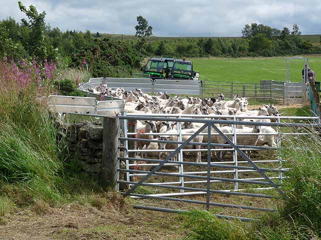
Bedrule Strips is a woodland area located in the historic county of Roxburghshire, in the Scottish Borders region of Scotland. Situated near the village of Bedrule, the strips encompass a total area of approximately 300 acres. This woodland is characterized by its dense growth of mixed broadleaf and coniferous trees, creating a diverse and picturesque landscape.

The woodland is primarily composed of native tree species, including oak, birch, beech, and Scots pine. These trees provide a habitat for a variety of wildlife, such as red squirrels, roe deer, and numerous species of birds. The forest floor is adorned with a rich carpet of ferns, mosses, and wildflowers, adding to the natural beauty of the area.

Bedrule Strips have a long history, with records dating back to the medieval era. In the past, the woodland was managed for timber production, providing a valuable resource for the local community. However, in recent years, the focus has shifted towards conservation and recreation. The woodland now serves as a recreational area for nature enthusiasts, offering walking trails and birdwatching opportunities.

The strips are managed by a local conservation group, who work to maintain the woodland's ecological balance and protect its biodiversity. They also organize educational activities and events to raise awareness about the importance of woodland conservation.

Overall, Bedrule Strips in Roxburghshire is a beautiful woodland area, rich in natural diversity and offering a peaceful escape into nature for visitors and locals alike.

If you have any feedback on the listing, please let us know in the comments section below.

Bedrule Strips Images

Images are sourced within 2km of 55.460406/-2.6384441 or Grid Reference NT5918. Thanks to Geograph Open Source API. All images are credited.

Farm access at Bedrule
New house at Bedrule
War memorial, Bedrule At the road junction south of the village.
War memorial, Bedrule
At the road junction south of the village.
Bedrule Village Hall A spacious hall for this small village, though I expect it caters for people from a wide area in these scattered communities. Rubers Law is in the background.
Bedrule Village Hall
A spacious hall for this small village, though I expect it caters for people from a wide area in these scattered communities. Rubers Law is in the background.
Minor road heading towards Huntly Hill Looking south-eastward.
Minor road heading towards Huntly Hill
Looking south-eastward.
Minor road enclosed between hedge and woodland near to Monks Pond Looking south-westward.
Minor road enclosed between hedge and woodland near to Monks Pond
Looking south-westward.
Minor road near Bedrule on a frosty December morning Looking north-eastward.
Minor road near Bedrule on a frosty December morning
Looking north-eastward.
Descending  from  Black  Law  toward  Bedrule An excellent view of the extinct volcano Rubers Law
Descending from Black Law toward Bedrule
An excellent view of the extinct volcano Rubers Law
Borders  Abbeys  Way  toward  Bedrule The B A Way follows this wall along to a track going right to the road at Bedrule
Borders Abbeys Way toward Bedrule
The B A Way follows this wall along to a track going right to the road at Bedrule
Road  into  Bedrule
Road into Bedrule
Road  junction  at  War  Memorial  near  Bedrule Borders Abbeys Way goes right here down to the river, Rule Water
Road junction at War Memorial near Bedrule
Borders Abbeys Way goes right here down to the river, Rule Water
War  Memorial  Bedrule Commemorating both world wars. The B A Way turns at this junction
War Memorial Bedrule
Commemorating both world wars. The B A Way turns at this junction
Farm road at Bedrule Forming part of the Border Abbeys Way.
Farm road at Bedrule
Forming part of the Border Abbeys Way.
Severely pruned trees Severely pruned mature trees at Bedrule Farm.
Severely pruned trees
Severely pruned mature trees at Bedrule Farm.
Field of oilseed rape North of Bedrule. Tractor tracks have made quite a mark.
Field of oilseed rape
North of Bedrule. Tractor tracks have made quite a mark.
Scottish National Sheepdog Trials, 2011 At Ruecastle Farm on the B6358.
Scottish National Sheepdog Trials, 2011
At Ruecastle Farm on the B6358.
Scottish National Sheepdog Trials, 2011 Don't know about the sheepdogs, but it is certainly a trial for the sheep involved.
Scottish National Sheepdog Trials, 2011
Don't know about the sheepdogs, but it is certainly a trial for the sheep involved.
Track above Bedrule On the route of the Borders Abbeys Way between Denholm and Jedburgh, giving views across Teviotdale to the west. Compare with <a href="https://www.geograph.org.uk/photo/107716">NT6017 : On the Borders Abbey Way near Bedrule</a> taken in October 2005 - the gate is the same.
Track above Bedrule
On the route of the Borders Abbeys Way between Denholm and Jedburgh, giving views across Teviotdale to the west. Compare with NT6017 : On the Borders Abbey Way near Bedrule taken in October 2005 - the gate is the same.
Show me another place!

Bedrule Strips is located at Grid Ref: NT5918 (Lat: 55.460406, Lng: -2.6384441)

Unitary Authority: The Scottish Borders

Police Authority: The Lothians and Scottish Borders

What 3 Words

///shrugging.judge.beside. Near Jedburgh, Scottish Borders

Related Wikis

Bedrule Castle

Bedrule Castle is a ruined 13th-century castle in the Rule Valley, in the Scottish Borders area of Scotland.The castle was built in the 13th century by...

Bedrule

Bedrule (Scottish Gaelic: Ruail Bheathaig) is a hamlet and civil parish in the historic county of Roxburghshire in the Scottish Borders area of Scotland...

Spittal-on-Rule

Spittal-on-Rule is a farm in the council area of Scottish Borders in Scotland. As the name suggests it is situated on the river Rule Water, and the Spittal...
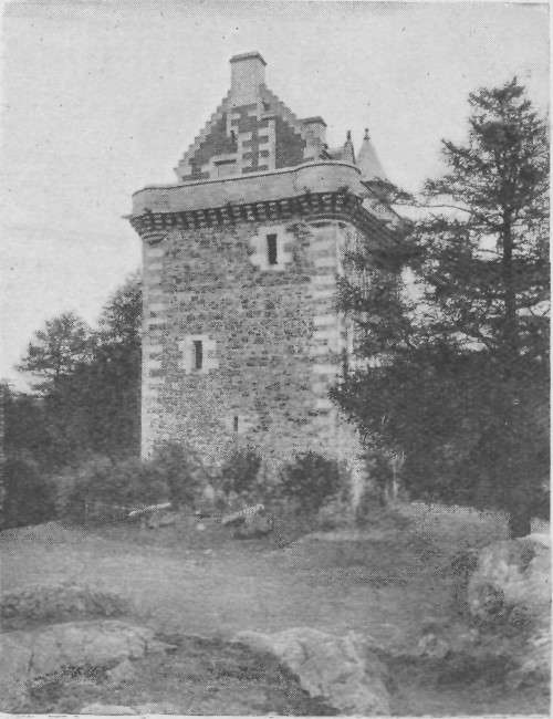
Barnhills Tower

Barnhills Tower was a 16th century tower house about 4.5 miles (7.2 km) west of Jedburgh in the Scottish Borders, Scotland, north of the River Teviot...

Rule Water

The Rule Water is a river in the Scottish Borders area of Scotland, and a tributary of the River Teviot. The Rule Water rises in Wauchope Forest and passes...

Fatlips Castle

Fatlips Castle is a peel tower in Roxburghshire, in the Scottish Borders. Situated at the top of Minto Crags, above the River Teviot, it was built in the...
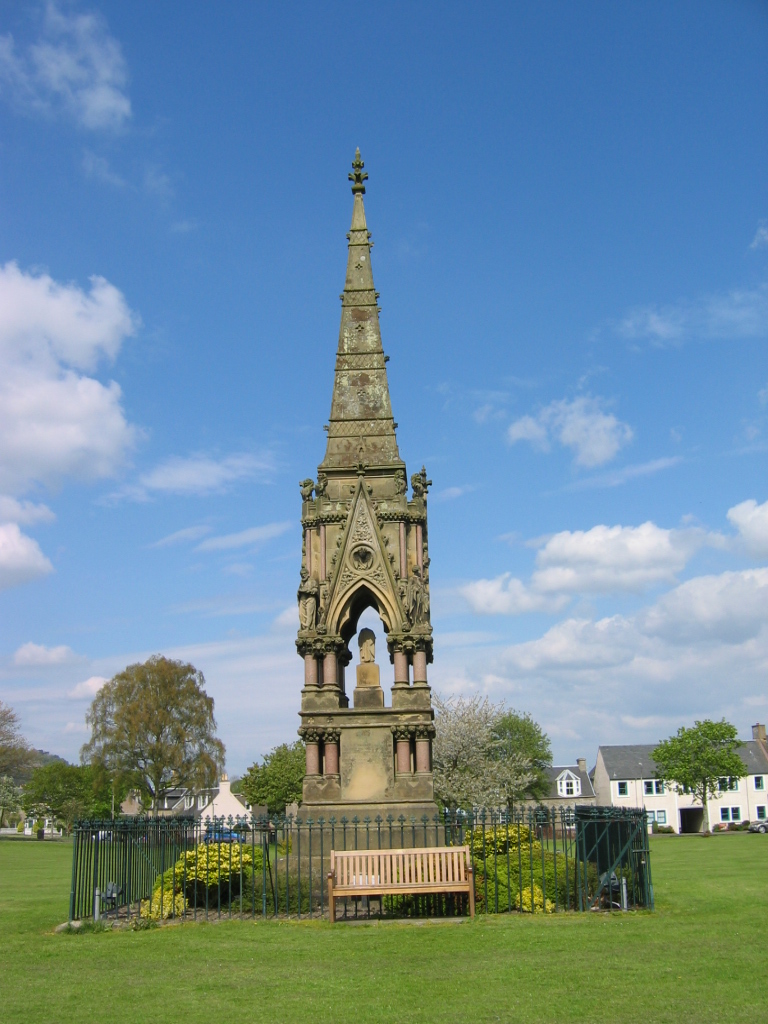
Denholm

Denholm is a small village located between Jedburgh and Hawick in the Scottish Borders region of Scotland, UK. The estimated population of Denholm is 600...

Westgate Hall, Denholm

Westgate Hall is located in Westgate in the village of Denholm, Roxburghshire, in the Scottish Borders. It stands at the western and south-western approaches...

Nearby Amenities

Located within 500m of 55.460406,-2.6384441
Power: pole
Source: Bing
Lat/Long: 55.4622666/-2.6452083
Power: pole
Source: Bing
Lat/Long: 55.4623168/-2.6421133
Power: pole
Source: Bing
Lat/Long: 55.4623357/-2.6409479
Power: pole
Source: Bing
Lat/Long: 55.4623537/-2.6398357
Power: pole
Source: Bing
Lat/Long: 55.4623839/-2.6386395
Power: pole
Source: Bing
Lat/Long: 55.4624151/-2.6374075
Power: pole
Source: Bing
Lat/Long: 55.4624445/-2.6362418
Power: pole
Source: Bing
Lat/Long: 55.4625067/-2.6337834
Power: pole
Source: Bing
Lat/Long: 55.4625265/-2.6329997
Power: pole
Source: Bing
Lat/Long: 55.4626122/-2.6450151
Power: pole
Source: Bing
Lat/Long: 55.4625561/-2.6318313
Power: pole
Source: Bing
Lat/Long: 55.4627876/-2.6425291
Power: pole
Source: Bing
Lat/Long: 55.4627413/-2.6431859
Power: pole
Source: Bing
Lat/Long: 55.4625452/-2.6397626
Power: pole
Source: Bing
Lat/Long: 55.4626084/-2.6374948
Power: pole
Source: Bing
Lat/Long: 55.4626445/-2.6361993
Power: pole
Source: Bing
Lat/Long: 55.4627498/-2.6324198
Bedrule Mill
Place: isolated_dwelling
Lat/Long: 55.4586479/-2.6434613
Fast Castle (Site of)
Historic: archaeological_site
Lat/Long: 55.456447/-2.6416438
Ford: yes
Lat/Long: 55.4573707/-2.6417325
Barrier: cattle_grid
Lat/Long: 55.4606547/-2.63792
Power: pole
Lat/Long: 55.4624689/-2.6352799
Power: pole
Lat/Long: 55.4627078/-2.6416182
Power: pole
Lat/Long: 55.4626256/-2.6406793
Power: pole
Lat/Long: 55.4625933/-2.6380369
Power: pole
Lat/Long: 55.4626819/-2.6348557
Power: pole
Lat/Long: 55.4627194/-2.6335118
Power: pole
Lat/Long: 55.4621264/-2.6396003
Power: pole
Lat/Long: 55.4628205/-2.6399668
Power: pole
Lat/Long: 55.4633543/-2.641107
Power: pole
Lat/Long: 55.4639012/-2.6422956
Power: pole
Lat/Long: 55.4561421/-2.636195
Power: pole
Lat/Long: 55.4569315/-2.6368287
Power: pole
Lat/Long: 55.4576819/-2.6374014
Power: pole
Lat/Long: 55.4585276/-2.6378137
Power: pole
Lat/Long: 55.4593588/-2.6382489
Power: pole
Lat/Long: 55.459923/-2.6385161
Power: pole
Lat/Long: 55.4604309/-2.6387553
Power: pole
Lat/Long: 55.4614064/-2.639272
Power: pole
Lat/Long: 55.4602477/-2.6398854
Power: pole
Lat/Long: 55.4603068/-2.6419316
Power: pole
Lat/Long: 55.4602332/-2.643054
Power: pole
Lat/Long: 55.4601337/-2.6444996
Power: pole
Lat/Long: 55.4598523/-2.6453064
Power: pole
Lat/Long: 55.459568/-2.6461081
Power: pole
Lat/Long: 55.4599446/-2.644184
Power: pole
Lat/Long: 55.4595132/-2.6434917
The data included in this document is from www.openstreetmap.org. The data is made available under ODbL.

Have you been to Bedrule Strips?

Leave your review of Bedrule Strips below (or comments, questions and feedback).