Milltown Belt

Wood, Forest in Aberdeenshire

Scotland

Milltown Belt

Night and Day 
Art Trail 


Hare, there and everywhere!
Clan Cancer Support, the north-east’s leading cancer support charity, has partnered with Wild in Art once again to bring an exciting new art trail to the north-east, Moray, Orkney and Shetland.

The Big Hop Trail will take the public on another cultural tour of the north-east and the islands from July to September 2023, with hare sculptures designed and created by some of the country’s most talented artists.

The trail coincides with Clan’s 40th anniversary, with the 40 hares being the focal point to celebrate the charity’s commitment to supporting people affected by cancer. 

We chose the hare sculpture as they are an indigenous animal found in all parts of Clan’s geography. Much like our clients during their cancer journey, hares have to navigate rough and difficult terrain in order to survive. They are also adaptable, like our services team who deliver support to anyone affected by cancer. Most importantly, hares have incredible hearing. What better way to depict our lifeline listening and support service and the importance of being heard?
Night and Day Credit: Ralph Greig

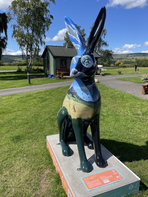
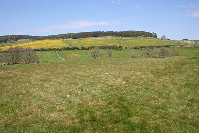
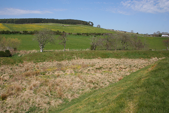
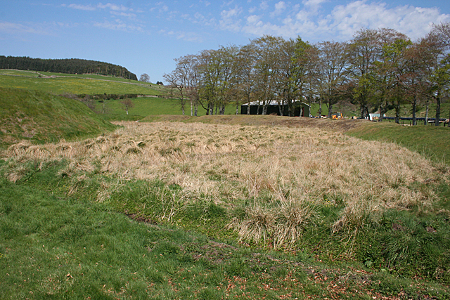
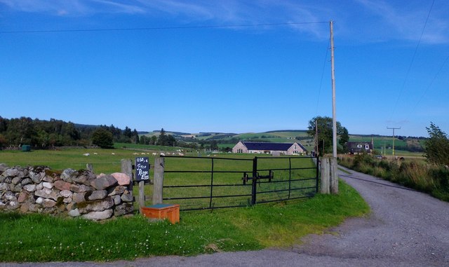
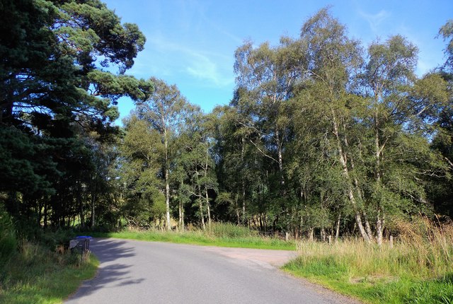
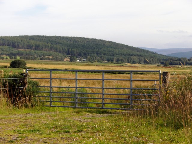
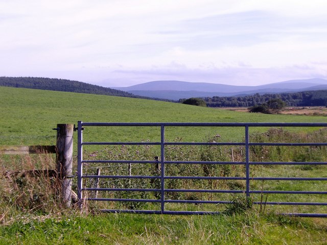
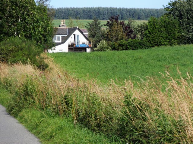
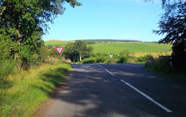
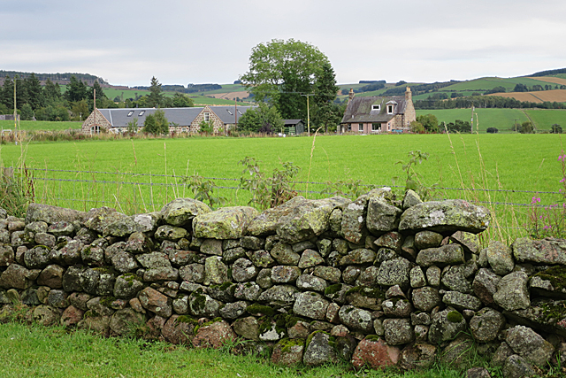
Milltown Belt, located in Aberdeenshire, Scotland, is a picturesque wood and forest area spanning approximately 200 acres. It is well-known for its beautiful landscapes, rich biodiversity, and historical significance. The belt has been carefully preserved and maintained by local authorities, making it an attractive destination for nature enthusiasts, hikers, and those seeking tranquility amidst nature.

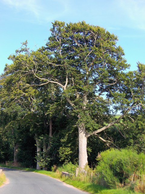
The woodlands in Milltown Belt are primarily composed of native tree species such as oak, birch, and pine. The varying tree sizes and densities create a diverse ecosystem, providing a habitat for a wide range of flora and fauna. Visitors can witness a stunning array of wildflowers, including bluebells and primroses, which bloom during the spring season, creating a colorful tapestry.

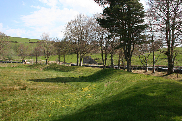
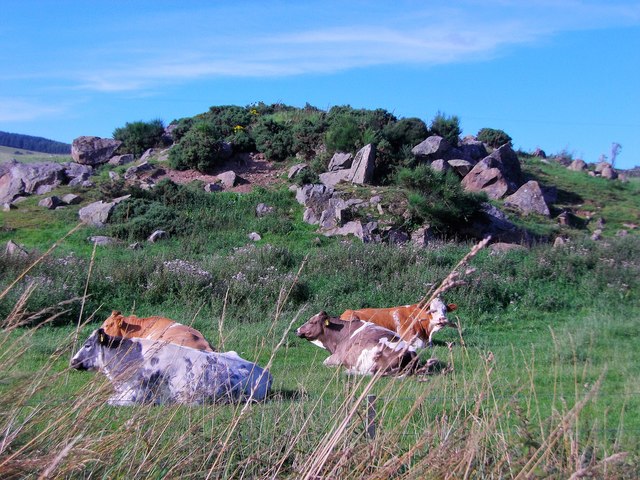
The forest is also home to a diverse range of wildlife species. Birdwatchers can spot various species of birds, such as woodpeckers, owls, and finches. Small mammals like red squirrels, foxes, and badgers can also be spotted in their natural habitat.

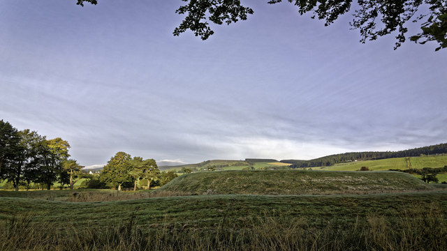
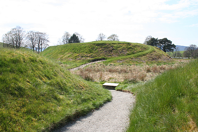
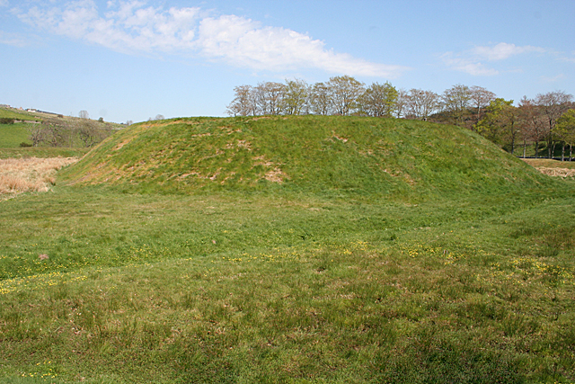
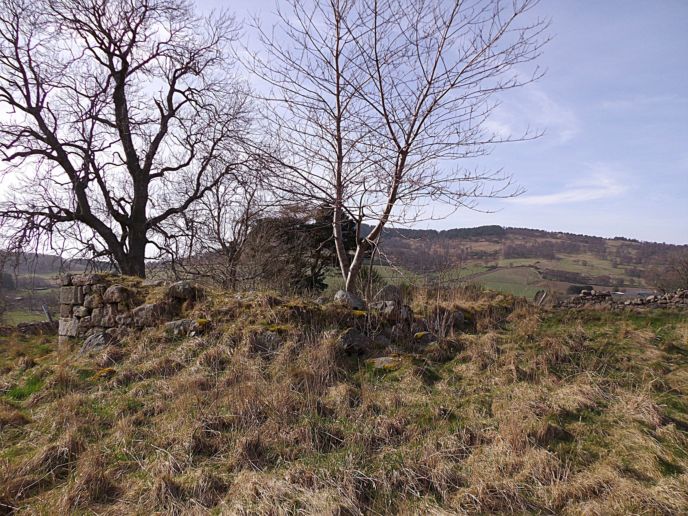
Milltown Belt has a rich historical background, with traces of ancient settlements and archaeological sites. The area has witnessed human activity dating back to the Neolithic era, and remnants of stone circles and burial sites can be found within the woodlands. These historical elements add a sense of mystery and fascination to the overall experience of exploring Milltown Belt.

Overall, Milltown Belt in Aberdeenshire offers a captivating blend of natural beauty, biodiversity, and historical significance. It provides a peaceful retreat for visitors, allowing them to immerse themselves in the wonders of nature while appreciating the rich cultural heritage of the area.

If you have any feedback on the listing, please let us know in the comments section below.

Milltown Belt Images

Images are sourced within 2km of 57.111396/-2.7034135 or Grid Reference NJ5702. Thanks to Geograph Open Source API. All images are credited.

Night and Day 
Art Trail 


Hare, there and everywhere!
Clan Cancer Support, the north-east’s leading cancer support charity, has partnered with Wild in Art once again to bring an exciting new art trail to the north-east, Moray, Orkney and Shetland.

The Big Hop Trail will take the public on another cultural tour of the north-east and the islands from July to September 2023, with hare sculptures designed and created by some of the country’s most talented artists.

The trail coincides with Clan’s 40th anniversary, with the 40 hares being the focal point to celebrate the charity’s commitment to supporting people affected by cancer. 

We chose the hare sculpture as they are an indigenous animal found in all parts of Clan’s geography. Much like our clients during their cancer journey, hares have to navigate rough and difficult terrain in order to survive. They are also adaptable, like our services team who deliver support to anyone affected by cancer. Most importantly, hares have incredible hearing. What better way to depict our lifeline listening and support service and the importance of being heard?
Night and Day
Art Trail Hare, there and everywhere! Clan Cancer Support, the north-east’s leading cancer support charity, has partnered with Wild in Art once again to bring an exciting new art trail to the north-east, Moray, Orkney and Shetland. The Big Hop Trail will take the public on another cultural tour of the north-east and the islands from July to September 2023, with hare sculptures designed and created by some of the country’s most talented artists. The trail coincides with Clan’s 40th anniversary, with the 40 hares being the focal point to celebrate the charity’s commitment to supporting people affected by cancer. We chose the hare sculpture as they are an indigenous animal found in all parts of Clan’s geography. Much like our clients during their cancer journey, hares have to navigate rough and difficult terrain in order to survive. They are also adaptable, like our services team who deliver support to anyone affected by cancer. Most importantly, hares have incredible hearing. What better way to depict our lifeline listening and support service and the importance of being heard?
Deeside Activity Park
Peel of Lumphanan
Peel of Lumphanan
Peel of Lumphanan (1) The Peel is a flat-topped motte surrounded by an outer rampart, with some boggy ground in between. This is the view from the entrance through a gap in the rampart. See <span class="nowrap"><a title="https://canmore.org.uk/site/17497/lumphanan" rel="nofollow ugc noopener" href="https://canmore.org.uk/site/17497/lumphanan">Link</a><img style="margin-left:2px;" alt="External link" title="External link - shift click to open in new window" src="https://s1.geograph.org.uk/img/external.png" width="10" height="10"/></span> for more information. <a href="https://www.geograph.org.uk/photo/4952465">NJ5703 : Peel of Lumphanan (2)</a>
Peel of Lumphanan (1)
The Peel is a flat-topped motte surrounded by an outer rampart, with some boggy ground in between. This is the view from the entrance through a gap in the rampart. See LinkExternal link for more information. NJ5703 : Peel of Lumphanan (2)
Peel of Lumphanan (2) The foreground is the flat top of the mediaeval motte, though it's not very enlightening as it's too wide to fit in the viewfinder. See <span class="nowrap"><a title="https://canmore.org.uk/site/17497/lumphanan" rel="nofollow ugc noopener" href="https://canmore.org.uk/site/17497/lumphanan">Link</a><img style="margin-left:2px;" alt="External link" title="External link - shift click to open in new window" src="https://s1.geograph.org.uk/img/external.png" width="10" height="10"/></span> for more information and for an aerial photograph which shows it much more convincingly. <a href="https://www.geograph.org.uk/photo/4952470">NJ5703 : Peel of Lumphanan (3)</a> I reckon the best part of this view is the field of buttercups at upper left.
Peel of Lumphanan (2)
The foreground is the flat top of the mediaeval motte, though it's not very enlightening as it's too wide to fit in the viewfinder. See LinkExternal link for more information and for an aerial photograph which shows it much more convincingly. NJ5703 : Peel of Lumphanan (3) I reckon the best part of this view is the field of buttercups at upper left.
Peel of Lumphanan (3) Looking from the top of the motte over some boggy ground to the earthen rampart. See <span class="nowrap"><a title="https://canmore.org.uk/site/17497/lumphanan" rel="nofollow ugc noopener" href="https://canmore.org.uk/site/17497/lumphanan">Link</a><img style="margin-left:2px;" alt="External link" title="External link - shift click to open in new window" src="https://s1.geograph.org.uk/img/external.png" width="10" height="10"/></span> for more information. <a href="https://www.geograph.org.uk/photo/4952472">NJ5703 : Peel of Lumphanan (4)</a> In the background is Craigton Hill.
Peel of Lumphanan (3)
Looking from the top of the motte over some boggy ground to the earthen rampart. See LinkExternal link for more information. NJ5703 : Peel of Lumphanan (4) In the background is Craigton Hill.
Peel of Lumphanan (4) This is part of the earth rampart that surrounds the motte. See <span class="nowrap"><a title="https://canmore.org.uk/site/17497/lumphanan" rel="nofollow ugc noopener" href="https://canmore.org.uk/site/17497/lumphanan">Link</a><img style="margin-left:2px;" alt="External link" title="External link - shift click to open in new window" src="https://s1.geograph.org.uk/img/external.png" width="10" height="10"/></span> for more information. <a href="https://www.geograph.org.uk/photo/4952474">NJ5703 : Peel of Lumphanan (5)</a> The masonry in the background is one side of a former railway overbridge.
Peel of Lumphanan (4)
This is part of the earth rampart that surrounds the motte. See LinkExternal link for more information. NJ5703 : Peel of Lumphanan (5) The masonry in the background is one side of a former railway overbridge.
Peel of Lumphanan (5) The motte is oval, and this is looking along the longer axis of the oval, which is the narrowest view, and can all be fitted into the viewfinder. See <span class="nowrap"><a title="https://canmore.org.uk/site/17497/lumphanan" rel="nofollow ugc noopener" href="https://canmore.org.uk/site/17497/lumphanan">Link</a><img style="margin-left:2px;" alt="External link" title="External link - shift click to open in new window" src="https://s1.geograph.org.uk/img/external.png" width="10" height="10"/></span> for more information. <a href="https://www.geograph.org.uk/photo/4952478">NJ5703 : Peel of Lumphanan (6)</a>
Peel of Lumphanan (5)
The motte is oval, and this is looking along the longer axis of the oval, which is the narrowest view, and can all be fitted into the viewfinder. See LinkExternal link for more information. NJ5703 : Peel of Lumphanan (6)
Peel of Lumphanan (6) This shows the south-eastern side of the motte, the boggy low-lying surround, and the encircling earth rampart. See <span class="nowrap"><a title="https://canmore.org.uk/site/17497/lumphanan" rel="nofollow ugc noopener" href="https://canmore.org.uk/site/17497/lumphanan">Link</a><img style="margin-left:2px;" alt="External link" title="External link - shift click to open in new window" src="https://s1.geograph.org.uk/img/external.png" width="10" height="10"/></span> for more information. <a href="https://www.geograph.org.uk/photo/4952461">NJ5703 : Peel of Lumphanan (1)</a> The building belongs to the neighbouring farm. It is not on the maps, so must be quite new. I am rather surprised that it was given planning permission when it has such a prominent effect on the view of the Peel.
Peel of Lumphanan (6)
This shows the south-eastern side of the motte, the boggy low-lying surround, and the encircling earth rampart. See LinkExternal link for more information. NJ5703 : Peel of Lumphanan (1) The building belongs to the neighbouring farm. It is not on the maps, so must be quite new. I am rather surprised that it was given planning permission when it has such a prominent effect on the view of the Peel.
The resurrected steading at Home Farm, Auchenhove Seen from the access off the minor road.
The resurrected steading at Home Farm, Auchenhove
Seen from the access off the minor road.
Access to Auchenhove House Off minor road to Lumphanan.
Access to Auchenhove House
Off minor road to Lumphanan.
A 7-bar steel field gate Off minor road west of Bogloch Farm.
A 7-bar steel field gate
Off minor road west of Bogloch Farm.
Another 7-bar steel field gate Off a minor road, near Bogloch Farm.
Another 7-bar steel field gate
Off a minor road, near Bogloch Farm.
Approaching Lea of Auchenhove On minor road from Marywell Copse.
Approaching Lea of Auchenhove
On minor road from Marywell Copse.
A rock pile near Cairn-na-Shin Cattle resting in its lea; near the minor road from Bogloch to Lumphanan
A rock pile near Cairn-na-Shin
Cattle resting in its lea; near the minor road from Bogloch to Lumphanan
'Give Way' at Eight Acres crossroads Crossroad of minor roads, west of Lumphanan.
'Give Way' at Eight Acres crossroads
Crossroad of minor roads, west of Lumphanan.
Mature trees sheltering Lumphanan Sewage Works (in August) Compare a view of the same area on the west side of Lumphanan in January 2008 <a href="https://www.geograph.org.uk/photo/307517">NJ5703 : Bridge over Dess Burn</a>.
Mature trees sheltering Lumphanan Sewage Works (in August)
Compare a view of the same area on the west side of Lumphanan in January 2008 NJ5703 : Bridge over Dess Burn.
Auchenhove Home Farm It's relatively unusual to find a 'home farm' in Scotland. Farms run directly by an estate are more commonly called 'Mains of ....'. Interestingly, this farm is on the second edition six-inch map, but not on the first edition, so it must have been built in the second half of the 19th century on a greenfield site. That too is quite unusual.
Auchenhove Home Farm
It's relatively unusual to find a 'home farm' in Scotland. Farms run directly by an estate are more commonly called 'Mains of ....'. Interestingly, this farm is on the second edition six-inch map, but not on the first edition, so it must have been built in the second half of the 19th century on a greenfield site. That too is quite unusual.
Show me another place!

Milltown Belt is located at Grid Ref: NJ5702 (Lat: 57.111396, Lng: -2.7034135)

Unitary Authority: Aberdeenshire

Police Authority: North East

What 3 Words

///blogs.buzzards.galaxies. Near Torphins, Aberdeenshire

Nearby Locations

Milltown Belt

Related Wikis

Battle of Lumphanan

The Battle of Lumphanan was fought on 15 August 1057, between Macbeth, King of Scots, and the future King Malcolm III. Macbeth would die from wounds sustained...

Peel of Lumphanan

The Peel of Lumphanan, also known as the Peel Ring or Peel Bog of Lumphanan, is a defensive structure dating back to the 13th century. It is located near...

Auchenhove Castle

Auchenhove Castle is a castle, of which little remains, dating from the 16th century, 3.5 miles (5.6 km) north-east of Aboyne, at Auchenhove, Aberdeenshire...

Lumphanan railway station

Lumphanan railway station, Lumphanan, Aberdeenshire, Scotland stood from 1859 to 1966 on the Deeside Railway that ran from Aberdeen (Joint) to Ballater...

Nearby Amenities

Located within 500m of 57.111396,-2.7034135
Power: pole
Lat/Long: 57.115371/-2.702787
Power: pole
Lat/Long: 57.1147997/-2.7033706
Power: pole
Lat/Long: 57.114191/-2.703993
Power: pole
Lat/Long: 57.1135842/-2.7046084
Power: pole
Lat/Long: 57.1129581/-2.7052627
Power: pole
Lat/Long: 57.1125097/-2.7057012
Power: pole
Lat/Long: 57.1120316/-2.7061999
Power: pole
Lat/Long: 57.1113757/-2.7066933
Power: pole
Lat/Long: 57.1108159/-2.7069709
Power: pole
Lat/Long: 57.1102167/-2.7071495
Power: pole
Lat/Long: 57.1096732/-2.7073175
Power: pole
Lat/Long: 57.1089252/-2.7075509
Power: pole
Lat/Long: 57.1081963/-2.7077596
Power: pole
Lat/Long: 57.1132241/-2.7055916
Power: pole
Lat/Long: 57.1126854/-2.7046349
Power: pole
Lat/Long: 57.1141343/-2.7089479
Power: pole
Lat/Long: 57.113975/-2.7081681
Power: pole
Lat/Long: 57.113829/-2.7073617
Power: pole
Lat/Long: 57.1136811/-2.7065978
Power: pole
Lat/Long: 57.1082174/-2.7007499
Power: pole
Lat/Long: 57.1090241/-2.7009356
Power: pole
Lat/Long: 57.1080734/-2.7088347
Power: pole
Lat/Long: 57.1083672/-2.7063361
Power: pole
Lat/Long: 57.1085151/-2.7051389
Power: pole
Lat/Long: 57.1087062/-2.7035934
Power: pole
Lat/Long: 57.1088474/-2.7023732
Power: pole
Lat/Long: 57.1091691/-2.6997243
Power: pole
Lat/Long: 57.1093515/-2.6982335
Power: pole
Lat/Long: 57.1096204/-2.6974555
Power: pole
Lat/Long: 57.110018/-2.6963025
The data included in this document is from www.openstreetmap.org. The data is made available under ODbL.

Have you been to Milltown Belt?

Leave your review of Milltown Belt below (or comments, questions and feedback).