Knockhill Wood

Wood, Forest in East Lothian

Scotland

Knockhill Wood

Deserted Hopes Looking to West Hope from near Hopes Dam, hills and tracks deserted now that you are no longer permitted to park at the end of the public road, unless you are 1 of the lucky 12 to get a permit.
Deserted Hopes Credit: Adam Ward

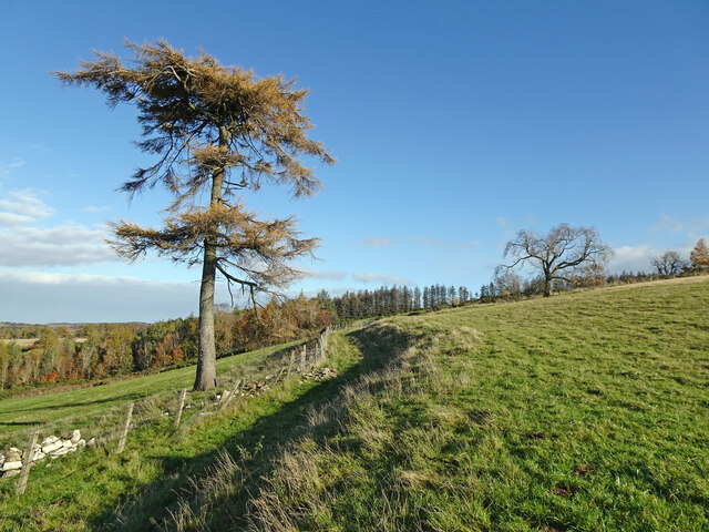
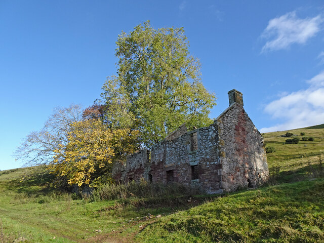
Knockhill Wood is a picturesque forest located in East Lothian, Scotland. Spanning across an area of approximately 100 acres, this woodland is a popular destination for nature enthusiasts and outdoor adventurers alike.

Situated just a few miles from the charming village of Gifford, Knockhill Wood offers a tranquil retreat from the hustle and bustle of everyday life. The woodland is characterized by its diverse range of tree species, including oak, beech, and birch, which create a vibrant and colorful canopy during the autumn months.

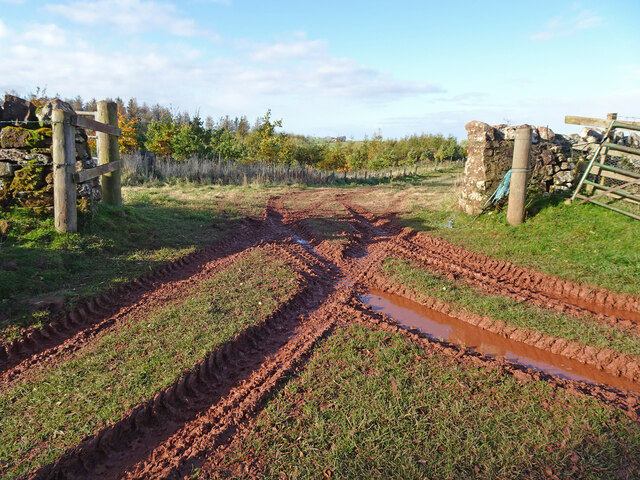
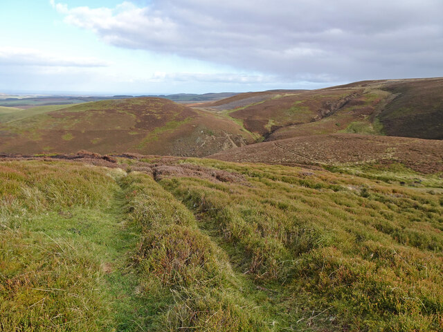
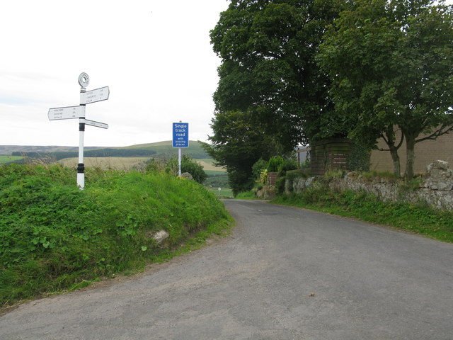
Visitors to Knockhill Wood can explore its many walking trails, which wind their way through the forest and provide breathtaking views of the surrounding countryside. These trails cater to all levels of fitness and offer opportunities for both leisurely strolls and more challenging hikes.

Wildlife thrives in Knockhill Wood, making it a haven for nature lovers. Squirrels, rabbits, and a variety of bird species can often be spotted amidst the trees, providing ample opportunities for wildlife enthusiasts to observe and appreciate the natural world.

For those seeking a bit of adventure, Knockhill Wood also offers opportunities for mountain biking. Its network of trails is suitable for both beginners and experienced riders, with varying levels of difficulty to cater to different skill levels.

Overall, Knockhill Wood is a beautiful and diverse woodland that provides a peaceful and immersive experience for visitors. Its natural beauty, combined with its range of recreational activities, makes it a must-visit destination for anyone looking to connect with nature in East Lothian.

If you have any feedback on the listing, please let us know in the comments section below.

Knockhill Wood Images

Images are sourced within 2km of 55.863927/-2.7095513 or Grid Reference NT5563. Thanks to Geograph Open Source API. All images are credited.

Deserted Hopes Looking to West Hope from near Hopes Dam, hills and tracks deserted now that you are no longer permitted to park at the end of the public road, unless you are 1 of the lucky 12 to get a permit.
Deserted Hopes
Looking to West Hope from near Hopes Dam, hills and tracks deserted now that you are no longer permitted to park at the end of the public road, unless you are 1 of the lucky 12 to get a permit.
Atmospheric Hopes Peaceful and atmospheric misty scene at Hopes Reservoir in the Lammermuirs.
Atmospheric Hopes
Peaceful and atmospheric misty scene at Hopes Reservoir in the Lammermuirs.
Old Birch A gnarly and twisted venerable old Birch tree on the slopes above the dam of Hopes Reservoir.
Old Birch
A gnarly and twisted venerable old Birch tree on the slopes above the dam of Hopes Reservoir.
Above Hopes A sunny interval before the atmospheric mist comes in again above the valley of Hopes Water and Hopes Reservoir. Harestone Hill in distance.
Above Hopes
A sunny interval before the atmospheric mist comes in again above the valley of Hopes Water and Hopes Reservoir. Harestone Hill in distance.
Waterworks Control tower at Hopes Dam reflected in the calm water of the Reservoir.
Waterworks
Control tower at Hopes Dam reflected in the calm water of the Reservoir.
Autumn Hopes Looking across Hope Reservoir on a lovely autumnal morning with wildfowl on the water.
Autumn Hopes
Looking across Hope Reservoir on a lovely autumnal morning with wildfowl on the water.
View from the Dam From the top of the dam of Hopes Reservoir on a bright autumnal day. Broadleaf woodland in seasonal colours and Harestone Hill in the centre.
View from the Dam
From the top of the dam of Hopes Reservoir on a bright autumnal day. Broadleaf woodland in seasonal colours and Harestone Hill in the centre.
Witches' Brooms Good view of Witches' brooms - a growth distortion - on a Birch tree above Hopes Reservoir on a bright autumn day:-
<span class="nowrap"><a title="https://www.woodlandtrust.org.uk/blog/2018/06/witches-broom/" rel="nofollow ugc noopener" href="https://www.woodlandtrust.org.uk/blog/2018/06/witches-broom/">Link</a><img style="margin-left:2px;" alt="External link" title="External link - shift click to open in new window" src="https://s1.geograph.org.uk/img/external.png" width="10" height="10"/></span>
Witches' Brooms
Good view of Witches' brooms - a growth distortion - on a Birch tree above Hopes Reservoir on a bright autumn day:- LinkExternal link
On Crow Cairn, Lammermuirs Crow Cairn above Hopes Reservoir in the Lammermuirs looking to Lammer Law with the heather starting to bloom.
On Crow Cairn, Lammermuirs
Crow Cairn above Hopes Reservoir in the Lammermuirs looking to Lammer Law with the heather starting to bloom.
Direction Sign – Signpost at Longyester Located on the southwest side of the T junction at Longyester. 4 arms and ball finial. See also <a title="https://www.geograph.org.uk/photo/4184232" href="https://www.geograph.org.uk/photo/4184232">Link</a> and <a title="https://www.geograph.org.uk/photo/4184227" href="https://www.geograph.org.uk/photo/4184227">Link</a>.
Direction Sign – Signpost at Longyester
Located on the southwest side of the T junction at Longyester. 4 arms and ball finial. See also Link and Link.
Lovely Larch Striking Larch tree in autumn colours beside track heading from Hopes to Quarryford.
Lovely Larch
Striking Larch tree in autumn colours beside track heading from Hopes to Quarryford.
Ruin above Brookside Burn Ruin of what has been a substantial building above the Brookside Burn near East Hopes. Now with trees growing in and around it.
Ruin above Brookside Burn
Ruin of what has been a substantial building above the Brookside Burn near East Hopes. Now with trees growing in and around it.
Tractor Tyre Trails Gate showing where tractors have left their mark in the soft ground - almost looking like a deliberate pattern has been left.
Tractor Tyre Trails
Gate showing where tractors have left their mark in the soft ground - almost looking like a deliberate pattern has been left.
View of Dod Law From the lower slopes of ancient fort near Nipper Knowes is a lovely view across the valley of Brookside Burn to Dod Law in the Lammernuirs. Recently burnt heather in foreground.
View of Dod Law
From the lower slopes of ancient fort near Nipper Knowes is a lovely view across the valley of Brookside Burn to Dod Law in the Lammernuirs. Recently burnt heather in foreground.
Above the Ramparts Coming down from the top of the ancient fort above Rushy Cleugh looking over several of the ramparts. Lower slopes of Bleak Law opposite.
Above the Ramparts
Coming down from the top of the ancient fort above Rushy Cleugh looking over several of the ramparts. Lower slopes of Bleak Law opposite.
Above the Fall Moorland track high up in the Lammermuirs, presumably to ease access for Grouse shooting. Track is right at the top of the Fall Burn which joins Long Grain and Hopes Water. Cairn is on summit of Harestone Hill.
Above the Fall
Moorland track high up in the Lammermuirs, presumably to ease access for Grouse shooting. Track is right at the top of the Fall Burn which joins Long Grain and Hopes Water. Cairn is on summit of Harestone Hill.
Long Grain Conduit Looking almost like a Madeiran Levada this conduit or aqueduct takes water from Long Grain round to Hopes Reservoir. Beyond is Harestone Hill.
Long Grain Conduit
Looking almost like a Madeiran Levada this conduit or aqueduct takes water from Long Grain round to Hopes Reservoir. Beyond is Harestone Hill.
Road to Hopes Near Longyester with an old traditional road sign at the corner.
Road to Hopes
Near Longyester with an old traditional road sign at the corner.
Show me another place!

Knockhill Wood is located at Grid Ref: NT5563 (Lat: 55.863927, Lng: -2.7095513)

Unitary Authority: East Lothian

Police Authority: The Lothians and Scottish Borders

What 3 Words

///hiked.edgy.stung. Near Haddington, East Lothian

Nearby Locations

Knockhill Wood Knock Hill

Related Wikis

Hopes Reservoir

Hopes Reservoir is a small reservoir in East Lothian, Scotland, in the Lammermuir Hills. It is located in the parish of Yester, 6 km (3.7 mi) south of...

Yester Castle

Yester Castle is a ruined castle, located 1+1⁄2 miles (2.5 kilometres) southeast of the village of Gifford in East Lothian, Scotland. The only remaining...

Black Castle, East Lothian

Black Castle, East Lothian is an Iron Age hillfort with a number of defensive banks, located 5 kilometres (3.1 mi) south-east of Gifford, East Lothian...

Yester Chapel

Yester Chapel is situated on the estate of Yester House, at the south-east edge of the village of Gifford in East Lothian, Scotland. The chapel is situated...

Nearby Amenities

Located within 500m of 55.863927,-2.7095513
Barrier: cattle_grid
Lat/Long: 55.8604018/-2.7088632
Knock Hill
Ele: 306
Natural: peak
Lat/Long: 55.8646203/-2.7122723
Power: pole
Lat/Long: 55.8598417/-2.7079951
Power: pole
Lat/Long: 55.8603691/-2.7083306
Power: pole
Lat/Long: 55.8609667/-2.7087348
Power: pole
Lat/Long: 55.861107/-2.7078992
Power: pole
Lat/Long: 55.8675263/-2.7069116
Power: pole
Lat/Long: 55.866194/-2.7069637
Power: pole
Lat/Long: 55.8654422/-2.7069928
Power: pole
Lat/Long: 55.8648845/-2.7070158
Power: pole
Lat/Long: 55.8643782/-2.7065678
Power: pole
Lat/Long: 55.8637701/-2.7065928
Power: pole
Lat/Long: 55.8631083/-2.7066511
Power: pole
Lat/Long: 55.8624816/-2.7070595
Power: pole
Lat/Long: 55.8617741/-2.7074867
The data included in this document is from www.openstreetmap.org. The data is made available under ODbL.

Have you been to Knockhill Wood?

Leave your review of Knockhill Wood below (or comments, questions and feedback).