Westmains Braes

Wood, Forest in Berwickshire

Scotland

Westmains Braes

Farm signs, St Leonards The road on the right is a former bend on the A68.
Farm signs, St Leonards Credit: Richard Webb

Westmains Braes is a picturesque woodland area situated in the region of Berwickshire, Scotland. Spanning over a vast expanse, this forested landscape offers visitors a tranquil and serene environment to explore and appreciate the beauty of nature.

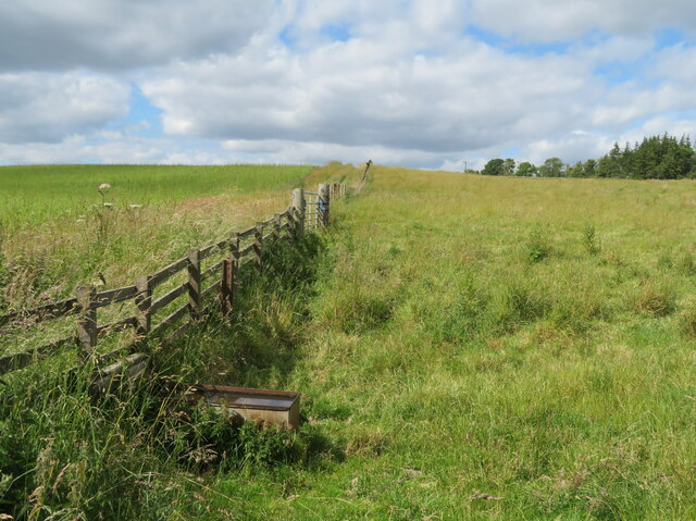
The woodland is predominantly comprised of native tree species, such as oak, birch, and Scots pine, which create a rich and diverse ecosystem. The dense canopy provides ample shade, making it an ideal habitat for a variety of wildlife, including deer, squirrels, and a wide array of bird species. Walking through the woods, visitors may catch a glimpse of these creatures as they go about their daily activities.

Westmains Braes also boasts a network of well-maintained trails that wind through the forest, allowing visitors to enjoy leisurely walks or invigorating hikes. These pathways offer breathtaking views of the surrounding countryside and provide an opportunity for visitors to connect with nature.

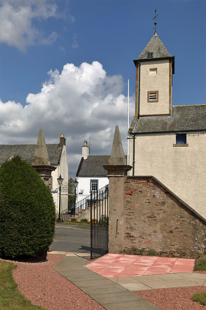
In addition to its natural beauty, Westmains Braes holds historical significance. The area was once part of a larger estate and has remnants of old structures, including the ruins of a former manor house. These remnants serve as a reminder of the rich history and heritage of the region.

Overall, Westmains Braes is a remarkable woodland area that offers visitors a chance to escape the hustle and bustle of everyday life and immerse themselves in the tranquility of nature. Whether it is a leisurely stroll or an adventurous hike, this forested landscape has something to offer for everyone.

If you have any feedback on the listing, please let us know in the comments section below.

Westmains Braes Images

Images are sourced within 2km of 55.711683/-2.7246457 or Grid Reference NT5446. Thanks to Geograph Open Source API. All images are credited.

Farm signs, St Leonards The road on the right is a former bend on the A68.
Farm signs, St Leonards
The road on the right is a former bend on the A68.
Barley field at West Mains The track is one of two that leads to the farm. The landmark Eildon Hills are on the skyline 14-15 km to the south.
Barley field at West Mains
The track is one of two that leads to the farm. The landmark Eildon Hills are on the skyline 14-15 km to the south.
Shelterbelt at West Mains Sheltering the farm road.
Shelterbelt at West Mains
Sheltering the farm road.
Wheat near Lauder Bridge A small field [4.7 ha], surrounded on all sides by trees.
Wheat near Lauder Bridge
A small field [4.7 ha], surrounded on all sides by trees.
Wheat near Lauder Bridge A small field [4.7 ha], surrounded on all sides by trees.
Wheat near Lauder Bridge
A small field [4.7 ha], surrounded on all sides by trees.
Cattle grazing at High Cross Pasture on Highcross Hill, near Thirlstane.
Cattle grazing at High Cross
Pasture on Highcross Hill, near Thirlstane.
Water trough at High Cross There are cattle grazing in the field.
Water trough at High Cross
There are cattle grazing in the field.
Road junction at High Cross The B6362 from Lauder and Thirlstane meets the main Carfraemill-Morpeth [A697] cross-border road.
Road junction at High Cross
The B6362 from Lauder and Thirlstane meets the main Carfraemill-Morpeth [A697] cross-border road.
Market Place, Lauder The excellent Black Bull Hotel in the background.  If visiting, check out the beautiful natural wood bar furniture, made by the proprietor.
Market Place, Lauder
The excellent Black Bull Hotel in the background. If visiting, check out the beautiful natural wood bar furniture, made by the proprietor.
Old milestone Set into the stone wall on the east side of the A68 at the south end of Lauder.   Plenty of lichens.   A painted legend may once have read Edinburgh 26 Kelso 17.   It is marked on the pre 1900 6" OS map but not on current maps.  It is near lamppost AE1609.
Old milestone
Set into the stone wall on the east side of the A68 at the south end of Lauder. Plenty of lichens. A painted legend may once have read Edinburgh 26 Kelso 17. It is marked on the pre 1900 6" OS map but not on current maps. It is near lamppost AE1609.
Old milestone A view of the old milestone set in the high, old stone wall at the south end of Lauder showing it between the Hydrant post and the street lamp.   This area of The Borders was in Berwickshire prior to the formation of the larger administration areas in the 1970s.
Old milestone
A view of the old milestone set in the high, old stone wall at the south end of Lauder showing it between the Hydrant post and the street lamp. This area of The Borders was in Berwickshire prior to the formation of the larger administration areas in the 1970s.
Old milepost Just northwest of where the road, B6362, turns left into Lauder is a steep banking bordered by a safety barrier. Behind the barrier the leaves and soil can be cleared slightly to reveal the top of a Smith Patterson post.   Having passed the turning for Lauder, only the mileage to Edinburgh is displayed on that face.  It is on the opposite side of the road to the other posts found between Kelso and the Lauder turn-off.
Old milepost
Just northwest of where the road, B6362, turns left into Lauder is a steep banking bordered by a safety barrier. Behind the barrier the leaves and soil can be cleared slightly to reveal the top of a Smith Patterson post. Having passed the turning for Lauder, only the mileage to Edinburgh is displayed on that face. It is on the opposite side of the road to the other posts found between Kelso and the Lauder turn-off.
Old milepost This shows the position of the milepost just behind the safety barrier.   A steep banking goes down to a very narrow, winding lane leading from the A road to the B6362 into Lauder.
Old milepost
This shows the position of the milepost just behind the safety barrier. A steep banking goes down to a very narrow, winding lane leading from the A road to the B6362 into Lauder.
The entrance gate to Lauder Old Parish Churchyard This is a view to the entrance at Market Place from the churchyard with the town hall clock tower on the right.
The entrance gate to Lauder Old Parish Churchyard
This is a view to the entrance at Market Place from the churchyard with the town hall clock tower on the right.
A68 south of Lauder
A68 south of Lauder
A697 west of Thirlestane
A697 near Thirlestane
Lauder Old Parish Church The church was built in 1673 to a Greek cross plan with a central tower over four pointed arches, becoming octagonal above roof level. There are some fine symbolic gravestones in the churchyard.
Lauder Old Parish Church
The church was built in 1673 to a Greek cross plan with a central tower over four pointed arches, becoming octagonal above roof level. There are some fine symbolic gravestones in the churchyard.
Show me another place!

Westmains Braes is located at Grid Ref: NT5446 (Lat: 55.711683, Lng: -2.7246457)

Unitary Authority: The Scottish Borders

Police Authority: The Lothians and Scottish Borders

What 3 Words

///expert.cured.mountains. Near Lauder, Scottish Borders

Related Wikis

Lauder Town Hall

Lauder Town Hall is a municipal structure in the Market Place in Lauder, Scottish Borders, Scotland. The structure, which is used as the local registrar...

Thirlestane Castle

Thirlestane Castle is a castle set in extensive parklands near Lauder in the Borders of Scotland. The site is aptly named Castle Hill, as it stands upon...
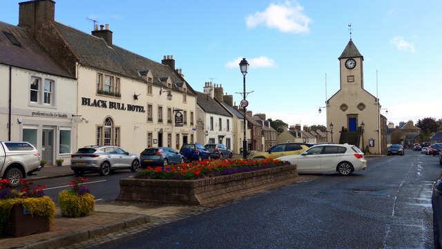
Lauder

The former Royal Burgh of Lauder (, Scottish Gaelic: Labhdar) is a town in the Scottish Borders in the historic county of Berwickshire. On the Southern...

Whitslaid Tower

Whitslaid Tower was an ancient Berwickshire seat of the Lauder family for over 300 years. It is today a ruin high above the eastern bank of the Leader...

Nearby Amenities

Located within 500m of 55.711683,-2.7246457
Bus Stop
Lauder Barns
Bench: no
Bus: yes
Departures Board: no
Lit: no
Local Ref: at
Naptan AtcoCode: 69001713
Naptan Bearing: SE
Naptan CommonName: Lauder Barns
Naptan Indicator: at
Naptan Landmark: Farm
Naptan NaptanCode: 72798453
Naptan Street: A68
Naptan Verified: yes
Public Transport: platform
Ref: 69001713
Shelter: no
Source: local knowledge;survey;NaPTAN
Lat/Long: 55.7112067/-2.7312733
Bus Stop
Lauder Barns
Bench: no
Bus: yes
Departures Board: no
Lit: no
Local Ref: opp
Naptan AtcoCode: 69001714
Naptan Bearing: NW
Naptan CommonName: Lauder Barns
Naptan Indicator: opp
Naptan Landmark: Farm
Naptan NaptanCode: 72798454
Naptan Street: A68
Naptan Verified: yes
Public Transport: platform
Ref: 69001714
Shelter: no
Source: local knowledge;survey;NaPTAN
Lat/Long: 55.7111408/-2.731387
West Mains
Place: hamlet
Lat/Long: 55.7110508/-2.7172952
Lauder Barns
Place: hamlet
Lat/Long: 55.7109281/-2.7303582
Lauder Barns Cottages
Place: hamlet
Lat/Long: 55.71319/-2.7318043
Power: pole
Lat/Long: 55.7112823/-2.7312472
Power: pole
Lat/Long: 55.7111169/-2.7315369
Power: pole
Lat/Long: 55.7129962/-2.7171394
Power: pole
Lat/Long: 55.712178/-2.7170844
Power: pole
Lat/Long: 55.7113756/-2.7170422
Power: pole
Lat/Long: 55.7114217/-2.7182606
Power: pole
Lat/Long: 55.7114852/-2.7198713
Power: pole
Lat/Long: 55.7115418/-2.7214283
Power: pole
Lat/Long: 55.7116/-2.7229089
Power: pole
Lat/Long: 55.7116612/-2.7243492
Power: pole
Lat/Long: 55.7117096/-2.7258083
Power: pole
Lat/Long: 55.7133649/-2.7306096
Power: pole
Lat/Long: 55.7138471/-2.7314279
Power: pole
Lat/Long: 55.7128511/-2.7297378
Power: pole
Lat/Long: 55.7123359/-2.7288634
Power: pole
Lat/Long: 55.7117617/-2.7269067
Power: pole
Lat/Long: 55.7118119/-2.7279829
Power: pole
Lat/Long: 55.7118433/-2.7290712
Power: pole
Lat/Long: 55.711903/-2.7301615
Power: pole
Lat/Long: 55.7120949/-2.7315543
The data included in this document is from www.openstreetmap.org. The data is made available under ODbL.

Have you been to Westmains Braes?

Leave your review of Westmains Braes below (or comments, questions and feedback).