Lady's Wood

Wood, Forest in East Lothian

Scotland

Lady's Wood

TV transmission mast near Seggarsdean Partially hidden by a shelterbelt
TV transmission mast near Seggarsdean Credit: M J Richardson

Lady's Wood is a picturesque forest located in East Lothian, Scotland. Covering an area of approximately 20 hectares, it is known for its natural beauty and diverse wildlife. The wood is situated on the outskirts of the small village of Gifford, making it easily accessible for visitors.

The woodland is predominantly composed of native broadleaf trees, including oak, birch, and beech, creating a rich and vibrant ecosystem. The dense canopy provides shelter for a variety of bird species, such as woodpeckers, thrushes, and owls, making it a haven for birdwatchers and nature enthusiasts.

Lady's Wood boasts a network of well-maintained trails that wind through the forest, allowing visitors to explore its enchanting scenery at their own pace. Whether it's a leisurely stroll or a challenging hike, there are routes suitable for all abilities. Along the way, hikers can discover hidden ponds, babbling brooks, and stunning viewpoints that offer breathtaking vistas of the surrounding countryside.

The forest is managed by the local council, ensuring its preservation and protection for future generations. It is a designated Site of Special Scientific Interest (SSSI), highlighting its ecological significance and the importance of its conservation.

Lady's Wood is not only a natural haven but also a cultural and historical site. It is believed to have been named after Lady Anne Seton, a prominent figure in Scottish history. The wood is steeped in folklore and legends, adding to its charm and mystique.

Overall, Lady's Wood is a delightful destination for those seeking tranquility, natural beauty, and a chance to connect with the great outdoors.

If you have any feedback on the listing, please let us know in the comments section below.
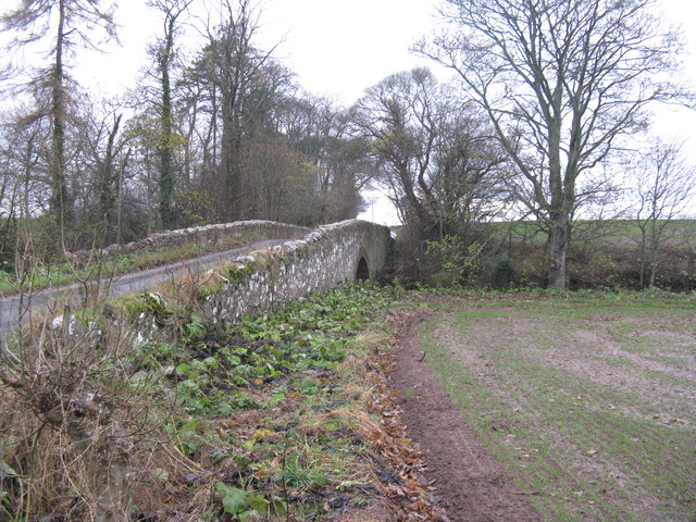
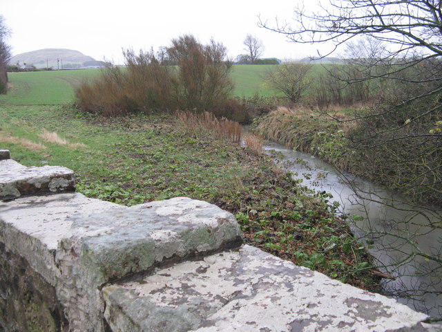
Lady's Wood Images

Images are sourced within 2km of 55.961109/-2.7371336 or Grid Reference NT5474. Thanks to Geograph Open Source API. All images are credited.

TV transmission mast near Seggarsdean Partially hidden by a shelterbelt
TV transmission mast near Seggarsdean
Partially hidden by a shelterbelt
Shelterbelt near Seggarsdean
Field and shelterbelt at West Bearford With Traprain Law 3.5km to the east, seen through rain.
Field and shelterbelt at West Bearford
With Traprain Law 3.5km to the east, seen through rain.
Wet country lane in East Lothian With a solitary pine looking like a proper tree, rather than the poor specimens seen in plantations.
Wet country lane in East Lothian
With a solitary pine looking like a proper tree, rather than the poor specimens seen in plantations.
Bearford Bridge Taking an East Lothian lane over the Bearford Burn.
Bearford Bridge
Taking an East Lothian lane over the Bearford Burn.
The Bearford Burn Looking upstream from the Bearford Bridge, which has an interesting 'crenellated' parapet. Traprain Law is in the distance, 2.7km to the east.
The Bearford Burn
Looking upstream from the Bearford Bridge, which has an interesting 'crenellated' parapet. Traprain Law is in the distance, 2.7km to the east.
Amisfield Walled Garden Amisfield Walled Garden dates from the late 18thC and is one of the largest walled gardens in Scotland, with extensive herbaceous borders, fruit and vegetable beds, wildflower meadow, orchard and woodland plantings.  Originally associated with Amisfield House, which no longer exists, it was an unsuccessful tree nursery in the 1980s, and was neglected until restoration began in 2006; it is now a community garden, and provides a venue for education and training for people of all abilities. It is run by the Amisfield Preservation Trust, who were granted a 99-year lease in 2013   <span class="nowrap"><a title="http://www.amisfield.org.uk/" rel="nofollow ugc noopener" href="http://www.amisfield.org.uk/">Link</a><img style="margin-left:2px;" alt="External link" title="External link - shift click to open in new window" src="https://s1.geograph.org.uk/img/external.png" width="10" height="10"/></span>. For a similar view, but 10 years earlier, see Lisa Jarvis's picture <a href="https://www.geograph.org.uk/photo/641391">NT5374 : Restoration of Amisfield walled garden</a>.
Amisfield Walled Garden
Amisfield Walled Garden dates from the late 18thC and is one of the largest walled gardens in Scotland, with extensive herbaceous borders, fruit and vegetable beds, wildflower meadow, orchard and woodland plantings. Originally associated with Amisfield House, which no longer exists, it was an unsuccessful tree nursery in the 1980s, and was neglected until restoration began in 2006; it is now a community garden, and provides a venue for education and training for people of all abilities. It is run by the Amisfield Preservation Trust, who were granted a 99-year lease in 2013 LinkExternal link. For a similar view, but 10 years earlier, see Lisa Jarvis's picture NT5374 : Restoration of Amisfield walled garden.
Northeast Pavilion, Amisfield Walled Garden One of the four pavilions at the corners of this historic garden which is being restored. <a href="https://www.geograph.org.uk/photo/5358556">NT5374 : Amisfield Walled Garden</a>
Northeast Pavilion, Amisfield Walled Garden
One of the four pavilions at the corners of this historic garden which is being restored. NT5374 : Amisfield Walled Garden
Looking across the Tyne valley With Beanston Mill in the dip occupied by the river. An abundance of rape and cereals.
Looking across the Tyne valley
With Beanston Mill in the dip occupied by the river. An abundance of rape and cereals.
Traprain Law A prominent feature of the East Lothian landscape. Looking southeast from near Beanston Mill.
Traprain Law
A prominent feature of the East Lothian landscape. Looking southeast from near Beanston Mill.
Road from Beanston and Sandy's Mills A cul-de-sac coming from the A1 and just giving access to the two ex-mills on the River Tyne.
Road from Beanston and Sandy's Mills
A cul-de-sac coming from the A1 and just giving access to the two ex-mills on the River Tyne.
Riverside path downstream of Haddington The path from Haddington to East Linton beside the Tyne.
Riverside path downstream of Haddington
The path from Haddington to East Linton beside the Tyne.
Riverside path Opposite Haddington sewage works.
Riverside path
Opposite Haddington sewage works.
Beside the Tyne, Abbeymill Between Haddington and East Linton, just downstream of Abbey Bridge.
Beside the Tyne, Abbeymill
Between Haddington and East Linton, just downstream of Abbey Bridge.
Gate, River Tyne path The path from Haddington to East Linton beside the Tyne.
Gate, River Tyne path
The path from Haddington to East Linton beside the Tyne.
River Tyne The Tyne and the riverside path.
River Tyne
The Tyne and the riverside path.
Haddington to East Linton path Near Sandy's Mill.
Haddington to East Linton path
Near Sandy's Mill.
River Tyne path Near Sandy's Mill.
River Tyne path
Near Sandy's Mill.
Show me another place!

Lady's Wood is located at Grid Ref: NT5474 (Lat: 55.961109, Lng: -2.7371336)

Unitary Authority: East Lothian

Police Authority: The Lothians and Scottish Borders

What 3 Words

///suits.quibble.totals. Near Haddington, East Lothian

Nearby Locations

Stevenson Wood Lady's Wood

Related Wikis

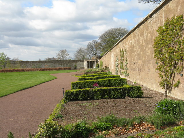
Stevenson House, East Lothian

Stevenson House is a mansion near the village of Haddington, East Lothian, Scotland. == History == The estate was once owned by the William Douglas of...
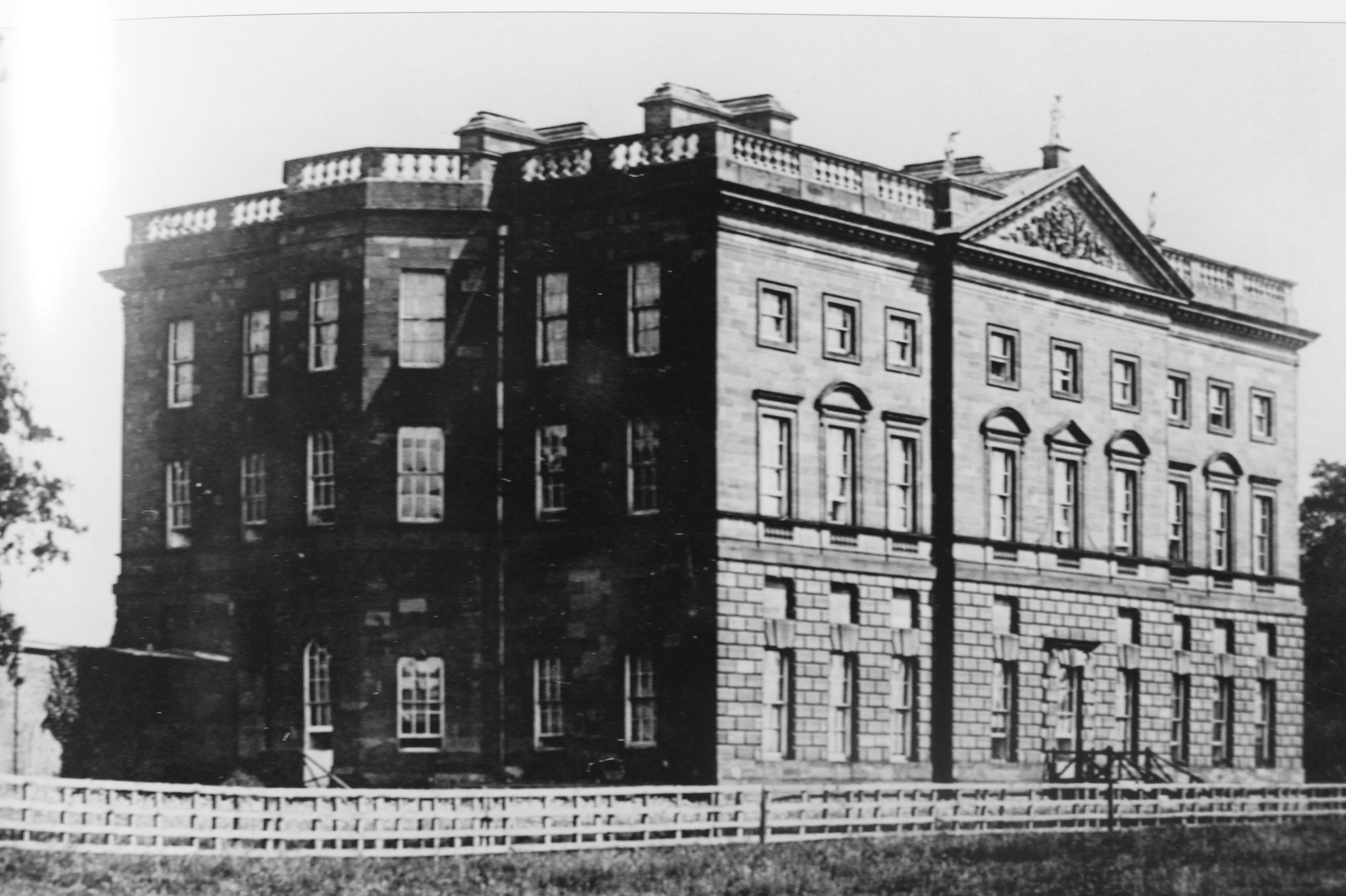
Amisfield House

Amisfield House was a substantial Palladian mansion near Haddington, East Lothian. == History == Previously known as Newmills, under that name in the 17th...

East Lothian (UK Parliament constituency)

East Lothian (; Scots: East Lowden; Scottish Gaelic: Lodainn an Ear) is a constituency in Scotland which returns one Member of Parliament (MP) to the House...

St Mary's Collegiate Church, Haddington

The Collegiate Church of St Mary the Virgin is a Church of Scotland parish church in Haddington, East Lothian, Scotland. Building work on the church was...

Nearby Amenities

Located within 500m of 55.961109,-2.7371336
Bus Stop
Stevenson Mains
Bus: yes
Naptan AtcoCode: 627009010275
Naptan Bearing: E
Naptan BusStopType: CUS
Naptan CommonName: Stevenson Mains
Naptan Indicator: at Seasons
Naptan NaptanCode: 58234724
Naptan Street: Minor Road C105
Naptan Verified: no
Public Transport: platform
Source: naptan_import
Lat/Long: 55.9577267/-2.7369868
Bus Stop
Stevenson Mains
Bus: yes
Naptan AtcoCode: 627009020275
Naptan Bearing: W
Naptan BusStopType: CUS
Naptan CommonName: Stevenson Mains
Naptan Indicator: opposite Seasons
Naptan NaptanCode: 58234752
Naptan Street: Minor Road C105
Naptan Verified: no
Public Transport: platform
Source: naptan_import
Lat/Long: 55.957574/-2.7369839
Power: pole
Lat/Long: 55.957952/-2.7316227
Power: pole
Lat/Long: 55.9585975/-2.7317912
The data included in this document is from www.openstreetmap.org. The data is made available under ODbL.

Have you been to Lady's Wood?

Leave your review of Lady's Wood below (or comments, questions and feedback).