Wood of Avochie

Wood, Forest in Aberdeenshire

Scotland

Wood of Avochie

The Ringing Stane Recumbent Stone Circle (1) The gentle mound is the ground originally surrounded by the circle. In the foreground are three stones lying flat, which are not thought to be in the original circle, though they might have been displaced from it. The taller stone on the left is the recumbent, with a stubby outcrop of rock beside it. See <span class="nowrap"><a title="https://canmore.org.uk/site/17827/the-ringing-stone" rel="nofollow ugc noopener" href="https://canmore.org.uk/site/17827/the-ringing-stone">Link</a><img style="margin-left:2px;" alt="External link" title="External link - shift click to open in new window" src="https://s1.geograph.org.uk/img/external.png" width="10" height="10"/></span> for more details. <a href="https://www.geograph.org.uk/photo/4742648">NJ5345 : The Ringing Stane Recumbent Stone Circle (2)</a>
The Ringing Stane Recumbent Stone Circle (1) Credit: Anne Burgess

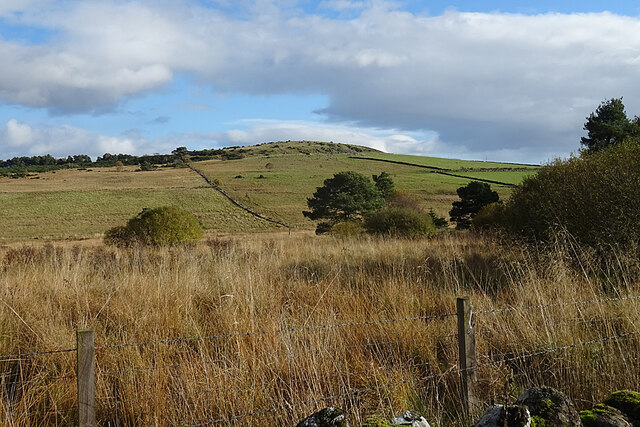
The Wood of Avochie is a picturesque forest located in Aberdeenshire, Scotland. Covering an area of approximately 300 acres, it is a haven of tranquility and natural beauty. The wood is situated near the village of Alford and is easily accessible by car or on foot.

The Wood of Avochie is predominantly composed of native woodland, featuring a diverse range of tree species including oak, birch, ash, and pine. These trees create a rich and varied habitat for a wide array of wildlife, making it a popular spot for nature enthusiasts and birdwatchers.

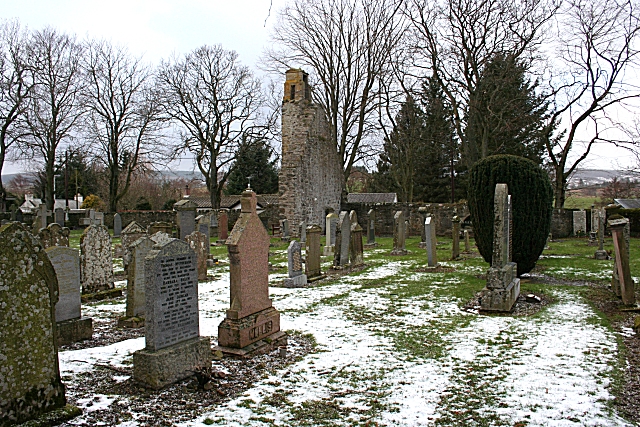
Visitors to the Wood of Avochie can explore its extensive network of paths and trails, which wind their way through the forest and offer stunning views of the surrounding countryside. The woods are also home to a number of historic features, including an ancient stone circle and the remains of a medieval chapel.

In addition to its natural and historical attractions, the Wood of Avochie is a great place for recreational activities such as walking, cycling, and picnicking. The peaceful atmosphere and beautiful surroundings make it an ideal destination for families and individuals seeking a peaceful escape from the hustle and bustle of everyday life.

Overall, the Wood of Avochie is a hidden gem in Aberdeenshire, offering visitors the chance to immerse themselves in nature and discover the region's rich history.

If you have any feedback on the listing, please let us know in the comments section below.

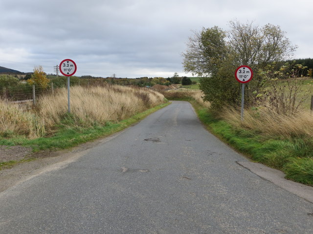
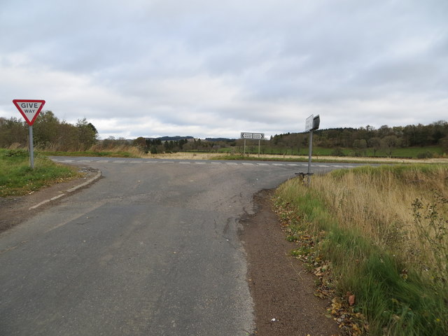
Wood of Avochie Images

Images are sourced within 2km of 57.499604/-2.7746399 or Grid Reference NJ5345. Thanks to Geograph Open Source API. All images are credited.

The Ringing Stane Recumbent Stone Circle (1) The gentle mound is the ground originally surrounded by the circle. In the foreground are three stones lying flat, which are not thought to be in the original circle, though they might have been displaced from it. The taller stone on the left is the recumbent, with a stubby outcrop of rock beside it. See <span class="nowrap"><a title="https://canmore.org.uk/site/17827/the-ringing-stone" rel="nofollow ugc noopener" href="https://canmore.org.uk/site/17827/the-ringing-stone">Link</a><img style="margin-left:2px;" alt="External link" title="External link - shift click to open in new window" src="https://s1.geograph.org.uk/img/external.png" width="10" height="10"/></span> for more details. <a href="https://www.geograph.org.uk/photo/4742648">NJ5345 : The Ringing Stane Recumbent Stone Circle (2)</a>
The Ringing Stane Recumbent Stone Circle (1)
The gentle mound is the ground originally surrounded by the circle. In the foreground are three stones lying flat, which are not thought to be in the original circle, though they might have been displaced from it. The taller stone on the left is the recumbent, with a stubby outcrop of rock beside it. See LinkExternal link for more details. NJ5345 : The Ringing Stane Recumbent Stone Circle (2)
The Ringing Stane Recumbent Stone Circle (2) On the left is the recumbent, with a natural outcrop in front of it. On the right are three stones which may have been part of the original circle, but are not in original positions. The prominent distant hill is Knock Hill. See <span class="nowrap"><a title="https://canmore.org.uk/site/17827/the-ringing-stone" rel="nofollow ugc noopener" href="https://canmore.org.uk/site/17827/the-ringing-stone">Link</a><img style="margin-left:2px;" alt="External link" title="External link - shift click to open in new window" src="https://s1.geograph.org.uk/img/external.png" width="10" height="10"/></span> for more details. <a href="https://www.geograph.org.uk/photo/4742653">NJ5345 : The Ringing Stane Recumbent Stone Circle (3)</a> (Sorry about my shadow - I couldn't avoid it!)
The Ringing Stane Recumbent Stone Circle (2)
On the left is the recumbent, with a natural outcrop in front of it. On the right are three stones which may have been part of the original circle, but are not in original positions. The prominent distant hill is Knock Hill. See LinkExternal link for more details. NJ5345 : The Ringing Stane Recumbent Stone Circle (3) (Sorry about my shadow - I couldn't avoid it!)
The Ringing Stane Recumbent Stone Circle (3) The large stone here is the recumbent, and it is the only stone still standing. The farmer who farms the land told me that it might have fallen over too, but his grandfather had added some stones to keep it upright. To its right is a natural outcrop, though I am surprised that the latter managed to survive the Ice Age.  See <span class="nowrap"><a title="https://canmore.org.uk/site/17827/the-ringing-stone" rel="nofollow ugc noopener" href="https://canmore.org.uk/site/17827/the-ringing-stone">Link</a><img style="margin-left:2px;" alt="External link" title="External link - shift click to open in new window" src="https://s1.geograph.org.uk/img/external.png" width="10" height="10"/></span> for more details. <a href="https://www.geograph.org.uk/photo/4742657">NJ5345 : The Ringing Stane Recumbent Stone Circle (4)</a>
The Ringing Stane Recumbent Stone Circle (3)
The large stone here is the recumbent, and it is the only stone still standing. The farmer who farms the land told me that it might have fallen over too, but his grandfather had added some stones to keep it upright. To its right is a natural outcrop, though I am surprised that the latter managed to survive the Ice Age. See LinkExternal link for more details. NJ5345 : The Ringing Stane Recumbent Stone Circle (4)
The Ringing Stane Recumbent Stone Circle (4) The recumbent is on the left, and from this angle you can see that the natural outcrop is a few feet from the recumbent. See <span class="nowrap"><a title="https://canmore.org.uk/site/17827/the-ringing-stone" rel="nofollow ugc noopener" href="https://canmore.org.uk/site/17827/the-ringing-stone">Link</a><img style="margin-left:2px;" alt="External link" title="External link - shift click to open in new window" src="https://s1.geograph.org.uk/img/external.png" width="10" height="10"/></span> for more details. <a href="https://www.geograph.org.uk/photo/4742661">NJ5345 : The Ringing Stane Recumbent Stone Circle (5)</a>
The Ringing Stane Recumbent Stone Circle (4)
The recumbent is on the left, and from this angle you can see that the natural outcrop is a few feet from the recumbent. See LinkExternal link for more details. NJ5345 : The Ringing Stane Recumbent Stone Circle (5)
The Ringing Stane Recumbent Stone Circle (5) This is the side of the recumbent that faces into the circle. The stones it sits on, and several others that are possibly not original, can be clearly seen. The rock on the left edge of the picture is a natural rock outcrop. See <span class="nowrap"><a title="https://canmore.org.uk/site/17827/the-ringing-stone" rel="nofollow ugc noopener" href="https://canmore.org.uk/site/17827/the-ringing-stone">Link</a><img style="margin-left:2px;" alt="External link" title="External link - shift click to open in new window" src="https://s1.geograph.org.uk/img/external.png" width="10" height="10"/></span> for more details. <a href="https://www.geograph.org.uk/photo/4742663">NJ5345 : The Ringing Stane Recumbent Stone Circle (6)</a>
The Ringing Stane Recumbent Stone Circle (5)
This is the side of the recumbent that faces into the circle. The stones it sits on, and several others that are possibly not original, can be clearly seen. The rock on the left edge of the picture is a natural rock outcrop. See LinkExternal link for more details. NJ5345 : The Ringing Stane Recumbent Stone Circle (6)
The Ringing Stane Recumbent Stone Circle (6) This is the recumbent, seen end-on. It is also known as the Iron Stane, and the name is because of the ringing sound it makes when struck. See <span class="nowrap"><a title="https://canmore.org.uk/site/17827/the-ringing-stone" rel="nofollow ugc noopener" href="https://canmore.org.uk/site/17827/the-ringing-stone">Link</a><img style="margin-left:2px;" alt="External link" title="External link - shift click to open in new window" src="https://s1.geograph.org.uk/img/external.png" width="10" height="10"/></span> for more details. <a href="https://www.geograph.org.uk/photo/4742671">NJ5345 : The Ringing Stane Recumbent Stone Circle (7)</a>
The Ringing Stane Recumbent Stone Circle (6)
This is the recumbent, seen end-on. It is also known as the Iron Stane, and the name is because of the ringing sound it makes when struck. See LinkExternal link for more details. NJ5345 : The Ringing Stane Recumbent Stone Circle (7)
The Ringing Stane Recumbent Stone Circle (7) If the stone in the foreground was part of the circle, it has been moved, and a row of wedge holes has been bored into it. In the background is the recumbent, seen end-on, with a natural rock outcrop to the left. See <span class="nowrap"><a title="https://canmore.org.uk/site/17827/the-ringing-stone" rel="nofollow ugc noopener" href="https://canmore.org.uk/site/17827/the-ringing-stone">Link</a><img style="margin-left:2px;" alt="External link" title="External link - shift click to open in new window" src="https://s1.geograph.org.uk/img/external.png" width="10" height="10"/></span> for more details. <a href="https://www.geograph.org.uk/photo/4742675">NJ5345 : The Ringing Stane Recumbent Stone Circle (8)</a>
The Ringing Stane Recumbent Stone Circle (7)
If the stone in the foreground was part of the circle, it has been moved, and a row of wedge holes has been bored into it. In the background is the recumbent, seen end-on, with a natural rock outcrop to the left. See LinkExternal link for more details. NJ5345 : The Ringing Stane Recumbent Stone Circle (8)
The Ringing Stane Recumbent Stone Circle (8) These stones, although lying close to the circle, are not part of it. In 1871, at least two of them were not where they are now, and the nearer one has had wedge holes bored into it.  See <span class="nowrap"><a title="https://canmore.org.uk/site/17827/the-ringing-stone" rel="nofollow ugc noopener" href="https://canmore.org.uk/site/17827/the-ringing-stone">Link</a><img style="margin-left:2px;" alt="External link" title="External link - shift click to open in new window" src="https://s1.geograph.org.uk/img/external.png" width="10" height="10"/></span> for more details. <a href="https://www.geograph.org.uk/photo/4742681">NJ5345 : The Ringing Stane Recumbent Stone Circle (9)</a>
The Ringing Stane Recumbent Stone Circle (8)
These stones, although lying close to the circle, are not part of it. In 1871, at least two of them were not where they are now, and the nearer one has had wedge holes bored into it. See LinkExternal link for more details. NJ5345 : The Ringing Stane Recumbent Stone Circle (9)
The Ringing Stane Recumbent Stone Circle (9) Apart from the recumbent, this is the only stone in its original position, though it is no longer standing.  See <span class="nowrap"><a title="https://canmore.org.uk/site/17827/the-ringing-stone" rel="nofollow ugc noopener" href="https://canmore.org.uk/site/17827/the-ringing-stone">Link</a><img style="margin-left:2px;" alt="External link" title="External link - shift click to open in new window" src="https://s1.geograph.org.uk/img/external.png" width="10" height="10"/></span> for more details. <a href="https://www.geograph.org.uk/photo/4742689">NJ5345 : The Ringing Stane Recumbent Stone Circle (10)</a>
The Ringing Stane Recumbent Stone Circle (9)
Apart from the recumbent, this is the only stone in its original position, though it is no longer standing. See LinkExternal link for more details. NJ5345 : The Ringing Stane Recumbent Stone Circle (10)
The Ringing Stane Recumbent Stone Circle (10) This grassy mound is what remains of the cairn inside the stone circle. It has been cultivated, but the farmer said that the bedrock is so close to the surface that it's only really suitable for grazing.  See <span class="nowrap"><a title="https://canmore.org.uk/site/17827/the-ringing-stone" rel="nofollow ugc noopener" href="https://canmore.org.uk/site/17827/the-ringing-stone">Link</a><img style="margin-left:2px;" alt="External link" title="External link - shift click to open in new window" src="https://s1.geograph.org.uk/img/external.png" width="10" height="10"/></span> for more details. <a href="https://www.geograph.org.uk/photo/4742641">NJ5345 : The Ringing Stane Recumbent Stone Circle (1)</a>
The Ringing Stane Recumbent Stone Circle (10)
This grassy mound is what remains of the cairn inside the stone circle. It has been cultivated, but the farmer said that the bedrock is so close to the surface that it's only really suitable for grazing. See LinkExternal link for more details. NJ5345 : The Ringing Stane Recumbent Stone Circle (1)
Tillytarmont Railway Bridge The bridge carries the Aberdeen and Inverness railway over the River Deveron. The Wood of Avochie is beyond the railway, and the farm on top of the hill is Dykehead, in the next square.
Tillytarmont Railway Bridge
The bridge carries the Aberdeen and Inverness railway over the River Deveron. The Wood of Avochie is beyond the railway, and the farm on top of the hill is Dykehead, in the next square.
Rail bridge over the Deveron
Rothiemay railway station (site), Aberdeenshire Opened in 1856 on the Great North of Scotland Railway's line from Aberdeen to Keith, this station closed in 1968. The line was later singled.
View north towards Cairnie Junction and Keith. A wall is still visible in the undergrowth.
Rothiemay railway station (site), Aberdeenshire
Opened in 1856 on the Great North of Scotland Railway's line from Aberdeen to Keith, this station closed in 1968. The line was later singled. View north towards Cairnie Junction and Keith. A wall is still visible in the undergrowth.
River Deveron
River Deveron
Road near Dykehead Looking south-eastward. A Low Bridge (railway) with only 11 foot of clearance lies ahead for the unwary.
Road near Dykehead
Looking south-eastward. A Low Bridge (railway) with only 11 foot of clearance lies ahead for the unwary.
Road from Ruthven joining the B9022 at Bridge of Isla Looking north-eastward.
Road from Ruthven joining the B9022 at Bridge of Isla
Looking north-eastward.
Ordnance Survey Cut Mark This mark can be found on the railway bridge near to Dykehead. The benchmark height is recorded as being 89.986 metres above sea level.
For more detail see : <span class="nowrap"><a title="https://www.bench-marks.org.uk/bm101732" rel="nofollow ugc noopener" href="https://www.bench-marks.org.uk/bm101732">Link</a><img style="margin-left:2px;" alt="External link" title="External link - shift click to open in new window" src="https://s1.geograph.org.uk/img/external.png" width="10" height="10"/></span>
Ordnance Survey Cut Mark
This mark can be found on the railway bridge near to Dykehead. The benchmark height is recorded as being 89.986 metres above sea level. For more detail see : LinkExternal link
White Hill Looking towards the summit of the modest hill from the grassy path alongside Brownhill Wood.
White Hill
Looking towards the summit of the modest hill from the grassy path alongside Brownhill Wood.
Show me another place!

Wood of Avochie is located at Grid Ref: NJ5345 (Lat: 57.499604, Lng: -2.7746399)

Unitary Authority: Aberdeenshire

Police Authority: North East

What 3 Words

///berated.gazes.laptops. Near Huntly, Aberdeenshire

Nearby Locations

Arn Hill Wood of Avochie

Related Wikis

Rothiemay railway station

Rothiemay railway station served the village of Milltown of Rothiemay, Aberdeenshire, Scotland from 1856 to 1968 on the Great North of Scotland Railway...

Avochie Castle

Avochie Castle is a ruined tower house, dating from the 16th century, or early 17th century, around 4.5 miles (7.2 km) north of Huntly, east of the river...

River Isla, Moray

The River Isla (Scottish Gaelic: Uisge Ìle) is a tributary of the River Deveron in North-East Scotland. The area surrounding it is known as Strathisla...

Ruthven, Aberdeenshire

Ruthven (, Gaelic: Ruadhainn), Aberdeenshire is a village in Scotland near Huntly (to the south east), and Keith (to the north west). It is traditionally...

Mountains Burn

Mountains Burn is a burn which marks the boundary of the parish of Huntly, Aberdeenshire, Scotland. == References ==

Milltown of Rothiemay

Milltown of Rothiemay (Scottish Gaelic: Ràth a' Mhuigh) is a small inland village, built mostly of granite, in the north-east of Scotland and is within...

Fourman Hill

Fourman Hill is a hill located west of Bogniebrae, Aberdeenshire, Scotland. It has an elevation of 1,127 feet (344 m). A cairn near the summit marked the...

Daugh Castle

Daugh Castle was a castle, about 5 miles (8.0 km) north of Huntly, Aberdeenshire, Scotland, near Cairnie Burn. It was also known as Castle of the Daach...

Nearby Amenities

Located within 500m of 57.499604,-2.7746399
Power: pole
Lat/Long: 57.5039476/-2.7744057
Power: pole
Lat/Long: 57.5010629/-2.7813858
Power: pole
Lat/Long: 57.5006889/-2.7810425
Power: pole
Lat/Long: 57.5003097/-2.7807625
Power: pole
Lat/Long: 57.4999017/-2.7804883
Power: pole
Lat/Long: 57.4995535/-2.7801738
Power: pole
Lat/Long: 57.4992763/-2.7797692
Little Haddoch
Place: isolated_dwelling
Lat/Long: 57.49948/-2.7794097
Dykehead
Place: isolated_dwelling
Lat/Long: 57.5036053/-2.7735647
The data included in this document is from www.openstreetmap.org. The data is made available under ODbL.

Have you been to Wood of Avochie?

Leave your review of Wood of Avochie below (or comments, questions and feedback).