Powet Sike Plantation

Wood, Forest in Roxburghshire

Scotland

Powet Sike Plantation

The B3157 heading for Old Castleton In Roxburghshire, Scottish Borders.
The B3157 heading for Old Castleton Credit: James Denham

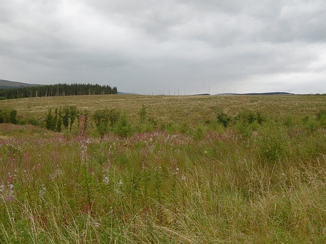
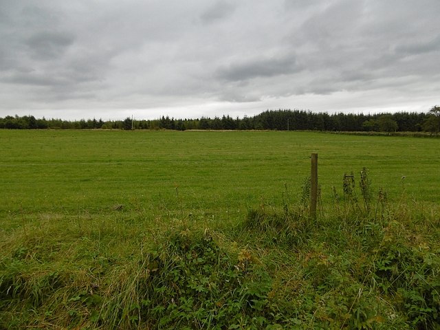
Powet Sike Plantation is a sprawling woodland located in Roxburghshire, Scotland. Covering a vast area of picturesque landscape, it is a haven for nature enthusiasts and outdoor adventurers alike. The plantation is situated in the heart of the Scottish Borders region, offering visitors a tranquil escape from the hustle and bustle of city life.

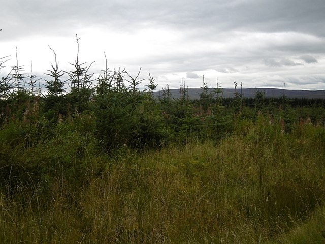
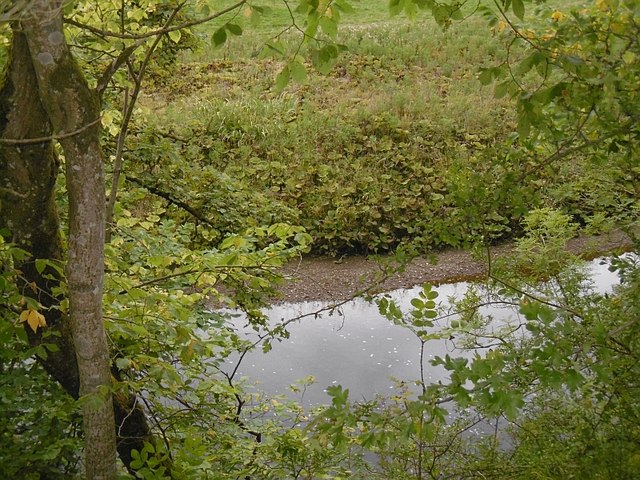
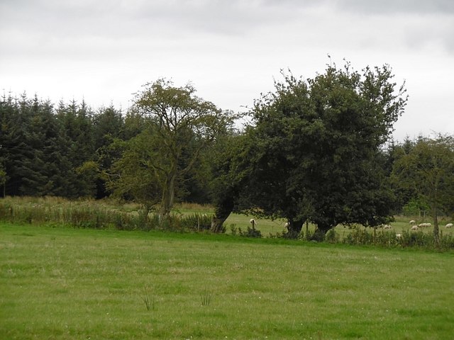
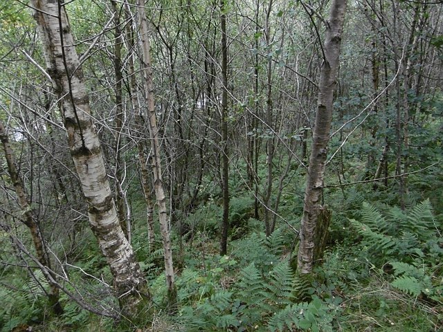
The plantation is predominantly composed of native tree species, such as Scots pine, oak, and birch, which create a diverse and vibrant ecosystem. The rich variety of flora and fauna found within Powet Sike makes it an important habitat for numerous species of birds, mammals, and insects. Birdwatchers are particularly drawn to the area, as it provides an excellent opportunity to spot rare and migratory species.

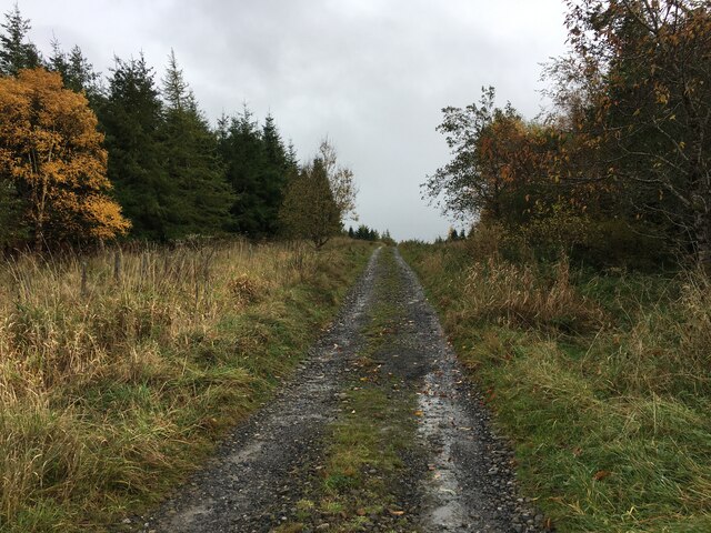
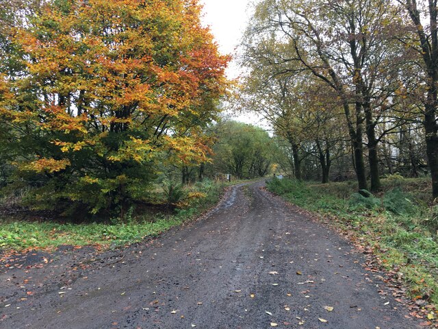
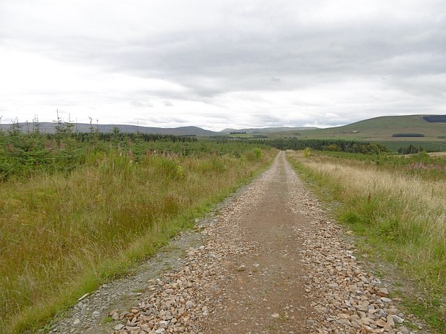
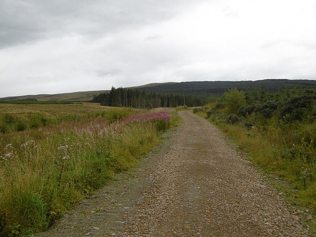
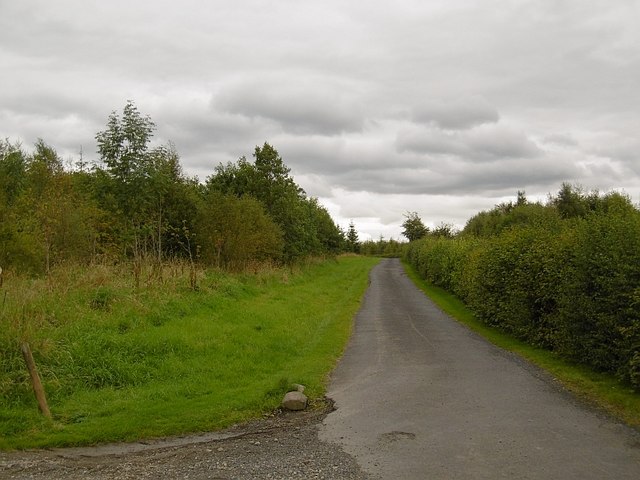
Visitors to Powet Sike can explore a network of well-maintained trails that wind through the woodland, offering stunning views and encounters with wildlife along the way. The paths cater to all levels of fitness, making it accessible for families and individuals of all ages. The plantation also boasts picnic areas and benches strategically placed throughout the area, providing perfect spots to relax and take in the natural beauty.

In addition to its recreational value, Powet Sike Plantation plays an important role in sustainable forestry practices. The management of the plantation focuses on maintaining a healthy and thriving woodland, ensuring the long-term preservation of the ecosystem and its biodiversity.

Overall, Powet Sike Plantation is a hidden gem in Roxburghshire, offering visitors a chance to connect with nature and experience the tranquility of the Scottish countryside.

If you have any feedback on the listing, please let us know in the comments section below.

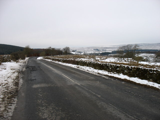
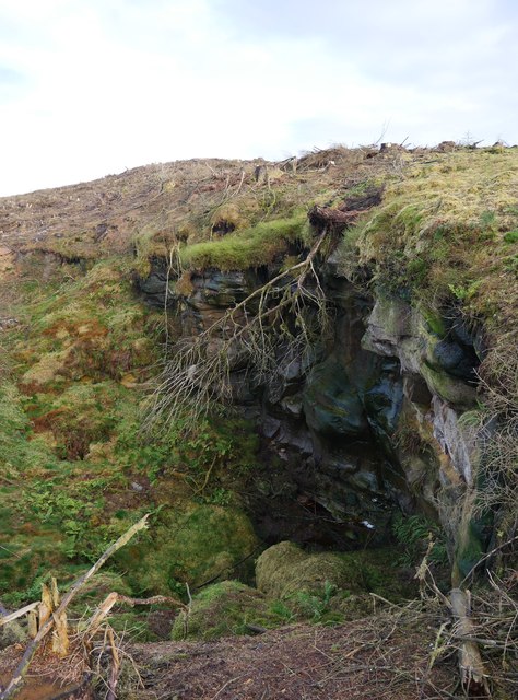
Powet Sike Plantation Images

Images are sourced within 2km of 55.211716/-2.7500748 or Grid Reference NY5291. Thanks to Geograph Open Source API. All images are credited.

The B3157 heading for Old Castleton In Roxburghshire, Scottish Borders.
The B3157 heading for Old Castleton
In Roxburghshire, Scottish Borders.
Forestry road near Kirndean
Forestry entrance near Florida
Larriston Fells road A recently resurfaced road serves a privately managed part of Newcastleton Forest and the police mast on Larriston Fells.
Larriston Fells road
A recently resurfaced road serves a privately managed part of Newcastleton Forest and the police mast on Larriston Fells.
Young trees, Newcastleton Forest This <a href="https://www.geograph.org.uk/photo/453172">NY5391 : Forest Road</a> block a few years on.
Young trees, Newcastleton Forest
This NY5391 : Forest Road block a few years on.
Felled and replanted area Newcastleton Forest near Mountain View.
Felled and replanted area
Newcastleton Forest near Mountain View.
Forest road, Newcastleton The road continues to a police radio mast on Larriston Fells.
Forest road, Newcastleton
The road continues to a police radio mast on Larriston Fells.
Liddel Water Downstream of Dinlabyre Bridge.
Liddel Water
Downstream of Dinlabyre Bridge.
B6357, Liddesdale Passing the outlet of the road to the police mast on Larriston Fells.
B6357, Liddesdale
Passing the outlet of the road to the police mast on Larriston Fells.
Field near Florida During the 1980s fields beyond this one were planted with conifers.
Field near Florida
During the 1980s fields beyond this one were planted with conifers.
Fields near Florida There was an area of rough grazing behind this field when I was orienteering here in 1980. Since then it was planted with conifers.
Fields near Florida
There was an area of rough grazing behind this field when I was orienteering here in 1980. Since then it was planted with conifers.
Woodland above the Liddel Water A steep slope falls to the river.
Woodland above the Liddel Water
A steep slope falls to the river.
Liddel Water Steep slopes on the outside of a meander at Mains.
Liddel Water
Steep slopes on the outside of a meander at Mains.
Castleton Muir A rashy field on the site of Castleton, a lost village.
Castleton Muir
A rashy field on the site of Castleton, a lost village.
Road to Kirndean Now running through a young woodland.
Road to Kirndean
Now running through a young woodland.
The B6357 heading for Newcastleton
Passing shower Shower clouds over the Newcastleton Forest near Harden Hill.
Passing shower
Shower clouds over the Newcastleton Forest near Harden Hill.
Queen o' Fairies' Hole Recently exposed by forestry operations, this intriguingly-named feature appears to be a swallow hole in an area of exposed limestone.
Queen o' Fairies' Hole
Recently exposed by forestry operations, this intriguingly-named feature appears to be a swallow hole in an area of exposed limestone.
Show me another place!

Powet Sike Plantation is located at Grid Ref: NY5291 (Lat: 55.211716, Lng: -2.7500748)

Unitary Authority: The Scottish Borders

Police Authority: The Lothians and Scottish Borders

What 3 Words

///plod.shortcuts.overt. Near Langholm, Dumfries & Galloway

Related Wikis

Dinlabyre

Dinlabyre is a village on the B6357 in Liddesdale, on the edge of the Newcastleton Forest, close to Castleton, in the Scottish Borders area of Scotland...

Liddel Castle

Liddel Castle is a ruined castle in Liddesdale, by the Liddel Water, near Castleton in the Scottish Borders area of Scotland, in the former county of Roxburghshire...

Steele Road railway station

Steele Road railway station served the hamlet of Steele Road, Scottish Borders, Scotland, from 1862 to 1969 on the Border Union Railway. == History... ==

Hermitage Water

The Hermitage Water is a river in Liddesdale, in the Scottish Borders area of Scotland. Among its many feeder burns are Braidley Burn, Dinley Burn, Gorrenberry...

Nearby Amenities

Located within 500m of 55.211716,-2.7500748
Power: pole
Lat/Long: 55.2134833/-2.7488698
Power: pole
Lat/Long: 55.2129982/-2.7494117
Power: pole
Lat/Long: 55.2125115/-2.7500018
Power: pole
Lat/Long: 55.2112896/-2.7515106
Power: pole
Lat/Long: 55.2106805/-2.7522374
Power: pole
Lat/Long: 55.2100484/-2.7529938
Power: pole
Lat/Long: 55.2094057/-2.7537743
Power: pole
Lat/Long: 55.2089037/-2.7544315
Power: pole
Lat/Long: 55.2083971/-2.7550216
Power: pole
Lat/Long: 55.2140754/-2.7480587
Power: pole
Lat/Long: 55.2146747/-2.7472888
Power: pole
Lat/Long: 55.2152623/-2.7464674
Power: pole
Lat/Long: 55.2140342/-2.7489458
Power: pole
Lat/Long: 55.2143905/-2.7497466
Power: pole
Lat/Long: 55.2146982/-2.7504251
Power: pole
Lat/Long: 55.2149693/-2.7510456
Power: pole
Lat/Long: 55.2152844/-2.7517409
Power: pole
Lat/Long: 55.215457/-2.7521451
Power: pole
Lat/Long: 55.2157214/-2.7527271
The data included in this document is from www.openstreetmap.org. The data is made available under ODbL.

Have you been to Powet Sike Plantation?

Leave your review of Powet Sike Plantation below (or comments, questions and feedback).