Droveroad Plantation

Wood, Forest in Roxburghshire

Scotland

Droveroad Plantation

A horse reflection at Riddell A large pond formed in this horse field after periods of heavy rain. I walked by here two days previously and there was no lying water in the field.
A horse reflection at Riddell Credit: Walter Baxter

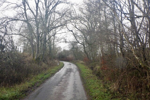
Droveroad Plantation is a picturesque woodland located in the county of Roxburghshire, Scotland. Situated in the southern part of the country, this plantation covers an expansive area of land, offering visitors a tranquil escape into nature.

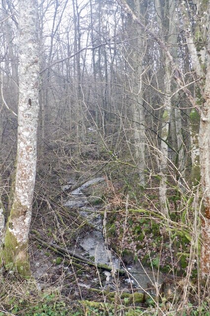
The plantation is predominantly composed of a diverse array of trees, making it a thriving forest ecosystem. Various species of broadleaf trees, including oak, beech, and birch, dominate the landscape, creating a dense canopy that provides shade and shelter to a wide range of flora and fauna.

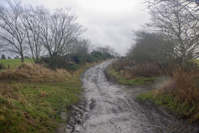
The woodland is intersected by several well-maintained trails, allowing visitors to explore the plantation on foot. These paths wind through the enchanting forest, leading to hidden groves and serene clearings. Along the way, walkers can enjoy the peaceful ambiance and observe the abundant wildlife that calls this woodland home. Squirrels darting between trees, birdsong filling the air, and occasionally glimpses of deer are common sights within the plantation.

Droveroad Plantation is not only a haven for wildlife but also a cherished recreational space for locals and tourists alike. The surrounding community often utilizes the woodland for activities such as walking, picnicking, and nature photography. The plantation's natural beauty and tranquility make it an ideal destination for those seeking a break from the hustle and bustle of everyday life.

Overall, Droveroad Plantation is a captivating woodland in Roxburghshire, offering visitors a chance to immerse themselves in the beauty of nature and discover the wonders of Scotland's forested landscapes.

If you have any feedback on the listing, please let us know in the comments section below.

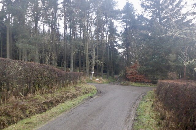
Droveroad Plantation Images

Images are sourced within 2km of 55.493673/-2.7593034 or Grid Reference NT5222. Thanks to Geograph Open Source API. All images are credited.

A horse reflection at Riddell A large pond formed in this horse field after periods of heavy rain. I walked by here two days previously and there was no lying water in the field.
A horse reflection at Riddell
A large pond formed in this horse field after periods of heavy rain. I walked by here two days previously and there was no lying water in the field.
Riddell South Bridge The bridge spans the Ale Water on the Riddell Estate. There is a sign at the junction of the estate road to the southeast and the B6400 warning of a maximum weight of two tonnes for this bridge.
Riddell South Bridge
The bridge spans the Ale Water on the Riddell Estate. There is a sign at the junction of the estate road to the southeast and the B6400 warning of a maximum weight of two tonnes for this bridge.
Ale Water bridge at Riddell A handsome single arched stone bridge in the Riddell estate.
Ale Water bridge at Riddell
A handsome single arched stone bridge in the Riddell estate.
Estate bridge over the Ale Water, Riddell A closer view of the bridge shown in <a href="https://www.geograph.org.uk/photo/7215637">NT5124 : Ale Water bridge at Riddell</a>. It is subject to a 2-ton weight limit.
Estate bridge over the Ale Water, Riddell
A closer view of the bridge shown in NT5124 : Ale Water bridge at Riddell. It is subject to a 2-ton weight limit.
Track into Riddell Estate The track meets the B6400 about 1km west of Lilliesleaf.
Track into Riddell Estate
The track meets the B6400 about 1km west of Lilliesleaf.
Flood debris, Riddell Remains of the bad flooding of December 2015.  On one day I was working adjacent to a flood wall in Hawick and the river was flowing above my feet.   It was a good wall.
Flood debris, Riddell
Remains of the bad flooding of December 2015. On one day I was working adjacent to a flood wall in Hawick and the river was flowing above my feet. It was a good wall.
Flood debris, Riddell Debris left against a hedge after December 2015's floods.
Flood debris, Riddell
Debris left against a hedge after December 2015's floods.
B6400 Near Riddell, Roxburghshire.
B6400
Near Riddell, Roxburghshire.
Farmland near Lilliesleaf from the air Lilliesleaf is obscured by the cloud.
Farmland near Lilliesleaf from the air
Lilliesleaf is obscured by the cloud.
Farmland near Lilliesleaf from the air Lilliesleaf is just out of sight to the left.
Farmland near Lilliesleaf from the air
Lilliesleaf is just out of sight to the left.
Lilliesleaf from the air A small village on the B6400 south east of Selkirk.
Lilliesleaf from the air
A small village on the B6400 south east of Selkirk.
Lilliesleaf from the air A small village on the B6400 south east of Selkirk.
Lilliesleaf from the air
A small village on the B6400 south east of Selkirk.
Road junction, Dimpleknowe
Minor road by Hermiston
Hermiston Burn
Hermiston Burn
Farm road, Hermiston
Hardenburn Plantation
Scots Grey Strip Recently felled stripwood.
Scots Grey Strip
Recently felled stripwood.
Show me another place!

Droveroad Plantation is located at Grid Ref: NT5222 (Lat: 55.493673, Lng: -2.7593034)

Unitary Authority: The Scottish Borders

Police Authority: The Lothians and Scottish Borders

What 3 Words

///choppers.summit.surely. Near Selkirk, Scottish Borders

Nearby Locations

Droveroad Plantation

Related Wikis

Bowismiln

Bowismiln is a village in the Scottish Borders area of Scotland. == See also == List of places in the Scottish Borders List of places in Scotland ��2...

Lilliesleaf

Lilliesleaf is a small village and civil parish 7 miles (11 km) south east of Selkirk in the Roxburghshire area of Scottish Borders of Scotland. Other...

Hassendean, Scottish Borders

Hassendean is a hamlet in the Scottish Borders south of Edinburgh, Scotland. The stream is the Hassendean Burn which flows down to the River Teviot 5 miles...

Hassendean railway station

Hassendean railway station served the village of Hassendean, Scottish Borders, Scotland from 1850 to 1969 on the Waverley Route. == History == The station...

Have you been to Droveroad Plantation?

Leave your review of Droveroad Plantation below (or comments, questions and feedback).