Whitehill Plantation

Wood, Forest in Aberdeenshire

Scotland

Whitehill Plantation

The Ringing Stane Recumbent Stone Circle (1) The gentle mound is the ground originally surrounded by the circle. In the foreground are three stones lying flat, which are not thought to be in the original circle, though they might have been displaced from it. The taller stone on the left is the recumbent, with a stubby outcrop of rock beside it. See <span class="nowrap"><a title="https://canmore.org.uk/site/17827/the-ringing-stone" rel="nofollow ugc noopener" href="https://canmore.org.uk/site/17827/the-ringing-stone">Link</a><img style="margin-left:2px;" alt="External link" title="External link - shift click to open in new window" src="https://s1.geograph.org.uk/img/external.png" width="10" height="10"/></span> for more details. <a href="https://www.geograph.org.uk/photo/4742648">NJ5345 : The Ringing Stane Recumbent Stone Circle (2)</a>
The Ringing Stane Recumbent Stone Circle (1) Credit: Anne Burgess

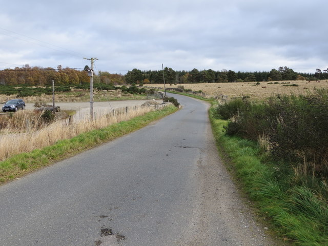
Whitehill Plantation is a picturesque woodland located in Aberdeenshire, Scotland. Spanning over a vast area, it is a captivating destination for nature enthusiasts and those seeking tranquility amidst the lush greenery. The plantation is situated near the village of Whitehill, surrounded by rolling hills and stunning landscapes.

The primary feature of Whitehill Plantation is its dense forest, consisting mainly of native tree species such as oak, birch, and pine. The towering trees create a dense canopy, filtering sunlight and casting a cool shade on the forest floor. The forest is home to a diverse range of flora and fauna, with various species of wildflowers, ferns, and mosses adding to its beauty.

Visitors can explore the plantation through a network of well-maintained walking trails that wind their way through the forest. These trails offer opportunities to immerse oneself in nature, with the chance to spot wildlife such as red squirrels, deer, and a wide variety of bird species.

In addition to its natural beauty, Whitehill Plantation also boasts historical significance. The area was once a thriving timber industry hub, with evidence of old sawmills and logging activities still visible today. This rich history adds an extra layer of interest for visitors interested in the region's past.

Overall, Whitehill Plantation is a stunning woodland retreat in Aberdeenshire, offering a serene environment for nature lovers and a glimpse into the area's past. Whether it's a leisurely stroll through the forest or an exploration of its historical significance, this plantation is a must-visit destination for anyone seeking solace in nature.

If you have any feedback on the listing, please let us know in the comments section below.

Whitehill Plantation Images

Images are sourced within 2km of 57.505819/-2.802091 or Grid Reference NJ5246. Thanks to Geograph Open Source API. All images are credited.

The Ringing Stane Recumbent Stone Circle (1) The gentle mound is the ground originally surrounded by the circle. In the foreground are three stones lying flat, which are not thought to be in the original circle, though they might have been displaced from it. The taller stone on the left is the recumbent, with a stubby outcrop of rock beside it. See <span class="nowrap"><a title="https://canmore.org.uk/site/17827/the-ringing-stone" rel="nofollow ugc noopener" href="https://canmore.org.uk/site/17827/the-ringing-stone">Link</a><img style="margin-left:2px;" alt="External link" title="External link - shift click to open in new window" src="https://s1.geograph.org.uk/img/external.png" width="10" height="10"/></span> for more details. <a href="https://www.geograph.org.uk/photo/4742648">NJ5345 : The Ringing Stane Recumbent Stone Circle (2)</a>
The Ringing Stane Recumbent Stone Circle (1)
The gentle mound is the ground originally surrounded by the circle. In the foreground are three stones lying flat, which are not thought to be in the original circle, though they might have been displaced from it. The taller stone on the left is the recumbent, with a stubby outcrop of rock beside it. See LinkExternal link for more details. NJ5345 : The Ringing Stane Recumbent Stone Circle (2)
The Ringing Stane Recumbent Stone Circle (2) On the left is the recumbent, with a natural outcrop in front of it. On the right are three stones which may have been part of the original circle, but are not in original positions. The prominent distant hill is Knock Hill. See <span class="nowrap"><a title="https://canmore.org.uk/site/17827/the-ringing-stone" rel="nofollow ugc noopener" href="https://canmore.org.uk/site/17827/the-ringing-stone">Link</a><img style="margin-left:2px;" alt="External link" title="External link - shift click to open in new window" src="https://s1.geograph.org.uk/img/external.png" width="10" height="10"/></span> for more details. <a href="https://www.geograph.org.uk/photo/4742653">NJ5345 : The Ringing Stane Recumbent Stone Circle (3)</a> (Sorry about my shadow - I couldn't avoid it!)
The Ringing Stane Recumbent Stone Circle (2)
On the left is the recumbent, with a natural outcrop in front of it. On the right are three stones which may have been part of the original circle, but are not in original positions. The prominent distant hill is Knock Hill. See LinkExternal link for more details. NJ5345 : The Ringing Stane Recumbent Stone Circle (3) (Sorry about my shadow - I couldn't avoid it!)
The Ringing Stane Recumbent Stone Circle (3) The large stone here is the recumbent, and it is the only stone still standing. The farmer who farms the land told me that it might have fallen over too, but his grandfather had added some stones to keep it upright. To its right is a natural outcrop, though I am surprised that the latter managed to survive the Ice Age.  See <span class="nowrap"><a title="https://canmore.org.uk/site/17827/the-ringing-stone" rel="nofollow ugc noopener" href="https://canmore.org.uk/site/17827/the-ringing-stone">Link</a><img style="margin-left:2px;" alt="External link" title="External link - shift click to open in new window" src="https://s1.geograph.org.uk/img/external.png" width="10" height="10"/></span> for more details. <a href="https://www.geograph.org.uk/photo/4742657">NJ5345 : The Ringing Stane Recumbent Stone Circle (4)</a>
The Ringing Stane Recumbent Stone Circle (3)
The large stone here is the recumbent, and it is the only stone still standing. The farmer who farms the land told me that it might have fallen over too, but his grandfather had added some stones to keep it upright. To its right is a natural outcrop, though I am surprised that the latter managed to survive the Ice Age. See LinkExternal link for more details. NJ5345 : The Ringing Stane Recumbent Stone Circle (4)
The Ringing Stane Recumbent Stone Circle (4) The recumbent is on the left, and from this angle you can see that the natural outcrop is a few feet from the recumbent. See <span class="nowrap"><a title="https://canmore.org.uk/site/17827/the-ringing-stone" rel="nofollow ugc noopener" href="https://canmore.org.uk/site/17827/the-ringing-stone">Link</a><img style="margin-left:2px;" alt="External link" title="External link - shift click to open in new window" src="https://s1.geograph.org.uk/img/external.png" width="10" height="10"/></span> for more details. <a href="https://www.geograph.org.uk/photo/4742661">NJ5345 : The Ringing Stane Recumbent Stone Circle (5)</a>
The Ringing Stane Recumbent Stone Circle (4)
The recumbent is on the left, and from this angle you can see that the natural outcrop is a few feet from the recumbent. See LinkExternal link for more details. NJ5345 : The Ringing Stane Recumbent Stone Circle (5)
The Ringing Stane Recumbent Stone Circle (5) This is the side of the recumbent that faces into the circle. The stones it sits on, and several others that are possibly not original, can be clearly seen. The rock on the left edge of the picture is a natural rock outcrop. See <span class="nowrap"><a title="https://canmore.org.uk/site/17827/the-ringing-stone" rel="nofollow ugc noopener" href="https://canmore.org.uk/site/17827/the-ringing-stone">Link</a><img style="margin-left:2px;" alt="External link" title="External link - shift click to open in new window" src="https://s1.geograph.org.uk/img/external.png" width="10" height="10"/></span> for more details. <a href="https://www.geograph.org.uk/photo/4742663">NJ5345 : The Ringing Stane Recumbent Stone Circle (6)</a>
The Ringing Stane Recumbent Stone Circle (5)
This is the side of the recumbent that faces into the circle. The stones it sits on, and several others that are possibly not original, can be clearly seen. The rock on the left edge of the picture is a natural rock outcrop. See LinkExternal link for more details. NJ5345 : The Ringing Stane Recumbent Stone Circle (6)
The Ringing Stane Recumbent Stone Circle (6) This is the recumbent, seen end-on. It is also known as the Iron Stane, and the name is because of the ringing sound it makes when struck. See <span class="nowrap"><a title="https://canmore.org.uk/site/17827/the-ringing-stone" rel="nofollow ugc noopener" href="https://canmore.org.uk/site/17827/the-ringing-stone">Link</a><img style="margin-left:2px;" alt="External link" title="External link - shift click to open in new window" src="https://s1.geograph.org.uk/img/external.png" width="10" height="10"/></span> for more details. <a href="https://www.geograph.org.uk/photo/4742671">NJ5345 : The Ringing Stane Recumbent Stone Circle (7)</a>
The Ringing Stane Recumbent Stone Circle (6)
This is the recumbent, seen end-on. It is also known as the Iron Stane, and the name is because of the ringing sound it makes when struck. See LinkExternal link for more details. NJ5345 : The Ringing Stane Recumbent Stone Circle (7)
The Ringing Stane Recumbent Stone Circle (7) If the stone in the foreground was part of the circle, it has been moved, and a row of wedge holes has been bored into it. In the background is the recumbent, seen end-on, with a natural rock outcrop to the left. See <span class="nowrap"><a title="https://canmore.org.uk/site/17827/the-ringing-stone" rel="nofollow ugc noopener" href="https://canmore.org.uk/site/17827/the-ringing-stone">Link</a><img style="margin-left:2px;" alt="External link" title="External link - shift click to open in new window" src="https://s1.geograph.org.uk/img/external.png" width="10" height="10"/></span> for more details. <a href="https://www.geograph.org.uk/photo/4742675">NJ5345 : The Ringing Stane Recumbent Stone Circle (8)</a>
The Ringing Stane Recumbent Stone Circle (7)
If the stone in the foreground was part of the circle, it has been moved, and a row of wedge holes has been bored into it. In the background is the recumbent, seen end-on, with a natural rock outcrop to the left. See LinkExternal link for more details. NJ5345 : The Ringing Stane Recumbent Stone Circle (8)
The Ringing Stane Recumbent Stone Circle (8) These stones, although lying close to the circle, are not part of it. In 1871, at least two of them were not where they are now, and the nearer one has had wedge holes bored into it.  See <span class="nowrap"><a title="https://canmore.org.uk/site/17827/the-ringing-stone" rel="nofollow ugc noopener" href="https://canmore.org.uk/site/17827/the-ringing-stone">Link</a><img style="margin-left:2px;" alt="External link" title="External link - shift click to open in new window" src="https://s1.geograph.org.uk/img/external.png" width="10" height="10"/></span> for more details. <a href="https://www.geograph.org.uk/photo/4742681">NJ5345 : The Ringing Stane Recumbent Stone Circle (9)</a>
The Ringing Stane Recumbent Stone Circle (8)
These stones, although lying close to the circle, are not part of it. In 1871, at least two of them were not where they are now, and the nearer one has had wedge holes bored into it. See LinkExternal link for more details. NJ5345 : The Ringing Stane Recumbent Stone Circle (9)
The Ringing Stane Recumbent Stone Circle (9) Apart from the recumbent, this is the only stone in its original position, though it is no longer standing.  See <span class="nowrap"><a title="https://canmore.org.uk/site/17827/the-ringing-stone" rel="nofollow ugc noopener" href="https://canmore.org.uk/site/17827/the-ringing-stone">Link</a><img style="margin-left:2px;" alt="External link" title="External link - shift click to open in new window" src="https://s1.geograph.org.uk/img/external.png" width="10" height="10"/></span> for more details. <a href="https://www.geograph.org.uk/photo/4742689">NJ5345 : The Ringing Stane Recumbent Stone Circle (10)</a>
The Ringing Stane Recumbent Stone Circle (9)
Apart from the recumbent, this is the only stone in its original position, though it is no longer standing. See LinkExternal link for more details. NJ5345 : The Ringing Stane Recumbent Stone Circle (10)
The Ringing Stane Recumbent Stone Circle (10) This grassy mound is what remains of the cairn inside the stone circle. It has been cultivated, but the farmer said that the bedrock is so close to the surface that it's only really suitable for grazing.  See <span class="nowrap"><a title="https://canmore.org.uk/site/17827/the-ringing-stone" rel="nofollow ugc noopener" href="https://canmore.org.uk/site/17827/the-ringing-stone">Link</a><img style="margin-left:2px;" alt="External link" title="External link - shift click to open in new window" src="https://s1.geograph.org.uk/img/external.png" width="10" height="10"/></span> for more details. <a href="https://www.geograph.org.uk/photo/4742641">NJ5345 : The Ringing Stane Recumbent Stone Circle (1)</a>
The Ringing Stane Recumbent Stone Circle (10)
This grassy mound is what remains of the cairn inside the stone circle. It has been cultivated, but the farmer said that the bedrock is so close to the surface that it's only really suitable for grazing. See LinkExternal link for more details. NJ5345 : The Ringing Stane Recumbent Stone Circle (1)
Tillytarmont Railway Bridge The bridge carries the Aberdeen and Inverness railway over the River Deveron. The Wood of Avochie is beyond the railway, and the farm on top of the hill is Dykehead, in the next square.
Tillytarmont Railway Bridge
The bridge carries the Aberdeen and Inverness railway over the River Deveron. The Wood of Avochie is beyond the railway, and the farm on top of the hill is Dykehead, in the next square.
Rail bridge over the Deveron
Rothiemay railway station (site), Aberdeenshire Opened in 1856 on the Great North of Scotland Railway's line from Aberdeen to Keith, this station closed in 1968. The line was later singled.
View north towards Cairnie Junction and Keith. A wall is still visible in the undergrowth.
Rothiemay railway station (site), Aberdeenshire
Opened in 1856 on the Great North of Scotland Railway's line from Aberdeen to Keith, this station closed in 1968. The line was later singled. View north towards Cairnie Junction and Keith. A wall is still visible in the undergrowth.
River Deveron
River Deveron
Minor road at Little Daugh Looking south-eastward.
Minor road at Little Daugh
Looking south-eastward.
Crossroads in Ruthven Looking south-eastward towards School Road.
Crossroads in Ruthven
Looking south-eastward towards School Road.
Road at Bridge of Hogston Looking eastward.
Road at Bridge of Hogston
Looking eastward.
Road at Crofthead Looking eastward.
Road at Crofthead
Looking eastward.
Show me another place!

Whitehill Plantation is located at Grid Ref: NJ5246 (Lat: 57.505819, Lng: -2.802091)

Unitary Authority: Aberdeenshire

Police Authority: North East

What 3 Words

///baker.unscathed.atom. Near Huntly, Aberdeenshire

Nearby Locations

Whitehill Plantation

Related Wikis

Ruthven, Aberdeenshire

Ruthven (, Gaelic: Ruadhainn), Aberdeenshire is a village in Scotland near Huntly (to the south east), and Keith (to the north west). It is traditionally...

Rothiemay railway station

Rothiemay railway station served the village of Milltown of Rothiemay, Aberdeenshire, Scotland from 1856 to 1968 on the Great North of Scotland Railway...

Avochie Castle

Avochie Castle is a ruined tower house, dating from the 16th century, or early 17th century, around 4.5 miles (7.2 km) north of Huntly, east of the river...

River Isla, Moray

The River Isla (Scottish Gaelic: Uisge Ìle) is a tributary of the River Deveron in North-East Scotland. The area surrounding it is known as Strathisla...

Nearby Amenities

Located within 500m of 57.505819,-2.802091
Natural: spring
Lat/Long: 57.5020985/-2.8032033
Natural: spring
Lat/Long: 57.5025827/-2.8034178
Natural: spring
Lat/Long: 57.509914/-2.8007142
Natural: spring
Lat/Long: 57.5079546/-2.8021733
Power: pole
Lat/Long: 57.510025/-2.8034412
Power: pole
Lat/Long: 57.5096325/-2.8033083
Power: pole
Lat/Long: 57.5094819/-2.8025968
Power: pole
Lat/Long: 57.5093153/-2.8017967
Dykehead
Place: isolated_dwelling
Lat/Long: 57.5090328/-2.8018454
The data included in this document is from www.openstreetmap.org. The data is made available under ODbL.

Have you been to Whitehill Plantation?

Leave your review of Whitehill Plantation below (or comments, questions and feedback).