Black Andrew Plantation

Wood, Forest in Roxburghshire

Scotland

Black Andrew Plantation

Section of mill lade With turbine components driven by water from the lade.
The mill was still in use in 1968 with the turbine still supplying power for the machinery.
Section of mill lade Credit: Russel Wills

Black Andrew Plantation is a historic woodland located in Roxburghshire, Scotland. The plantation covers a vast area and is known for its dense forest and rich biodiversity. It is situated in the picturesque countryside, offering stunning views of the surrounding landscape.

The woodland is predominantly composed of native tree species, including oak, beech, and birch, which provide a diverse habitat for various wildlife species. The dense foliage and undergrowth offer shelter and nesting sites for numerous bird species, such as blackbirds, thrushes, and woodpeckers. Additionally, the woodland is home to several mammal species, including red squirrels, badgers, and roe deer.

Black Andrew Plantation is a popular destination for nature lovers and outdoor enthusiasts. It offers numerous walking trails and paths, allowing visitors to explore the woodland's beauty and observe its wildlife. The plantation also provides opportunities for recreational activities such as bird watching, photography, and nature study.

The woodland has a rich history, dating back several centuries. It is named after Black Andrew, a historical figure believed to have been a forester or gamekeeper in the area. The plantation's historical significance adds to its charm and allure, attracting visitors who appreciate its cultural and natural heritage.

Overall, Black Andrew Plantation in Roxburghshire is a treasured woodland, offering a serene and idyllic setting for nature enthusiasts and those seeking tranquility amidst Scotland's stunning countryside.

If you have any feedback on the listing, please let us know in the comments section below.

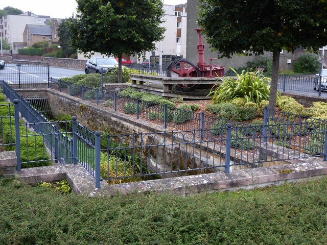
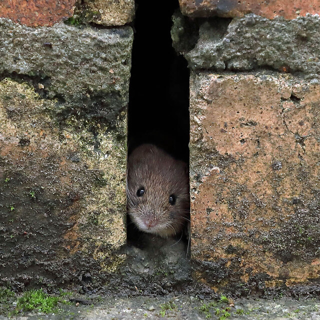
Black Andrew Plantation Images

Images are sourced within 2km of 55.61815/-2.775109 or Grid Reference NT5136. Thanks to Geograph Open Source API. All images are credited.

Section of mill lade With turbine components driven by water from the lade.
The mill was still in use in 1968 with the turbine still supplying power for the machinery.
Section of mill lade
With turbine components driven by water from the lade. The mill was still in use in 1968 with the turbine still supplying power for the machinery.
Backlit cherry tree leaves The leaves on an upright cherry tree in my garden turn to glorious yellow and red shades in the autumn.
Backlit cherry tree leaves
The leaves on an upright cherry tree in my garden turn to glorious yellow and red shades in the autumn.
A wood mouse (Apodemus sylveticus) This wood mouse is peeping out from a weep hole in a brick wall in my back yard. When I put out sultanas for the birds it often appears from the wall.
A wood mouse (Apodemus sylveticus)
This wood mouse is peeping out from a weep hole in a brick wall in my back yard. When I put out sultanas for the birds it often appears from the wall.
A stunning November sunset over Galashiels The sunset was visible over most of the south of Scotland. The foreground cross on a tree is a direction marker behind the second green at Galashiels golf course. The tree has been reduced over the years and the marker used to be a car tyre painted white.
A stunning November sunset over Galashiels
The sunset was visible over most of the south of Scotland. The foreground cross on a tree is a direction marker behind the second green at Galashiels golf course. The tree has been reduced over the years and the marker used to be a car tyre painted white.
Fallen trees, Gala Hill Trees probably brought down in Storm Arwen (November 26-27) just above the houses on the eastern flank of the hill.
Fallen trees, Gala Hill
Trees probably brought down in Storm Arwen (November 26-27) just above the houses on the eastern flank of the hill.
The Transport Interchange building in Galashiels The bus station which is located opposite the railway station was opened to the public on 10/08/2015.
The Transport Interchange building in Galashiels
The bus station which is located opposite the railway station was opened to the public on 10/08/2015.
New housing at Huddersfield Street, Galashiels This Eildon Housing development called Elworthy Place at Huddersfield Street comprises of 35 flats for rent.
New housing at Huddersfield Street, Galashiels
This Eildon Housing development called Elworthy Place at Huddersfield Street comprises of 35 flats for rent.
Snow-covered snowdrops The snowdrops are in my garden.
Snow-covered snowdrops
The snowdrops are in my garden.
A male sparrowhawk (Accipiter nisus) The sparrowhawk landed on a handrail in my back garden for a few minutes giving me time to get some shots. For a similar shot taken in 2013, see <a href="https://www.geograph.org.uk/photo/3430575">NT4936 : A sparrowhawk (Accipiter nisus)</a>.
A male sparrowhawk (Accipiter nisus)
The sparrowhawk landed on a handrail in my back garden for a few minutes giving me time to get some shots. For a similar shot taken in 2013, see NT4936 : A sparrowhawk (Accipiter nisus).
Gala Water Opposite Abbotsford Mill
Gala Water
Opposite Abbotsford Mill
Abbotsford Mill Still working.
Abbotsford Mill
Still working.
Steps down to Huddersfield Street, Galashiels A path with steps down from Douglas Place.
Steps down to Huddersfield Street, Galashiels
A path with steps down from Douglas Place.
Gala Mill from Huddersfield Street A substantial building with the last remaining mill chimney in the town.
Gala Mill from Huddersfield Street
A substantial building with the last remaining mill chimney in the town.
New flats, Galashiels New housing in Huddersfield Street Galashiels.
New flats, Galashiels
New housing in Huddersfield Street Galashiels.
Gala Water Retail Park A large Tesco supermarket and several other well-known retailers.
Gala Water Retail Park
A large Tesco supermarket and several other well-known retailers.
A wood mouse (Apodemus sylveticus) in the rockery This endearing wood mouse is ready to pop out from some rockery stones in my back garden.
A wood mouse (Apodemus sylveticus) in the rockery
This endearing wood mouse is ready to pop out from some rockery stones in my back garden.
Nest lining collectors I fixed some horse hair clippings to my clothes line and within minutes birds were down collecting nest lining material. The usual visitors were blue tits but sometimes a house sparrow appeared like the male bird on the left.
Nest lining collectors
I fixed some horse hair clippings to my clothes line and within minutes birds were down collecting nest lining material. The usual visitors were blue tits but sometimes a house sparrow appeared like the male bird on the left.
Open wide! I doubt if this woodpigeon could open its beak any wider and it looks like the regimental sergeant major of the bird world.
Open wide!
I doubt if this woodpigeon could open its beak any wider and it looks like the regimental sergeant major of the bird world.
Show me another place!

Black Andrew Plantation is located at Grid Ref: NT5136 (Lat: 55.61815, Lng: -2.775109)

Unitary Authority: The Scottish Borders

Police Authority: The Lothians and Scottish Borders

What 3 Words

///coverings.foods.tenses. Near Tweedbank, Scottish Borders

Nearby Locations

Black Andrew Plantation

Related Wikis

Gala Water

The Gala Water (Lowland Scots: Gala Watter; Scottish Gaelic An Geal Ath) is a river in the Scottish Borders area of Scotland and a tributary of the River...

Borders College

Borders College (Scottish Gaelic: Colaiste nan Crìochan) is a further education institution in the Scottish Borders, Scotland. Its main campus is located...
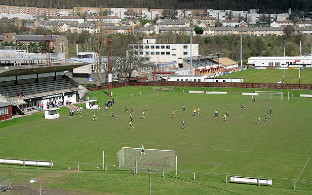
Netherdale

Netherdale is a sports complex in Galashiels, Scottish Borders, consisting of two adjacent stadiums used for rugby union and football. The rugby ground...

Tweedbank railway station

Tweedbank is a railway station on the Borders Railway, which runs between Edinburgh Waverley and Tweedbank. The station, situated 35 miles 34 chains (57...

Nearby Amenities

Located within 500m of 55.61815,-2.775109
Bus Stop
Hawthorn Rd Terminus
Bench: yes
Bus: yes
Departures Board: no
Lit: yes
Local Ref: at
Naptan AtcoCode: 6900364
Naptan Bearing: E
Naptan CommonName: Hawthorn Rd Terminus
Naptan Indicator: at
Naptan NaptanCode: 72724269
Naptan Street: Hawthorn Road
Operator: Scottish Borders Council
Public Transport: platform
Ref: 6900364
Shelter: yes
Source: local knowledge;survey;NaPTAN
Lat/Long: 55.6143212/-2.7729706
Power: tower
Lat/Long: 55.6179647/-2.7712087
Power: tower
Lat/Long: 55.6148649/-2.7719853
Power: tower
Lat/Long: 55.6149794/-2.77099
Power: tower
Lat/Long: 55.6167218/-2.7691766
Power: tower
Lat/Long: 55.6163676/-2.7715953
Power: tower
Lat/Long: 55.6211951/-2.7696177
Power: pole
Lat/Long: 55.6161692/-2.7682221
Power: pole
Lat/Long: 55.6159829/-2.7693889
Power: pole
Lat/Long: 55.6158284/-2.77051
Location Transition: yes
Power: pole
Lat/Long: 55.6149816/-2.7716097
Power: pole
Lat/Long: 55.6153997/-2.771489
Power: pole
Lat/Long: 55.6220777/-2.776317
Power: pole
Lat/Long: 55.6214265/-2.7760112
Power: pole
Lat/Long: 55.6207964/-2.775684
Power: pole
Lat/Long: 55.6201118/-2.7753782
Power: pole
Lat/Long: 55.6193454/-2.7750242
Power: pole
Lat/Long: 55.6187608/-2.7747184
Power: pole
Lat/Long: 55.6180126/-2.7743965
Power: pole
Lat/Long: 55.6173613/-2.7739137
Power: pole
Lat/Long: 55.6166706/-2.7735007
Power: pole
Lat/Long: 55.6159768/-2.7730608
Power: pole
Lat/Long: 55.6152225/-2.7725619
Power: pole
Lat/Long: 55.6152467/-2.7722508
Power: pole
Lat/Long: 55.6159511/-2.7727175
Power: pole
Lat/Long: 55.6166706/-2.7731413
Power: pole
Lat/Long: 55.6173946/-2.7736348
Power: pole
Lat/Long: 55.6181337/-2.7741659
Power: pole
Lat/Long: 55.6187699/-2.7744126
Power: pole
Lat/Long: 55.6194212/-2.7747184
Power: pole
Lat/Long: 55.6202179/-2.7751422
Power: pole
Lat/Long: 55.6209418/-2.775448
Noexit: yes
Lat/Long: 55.6145777/-2.7707819
Noexit: yes
Lat/Long: 55.6201344/-2.7716597
Generator Method: photovoltaic
Generator Output Electricity: yes
Generator Source: solar
Generator Type: solar_photovoltaic_panel
Power: generator
Lat/Long: 55.6139425/-2.7724653
Generator Method: photovoltaic
Generator Output Electricity: yes
Generator Source: solar
Generator Type: solar_photovoltaic_panel
Power: generator
Lat/Long: 55.614409/-2.7753058
Generator Method: photovoltaic
Generator Output Electricity: yes
Generator Source: solar
Generator Type: solar_photovoltaic_panel
Power: generator
Lat/Long: 55.6144954/-2.7770788
Generator Method: photovoltaic
Generator Output Electricity: yes
Generator Source: solar
Generator Type: solar_photovoltaic_panel
Power: generator
Lat/Long: 55.6144741/-2.7772424
Generator Method: photovoltaic
Generator Output Electricity: yes
Generator Source: solar
Generator Type: solar_photovoltaic_panel
Power: generator
Lat/Long: 55.6144681/-2.7778995
Generator Method: photovoltaic
Generator Output Electricity: yes
Generator Source: solar
Generator Type: solar_photovoltaic_panel
Power: generator
Lat/Long: 55.6144651/-2.7780631
Generator Method: photovoltaic
Generator Output Electricity: yes
Generator Source: solar
Generator Type: solar_photovoltaic_panel
Power: generator
Lat/Long: 55.6142727/-2.7762446
Generator Method: photovoltaic
Generator Output Electricity: yes
Generator Source: solar
Generator Type: solar_photovoltaic_panel
Power: generator
Lat/Long: 55.6139318/-2.7771485
Generator Method: photovoltaic
Generator Output Electricity: yes
Generator Source: solar
Generator Type: solar_photovoltaic_panel
Power: generator
Lat/Long: 55.6205305/-2.781601
Generator Method: photovoltaic
Generator Output Electricity: yes
Generator Source: solar
Generator Type: solar_photovoltaic_panel
Power: generator
Lat/Long: 55.6144795/-2.7760313
Power: pole
Lat/Long: 55.6217265/-2.7706277
Power: pole
Lat/Long: 55.6209907/-2.7705183
Power: pole
Lat/Long: 55.6205495/-2.7702307
Power: pole
Lat/Long: 55.6198827/-2.7697293
Power: pole
Lat/Long: 55.6193366/-2.769429
Power: pole
Lat/Long: 55.6188465/-2.769177
Power: pole
Lat/Long: 55.6184326/-2.7689836
Power: pole
Lat/Long: 55.6177772/-2.7686654
Power: pole
Lat/Long: 55.6171276/-2.7683499
Power: pole
Lat/Long: 55.6164132/-2.7680088
Power: pole
Lat/Long: 55.6223775/-2.77626
Power: pole
Lat/Long: 55.621932/-2.7777234
Power: pole
Lat/Long: 55.6215023/-2.7791028
Power: pole
Lat/Long: 55.6210698/-2.7805383
Power: pole
Lat/Long: 55.6207665/-2.7814952
Power: pole
Lat/Long: 55.6211962/-2.7792683
Power: pole
Lat/Long: 55.6204762/-2.7797544
Power: pole
Lat/Long: 55.6197217/-2.7802227
Power: pole
Lat/Long: 55.6191612/-2.7807215
Power: pole
Lat/Long: 55.6185734/-2.7812611
Power: pole
Lat/Long: 55.6180805/-2.7808946
The data included in this document is from www.openstreetmap.org. The data is made available under ODbL.

Have you been to Black Andrew Plantation?

Leave your review of Black Andrew Plantation below (or comments, questions and feedback).