Parkhead Wood

Wood, Forest in Aberdeenshire

Scotland

Parkhead Wood

Minor road towards Rhynie
Minor road towards Rhynie Credit: Steven Brown

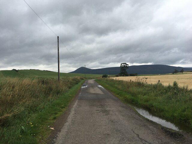
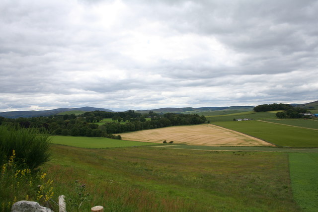
Parkhead Wood is a picturesque forest located in Aberdeenshire, Scotland. Covering an area of approximately 30 hectares, it is a popular destination for nature lovers and outdoor enthusiasts.

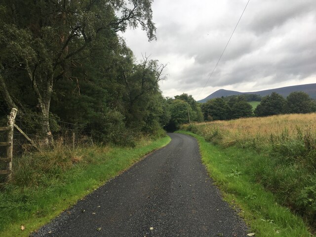
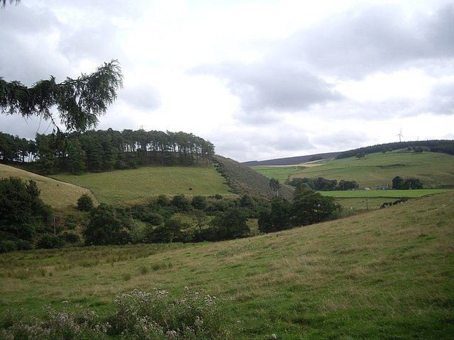
The wood is characterized by its diverse range of tree species, including Scots pine, birch, and oak, which create a vibrant and lush environment. The dense canopy offers shade and shelter, making it an ideal habitat for a variety of wildlife, such as red squirrels, roe deer, and a wide array of bird species.

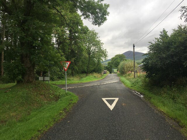
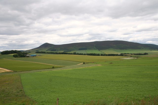
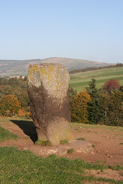
Visitors to Parkhead Wood can explore the numerous walking trails that wind their way through the forest. These paths provide the perfect opportunity to immerse oneself in nature and enjoy the tranquil surroundings. Along the trails, there are several designated viewpoints that offer stunning vistas of the surrounding countryside, including rolling hills and distant mountains.

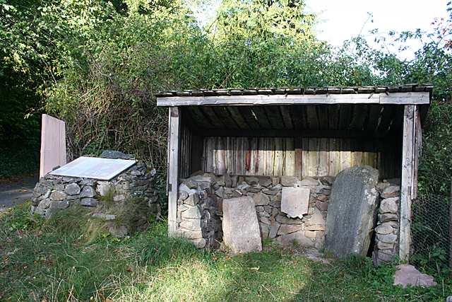
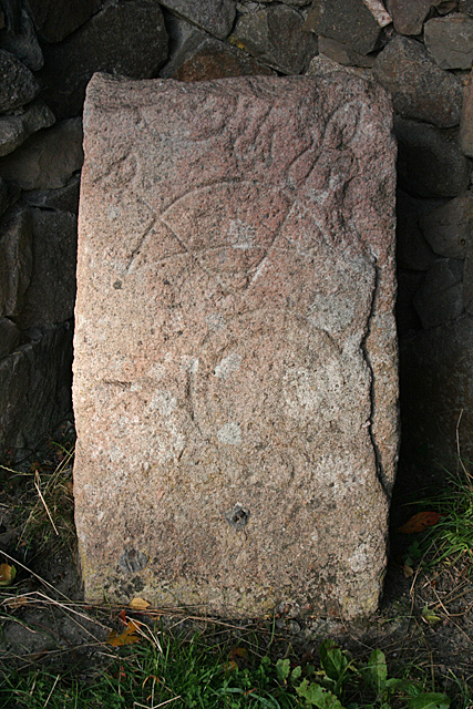
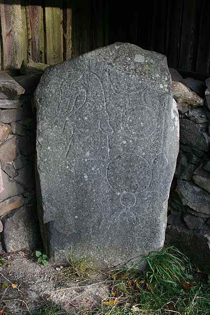
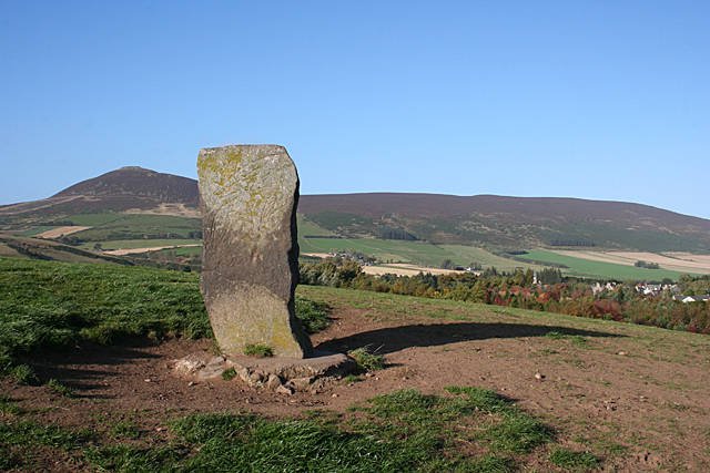
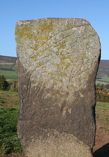
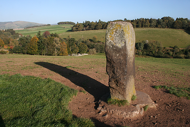
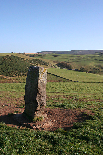
For those interested in history, Parkhead Wood boasts several ancient archaeological sites. These include remnants of prehistoric settlements and burial mounds, providing a glimpse into the area's rich cultural heritage.

The wood is also home to a small visitor center, where visitors can obtain information about the forest and its wildlife. Additionally, there are picnic areas and benches scattered throughout the wood, allowing visitors to relax and enjoy a meal amidst the natural beauty.

Overall, Parkhead Wood in Aberdeenshire is a haven for nature enthusiasts, offering a tranquil escape from the hustle and bustle of everyday life. With its diverse ecosystem, scenic trails, and rich history, it is a must-visit destination for anyone seeking to connect with nature in the heart of Scotland.

If you have any feedback on the listing, please let us know in the comments section below.

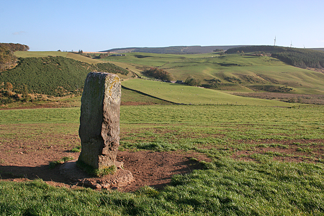
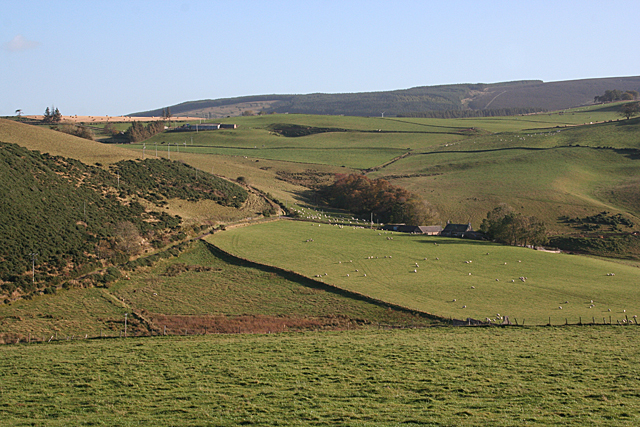
Parkhead Wood Images

Images are sourced within 2km of 57.322075/-2.812812 or Grid Reference NJ5126. Thanks to Geograph Open Source API. All images are credited.

Minor road towards Rhynie
Road junction near Rhynie
Kearn Fields Farmland by Bridge of Kearn with Tap o Noth taken from the Clatt Road by Gartnoch Hill.
Kearn Fields
Farmland by Bridge of Kearn with Tap o Noth taken from the Clatt Road by Gartnoch Hill.
Bridge of Kearn and Druminor Farmland by Bridge of Kearn and Druminor Woods.
Bridge of Kearn and Druminor
Farmland by Bridge of Kearn and Druminor Woods.
The southern end of Drum Wood Seen from near Rhynie cemetery. The wind turbine on right hand skyline is on Cairn More <a href="https://www.geograph.org.uk/gridref/NJ5024">NJ5024</a>.
The southern end of Drum Wood
Seen from near Rhynie cemetery. The wind turbine on right hand skyline is on Cairn More NJ5024.
Semi-detached bungalows On the Bogie Road out of Rhynie.
Semi-detached bungalows
On the Bogie Road out of Rhynie.
The A97 crosses the Ord Burn at Mill of Noth
Rhynie Symbol Stones These are three of eight incised symbol stones found around Rhynie. They are house in an open shed beside the car park below the cemetery. See <a href="https://www.geograph.org.uk/photo/4712493">NJ4926 : Rhynie Symbol Stone No 5</a> and <a href="https://www.geograph.org.uk/photo/4712501">NJ4926 : Rhynie Symbol Stone No 6</a> for cloe-ups of two of the stones. The carving on the middle one was too worn and the photograph was indistinct.
Rhynie Symbol Stones
These are three of eight incised symbol stones found around Rhynie. They are house in an open shed beside the car park below the cemetery. See NJ4926 : Rhynie Symbol Stone No 5 and NJ4926 : Rhynie Symbol Stone No 6 for cloe-ups of two of the stones. The carving on the middle one was too worn and the photograph was indistinct.
Rhynie Symbol Stone No 5 The description of this stone at <span class="nowrap"><a title="http://canmore.org.uk/site/17194/rhynie-st-luags-church-churchyard-rhynie-no-5" rel="nofollow ugc noopener" href="http://canmore.org.uk/site/17194/rhynie-st-luags-church-churchyard-rhynie-no-5">Link</a><img style="margin-left:2px;" alt="External link" title="External link - shift click to open in new window" src="https://s1.geograph.org.uk/img/external.png" width="10" height="10"/></span> is a bit confusing. It shows two different stones under the same heading. This one is definitely pink granite, and I can make out a 'crescent and V-rod' and 'mirror' symbols. This is the one on the left in <a href="https://www.geograph.org.uk/photo/4712489">NJ4926 : Rhynie Symbol Stones</a>.
Rhynie Symbol Stone No 5
The description of this stone at LinkExternal link is a bit confusing. It shows two different stones under the same heading. This one is definitely pink granite, and I can make out a 'crescent and V-rod' and 'mirror' symbols. This is the one on the left in NJ4926 : Rhynie Symbol Stones.
Rhynie Symbol Stone No 6 The description of this stone at <span class="nowrap"><a title="http://canmore.org.uk/site/319702/rhynie-st-luags-church-churchyard-rhynie-no-6" rel="nofollow ugc noopener" href="http://canmore.org.uk/site/319702/rhynie-st-luags-church-churchyard-rhynie-no-6">Link</a><img style="margin-left:2px;" alt="External link" title="External link - shift click to open in new window" src="https://s1.geograph.org.uk/img/external.png" width="10" height="10"/></span> is a bit confusing. It shows two different stones under the same heading. This one is definitely grey whinstone, and I can make out a 'dog's head, 'double disc and z-rod' and 'mirror' symbols. It is supposed to have a 'comb' but if it is there it is very indistinct. This is the one on the right in <a href="https://www.geograph.org.uk/photo/4712489">NJ4926 : Rhynie Symbol Stones</a>.
Rhynie Symbol Stone No 6
The description of this stone at LinkExternal link is a bit confusing. It shows two different stones under the same heading. This one is definitely grey whinstone, and I can make out a 'dog's head, 'double disc and z-rod' and 'mirror' symbols. It is supposed to have a 'comb' but if it is there it is very indistinct. This is the one on the right in NJ4926 : Rhynie Symbol Stones.
Craw Stane (1) The Craw Stane is thought to be the most important of the eight symbol stones found around Rhynie. It stands on a low hill south of the village. See <span class="nowrap"><a title="http://canmore.org.uk/site/17199/rhynie-craw-stane" rel="nofollow ugc noopener" href="http://canmore.org.uk/site/17199/rhynie-craw-stane">Link</a><img style="margin-left:2px;" alt="External link" title="External link - shift click to open in new window" src="https://s1.geograph.org.uk/img/external.png" width="10" height="10"/></span> for more information. <a href="https://www.geograph.org.uk/photo/4712678">NJ4926 : Craw Stane (2)</a>
Craw Stane (1)
The Craw Stane is thought to be the most important of the eight symbol stones found around Rhynie. It stands on a low hill south of the village. See LinkExternal link for more information. NJ4926 : Craw Stane (2)
Craw Stane (2) The Craw Stane is thought to be the most important of the eight symbol stones found around Rhynie. It stands on a low hill south of the village. See <span class="nowrap"><a title="http://canmore.org.uk/site/17199/rhynie-craw-stane" rel="nofollow ugc noopener" href="http://canmore.org.uk/site/17199/rhynie-craw-stane">Link</a><img style="margin-left:2px;" alt="External link" title="External link - shift click to open in new window" src="https://s1.geograph.org.uk/img/external.png" width="10" height="10"/></span> for more information. The village is just visible at right and in the distance is Tap o' Noth in NJ4829. <a href="https://www.geograph.org.uk/photo/4712679">NJ4926 : Craw Stane (3)</a>
Craw Stane (2)
The Craw Stane is thought to be the most important of the eight symbol stones found around Rhynie. It stands on a low hill south of the village. See LinkExternal link for more information. The village is just visible at right and in the distance is Tap o' Noth in NJ4829. NJ4926 : Craw Stane (3)
Craw Stane (3) The Craw Stane is thought to be the most important of the eight symbol stones found around Rhynie. It stands on a low hill south of the village. In this close-up view you can see the incised 'fish' and 'elephant' symbols on the south face of the stone. See <span class="nowrap"><a title="http://canmore.org.uk/site/17199/rhynie-craw-stane" rel="nofollow ugc noopener" href="http://canmore.org.uk/site/17199/rhynie-craw-stane">Link</a><img style="margin-left:2px;" alt="External link" title="External link - shift click to open in new window" src="https://s1.geograph.org.uk/img/external.png" width="10" height="10"/></span> for more information. <a href="https://www.geograph.org.uk/photo/4712685">NJ4926 : Craw Stane (4)</a>
Craw Stane (3)
The Craw Stane is thought to be the most important of the eight symbol stones found around Rhynie. It stands on a low hill south of the village. In this close-up view you can see the incised 'fish' and 'elephant' symbols on the south face of the stone. See LinkExternal link for more information. NJ4926 : Craw Stane (4)
Craw Stane (4) The Craw Stane is thought to be the most important of the eight symbol stones found around Rhynie. It stands on a low hill south of the village. This is the west face of the stone, with the corner of the cemetery just in view among the trees to the left, below the long shadow. See <span class="nowrap"><a title="http://canmore.org.uk/site/17199/rhynie-craw-stane" rel="nofollow ugc noopener" href="http://canmore.org.uk/site/17199/rhynie-craw-stane">Link</a><img style="margin-left:2px;" alt="External link" title="External link - shift click to open in new window" src="https://s1.geograph.org.uk/img/external.png" width="10" height="10"/></span> for more information. <a href="https://www.geograph.org.uk/photo/4712687">NJ4926 : Craw Stane (5)</a>
Craw Stane (4)
The Craw Stane is thought to be the most important of the eight symbol stones found around Rhynie. It stands on a low hill south of the village. This is the west face of the stone, with the corner of the cemetery just in view among the trees to the left, below the long shadow. See LinkExternal link for more information. NJ4926 : Craw Stane (5)
Craw Stane (5) The Craw Stane is thought to be the most important of the eight symbol stones found around Rhynie. It stands on a low hill south of the village. This is the back of the stone from the north-west. See <span class="nowrap"><a title="http://canmore.org.uk/site/17199/rhynie-craw-stane" rel="nofollow ugc noopener" href="http://canmore.org.uk/site/17199/rhynie-craw-stane">Link</a><img style="margin-left:2px;" alt="External link" title="External link - shift click to open in new window" src="https://s1.geograph.org.uk/img/external.png" width="10" height="10"/></span> for more information.  <a href="https://www.geograph.org.uk/photo/4712688">NJ4926 : Craw Stane (6)</a>
Craw Stane (5)
The Craw Stane is thought to be the most important of the eight symbol stones found around Rhynie. It stands on a low hill south of the village. This is the back of the stone from the north-west. See LinkExternal link for more information. NJ4926 : Craw Stane (6)
Craw Stane (6) The Craw Stane is thought to be the most important of the eight symbol stones found around Rhynie. It stands on a low hill south of the village, with a fine view to the south-east. See <span class="nowrap"><a title="http://canmore.org.uk/site/17199/rhynie-craw-stane" rel="nofollow ugc noopener" href="http://canmore.org.uk/site/17199/rhynie-craw-stane">Link</a><img style="margin-left:2px;" alt="External link" title="External link - shift click to open in new window" src="https://s1.geograph.org.uk/img/external.png" width="10" height="10"/></span> for more information. <a href="https://www.geograph.org.uk/photo/4712674">NJ4926 : Craw Stane (1)</a>
Craw Stane (6)
The Craw Stane is thought to be the most important of the eight symbol stones found around Rhynie. It stands on a low hill south of the village, with a fine view to the south-east. See LinkExternal link for more information. NJ4926 : Craw Stane (1)
Across the Bogie Water This is the view from beside the <a href="https://www.geograph.org.uk/photo/4712674">NJ4926 : Craw Stane (1)</a>. The Water of Bogie runs through the floor of the valley. Beyond it, the nearest farm is Barflat, which is just in the next square. Above and to the left is Bankhead (not to be confused with other places of the same name; this one is in the parish of Rhynie). The intervening farm, Sandholes, is hidden by the lie of the land.
Across the Bogie Water
This is the view from beside the NJ4926 : Craw Stane (1). The Water of Bogie runs through the floor of the valley. Beyond it, the nearest farm is Barflat, which is just in the next square. Above and to the left is Bankhead (not to be confused with other places of the same name; this one is in the parish of Rhynie). The intervening farm, Sandholes, is hidden by the lie of the land.
Show me another place!

Parkhead Wood is located at Grid Ref: NJ5126 (Lat: 57.322075, Lng: -2.812812)

Unitary Authority: Aberdeenshire

Police Authority: North East

What 3 Words

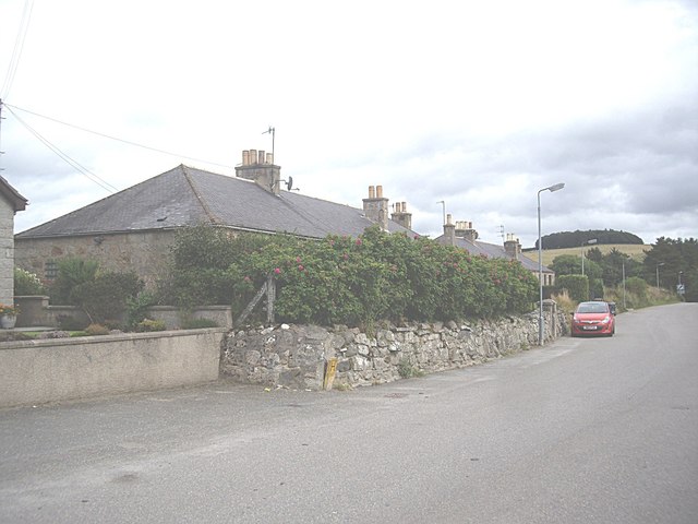
///shipwreck.cactus.glimmers. Near Alford, Aberdeenshire

Related Wikis

Druminnor Castle

Druminnor Castle is an L-plan castle, dating from the early 15th century, about two miles east of Rhynnie, in a steep valley by the Keron burn, in Aberdeenshire...

Rhynie, Aberdeenshire

Rhynie () (Scottish Gaelic: Roinnidh) is a village in Aberdeenshire, Scotland. It is on the A97 road, 14 miles (23 km) northwest of Alford. The Rhynie...
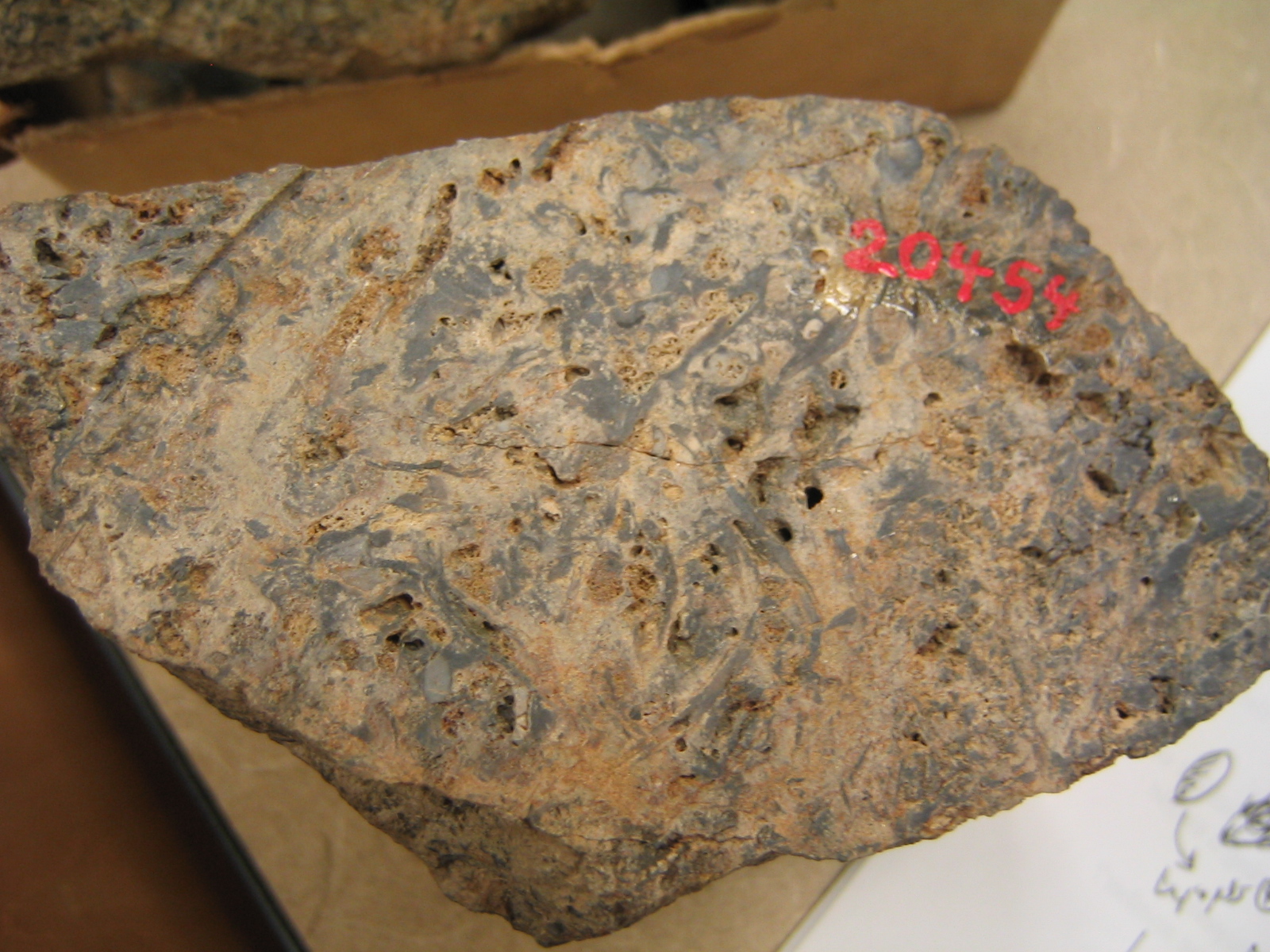
Rhynie chert

The Rhynie chert is a Lower Devonian sedimentary deposit exhibiting extraordinary fossil detail or completeness (a Lagerstätte). It is exposed near the...

Clatt

Clatt (Gaelic cleithe, 'concealed'), is a village in Aberdeenshire, Scotland. The remains of a morthouse are located in the cemetery of the old church...

Nearby Amenities

Located within 500m of 57.322075,-2.812812
Barrier: swing_gate
Bicycle: yes
Foot: yes
Height: 2
Horse: yes
Material: wood
Motor Vehicle: no
Wheelchair: no
Lat/Long: 57.3237668/-2.8122265
Power: pole
Lat/Long: 57.3255424/-2.816276
Power: pole
Lat/Long: 57.3261228/-2.8160615
Power: pole
Lat/Long: 57.3259893/-2.8137674
Power: pole
Lat/Long: 57.3259866/-2.8124021
Power: pole
Lat/Long: 57.3261365/-2.8127781
Power: pole
Lat/Long: 57.3262087/-2.8119074
Power: pole
Lat/Long: 57.3262332/-2.8105068
Power: pole
Lat/Long: 57.3258967/-2.8099591
The data included in this document is from www.openstreetmap.org. The data is made available under ODbL.

Have you been to Parkhead Wood?

Leave your review of Parkhead Wood below (or comments, questions and feedback).