Common Strip

Wood, Forest in East Lothian

Scotland

Common Strip

Halfmoon Plantation Some surviving bits of the depleted Archerfield woodlands.
Halfmoon Plantation Credit: Richard Webb

Common Strip is a woodland area located in East Lothian, Scotland. Situated in the heart of the county, this wood forest covers a vast area and is known for its natural beauty and diverse ecosystem. The woodland is easily accessible from nearby towns and villages, making it a popular destination for locals and tourists alike.

Common Strip boasts a wide range of tree species, including oak, beech, and birch, creating a rich and vibrant landscape throughout the year. The forest floor is covered with a lush carpet of ferns, wildflowers, and mosses, providing a habitat for various wildlife species.

In addition to its natural beauty, Common Strip offers a range of outdoor activities for visitors to enjoy. There are numerous walking trails and paths that wind through the woodland, allowing visitors to explore the area at their own pace. These trails vary in difficulty, catering to both casual strollers and more experienced hikers.

Birdwatchers will be delighted by the abundance of bird species that call Common Strip home. From small songbirds to majestic birds of prey, there is always something to spot and admire. The forest also provides a habitat for mammals such as deer, foxes, and rabbits, offering ample opportunities for nature enthusiasts to observe and appreciate Scotland's wildlife.

Overall, Common Strip in East Lothian is a scenic and diverse woodland forest that offers a tranquil escape from the hustle and bustle of everyday life. With its picturesque landscapes, varied trails, and abundant wildlife, it is a must-visit destination for nature lovers and outdoor enthusiasts.

If you have any feedback on the listing, please let us know in the comments section below.

Common Strip Images

Images are sourced within 2km of 56.0554/-2.7875844 or Grid Reference NT5185. Thanks to Geograph Open Source API. All images are credited.

Halfmoon Plantation Some surviving bits of the depleted Archerfield woodlands.
Halfmoon Plantation
Some surviving bits of the depleted Archerfield woodlands.
Sand and rocks The coast W of Wreaklaw Rocks with the island of Fidra coming into view. The Isle of May is on the horizon, about 21km away.
Sand and rocks
The coast W of Wreaklaw Rocks with the island of Fidra coming into view. The Isle of May is on the horizon, about 21km away.
Fidra A small island of basalt lava, said to be the model for Stevenson's 'Treasure Island'. The detached rock of North Dog is to the left and part of the Isle of May is on the horizon, about 21km away.
Fidra
A small island of basalt lava, said to be the model for Stevenson's 'Treasure Island'. The detached rock of North Dog is to the left and part of the Isle of May is on the horizon, about 21km away.
John Muir Way joins the A198 The Way reaches the A198 road here to the east of Gullane.
John Muir Way joins the A198
The Way reaches the A198 road here to the east of Gullane.
Renaissance Club golf course A course situated between Archerfield and Muirfield on the East Lothian 'Golf Coast'. The tower on the left supports a radar antenna.
Renaissance Club golf course
A course situated between Archerfield and Muirfield on the East Lothian 'Golf Coast'. The tower on the left supports a radar antenna.
Halfmoon Plantation Path running through woodland at Archerfield.
Halfmoon Plantation
Path running through woodland at Archerfield.
Beach at Weaklaw Rocks According to the maps, the shore here is a rock platform. So either the maps are wrong or my GPS is wrong. The lighthouse is on Fidra.
Beach at Weaklaw Rocks
According to the maps, the shore here is a rock platform. So either the maps are wrong or my GPS is wrong. The lighthouse is on Fidra.
Weaklaw Rocks The rocks at the east end of the beach, which doesn't appear to have a name, are a wave-cut platform of volcanic breccia and tuff. Fidra is in the distance.
Weaklaw Rocks
The rocks at the east end of the beach, which doesn't appear to have a name, are a wave-cut platform of volcanic breccia and tuff. Fidra is in the distance.
Weaklaw Rocks There's a platform of rock to be crossed on the way to the nameless sandy beach.
Weaklaw Rocks
There's a platform of rock to be crossed on the way to the nameless sandy beach.
Hanging Rocks These two bluffs above the beach are formed of pyroclastic breccia reverse-faulted against younger rocks.
Hanging Rocks
These two bluffs above the beach are formed of pyroclastic breccia reverse-faulted against younger rocks.
Snow Cloud above Fidra Lovely day on East Lothians coast, though bitterly cold and the anvil shaped cloud above Fidra had snow in it. Fortunately for me I managed to avoid the snow showers.
Snow Cloud above Fidra
Lovely day on East Lothians coast, though bitterly cold and the anvil shaped cloud above Fidra had snow in it. Fortunately for me I managed to avoid the snow showers.
Beach, West Links
Beach, West Links
Built object, West Links A stone plinth off the beach - purpose unknown.
Built object, West Links
A stone plinth off the beach - purpose unknown.
West Links, Gullane Still open dune grassland, occasionally threatened by golfers, always threatened by buckthorn.
West Links, Gullane
Still open dune grassland, occasionally threatened by golfers, always threatened by buckthorn.
Columnar Basalt These rocks are columnar basalts like the famous ones on Staffa - but much easier to get to!
Columnar Basalt
These rocks are columnar basalts like the famous ones on Staffa - but much easier to get to!
Sunset on the Forth
Sunset on the Forth
West Links Mature dunes. A lot of this square is made up of a forested area of dunes, but this woodland is being turned into golfcourses. The dunes, between Muirfield and the sea are safe, a wonderful wild place.
West Links
Mature dunes. A lot of this square is made up of a forested area of dunes, but this woodland is being turned into golfcourses. The dunes, between Muirfield and the sea are safe, a wonderful wild place.
Hanging Rocks Gullane dunes meet a low craggy piece of shoreline. The beaches here are a longish walk from a car park, behind Muirfield, so are quiet. As well as the vast dune system, there is woodland here, but it is being turned into an extremely expensive pair of golf courses. The dunes here are worth climbing for the views.
Hanging Rocks
Gullane dunes meet a low craggy piece of shoreline. The beaches here are a longish walk from a car park, behind Muirfield, so are quiet. As well as the vast dune system, there is woodland here, but it is being turned into an extremely expensive pair of golf courses. The dunes here are worth climbing for the views.
Show me another place!

Common Strip is located at Grid Ref: NT5185 (Lat: 56.0554, Lng: -2.7875844)

Unitary Authority: East Lothian

Police Authority: The Lothians and Scottish Borders

What 3 Words

///shuffles.snips.impaled. Near Gullane, East Lothian

Related Wikis

Archerfield Estate and Links

Archerfield and Archerfield Links are a country house (now hotel) and pair of golf courses in the parish of Dirleton, East Lothian, Scotland. An older...
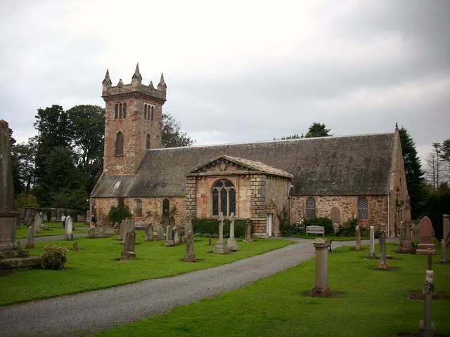
Dirleton Kirk

Dirleton Kirk is a church in the village of Dirleton, in East Lothian, Scotland. The church (at grid reference NT512842) is to the north of the village...
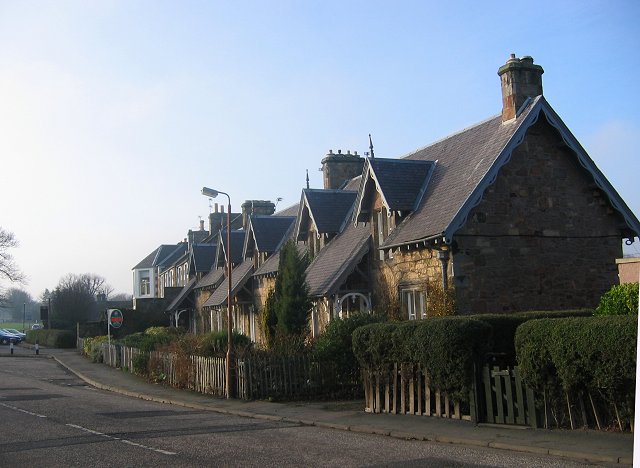
Dirleton

Dirleton is a village and civil parish in East Lothian, Scotland approximately 20 miles (32 km) east of Edinburgh on the A198. It contains 7,500 acres...

Yellowcraig

Yellowcraig, also known as Broad Sands Beach, is a coastal area of forest, beach and grassland in East Lothian, south-east Scotland. Yellowcraig is partly...

Nearby Amenities

Located within 500m of 56.0554,-2.7875844
Addr Housenumber: 34
Lat/Long: 56.0579524/-2.7875796
Archerfield The Village
Place: neighbourhood
Lat/Long: 56.0548895/-2.7902565
The data included in this document is from www.openstreetmap.org. The data is made available under ODbL.

Have you been to Common Strip?

Leave your review of Common Strip below (or comments, questions and feedback).