Ceidio Fawr

Settlement in Caernarfonshire

Wales

Ceidio Fawr

Y Bryncynan Large family pub at the junction of the A497 and B4412, between Pwllheli and Morfa Nefyn
Y Bryncynan Credit: Eirian Evans

Ceidio Fawr is a small village located in the historic county of Caernarfonshire, Wales. Situated in the beautiful countryside, it lies about 3 miles northeast of the town of Pwllheli and is surrounded by rolling hills and lush green fields. The village is a part of the community of Llannor and falls within the Gwynedd county council area.

Ceidio Fawr is known for its charming and peaceful atmosphere, making it an ideal place for those seeking tranquility away from the hustle and bustle of city life. The village is characterized by traditional Welsh stone cottages and farmhouses, adding to its rustic charm. The local community is close-knit and friendly, and residents often take part in various community activities and events.

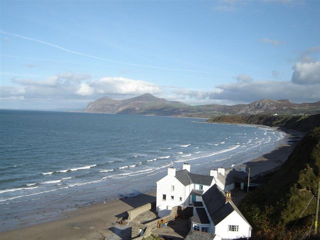
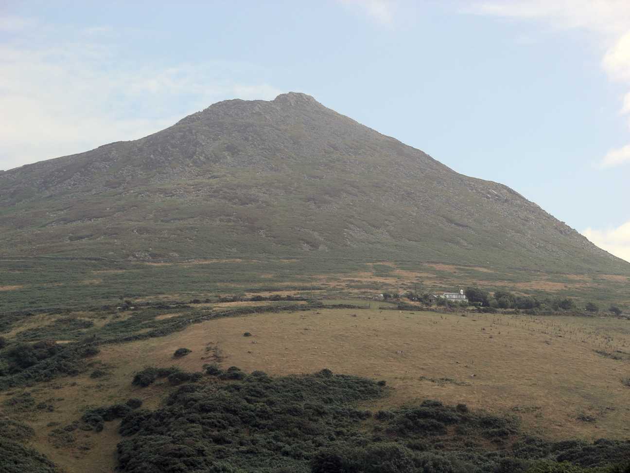
The area offers stunning natural beauty and is a haven for outdoor enthusiasts. It is located close to the coast, allowing residents and visitors to enjoy beautiful sandy beaches and breathtaking coastal walks. The nearby countryside provides ample opportunities for hiking, cycling, and exploring the surrounding nature reserves.

Although small in size, Ceidio Fawr has a rich history and heritage. It is home to a few notable landmarks, including the historic St. Ceidio's Church, which dates back to the 12th century. The church is renowned for its unique architecture and beautiful stained glass windows.

In summary, Ceidio Fawr is a picturesque village nestled in the countryside of Caernarfonshire, Wales. With its peaceful ambiance, natural beauty, and rich history, it is a hidden gem for those seeking a tranquil retreat in a stunning rural setting.

If you have any feedback on the listing, please let us know in the comments section below.
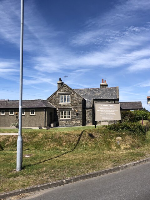
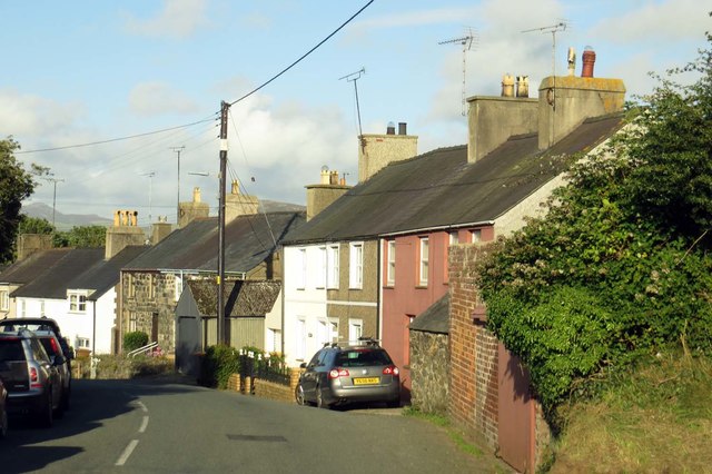
Ceidio Fawr Images

Images are sourced within 2km of 52.91347/-4.55295 or Grid Reference SH2838. Thanks to Geograph Open Source API. All images are credited.

Y Bryncynan Large family pub at the junction of the A497 and B4412, between Pwllheli and Morfa Nefyn
Y Bryncynan
Large family pub at the junction of the A497 and B4412, between Pwllheli and Morfa Nefyn
Edern A small village on the northern side of the Lleyn peninsula.
Edern
A small village on the northern side of the Lleyn peninsula.
Main road through Edern The B4417 cuts through the middle of the village
Main road through Edern
The B4417 cuts through the middle of the village
Ty'n Llan Farm Mechanisation had come to this north Wales farm by the mid-1960s in the form of a contraption for lifting bales high on the stack and a wood saw driven by a band attached to the tractor. The sawing operation would be unlikely to satisfy health and safety requirements nowadays. Of interest are the two classic tractors: a Fordson Major, which would have been relatively new at the time, and an older David Brown Cropmaster behind.
Ty'n Llan Farm
Mechanisation had come to this north Wales farm by the mid-1960s in the form of a contraption for lifting bales high on the stack and a wood saw driven by a band attached to the tractor. The sawing operation would be unlikely to satisfy health and safety requirements nowadays. Of interest are the two classic tractors: a Fordson Major, which would have been relatively new at the time, and an older David Brown Cropmaster behind.
On Carn Fadryn - view towards Yr Eifl
Pont Edern Carries the B4417 (Lon Goch) through Edern over the Afon Geirch. It is listed Grade II
Pont Edern
Carries the B4417 (Lon Goch) through Edern over the Afon Geirch. It is listed Grade II
Y Llong/The Ship, Edern Traditional pub in the centre of the village
Y Llong/The Ship, Edern
Traditional pub in the centre of the village
Cerrig Llwydion, Edern Pretty little stone cottage on Lon Gerddi
Cerrig Llwydion, Edern
Pretty little stone cottage on Lon Gerddi
Edern War Memorial
Edern War Memorial
Canolfan Gymdeithasol Edern Community Centre
B4417 near Bryn
B4417 near Bryn
B4417 at Pont Edern
B4417 at Pont Edern
Old Milestone by B4417, Edern The Milestone is located end of a garden wall opposite The Ship Inn on the side of the road.  Parish of Nefyn (Gwynedd District), erected in the 19th Century. 

Inscription reads:-  C22 / N2 / A11  

Milestone Society National ID: CAE_NFAD02
Old Milestone by B4417, Edern
The Milestone is located end of a garden wall opposite The Ship Inn on the side of the road.  Parish of Nefyn (Gwynedd District), erected in the 19th Century. Inscription reads:- C22 / N2 / A11 Milestone Society National ID: CAE_NFAD02
The B4417 to Groesffordd
Lon Groesffordd heading north-east
The B4417 into Groesffordd
The B4417 in Groesffordd
Lon Gerddi in Erdon
Lon Gerddi in Erdon
Show me another place!

Ceidio Fawr is located at Grid Ref: SH2838 (Lat: 52.91347, Lng: -4.55295)

Unitary Authority: Gwynedd

Police Authority: North Wales

What 3 Words

///awakes.marching.etchings. Near Nefyn, Gwynedd

Nearby Locations

Ceidio Fawr Ceidio

Related Wikis

Ceidio

Ceidio is a former civil parish in the Welsh county of Gwynedd. It was abolished in 1934, and incorporated into Buan. == References ==

Llandudwen

Llandudwen is a former civil parish in the Welsh county of Gwynedd. It was abolished in 1934, and divided between Buan and Tudweiliog. == References ==

Edern, Gwynedd

Edern, formerly known as Edeyrn, is a village and until 1939 a civil parish, in the Welsh county of Gwynedd. It is about 1 km southwest of the larger village...

Cors Geirch National Nature Reserve

Cors Geirch National Nature Reserve is an extensive wetland site on the Llŷn Peninsula, in the central part of the valley that runs between Nefyn and Pwllheli...

Morfa Nefyn

Morfa Nefyn is a village on the northern coast of the Llŷn Peninsula in Gwynedd, Wales. It lies on the crossroads of the B4417 and B4412. The village has...

Garn Boduan

Garn Boduan is an Iron Age hillfort and hill near Nefyn, on the Llŷn Peninsula in Wales. In a survey in the 1950s the traces of over 170 round houses were...

Nefyn

Nefyn (Welsh pronunciation: [ˈnɛvɨn], archaically anglicised as Nevin) is both a small town and a community on the northwest coast of the Llŷn Peninsula...

Carn Fadryn

Carn Fadryn, sometimes Carn Fadrun or Garn Fadryn, is a five-hectare Iron Age hillfort and is the name of the mountain on which the fort is situated. It...

Nearby Amenities

Located within 500m of 52.91347,-4.55295
Ceidio
Place: hamlet
Source: OS_OpenData_StreetView
Lat/Long: 52.9150475/-4.5546696
Power: pole
Lat/Long: 52.9175059/-4.5539135
Power: pole
Lat/Long: 52.9179248/-4.5529452
Power: pole
Lat/Long: 52.9129604/-4.5597231
Power: pole
Lat/Long: 52.9136155/-4.5592538
Power: pole
Lat/Long: 52.9142123/-4.5594308
Direction: 165
Generator Method: photovoltaic
Generator Output Electricity: yes
Generator Solar Modules: 14
Generator Source: solar
Generator Type: solar_photovoltaic_panel
Location: roof
Power: generator
Lat/Long: 52.9157593/-4.5539618
Direction: 165
Generator Method: photovoltaic
Generator Output Electricity: yes
Generator Solar Modules: 6
Generator Source: solar
Generator Type: solar_photovoltaic_panel
Location: roof
Power: generator
Lat/Long: 52.9156882/-4.554293
Direction: ENE
Generator Method: photovoltaic
Generator Output Electricity: yes
Generator Solar Modules: 8
Generator Source: solar
Generator Type: solar_photovoltaic_panel
Location: roof
Power: generator
Lat/Long: 52.9155693/-4.5546685
Direction: WSW
Generator Method: photovoltaic
Generator Output Electricity: yes
Generator Solar Modules: 8
Generator Source: solar
Generator Type: solar_photovoltaic_panel
Location: roof
Power: generator
Lat/Long: 52.9155523/-4.5547168
Barrier: stile
Material: stone
Stile: stepover
Lat/Long: 52.9137865/-4.5481675
Barrier: lych_gate
Lat/Long: 52.9138082/-4.5481165
Direction: 165
Generator Method: photovoltaic
Generator Output Electricity: yes
Generator Solar Modules: 6
Generator Source: solar
Generator Type: solar_photovoltaic_panel
Location: roof
Power: generator
Lat/Long: 52.9157192/-4.5543577
Direction: 165
Generator Method: photovoltaic
Generator Output Electricity: yes
Generator Solar Modules: 3
Generator Source: solar
Generator Type: solar_photovoltaic_panel
Location: roof
Power: generator
Lat/Long: 52.9156962/-4.5544314
Parking
Access: destination
Lat/Long: 52.9131594/-4.54744
The data included in this document is from www.openstreetmap.org. The data is made available under ODbL.

Have you been to Ceidio Fawr?

Leave your review of Ceidio Fawr below (or comments, questions and feedback).