Burnt Plantation

Wood, Forest in Fife

Scotland

Burnt Plantation

A915 Milestone Milestone with rusting cast-iron cap in the undergrowth by the A915 six miles south of St Andrews.
A915 Milestone Credit: Scott Cormie

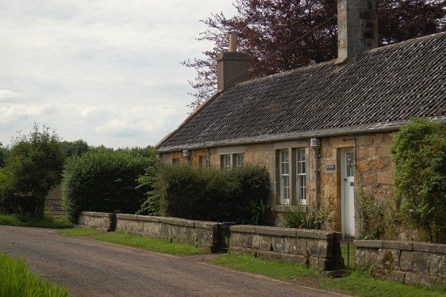
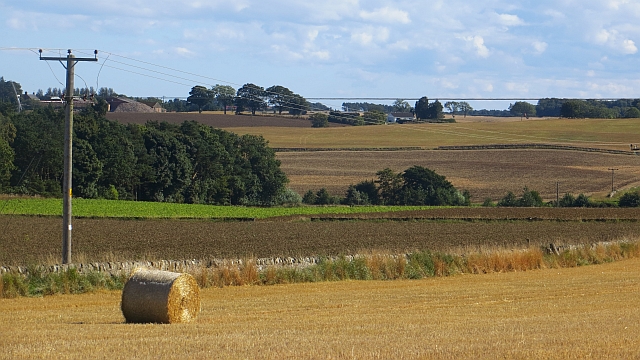
Burnt Plantation, located in Fife, Scotland, is a woodland area known for its rich history and diverse ecosystem. Spanning approximately 50 acres, this forested landscape offers a tranquil retreat for nature enthusiasts and history buffs alike.

The name "Burnt Plantation" stems from a fire that ravaged the area in the 19th century, leaving behind charred remnants of trees and vegetation. However, the forest has since regenerated, showcasing a mix of native and non-native tree species.

The woodland boasts a variety of tree types, including oak, birch, beech, and Scots pine, creating a lush canopy that shelters a wide range of flora and fauna. Wildflowers, such as bluebells and primroses, bloom in the spring, adding vibrant colors to the forest floor. The plantation is also home to several species of birds, including woodpeckers, owls, and songbirds, making it a popular spot for birdwatching enthusiasts.

Walking trails wind through the woods, offering visitors the chance to explore the area and discover its hidden gems. The trails vary in difficulty, catering to both casual strollers and avid hikers. Along these paths, there are informative signboards that provide insights into the history and biodiversity of the plantation.

Burnt Plantation is not only a haven for nature lovers but also a site of historical significance. The remnants of old charcoal pits and lime kilns can still be found within the woodland, serving as a reminder of the area's past industrial activities. These features offer a glimpse into the region's past and provide opportunities for educational experiences.

Overall, Burnt Plantation, with its picturesque landscape and historical remnants, offers a captivating blend of nature and history for visitors to enjoy.

If you have any feedback on the listing, please let us know in the comments section below.

Burnt Plantation Images

Images are sourced within 2km of 56.28338/-2.8000031 or Grid Reference NO5010. Thanks to Geograph Open Source API. All images are credited.

A915 Milestone Milestone with rusting cast-iron cap in the undergrowth by the A915 six miles south of St Andrews.
A915 Milestone
Milestone with rusting cast-iron cap in the undergrowth by the A915 six miles south of St Andrews.
C41 and A915 junction The C41 (Fife) road meeting the A915 near Lathockar.
C41 and A915 junction
The C41 (Fife) road meeting the A915 near Lathockar.
Heathland near Lathockar Looking south from the C41 road to heathland near Lathockar.
Heathland near Lathockar
Looking south from the C41 road to heathland near Lathockar.
Lathockar House The ruins of this once fairly large house lie right on the edge of some very nice parkland.
Lathockar House
The ruins of this once fairly large house lie right on the edge of some very nice parkland.
By Priorletham Looking south towards the Cameron Burn from near to Priorletham farm house.
By Priorletham
Looking south towards the Cameron Burn from near to Priorletham farm house.
Wester Gilmerton Lands by Wester Gilmerton. Looking due South by Lochaber, Priorletham in the trees right of skyline.
Wester Gilmerton
Lands by Wester Gilmerton. Looking due South by Lochaber, Priorletham in the trees right of skyline.
Road by Lathocker The Cameron to Dunino road by Lathocker saw mill.
Road by Lathocker
The Cameron to Dunino road by Lathocker saw mill.
Lathockar Mill Lathockar saw mill from the road.
Lathockar Mill
Lathockar saw mill from the road.
Shed 1 - the Saw Shop at Lathockar Mill The view of the Saw Shop shed at Lathockar Mill, as seen from the end of the driveway to the mill <a href="https://www.geograph.org.uk/photo/641159">NO4910 : Lathockar Mill</a>.
Shed 1 - the Saw Shop at Lathockar Mill
The view of the Saw Shop shed at Lathockar Mill, as seen from the end of the driveway to the mill NO4910 : Lathockar Mill.
Lathockar Road Junction Where the minor road from  Stravithie joins the A915.
Lathockar Road Junction
Where the minor road from Stravithie joins the A915.
Muddy track Leading about 750 metres southwards through woodland from near Lathockar road junction to a dead end.
Muddy track
Leading about 750 metres southwards through woodland from near Lathockar road junction to a dead end.
Turning trees into these Lathockar Mill, where they manufacture all manner of huts and sheds from timber.
Turning trees into these
Lathockar Mill, where they manufacture all manner of huts and sheds from timber.
Plough and plantation A ploughed field east of Wester Gilmerton farm.
Plough and plantation
A ploughed field east of Wester Gilmerton farm.
Farm buildings at Wester Gilmerton
Milestone, Hazeldene Milestone beside the A915.  It is missing the plates that show the distances although the bench mark is in good condition.
Milestones are the original roadside heritage features with many dating back hundreds of years and these historic items are under threat from highway developments.
Milestone, Hazeldene
Milestone beside the A915. It is missing the plates that show the distances although the bench mark is in good condition. Milestones are the original roadside heritage features with many dating back hundreds of years and these historic items are under threat from highway developments.
Milestone and bench mark, Hazeldene For a wider view <a href="https://www.geograph.org.uk/photo/1868597">NO4811 : Milestone, Hazeldene</a>
Milestones did not come into general use until the Turnpike Act of 1766 made them compulsory on turnpike roads, these roads were built by private enterprise under licence from the Government and maintained by tolls on those who used them.  Before this Act milestones were put up occasionally, often as charitable acts and commemorations.   Many Turnpike Act stones still exist.  They are usually 2-3 ft high, with the initial letter or abbreviation of the nearest market town show on two faces, and the distance from it.
Lots of information about the bench mark at 
A bench mark is an Ordnance Survey arrowhead sign found on walls, bridges, churches and specially erected triangulation pillars where the altitude above sea-level has been accurately measured by surveyors.  The arrowhead points to a horizontal line above it which marks the exact altitude.  
With rivets and pivots there is no datum (horizontal line) cut, the pointed-to horizontal surface defining the datum height.
Milestone and bench mark, Hazeldene
For a wider view NO4811 : Milestone, Hazeldene Milestones did not come into general use until the Turnpike Act of 1766 made them compulsory on turnpike roads, these roads were built by private enterprise under licence from the Government and maintained by tolls on those who used them. Before this Act milestones were put up occasionally, often as charitable acts and commemorations. Many Turnpike Act stones still exist. They are usually 2-3 ft high, with the initial letter or abbreviation of the nearest market town show on two faces, and the distance from it. Lots of information about the bench mark at A bench mark is an Ordnance Survey arrowhead sign found on walls, bridges, churches and specially erected triangulation pillars where the altitude above sea-level has been accurately measured by surveyors. The arrowhead points to a horizontal line above it which marks the exact altitude. With rivets and pivots there is no datum (horizontal line) cut, the pointed-to horizontal surface defining the datum height.
Cottages, Kinaldy
Cottages, Kinaldy
Round bale, Kinaldy There are plans to stick a wind farm on the low ridge in the background. Locals are not amused judging by the roadside displays.
Round bale, Kinaldy
There are plans to stick a wind farm on the low ridge in the background. Locals are not amused judging by the roadside displays.
Show me another place!

Burnt Plantation is located at Grid Ref: NO5010 (Lat: 56.28338, Lng: -2.8000031)

Unitary Authority: Fife

Police Authority: Fife

What 3 Words

///nutty.zest.nuzzled. Near St Andrews, Fife

Nearby Locations

Burnt Plantation

Related Wikis

Pittarthie Castle

Pittarthie Castle is the remains of what was a laird’s tower house in Fife, Scotland dating to the end of the sixteenth century. The ruins of the structure...

Riggin o Fife

The Riggin o Fife is an upland area of Fife, Scotland which runs eastward from the Markinch Gap and the Howe of Fife to form the elevated hinterland to...

Cameron, Fife

Cameron is a parish in east Fife, Scotland, 3½ miles south-west of St Andrews. It is bounded on the north by the parish of St Andrews, on the east by Dunino...
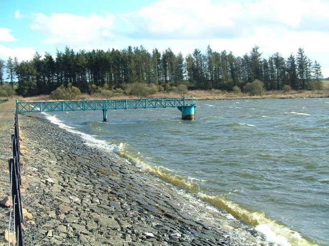
Cameron Reservoir

Cameron Reservoir is an artificial loch in the parish of Cameron in east Fife, Scotland. Covering an area of 69 hectares, it serves as a domestic water...

Have you been to Burnt Plantation?

Leave your review of Burnt Plantation below (or comments, questions and feedback).