Craigie Wood

Wood, Forest in Roxburghshire

Scotland

Craigie Wood

Enclosed footpath beside Halfcrown Corner Covert Looking south-westward. The path is part of the Borders Abbey Way Path.
Enclosed footpath beside Halfcrown Corner Covert Credit: Peter Wood

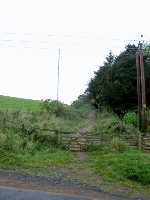
Craigie Wood is a picturesque forest located in Roxburghshire, Scotland. Spread over an area of approximately 500 hectares, it is a stunning example of native woodland in the region. The wood is situated on the steep slopes of the Eildon Hills, offering panoramic views of the surrounding countryside.

This ancient woodland is predominantly made up of diverse tree species, including oak, birch, and beech, creating a rich and varied habitat for a wide range of flora and fauna. The forest floor is adorned with an array of wildflowers, such as bluebells and wood sorrel, creating a vibrant and colorful display during the springtime.

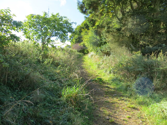
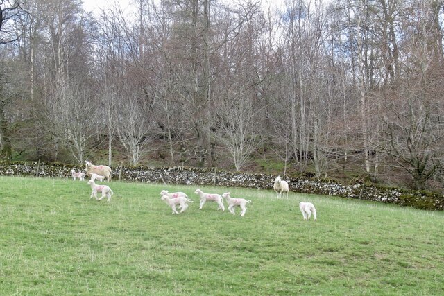
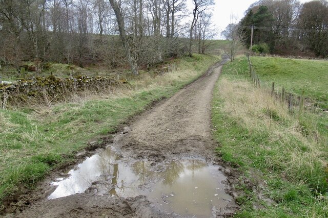
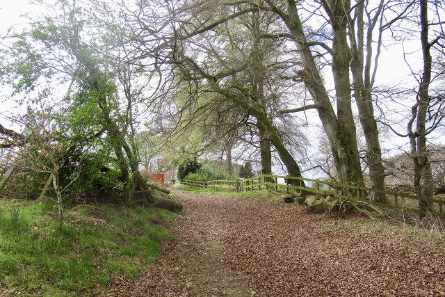
Numerous walking trails meander through Craigie Wood, allowing visitors to explore the beauty of the forest at their own pace. The paths are well-maintained and clearly marked, making it easy for hikers to navigate through the dense woodland. Along the way, visitors may encounter various wildlife species, including red squirrels, roe deer, and a variety of bird species.

Craigie Wood is not only a haven for nature enthusiasts but also offers recreational activities for all ages. The forest provides ample opportunities for picnicking, birdwatching, and photography. Additionally, there are designated areas for camping and barbecues, allowing visitors to immerse themselves in the peaceful atmosphere of the wood while enjoying outdoor activities.

Overall, Craigie Wood is a natural gem in Roxburghshire, offering a tranquil and enchanting setting for nature lovers and outdoor enthusiasts alike. Its diverse ecosystem, scenic beauty, and recreational opportunities make it a must-visit destination for those seeking to connect with nature in the heart of Scotland.

If you have any feedback on the listing, please let us know in the comments section below.

Craigie Wood Images

Images are sourced within 2km of 55.574535/-2.7918701 or Grid Reference NT5031. Thanks to Geograph Open Source API. All images are credited.

Enclosed footpath beside Halfcrown Corner Covert Looking south-westward. The path is part of the Borders Abbey Way Path.
Enclosed footpath beside Halfcrown Corner Covert
Looking south-westward. The path is part of the Borders Abbey Way Path.
Lambs by the Batts Burn
Green lane, Lindean
Green lane, Lindean
Green lane, Woodlands Climbing on to Linean Moor.
Green lane, Woodlands
Climbing on to Linean Moor.
Borders  Abbeys  Way  toward  Whitlaw  Kips
Borders Abbeys Way toward Whitlaw Kips
Borders  Abbeys  Way   alongside  Halfcrown  Corner  Covert Radio mast on Lindean Moor left of centre
Borders Abbeys Way alongside Halfcrown Corner Covert
Radio mast on Lindean Moor left of centre
A set aside strip between two fields
Water trough This water trough is in a field near Nether Whitlaw Farm
Water trough
This water trough is in a field near Nether Whitlaw Farm
Pigs, Halfcrown Corner Covert Denizens of Halfcrown Corner Covert - very friendly and rather old fashioned looking pigs.
Pigs, Halfcrown Corner Covert
Denizens of Halfcrown Corner Covert - very friendly and rather old fashioned looking pigs.
Sheep, Lindean Sheep grazing before the television mast.
Sheep, Lindean
Sheep grazing before the television mast.
Lindean Moor Farm Sitting near the junction of Lindean and Selkirk roads.
Lindean Moor Farm
Sitting near the junction of Lindean and Selkirk roads.
Farmland at Lindean Moor A large grazing field between Lindean Moor Farm and Nether Whitlaw Farm.
Farmland at Lindean Moor
A large grazing field between Lindean Moor Farm and Nether Whitlaw Farm.
Farmland at Lindean Moor Lindean Moor Farm is in the background.
Farmland at Lindean Moor
Lindean Moor Farm is in the background.
Hydraulic ram on Batts Burn A hydraulic ram is a water-operated pump that lifts water to a higher level on a regular pulsing cycle, requiring no extra power source. The power comes from the flow energy of the water entering the pump - see <span class="nowrap"><a title="http://en.wikipedia.org/wiki/Hydraulic_ram" rel="nofollow ugc noopener" href="http://en.wikipedia.org/wiki/Hydraulic_ram">Link</a><img style="margin-left:2px;" alt="External link" title="External link - shift click to open in new window" src="https://s1.geograph.org.uk/img/external.png" width="10" height="10"/></span>

The nearer brick chamber appears to have been a water tank used to supply the ram, which is situated in the second brick structure. It could have been used to pump water up to a nearby building.
Hydraulic ram on Batts Burn
A hydraulic ram is a water-operated pump that lifts water to a higher level on a regular pulsing cycle, requiring no extra power source. The power comes from the flow energy of the water entering the pump - see LinkExternal link The nearer brick chamber appears to have been a water tank used to supply the ram, which is situated in the second brick structure. It could have been used to pump water up to a nearby building.
Borders Abbeys Way signpost The Way crosses the minor road to Lindean Reservoir and swings W on its descent to Selkirk.
Borders Abbeys Way signpost
The Way crosses the minor road to Lindean Reservoir and swings W on its descent to Selkirk.
"This is my best side!" A turkey cock posing for the camera, giving a magnificent display of inflated pomposity and putting the photographer firmly in his place.
"This is my best side!"
A turkey cock posing for the camera, giving a magnificent display of inflated pomposity and putting the photographer firmly in his place.
Lindean Moor Farm
Lindean Moor Farm
Halfcrown Corner Covert A small wood surrounding farm buildings on Lindean Moor - to be renamed '12.5p Corner Covert'?
Halfcrown Corner Covert
A small wood surrounding farm buildings on Lindean Moor - to be renamed '12.5p Corner Covert'?
Show me another place!

Craigie Wood is located at Grid Ref: NT5031 (Lat: 55.574535, Lng: -2.7918701)

Unitary Authority: The Scottish Borders

Police Authority: The Lothians and Scottish Borders

What 3 Words

///factoring.slogans.groomed. Near Tweedbank, Scottish Borders

Nearby Locations

Craigie Wood

Related Wikis

Lindean

Lindean is a village north of Selkirk and the Ettrick Water, in the Scottish Borders area of Scotland. In 1590 the parishioners of Lindean had permission...

Boleside

Boleside is a village in the Scottish Borders area of Scotland, on the B7060, south of Galashiels. It is very close to the place where the Ettrick Water...

Ettrick Water

The Ettrick Water is a river in Ettrick, by the village of Ettrickbridge and the historic town of Selkirk, in the Scottish Borders area of Scotland. The...

Lindean railway station

Lindean railway station served the village of Lindean, Scottish Borders, Scotland, from 1856 to 1964 on the Selkirk and Galashiels Railway. == History... ==

Abbotsford Ferry railway station

Abbotsford Ferry railway station was a small railway station on the branch line from Galashiels to Selkirk railway station at Selkirk in the Scottish county...

Selkirk transmitting station

The Selkirk transmitting station is a telecommunications facility located next to Lindean Loch, near Selkirk in the Scottish Borders. It includes a 229...

Bridgelands

Bridgelands is a village and an 18th-century house in the Scottish Borders area of Scotland, in the parish of Selkirk. Sir Henry Raeburn's wife came from...

Abbotsford, Scottish Borders

Abbotsford is a historic country house in the Scottish Borders, near Galashiels, on the south bank of the River Tweed. Now open to the public, it was built...

Nearby Amenities

Located within 500m of 55.574535,-2.7918701
Woodrigs
Place: isolated_dwelling
Lat/Long: 55.5714492/-2.7962508
The data included in this document is from www.openstreetmap.org. The data is made available under ODbL.

Have you been to Craigie Wood?

Leave your review of Craigie Wood below (or comments, questions and feedback).