Backburn Wood

Wood, Forest in East Lothian

Scotland

Backburn Wood

Green Gates Wood Oak woods along a path between Liberty Hall and Letham Holdings.  East Lothian core path no. 110.
Green Gates Wood Credit: Richard Webb

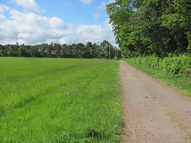
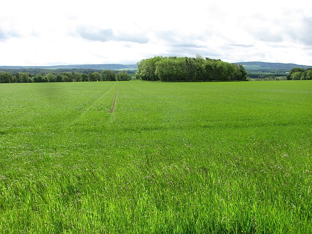
Backburn Wood is a picturesque forest located in East Lothian, Scotland. Covering an area of approximately 50 hectares, it is a popular destination for nature enthusiasts and hikers alike. The wood is situated around 7 miles southeast of Haddington, and is easily accessible by road.

The woodland is predominantly composed of native broadleaf trees, including oak, birch, and beech. These trees create a dense canopy, providing shelter for a variety of wildlife species. Visitors to Backburn Wood can expect to encounter a diverse range of fauna, such as red squirrels, roe deer, and a multitude of bird species.

A network of well-maintained trails winds through the wood, allowing visitors to explore its beauty at their own pace. These paths vary in difficulty, catering to both casual walkers and more experienced hikers. Along the trails, there are several designated picnic areas where visitors can take a break and enjoy the tranquil surroundings.

Backburn Wood also holds historical significance, with remnants of ancient settlements and prehistoric sites scattered throughout the area. Archaeological discoveries, including flint tools and pottery fragments, suggest that the wood has been inhabited for thousands of years.

The wood offers breathtaking views, particularly during the autumn season when the leaves change color, creating a vibrant tapestry of reds, oranges, and yellows. Whether it be for a peaceful walk, birdwatching, or simply appreciating the beauty of nature, Backburn Wood is a must-visit destination for anyone seeking a tranquil escape in East Lothian.

If you have any feedback on the listing, please let us know in the comments section below.

Backburn Wood Images

Images are sourced within 2km of 55.952102/-2.8202522 or Grid Reference NT4873. Thanks to Geograph Open Source API. All images are credited.

Green Gates Wood Oak woods along a path between Liberty Hall and Letham Holdings.  East Lothian core path no. 110.
Green Gates Wood
Oak woods along a path between Liberty Hall and Letham Holdings. East Lothian core path no. 110.
East Lothian core path no.110 A wide field margin, prone to being muddy, but very dry today.
East Lothian core path no.110
A wide field margin, prone to being muddy, but very dry today.
Woodland, Letham Stripwoods, offset at this point. On the path between Letham Holdings and Liberty Hall. (East Lothian core path 110).
Woodland, Letham
Stripwoods, offset at this point. On the path between Letham Holdings and Liberty Hall. (East Lothian core path 110).
Letham Holdings
Letham Holdings
East Lothian core path no.110 Singletrack through a stripwood. The path leads through woodland and along field margins to Liberty Hall.
East Lothian core path no.110
Singletrack through a stripwood. The path leads through woodland and along field margins to Liberty Hall.
Letham Holdings A large area of land west of Haddington has been used for small holdings. Nowadays there is a fair scattering of trophy homes amongst the small flocks of sheep and gardening enterprise. A house with a bit of land is very attractive to horse owners. This view is of the more traditional land use, the foreground field contains sheep.
Letham Holdings
A large area of land west of Haddington has been used for small holdings. Nowadays there is a fair scattering of trophy homes amongst the small flocks of sheep and gardening enterprise. A house with a bit of land is very attractive to horse owners. This view is of the more traditional land use, the foreground field contains sheep.
Woodland path, Letham Holdings A lovely stretch of woodland singletrack. The path runs between Haddington and Liberty Hall via Letham Holdings. East Lothian core path 109.
Woodland path, Letham Holdings
A lovely stretch of woodland singletrack. The path runs between Haddington and Liberty Hall via Letham Holdings. East Lothian core path 109.
Letham Burn At the end of a stripwood near Letham House.
Letham Burn
At the end of a stripwood near Letham House.
East Lothian core path no.109 Lovely piece of singletrack between Haddington and Letham Holdings. The track that crosses it here runs from Letham House to fields.
East Lothian core path no.109
Lovely piece of singletrack between Haddington and Letham Holdings. The track that crosses it here runs from Letham House to fields.
Estate road, Clerkington
Cereals, Clerkington Arable farming at Clerkington Mains.
Cereals, Clerkington
Arable farming at Clerkington Mains.
Path, Letham Mains Path running through a stripwood. East Lothian core path no. 110.
Path, Letham Mains
Path running through a stripwood. East Lothian core path no. 110.
Old A1 Now replaced by a dual carriageway.
Old A1
Now replaced by a dual carriageway.
A long narrow field A rump field left after the A1 was rebuilt through arable land near Haddington.
A long narrow field
A rump field left after the A1 was rebuilt through arable land near Haddington.
A1 The new dual carriageway A1 looking eastwards. The strip of land between the new and old road is narrow here and is not in production.
A1
The new dual carriageway A1 looking eastwards. The strip of land between the new and old road is narrow here and is not in production.
A small wood near Merryhatton A clump of pines off a road to Huntington.
A small wood near Merryhatton
A clump of pines off a road to Huntington.
The Haddington Branch The North British Railway upset a lot of people when they chose to ignore Haddington and run some distance to the north of the town. Going north meant easier gradients and missing the high ground around Pencraig.  Haddington had to put up with a branch line.

There is no doubt that Haddington could support a service to Edinburgh now, but lack of capacity between Longniddry and Edinburgh is probably a problem. The trackbed is now a cycle path.
The Haddington Branch
The North British Railway upset a lot of people when they chose to ignore Haddington and run some distance to the north of the town. Going north meant easier gradients and missing the high ground around Pencraig. Haddington had to put up with a branch line. There is no doubt that Haddington could support a service to Edinburgh now, but lack of capacity between Longniddry and Edinburgh is probably a problem. The trackbed is now a cycle path.
Cereals, Bangly Winter crops near the quarry.
Cereals, Bangly
Winter crops near the quarry.
Show me another place!

Backburn Wood is located at Grid Ref: NT4873 (Lat: 55.952102, Lng: -2.8202522)

Unitary Authority: East Lothian

Police Authority: The Lothians and Scottish Borders

What 3 Words

///grin.prospered.bland. Near Haddington, East Lothian

Nearby Locations

Backburn Wood

Related Wikis

East Lothian Community Hospital

East Lothian Community Hospital is a hospital located on Station Road, Haddington, East Lothian, Scotland. The hospital is operated by NHS Lothian. �...

Haddington line

The Haddington line was a branch railway line connecting the Burgh of Haddington to the main line railway network at Longniddry. It was the first branch...

Haddington railway station

Haddington railway station served the town of Haddington, Scotland. Services were provided by trains on the Haddington line. == History == The station...

Knox Academy

Knox Academy is a co-educational state secondary school located in Haddington, East Lothian, Scotland. Originally founded in 1379 as a medieval grammar...

Herdmanflat Hospital

Herdmanflat Hospital was a psychiatric hospital in Aberlady Road, Haddington, Scotland. It was operated by NHS Lothian. == History == The hospital was...

Haddington Athletic F.C.

Haddington Athletic Football Club are a Scottish football club based in Haddington, the county town of East Lothian. Nicknamed the Hi-His, the club were...

Siege of Haddington

The sieges of Haddington were a series of sieges staged at the Royal Burgh of Haddington, East Lothian, Scotland, as part of the War of the Rough Wooing...

County Buildings, Haddington

County Buildings is a municipal structure in Court Street, Haddington, East Lothian, Scotland. The structure, which was the headquarters of East Lothian...

Nearby Amenities

Located within 500m of 55.952102,-2.8202522
Speed Camera
Lat/Long: 55.9552819/-2.8159356
Bus Stop
Letham Mains Road End
Bus: yes
Naptan AtcoCode: 627009050320
Naptan Bearing: W
Naptan CommonName: Letham Mains Road End
Naptan Indicator: at Letham Mains junction
Naptan NaptanCode: 58234238
Naptan Street: A199
Naptan Verified: no
Public Transport: platform
Source: naptan_import
Lat/Long: 55.9539438/-2.8240229
Letham Mains
Naptan AtcoCode: 627009060320
Naptan Bearing: E
Naptan BusStopType: CUS
Naptan CommonName: Letham Mains
Naptan Indicator: opposite Letham Mains
Naptan NaptanCode: 58234879
Naptan Street: A199
Naptan Verified: no
Source: naptan_import
Lat/Long: 55.954064/-2.8240658
West Letham
Place: hamlet
Lat/Long: 55.9511768/-2.8162342
Cafe
Costa
Brand: Costa
Brand Wikidata: Q608845
Brand Wikipedia: en:Costa Coffee
Cuisine: coffee_shop
Drive Through: yes
Outdoor Seating: yes
Takeaway: yes
Lat/Long: 55.9544844/-2.814159
Power: pole
Lat/Long: 55.9521182/-2.8281901
Power: pole
Lat/Long: 55.9521485/-2.8267315
Power: pole
Lat/Long: 55.9521777/-2.825273
Power: pole
Lat/Long: 55.9521963/-2.8240165
Power: pole
Lat/Long: 55.9521847/-2.8223433
Power: pole
Lat/Long: 55.9523643/-2.8203409
Power: pole
Lat/Long: 55.9522057/-2.8190365
Power: pole
Lat/Long: 55.9520517/-2.8176946
Power: pole
Lat/Long: 55.9518848/-2.8163298
Power: pole
Lat/Long: 55.951963/-2.8155839
Power: pole
Lat/Long: 55.9525615/-2.8152671
Power: pole
Lat/Long: 55.9533034/-2.8149171
Power: pole
Lat/Long: 55.954134/-2.8145378
Power: pole
Lat/Long: 55.9488223/-2.8168716
Power: pole
Lat/Long: 55.9497359/-2.8168153
Power: pole
Lat/Long: 55.950605/-2.8166924
Power: pole
Lat/Long: 55.951347/-2.8164694
Power: pole
Lat/Long: 55.9505537/-2.81778
Power: pole
Lat/Long: 55.9505502/-2.8184364
Power: pole
Lat/Long: 55.9505607/-2.819274
Shop: convenience
Lat/Long: 55.954519/-2.814175
Fuel
Shell
Brand: Shell
Brand Wikidata: Q110716465
Website: https://find.shell.com/gb/fuel/12875605-eg-haddington-service-station
Lat/Long: 55.9545911/-2.8137794
The data included in this document is from www.openstreetmap.org. The data is made available under ODbL.

Have you been to Backburn Wood?

Leave your review of Backburn Wood below (or comments, questions and feedback).