Saugh Moss

Wood, Forest in Aberdeenshire

Scotland

Saugh Moss

Minor road between Lower Gordonsburn and Bailiesward Looking south-westward.
Minor road between Lower Gordonsburn and Bailiesward Credit: Peter Wood

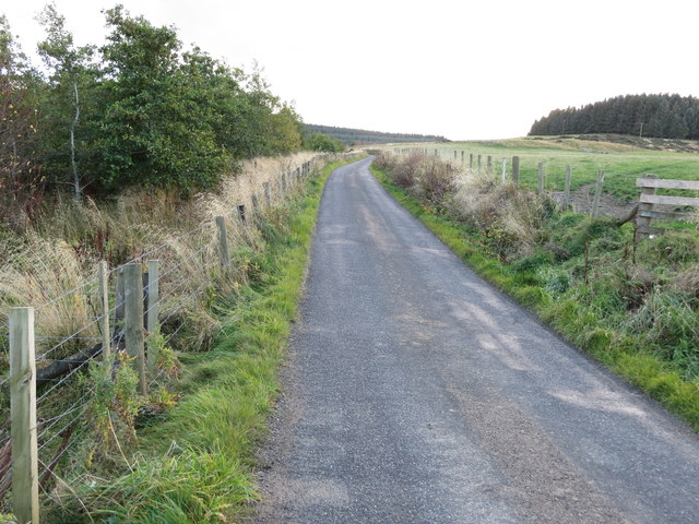
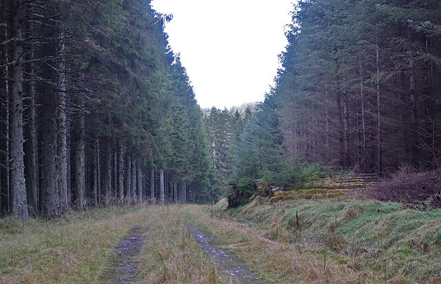
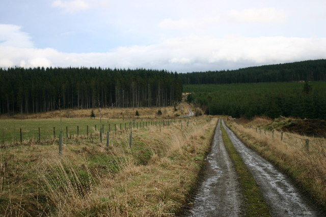
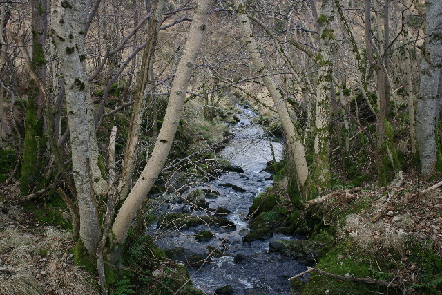
Saugh Moss is a picturesque woodland located in Aberdeenshire, Scotland. Spanning over a vast area, it is known for its dense tree cover and diverse flora and fauna. The moss is primarily composed of saugh, or willow, trees, giving it its name.

The woodland offers a tranquil escape from the bustling city life, with its peaceful ambiance and breathtaking beauty. The towering saugh trees create a canopy that filters the sunlight, creating a dappled effect on the forest floor. This creates a perfect habitat for a variety of wildlife species.

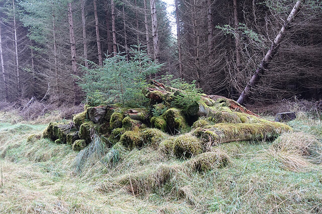
Saugh Moss is home to a rich biodiversity, housing numerous species of birds, mammals, and insects. It is a popular spot for birdwatching, attracting avian enthusiasts from far and wide. Visitors can spot a wide range of bird species, including woodpeckers, owls, and various songbirds.

The forest also boasts a diverse range of plant life, with mosses, ferns, and wildflowers carpeting the forest floor. The vibrant colors and delicate fragrances add to the enchanting atmosphere of Saugh Moss.

Recreational activities such as hiking and nature walks are popular among visitors. There are designated trails that wind through the forest, allowing visitors to explore the woodland at their own pace. These trails offer stunning views of the surrounding landscape, including rolling hills and meandering streams.

Overall, Saugh Moss is a hidden gem in Aberdeenshire, offering a serene environment and a chance to reconnect with nature. Its natural beauty and abundant wildlife make it a must-visit destination for nature lovers and outdoor enthusiasts.

If you have any feedback on the listing, please let us know in the comments section below.

Saugh Moss Images

Images are sourced within 2km of 57.419567/-2.878573 or Grid Reference NJ4736. Thanks to Geograph Open Source API. All images are credited.

Minor road between Lower Gordonsburn and Bailiesward Looking south-westward.
Minor road between Lower Gordonsburn and Bailiesward
Looking south-westward.
Forest Track We chose the lower track here, rather than the one passing Corshellach, because we hoped that it would bring us out of the forest near Wester Tillathrowie.
Forest Track
We chose the lower track here, rather than the one passing Corshellach, because we hoped that it would bring us out of the forest near Wester Tillathrowie.
Log Pile This log pile has obviously escaped the attentions of the forestry workers and has been left to decompose instead of being taken out of the forest to be used.
Log Pile
This log pile has obviously escaped the attentions of the forestry workers and has been left to decompose instead of being taken out of the forest to be used.
Forest Clearing The maps suggest that there is a road across this clearing, and there is indeed a hint of it, but we were not confident enough that it would be dry, or that it would take us to the far side of the burn, so we opted to stay on the slightly more obvious track. <a href="https://www.geograph.org.uk/photo/6715025">NJ4635 : Forest Clearing</a> seems to the other other end of the faint road.
Forest Clearing
The maps suggest that there is a road across this clearing, and there is indeed a hint of it, but we were not confident enough that it would be dry, or that it would take us to the far side of the burn, so we opted to stay on the slightly more obvious track. NJ4635 : Forest Clearing seems to the other other end of the faint road.
Burn of Corshellach This faintly visible watercourse is one of the headwaters of the Burn of Corshellach.
Burn of Corshellach
This faintly visible watercourse is one of the headwaters of the Burn of Corshellach.
Forest Clearing This is probably the other end of the faint road we had seen at <a href="https://www.geograph.org.uk/photo/6715019">NJ4635 : Forest Clearing</a>, but we were glad that we had not attempted to follow it.
Forest Clearing
This is probably the other end of the faint road we had seen at NJ4635 : Forest Clearing, but we were glad that we had not attempted to follow it.
Roadside Shed The shed stands beside a row of cottages east of Tillathrowie. The farm in the background is Easter Tillathrowie, which is in the next square.
Roadside Shed
The shed stands beside a row of cottages east of Tillathrowie. The farm in the background is Easter Tillathrowie, which is in the next square.
Chapel Hill Farm land extends most of the way up Chapel Hill.
Chapel Hill
Farm land extends most of the way up Chapel Hill.
Whitestone of Tillathrowie The old farm house of Whitestones is hidden among the trees, but a new wooden house has been built nearby.
Whitestone of Tillathrowie
The old farm house of Whitestones is hidden among the trees, but a new wooden house has been built nearby.
Former School According to the second edition of the Ordnance Surbey 25-inch map, surveyed in 1899, this house was originally a school.
Former School
According to the second edition of the Ordnance Surbey 25-inch map, surveyed in 1899, this house was originally a school.
Forest track near Muckle Long Hill Looking E from position
Forest track near Muckle Long Hill
Looking E from position
Forest track near Muckle Long Hill Looking S from position
Forest track near Muckle Long Hill
Looking S from position
End of the public road near Bailiesward Looking ENE from position
End of the public road near Bailiesward
Looking ENE from position
Trees on Muckle Long Hill Looking E from position
Trees on Muckle Long Hill
Looking E from position
Glen Burn Looking W from position
Glen Burn
Looking W from position
Farm Track to Whitestones One of the many tracks to farms and houses off this road.
Farm Track to Whitestones
One of the many tracks to farms and houses off this road.
Tillathrowie Just above the road is the small hill farm of Tillathrowie much of which is now down to forestry, like many upland farms in this area.
Tillathrowie
Just above the road is the small hill farm of Tillathrowie much of which is now down to forestry, like many upland farms in this area.
Ruined Buildings? This fence encloses a roughish patch with what may be the remains of long-vanished buildings. There is nothing on the maps suggesting what it was.
Ruined Buildings?
This fence encloses a roughish patch with what may be the remains of long-vanished buildings. There is nothing on the maps suggesting what it was.
Show me another place!

Saugh Moss is located at Grid Ref: NJ4736 (Lat: 57.419567, Lng: -2.878573)

Unitary Authority: Aberdeenshire

Police Authority: North East

What 3 Words

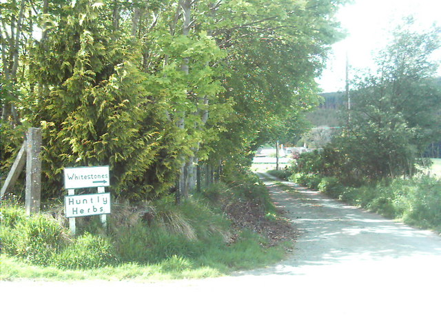
///hooks.grafted.yappy. Near Huntly, Aberdeenshire

Nearby Locations

Saugh Moss

Related Wikis

Kye Hill

Kye Hill is a hill by Huntly, Aberdeenshire, Scotland. It lies southwest of The Clashmach hill and is nearly the same height. There is a former limestone...

Torry Burn, Huntly

Torry Burn is a burn which marks the boundary of the parish of Huntly, Aberdeenshire, Scotland. == References ==

Beldorney Castle

Beldorney Castle is a Z-plan castle dating from the mid-16th century, about two miles south of Glass, in hilly country in the valley of the Deveron, in...

Burn of Tullochbeg

Burn of Tullochbeg is a burn which marks the boundary of the parish of Huntly, Aberdeenshire, Scotland. == References ==

Blairmore School

Blairmore School was an independent boarding preparatory school in Glass near Huntly, Aberdeenshire until its closure in 1993. The site is now owned and...

Dunbennan

Dunbennan is a settlement near Huntly, Aberdeenshire, Scotland. The name comes from the Gaelic dun-beinnean, or the fort of the little hill, and originally...

Strathbogie, Scotland

Strathbogie (Scottish Gaelic: Srath Bholgaidh or Srath Bhalgaidh) is a district and river valley of northwest Aberdeenshire in Scotland, formerly one of...

Glass, Aberdeenshire

Glass is a parish about 8 miles west of Huntly, Aberdeenshire, Scotland. It is now wholly located in Aberdeenshire but before the reorganisation of Scottish...

Nearby Amenities

Located within 500m of 57.419567,-2.878573
Power: pole
Lat/Long: 57.4216372/-2.883766
Power: pole
Lat/Long: 57.4221752/-2.8830991
Power: pole
Lat/Long: 57.4227137/-2.8824699
Power: pole
Lat/Long: 57.4235045/-2.8825585
Bailiesward
Place: isolated_dwelling
Lat/Long: 57.4209943/-2.8838628
Saughs
Place: isolated_dwelling
Lat/Long: 57.4224597/-2.8772216
The data included in this document is from www.openstreetmap.org. The data is made available under ODbL.

Have you been to Saugh Moss?

Leave your review of Saugh Moss below (or comments, questions and feedback).