Laverocklaw Woods
Wood, Forest in East Lothian
Scotland
Laverocklaw Woods

The requested URL returned error: 429 Too Many Requests
If you have any feedback on the listing, please let us know in the comments section below.
Laverocklaw Woods Images
Images are sourced within 2km of 55.965909/-2.8537858 or Grid Reference NT4675. Thanks to Geograph Open Source API. All images are credited.


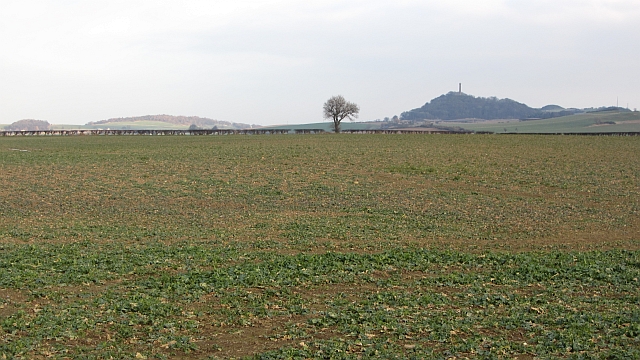


![Winter wheat at Setonhill Still quite green below, and still a long way from ripe. The woods are Redcoll[left] and Setohill [right]. The Firth of Forth was visible through the gap.](https://s0.geograph.org.uk/geophotos/03/10/24/3102420_5398906d.jpg)


Laverocklaw Woods is located at Grid Ref: NT4675 (Lat: 55.965909, Lng: -2.8537858)
Unitary Authority: East Lothian
Police Authority: The Lothians and Scottish Borders
What 3 Words
///stages.example.whistling. Near Longniddry, East Lothian
Nearby Locations
Related Wikis

Haddington line
The Haddington line was a branch railway line connecting the Burgh of Haddington to the main line railway network at Longniddry. It was the first branch...
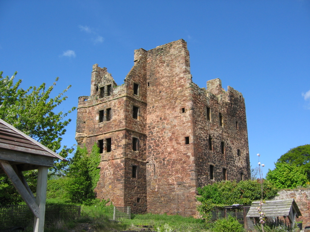
Redhouse Castle
Redhouse Castle is a ruined tower house castle, 2 km east of Longniddry, East Lothian, Scotland, UK, on the B1377, close to Spittal. The castle designated...

Gladsmuir
Gladsmuir is a village and parish in East Lothian, Scotland, situated on the A199 and near Tranent and Prestonpans. == Description == Gladsmuir's principal...

Spittal, East Lothian
Spittal is a hamlet or small village in East Lothian, Scotland, UK, on the B1377, east of Longniddry, south-south-west of Aberlady and to the west of Garleton...
Nearby Amenities
Located within 500m of 55.965909,-2.8537858Have you been to Laverocklaw Woods?
Leave your review of Laverocklaw Woods below (or comments, questions and feedback).