Cushnie Moss

Wood, Forest in Aberdeenshire

Scotland

Cushnie Moss

The Lumsden Arms, Lumsden The main road (the A97) through the village is visible to the left of the inn, which is in need of a repaint...
The Lumsden Arms, Lumsden Credit: Bill Harrison

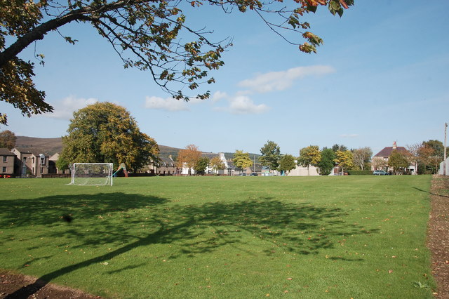
Cushnie Moss is a sprawling woodland area located in Aberdeenshire, Scotland. Nestled amidst the picturesque landscape of the region, it is a haven for nature enthusiasts and those seeking tranquility in the heart of the countryside.

Covering an expansive land area, Cushnie Moss boasts a diverse range of flora and fauna, making it an ideal habitat for various species. The woodland is primarily composed of native trees, including oak, birch, and pine, which provide a canopy of shade during the summer months. The forest floor is carpeted with a rich tapestry of wildflowers, ferns, and mosses, creating a vibrant and enchanting atmosphere.

Visitors to Cushnie Moss can explore its extensive network of walking trails, which meander through the woodland and offer opportunities to discover hidden gems along the way. The trails are well-maintained and suitable for all ages and fitness levels, making it an excellent destination for families and outdoor enthusiasts.

The woodland is also home to a diverse array of wildlife, making it a popular spot for birdwatching and nature photography. Visitors may catch a glimpse of native bird species, such as woodpeckers, owls, and pheasants, along with occasional sightings of deer and other small mammals.

Cushnie Moss offers a serene and peaceful setting, allowing visitors to immerse themselves in the beauty of nature. Whether it's a leisurely stroll, birdwatching, or simply enjoying a picnic amidst the tranquil surroundings, this woodland gem is a must-visit destination for nature lovers in Aberdeenshire.

If you have any feedback on the listing, please let us know in the comments section below.

Cushnie Moss Images

Images are sourced within 2km of 57.287185/-2.8871775 or Grid Reference NJ4622. Thanks to Geograph Open Source API. All images are credited.

The Lumsden Arms, Lumsden The main road (the A97) through the village is visible to the left of the inn, which is in need of a repaint...
The Lumsden Arms, Lumsden
The main road (the A97) through the village is visible to the left of the inn, which is in need of a repaint...
Lumsden village hall The hall faces onto the grassed market square.  Lumsden was founded as an improvement village in ca. 1825.
Lumsden village hall
The hall faces onto the grassed market square. Lumsden was founded as an improvement village in ca. 1825.
Lumsden Square A nice big area of public green space in the centre of the village.
Lumsden Square
A nice big area of public green space in the centre of the village.
Lumsden Primary School Located at the very southern end of the village with (presumably) the teacher's house adjoining.  School roll (2016-17): 16 pupils taught in two classes.
Lumsden Primary School
Located at the very southern end of the village with (presumably) the teacher's house adjoining. School roll (2016-17): 16 pupils taught in two classes.
Roadside sculpture A perhaps unexpected site for rural Aberdeenshire, but doubtless connected to the Scottish Sculpture Workshop (<span class="nowrap"><a title="http://www.ssw.org.uk/?page_id=5750" rel="nofollow ugc noopener" href="http://www.ssw.org.uk/?page_id=5750">Link</a><img style="margin-left:2px;" alt="External link" title="External link - shift click to open in new window" src="https://s1.geograph.org.uk/img/external.png" width="10" height="10"/></span> ) located in the village.
Roadside sculpture
A perhaps unexpected site for rural Aberdeenshire, but doubtless connected to the Scottish Sculpture Workshop (LinkExternal link ) located in the village.
View towards Deskie Wood Elevation 311 m.
View towards Deskie Wood
Elevation 311 m.
Sculpture walk... ...beside the A97 just south of Lumsden.
Sculpture walk...
...beside the A97 just south of Lumsden.
Lumsden petrol station The brand of petrol sold has changed to Gulf from the obscure Thames since Stanley Howe took his picture eight years ago: <a title="https://www.geograph.org.uk/photo/1575874" href="https://www.geograph.org.uk/photo/1575874">Link</a> .  The village shop is also now closed (<a title="https://www.geograph.org.uk/photo/13955" href="https://www.geograph.org.uk/photo/13955">Link</a> ) and the garage shop serves as the village post office for a few hours per week.
Lumsden petrol station
The brand of petrol sold has changed to Gulf from the obscure Thames since Stanley Howe took his picture eight years ago: Link . The village shop is also now closed (Link ) and the garage shop serves as the village post office for a few hours per week.
Terraced cottages, Lumsden The village was founded in 1825 but these are from the early 20th Century.
Terraced cottages, Lumsden
The village was founded in 1825 but these are from the early 20th Century.
Kirk and manse The kirk was built for the United Presbyterian Church in 1889.  At that time, the (established) village kirk was in the very inconvenient location of Auchindoir, about 2.5 km to the north.  The latter kirk is now a ruin and this church now serves Lumsden village, although it is still called Auchindoir Church.
Kirk and manse
The kirk was built for the United Presbyterian Church in 1889. At that time, the (established) village kirk was in the very inconvenient location of Auchindoir, about 2.5 km to the north. The latter kirk is now a ruin and this church now serves Lumsden village, although it is still called Auchindoir Church.
Lumsden well Dating from 1814 and the only listed structure in the village (LB2739): <span class="nowrap"><a title="http://portal.historicenvironment.scot/designation/LB2739" rel="nofollow ugc noopener" href="http://portal.historicenvironment.scot/designation/LB2739">Link</a><img style="margin-left:2px;" alt="External link" title="External link - shift click to open in new window" src="https://s1.geograph.org.uk/img/external.png" width="10" height="10"/></span> .
Lumsden well
Dating from 1814 and the only listed structure in the village (LB2739): LinkExternal link .
Auchindoir Parish war memorial... ...in the village of Lumsden.
Auchindoir Parish war memorial...
...in the village of Lumsden.
Auchindoir Parish war memorial (south elevation)
Auchindoir Parish war memorial (north elevation)
Auchindoir Parish war memorial (east elevation)
Old Milestone by the A97, Lumsden, Auchindoir and Kearn parish Milestone by the A97, in parish of Auchindoir and Kearn (District), Lumsden, North of school, near Sculpture Walk, West side of road.

Inscription reads:-
34
(To Aberdeen)

Surveyed

Milestone Society National ID: AD_ALHN34
Old Milestone by the A97, Lumsden, Auchindoir and Kearn parish
Milestone by the A97, in parish of Auchindoir and Kearn (District), Lumsden, North of school, near Sculpture Walk, West side of road. Inscription reads:- 34 (To Aberdeen) Surveyed Milestone Society National ID: AD_ALHN34
War memorial with park and houses in Lumsden Lumsden's war memorial stands on the east side of the A97 near to the centre of the village.
War memorial with park and houses in Lumsden
Lumsden's war memorial stands on the east side of the A97 near to the centre of the village.
Auchinleith Auchinleith is reached by an access road leaving a minor, public road from which the image was taken. There's at least one dwelling there that in 2007 at least <a title="https://www.geograph.org.uk/photo/439682" href="https://www.geograph.org.uk/photo/439682">Link</a> was unoccupied. The heather slopes beyond Auchinleith rise to the Hill of Towanreef.
Auchinleith
Auchinleith is reached by an access road leaving a minor, public road from which the image was taken. There's at least one dwelling there that in 2007 at least Link was unoccupied. The heather slopes beyond Auchinleith rise to the Hill of Towanreef.
Show me another place!

Cushnie Moss is located at Grid Ref: NJ4622 (Lat: 57.287185, Lng: -2.8871775)

Unitary Authority: Aberdeenshire

Police Authority: North East

What 3 Words

///universally.snacking.loses. Near Alford, Aberdeenshire

Related Wikis

Lumsden, Aberdeenshire

Lumsden is an inland village in Aberdeenshire, Scotland on the A97 road. == Location == It crowns a rising-ground 227 m (745 ft) above sea level amid a...

Clova Monastery

Clova Monastery (also called Cloveth) was a medieval Culdee monastery in Kildrummy, Aberdeenshire, Scotland. == Founding == Clova was founded in the late...

St Mary's Kirk, Auchindoir

St Mary's Kirk at Auchindoir, between Rhynie and Lumsden, in Aberdeenshire, Scotland, is one of the country's finest surviving medieval parish kirks. The...

Mossat

Mossat is a settlement in Aberdeenshire, Scotland on the A97 road near Glenkindie and Lumsden, between Bridge of Alford and Strathdon, and is situated...

Nearby Amenities

Located within 500m of 57.287185,-2.8871775
Power: pole
Lat/Long: 57.2846103/-2.8840155
Power: pole
Lat/Long: 57.2846717/-2.8827374
Power: pole
Lat/Long: 57.2847331/-2.8814024
The data included in this document is from www.openstreetmap.org. The data is made available under ODbL.

Have you been to Cushnie Moss?

Leave your review of Cushnie Moss below (or comments, questions and feedback).