Raelees Wood

Wood, Forest in Selkirkshire

Scotland

Raelees Wood

A fly agaric mushroom (Amanita muscaria) This mushroom which is usually associated with birch and pine trees is one of the easiest species to recognise.
A fly agaric mushroom (Amanita muscaria) Credit: Walter Baxter

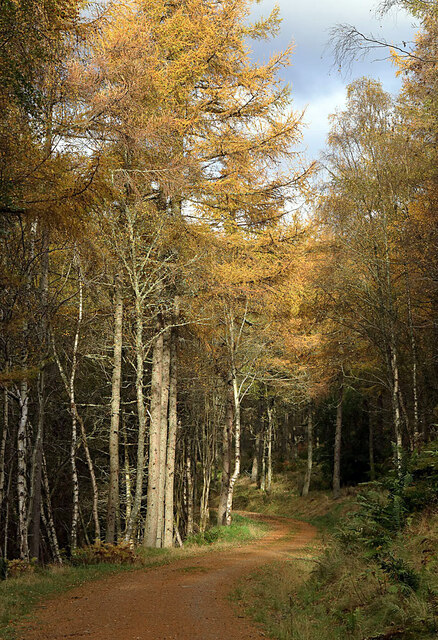
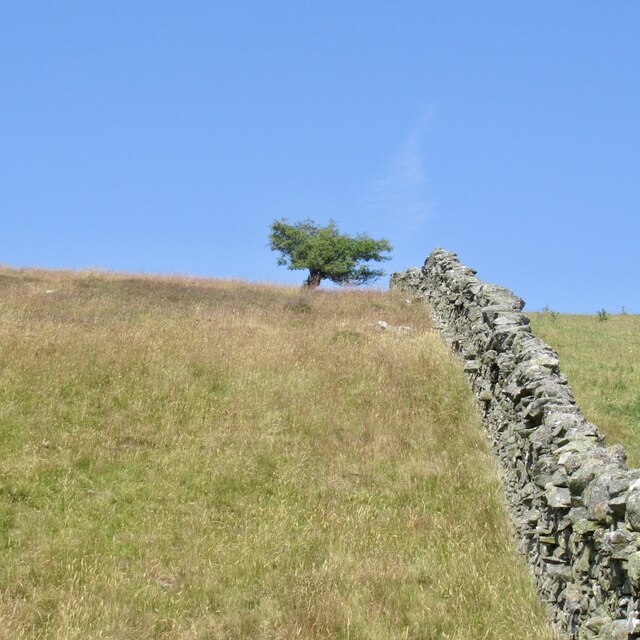
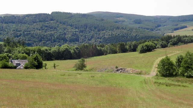
Raelees Wood is a picturesque forest located in Selkirkshire, a historic county in the Scottish Borders region of Scotland. Spanning an area of approximately 200 acres, this woodland is a haven for nature enthusiasts and outdoor enthusiasts alike.

The wood is primarily composed of a mixture of deciduous and coniferous trees, including oak, birch, pine, and beech. These trees create a diverse and vibrant ecosystem, providing habitat for a variety of wildlife species. Visitors to Raelees Wood may be lucky enough to spot red squirrels, roe deer, and an array of bird species, including woodpeckers and owls.

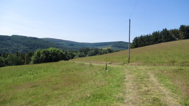
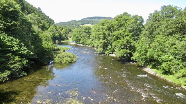
A network of well-maintained walking trails winds through the wood, allowing visitors to explore its beauty at their own pace. These paths range from easy strolls to more challenging hikes, catering to all fitness levels. Along the way, walkers will encounter babbling brooks, wildflowers, and breathtaking views of the surrounding countryside.

For those interested in history, Raelees Wood holds some significance. It is believed to have been an ancient hunting ground, with evidence of prehistoric settlements found in the area. Additionally, remnants of old charcoal pits and lime kilns can still be seen within the wood, providing a glimpse into its industrial past.

Raelees Wood is open to the public year-round and is managed by the local authorities. Facilities such as picnic areas and parking are available, making it an ideal destination for a day trip or a peaceful retreat in nature. Whether seeking tranquility or adventure, visitors to Raelees Wood are sure to find solace in its serene surroundings.

If you have any feedback on the listing, please let us know in the comments section below.
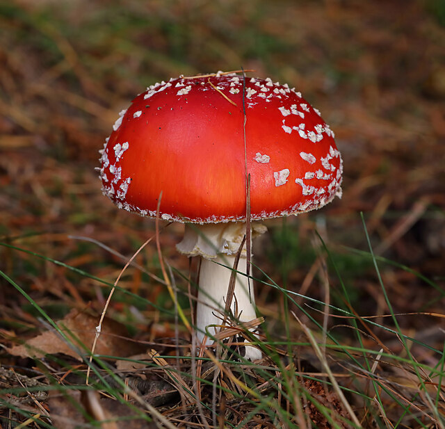
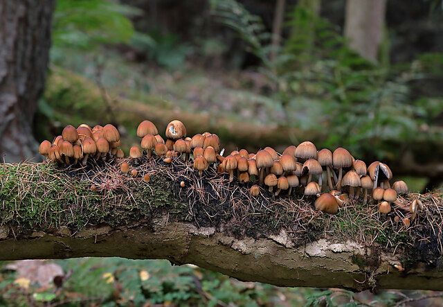
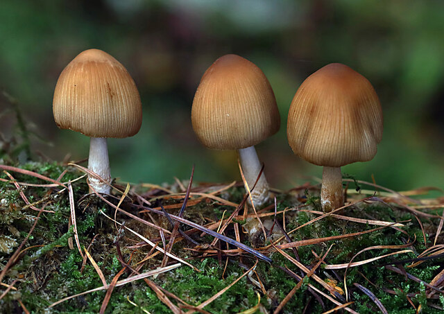
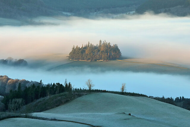
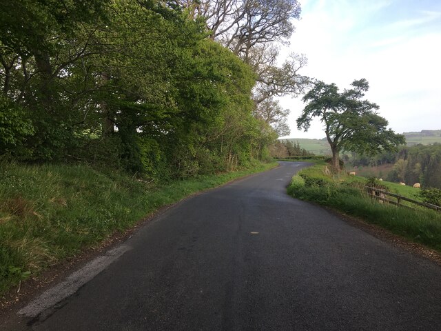
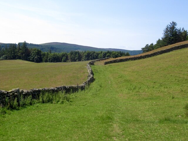
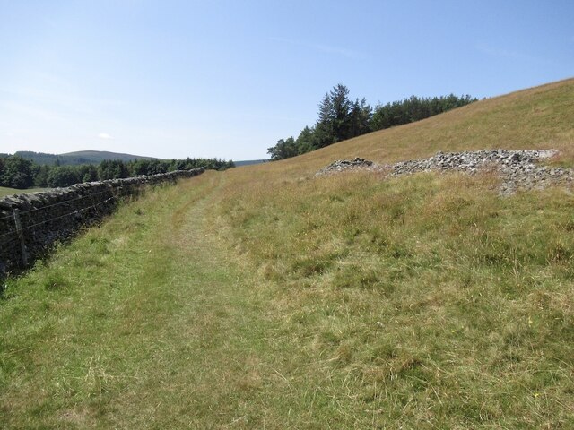
Raelees Wood Images

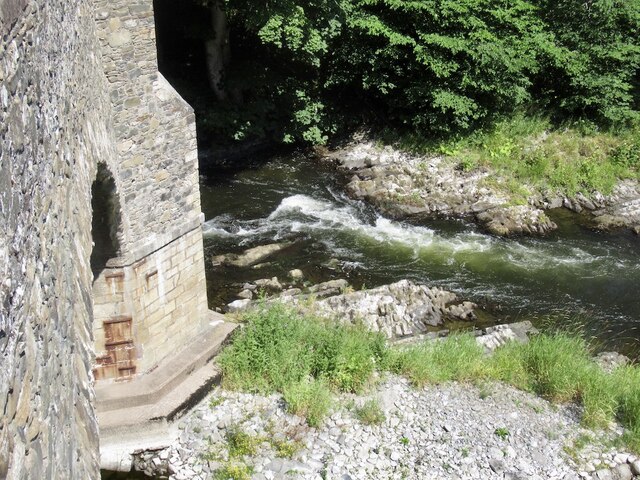
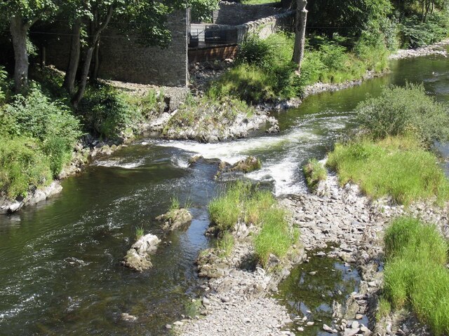
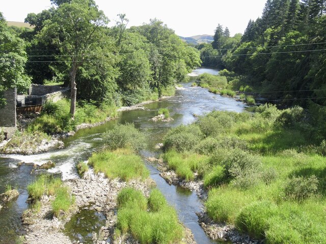
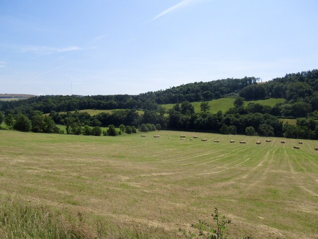
Images are sourced within 2km of 55.580151/-2.8521655 or Grid Reference NT4632. Thanks to Geograph Open Source API. All images are credited.

A fly agaric mushroom (Amanita muscaria) This mushroom which is usually associated with birch and pine trees is one of the easiest species to recognise.
A fly agaric mushroom (Amanita muscaria)
This mushroom which is usually associated with birch and pine trees is one of the easiest species to recognise.
Glistening ink cap mushrooms (Coprinellus micaceus) This edible species is usually associated with dead tree stumps or buried wood. The photograph was taken in Lindinny Wood.
Glistening ink cap mushrooms (Coprinellus micaceus)
This edible species is usually associated with dead tree stumps or buried wood. The photograph was taken in Lindinny Wood.
A forestry track in Howlands Plantation
Rink Hill from Eildon Mid Hill The small circular plantation on Rink Hill is the site of an Iron Age hillfort. This telephoto shot was taken from the summit of Eildon Mid Hill during a December sunrise. For two closer views of the small plantation on Rink Hill, see <a href="https://www.geograph.org.uk/photo/2347041">NT4832 : The Rink Hill Fort</a> and <a href="https://www.geograph.org.uk/photo/1758293">NT4732 : Rink Hill</a>.
Rink Hill from Eildon Mid Hill
The small circular plantation on Rink Hill is the site of an Iron Age hillfort. This telephoto shot was taken from the summit of Eildon Mid Hill during a December sunrise. For two closer views of the small plantation on Rink Hill, see NT4832 : The Rink Hill Fort and NT4732 : Rink Hill.
B7060 near Yair
B7060 near Yair
Southern Upland Way, Hog Hill
Southern Upland Way, Hog Hill Before the plunge down to the Tweed.
Southern Upland Way, Hog Hill
Before the plunge down to the Tweed.
Hog Hill
Hog Hill
Drying grassland, Calfshaw The following six weeks were also dry, rains returned in September 2022.
Drying grassland, Calfshaw
The following six weeks were also dry, rains returned in September 2022.
Calfshaw View over Tweeddale from the Southern Upland Way.
Calfshaw
View over Tweeddale from the Southern Upland Way.
Southern Upland Way, Calfshaw Good conditions for the bike, but a serious issue for livestock farmers.
Southern Upland Way, Calfshaw
Good conditions for the bike, but a serious issue for livestock farmers.
River Tweed, Fairnielee Upstream from Yair Bridge.
River Tweed, Fairnielee
Upstream from Yair Bridge.
Yair Bridge And low water on the Fairnielee rapids
Yair Bridge
And low water on the Fairnielee rapids
Fairnielee Rapids Very low water conditions.
Fairnielee Rapids
Very low water conditions.
Low water on the Tweed Fairnielee rapids during extremely low water conditions.
Low water on the Tweed
Fairnielee rapids during extremely low water conditions.
Field, Fairnielee
Field, Fairnielee
Sheep above the Tweed
Show me another place!

Raelees Wood is located at Grid Ref: NT4632 (Lat: 55.580151, Lng: -2.8521655)

Unitary Authority: The Scottish Borders

Police Authority: The Lothians and Scottish Borders

What 3 Words

///registry.removing.showering. Near Selkirk, Scottish Borders

Nearby Locations

Brander Pool Raelees Wood

Related Wikis

Yair, Scottish Borders

Yair, also known as The Yair, is an estate in the Scottish Borders. It stands by the River Tweed in the former county of Selkirkshire, 2.5 miles (4.0 km...

Yair Bridge

The Yair Bridge or Fairnilee Bridge is a bridge across the River Tweed at Yair, near Galashiels in the Scottish Borders. == History == It was built in...

Lindean railway station

Lindean railway station served the village of Lindean, Scottish Borders, Scotland, from 1856 to 1964 on the Selkirk and Galashiels Railway. == History... ==

Ettrick Water

The Ettrick Water is a river in Ettrick, by the village of Ettrickbridge and the historic town of Selkirk, in the Scottish Borders area of Scotland. The...

Nearby Amenities

Located within 500m of 55.580151,-2.8521655
Material: wood
Power: pole
Lat/Long: 55.5838011/-2.8559169
Material: wood
Power: pole
Lat/Long: 55.5834524/-2.854785
Material: wood
Power: pole
Lat/Long: 55.5834615/-2.8536049
Power: pole
Lat/Long: 55.5834524/-2.8522798
Power: pole
Lat/Long: 55.5834539/-2.8511748
Power: pole
Lat/Long: 55.5834463/-2.8499007
Power: pole
Lat/Long: 55.5808703/-2.8449799
Power: pole
Lat/Long: 55.5801693/-2.8459646
Power: pole
Lat/Long: 55.578977/-2.8476395
Power: pole
Lat/Long: 55.5781277/-2.8474837
Power: pole
Lat/Long: 55.5781611/-2.8476746
Power: pole
Lat/Long: 55.579013/-2.8478304
Power: pole
Lat/Long: 55.5801769/-2.8461446
Power: pole
Lat/Long: 55.5809091/-2.8450842
Power: pole
Lat/Long: 55.5831159/-2.8492597
Power: pole
Lat/Long: 55.5824973/-2.8481385
Power: pole
Lat/Long: 55.582091/-2.8473258
Power: pole
Lat/Long: 55.5817007/-2.8464554
Power: pole
Lat/Long: 55.5812007/-2.8452987
Power: pole
Lat/Long: 55.5773841/-2.8473472
Calfshaw Burn
Leisure: fishing
Lat/Long: 55.583175/-2.8561677
Power: pole
Lat/Long: 55.5795222/-2.8470928
Power: pole
Lat/Long: 55.5795067/-2.8468954
Power: pole
Lat/Long: 55.5811154/-2.8450795
Power: tower
Lat/Long: 55.5811852/-2.8450164
Power: pole
Lat/Long: 55.5812147/-2.8447267
Power: pole
Lat/Long: 55.5811867/-2.8446282
Power: pole
Lat/Long: 55.581015/-2.8448347
Power: pole
Lat/Long: 55.5810419/-2.8449313
Noexit: yes
Lat/Long: 55.5812716/-2.8448863
Power: pole
Lat/Long: 55.5840005/-2.8498232
Power: pole
Lat/Long: 55.5844033/-2.8496959
Power: pole
Lat/Long: 55.5810127/-2.8452089
Power: pole
Lat/Long: 55.580889/-2.8447661
Power: pole
Lat/Long: 55.5773588/-2.8475279
The data included in this document is from www.openstreetmap.org. The data is made available under ODbL.

Have you been to Raelees Wood?

Leave your review of Raelees Wood below (or comments, questions and feedback).