Cefn-mawr
Settlement in Montgomeryshire
Wales
Cefn-mawr

Cefn-mawr is a small village located in the county of Montgomeryshire, Wales. Situated in the picturesque valley of the River Vyrnwy, Cefn-mawr is surrounded by lush green hills and offers stunning views of the Welsh countryside.
The village is known for its rich history and heritage, with evidence of human settlement in the area dating back to ancient times. It was a significant mining community during the 19th and early 20th centuries, with coal being the primary resource extracted from the nearby mines. The remnants of the mining industry can still be seen in the form of old mine shafts and buildings scattered throughout the village.
Today, Cefn-mawr is a quiet and peaceful village with a close-knit community. It offers a range of amenities to its residents, including a small convenience store, a post office, and a local pub. The village is also home to a primary school, providing education to the younger population.
Nature lovers will find plenty to explore around Cefn-mawr, with numerous walking trails and hiking routes in the surrounding hills. The River Vyrnwy offers opportunities for fishing, and the nearby Lake Vyrnwy is a popular spot for water sports and birdwatching.
Overall, Cefn-mawr is a charming village that combines its industrial past with its natural beauty, making it an attractive destination for both residents and visitors seeking a peaceful retreat in the heart of the Welsh countryside.
If you have any feedback on the listing, please let us know in the comments section below.
Cefn-mawr Images
Images are sourced within 2km of 52.534919/-3.305469 or Grid Reference SO1193. Thanks to Geograph Open Source API. All images are credited.


Cefn-mawr is located at Grid Ref: SO1193 (Lat: 52.534919, Lng: -3.305469)
Unitary Authority: Powys
Police Authority: Dyfed Powys
Also known as: Cefn Mawr
What 3 Words
///toys.accented.unions. Near Newtown, Powys
Related Wikis
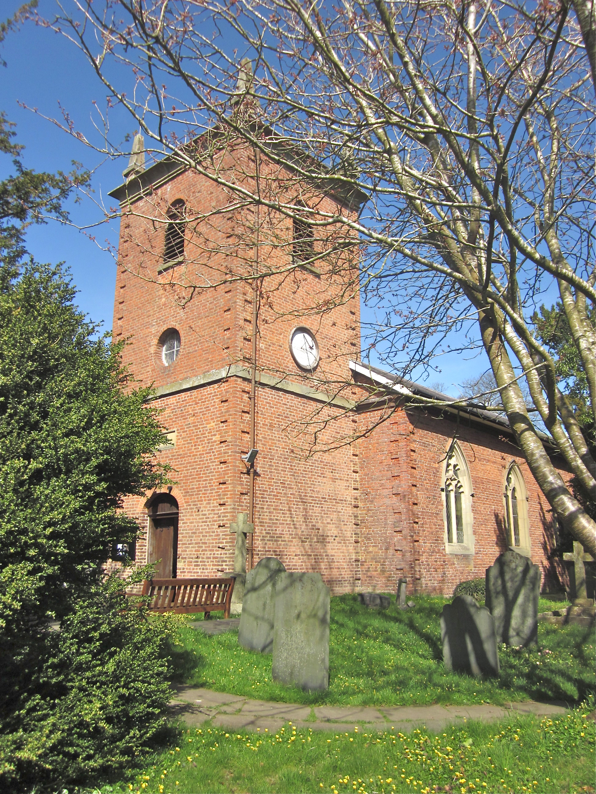
St Llwchaiarn's Church, Llanllwchaiarn
St Llwchaiarn's church, Llanllwchaiarn was the parish church of Llanllwchaiarn, now within the community of Newtown with Llanllwchaiarn and lies within...
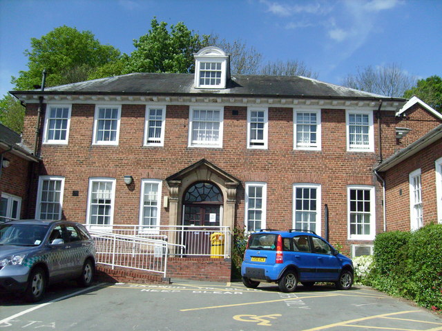
Montgomery County Infirmary
Montgomery County Infirmary (Welsh: Ysbyty Sir Drefaldwyn) is a health facility in Llanfair Road, Newtown, Powys, Wales. It is managed by the Powys Teaching...

Llanllwchaiarn
Llanllwchaiarn or Llanllwchaearn (Welsh: [ɬanɬuː′χaɨarn]) in Welsh) is a village on the outskirts of Newtown in Powys, Wales. It forms part of the community...

Newtown and Llanllwchaiarn
Newtown and Llanllwchaiarn (Welsh: Y Drenewydd a Llanllwchaearn) is a local government community in mid Powys, Wales. It includes the town of Newtown and...
Nearby Amenities
Located within 500m of 52.534919,-3.305469Have you been to Cefn-mawr?
Leave your review of Cefn-mawr below (or comments, questions and feedback).