Davoch Plantation
Wood, Forest in Aberdeenshire
Scotland
Davoch Plantation

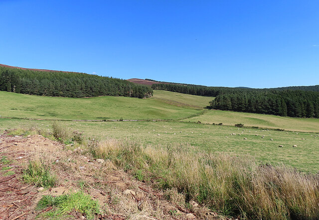
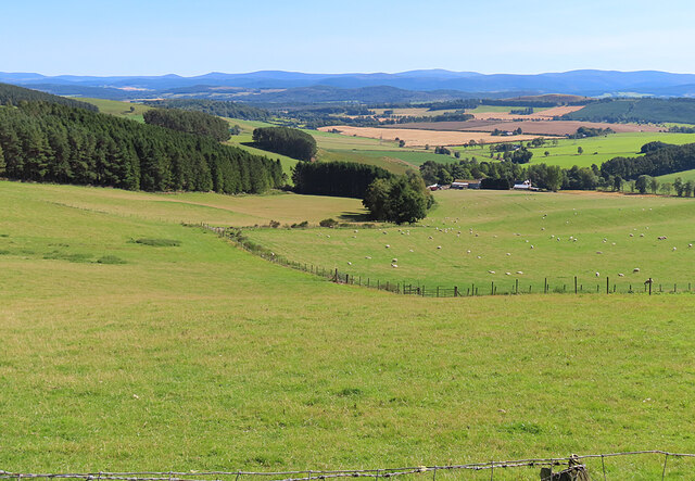
Davoch Plantation is a picturesque woodland area located in Aberdeenshire, Scotland. Spanning over several hectares, it is nestled in the heart of the scenic countryside, offering visitors a serene and tranquil escape from the bustling city life. The plantation, also known as Davoch Wood or Davoch Forest, is known for its diverse and abundant flora and fauna.
The woodland is primarily composed of native Scottish tree species, including oak, birch, and pine. These majestic trees create a dense canopy that provides shelter for a wide range of wildlife. Visitors to Davoch Plantation can expect to encounter a variety of bird species, such as woodpeckers, owls, and songbirds, as well as small mammals like squirrels and rabbits.
There are well-maintained trails throughout the plantation, allowing visitors to explore the area on foot or by bike. The paths wind through the woodland, offering glimpses of beautiful wildflowers, moss-covered rocks, and babbling streams. Nature enthusiasts will appreciate the tranquility of the surroundings, making it an ideal location for birdwatching, photography, or simply enjoying a peaceful walk in nature.
Davoch Plantation is open to the public year-round, and admission is free. The site is also popular for educational activities, with local schools often arranging field trips to teach students about the importance of preserving and appreciating natural habitats. The plantation is easily accessible by car, with ample parking available. Whether visitors are seeking a quiet retreat or an educational adventure, Davoch Plantation offers a memorable experience immersed in the beauty of Aberdeenshire's woodlands.
If you have any feedback on the listing, please let us know in the comments section below.
Davoch Plantation Images
Images are sourced within 2km of 57.162893/-2.890696 or Grid Reference NJ4608. Thanks to Geograph Open Source API. All images are credited.


Davoch Plantation is located at Grid Ref: NJ4608 (Lat: 57.162893, Lng: -2.890696)
Unitary Authority: Aberdeenshire
Police Authority: North East
What 3 Words
///stretch.engulfing.fuse. Near Aboyne, Aberdeenshire
Nearby Locations
Related Wikis

Migvie Castle
Migvie Castle was a 13th-century castle to the west of Migvie, Aberdeenshire, Scotland. Its remains were listed as a scheduled monument in 2007. ��2�...

Tarland
Tarland (Gaelic: Turlann) is a village in Aberdeenshire, Scotland and is located 5 miles (8 km) northwest of Aboyne, and 30 miles (50 km) west of Aberdeen...
Logie Coldstone
Logie Coldstone (Scottish Gaelic: Lògaidh) is a village in Aberdeenshire, Scotland. The village lies north of the River Dee, near Tarland in the Cromar...

Towie, Aberdeenshire
Towie is a small hamlet and civil parish in Aberdeenshire, Scotland, close to Alford and Lumsden, on the River Don.One of the most notable features of...
Nearby Amenities
Located within 500m of 57.162893,-2.890696Have you been to Davoch Plantation?
Leave your review of Davoch Plantation below (or comments, questions and feedback).