Cefn Golau

Settlement in Monmouthshire

Wales

Cefn Golau

Llwybr i Barc Bryn Bach / Path to Bryn Bach Park Llwybr yn mynd i gyfeiriad Parc Bryn Bach.

Path heading towards Bryn Bach Park (trans. little hill).
Llwybr i Barc Bryn Bach / Path to Bryn Bach Park Credit: Alan Richards

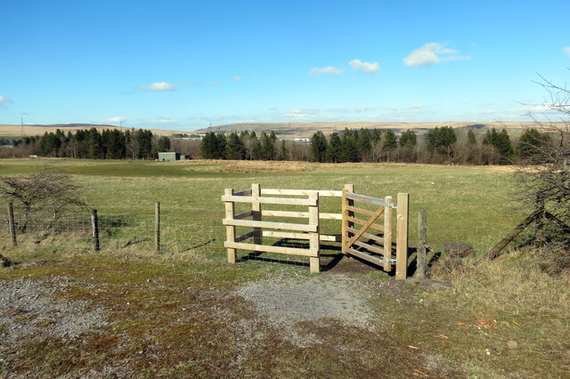
Cefn Golau is a small village located in the county of Monmouthshire, Wales. Situated in the eastern part of the county, it lies at the southern edge of the Brecon Beacons National Park. The village is nestled amidst picturesque rolling hills and offers stunning views of the surrounding countryside.

Cefn Golau is a rural community that is primarily known for its agricultural heritage. The village is surrounded by farmland, where livestock farming and crop cultivation are common practices. The local economy is largely dependent on agriculture, with many residents working in farming or related industries.

Despite its small size, Cefn Golau has a tight-knit community and a friendly atmosphere. The village has a community hall that serves as a gathering place for various events and activities. There are also several local clubs and organizations that provide opportunities for socializing and engaging in hobbies.

Nature enthusiasts and outdoor lovers are drawn to Cefn Golau due to its proximity to the Brecon Beacons National Park. The park offers a wealth of opportunities for hiking, camping, and exploring the natural beauty of the area. The nearby Black Mountains also provide a scenic backdrop for outdoor activities.

In terms of amenities, Cefn Golau has limited facilities. There is a local pub that serves as a meeting point for residents and visitors alike. For more extensive shopping and services, the nearby town of Abergavenny is a short drive away.

Overall, Cefn Golau is a charming village that offers a peaceful and rural lifestyle, as well as easy access to the stunning landscapes of the Brecon Beacons National Park.

If you have any feedback on the listing, please let us know in the comments section below.

Cefn Golau Images

Images are sourced within 2km of 51.769018/-3.252718 or Grid Reference SO1308. Thanks to Geograph Open Source API. All images are credited.
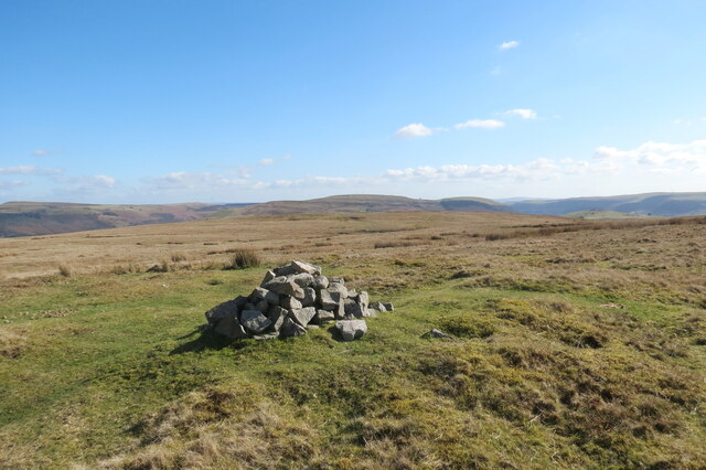
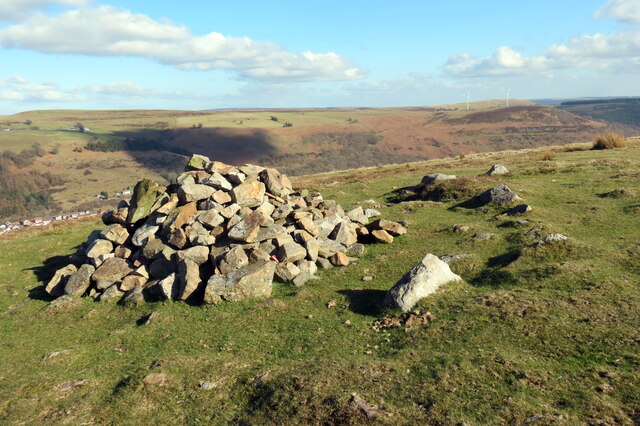
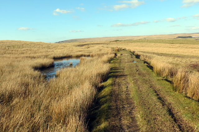
Llwybr i Barc Bryn Bach / Path to Bryn Bach Park Llwybr yn mynd i gyfeiriad Parc Bryn Bach.

Path heading towards Bryn Bach Park (trans. little hill).
Llwybr i Barc Bryn Bach / Path to Bryn Bach Park
Llwybr yn mynd i gyfeiriad Parc Bryn Bach. Path heading towards Bryn Bach Park (trans. little hill).
Ar lethrau Bryn Rhymni / On the slopes of Rhymney Hill Piler arolwg ar lawr ar lethrau Bryn Rhymni. Yn y pellter mae Llyn Bryn Bach.

A recumbent survey pillar on the slopes of Rhymney Hill. Visible in the distance is Bryn Bach Lake (trans. little hill).
Ar lethrau Bryn Rhymni / On the slopes of Rhymney Hill
Piler arolwg ar lawr ar lethrau Bryn Rhymni. Yn y pellter mae Llyn Bryn Bach. A recumbent survey pillar on the slopes of Rhymney Hill. Visible in the distance is Bryn Bach Lake (trans. little hill).
Carn ar Fryn Rhymni / A cairn on Rhymney Hill Domen o gerrig, nod terfyn posibl, ar Fryn Rhymni ger ei gopa. Yn y pellter mae Mynydd Bedwellte.

A pile of stones, possibly a boundary marker, on Rhymney Hill near its summit. Mynydd Bedwellte (trans. mountain of Mellte's abode) can be seen in the distance.
Carn ar Fryn Rhymni / A cairn on Rhymney Hill
Domen o gerrig, nod terfyn posibl, ar Fryn Rhymni ger ei gopa. Yn y pellter mae Mynydd Bedwellte. A pile of stones, possibly a boundary marker, on Rhymney Hill near its summit. Mynydd Bedwellte (trans. mountain of Mellte's abode) can be seen in the distance.
Carn ar Fryn Rhymni / A cairn on Rhymney Hill Domen o gerrig, nod terfyn posibl, ar Fryn Rhymni. Yn y pellter mae Pownd Blaencarno.

A pile of stones, possibly a boundary marker, on Rhymney Hill. Blaencarno Pond (trans. source of the Carno [stream]) can be seen in the distance.
Carn ar Fryn Rhymni / A cairn on Rhymney Hill
Domen o gerrig, nod terfyn posibl, ar Fryn Rhymni. Yn y pellter mae Pownd Blaencarno. A pile of stones, possibly a boundary marker, on Rhymney Hill. Blaencarno Pond (trans. source of the Carno [stream]) can be seen in the distance.
Grid Gwartheg ar y B4256 / Cattle grid on the B4246 Grid gwartheg ar y B4256 ger Cefn Golau.

A cattle grid on the B4256 near Cefn Golau (trans. light ridge).
Grid Gwartheg ar y B4256 / Cattle grid on the B4246
Grid gwartheg ar y B4256 ger Cefn Golau. A cattle grid on the B4256 near Cefn Golau (trans. light ridge).
Colfen arswydus / Spooky tree Colfen arswydus ei golwg yng Nghladdfa Cefn Golau.

A spooky looking tree at Cefn Golau cemetery (trans. light ridge).
Colfen arswydus / Spooky tree
Colfen arswydus ei golwg yng Nghladdfa Cefn Golau. A spooky looking tree at Cefn Golau cemetery (trans. light ridge).
Pownd Cefn Golau / Cefn Golau Pond Gorlifiad Pownd Cefn Golau.

The overflow of Cefn Golau Pond (trans. light ridge).
Pownd Cefn Golau / Cefn Golau Pond
Gorlifiad Pownd Cefn Golau. The overflow of Cefn Golau Pond (trans. light ridge).
Ar lethrau Mynydd Bedwellte / On the slopes of Mynydd Bedwellte Wal gerrig sych ar lethrau Mynydd Bedwellte.

A dry stone wall on the slopes of Mynydd Bedwellte (trans. mountain of Mellte's abode).
Ar lethrau Mynydd Bedwellte / On the slopes of Mynydd Bedwellte
Wal gerrig sych ar lethrau Mynydd Bedwellte. A dry stone wall on the slopes of Mynydd Bedwellte (trans. mountain of Mellte's abode).
Llwybr i lawr i Dredegar / Path down to Tredegar Llwybr cyhoeddus yn mynd i lawr y waered i gyfeiriad Tredegar.

A public footpath descending towards Tredegar.
Llwybr i lawr i Dredegar / Path down to Tredegar
Llwybr cyhoeddus yn mynd i lawr y waered i gyfeiriad Tredegar. A public footpath descending towards Tredegar.
Carn Stwpa Gweddillion Carn Stwpa, heneb o'r Oes Efydd. Sylwer ar y dde ymylfeini o'r garn wreiddiol.

The remains of Carn Stwpa, a Bronze Age monument. Note on the right surviving kerbstones of the original cairn.
Carn Stwpa
Gweddillion Carn Stwpa, heneb o'r Oes Efydd. Sylwer ar y dde ymylfeini o'r garn wreiddiol. The remains of Carn Stwpa, a Bronze Age monument. Note on the right surviving kerbstones of the original cairn.
Carn Stwpa Gweddillion Carn Stwpa, heneb o'r Oes Efydd. Yn y pellter mae Tredegar.

The remains of Carn Stwpa, a Bronze Age monument. Tredegar can be seen in the distance.
Carn Stwpa
Gweddillion Carn Stwpa, heneb o'r Oes Efydd. Yn y pellter mae Tredegar. The remains of Carn Stwpa, a Bronze Age monument. Tredegar can be seen in the distance.
Ystad Cefn Golau / Cefn Golau Estate Ystad Cefn Golau yn ffinio â'r mynydd.

Cefn Golau Estate borders the mountain.
Ystad Cefn Golau / Cefn Golau Estate
Ystad Cefn Golau yn ffinio â'r mynydd. Cefn Golau Estate borders the mountain.
Trac lawr i Ystad Cefn Golau / Track down to Cefn Golau Estate Trac o'r mynydd yn mynd i lawr y waered i gyfeiriad Ystad Gefn Golud.

A track from the mountain descending towards Cefn Golau Estate (trans. light ridge).
Trac lawr i Ystad Cefn Golau / Track down to Cefn Golau Estate
Trac o'r mynydd yn mynd i lawr y waered i gyfeiriad Ystad Gefn Golud. A track from the mountain descending towards Cefn Golau Estate (trans. light ridge).
Llwybr ar lethrau Bryn Rhymni /  Path on the slopes of Rhymney Hill Sticil ar lethrau Bryn Rhymni.

A stile on the slopes of Rhymney Hill.
Llwybr ar lethrau Bryn Rhymni / Path on the slopes of Rhymney Hill
Sticil ar lethrau Bryn Rhymni. A stile on the slopes of Rhymney Hill.
Trac ar lethrau Bryn Rhymni / Track on the slopes of Rhymney Hill Trac ar lethrau Bryn Rhymni yn mynd i gyfeiriad lleoliad o'r enw Tredegar Patch.

A track on the slopes of Rhymney Hill heading towards a location known as Tredegar Patch.
Trac ar lethrau Bryn Rhymni / Track on the slopes of Rhymney Hill
Trac ar lethrau Bryn Rhymni yn mynd i gyfeiriad lleoliad o'r enw Tredegar Patch. A track on the slopes of Rhymney Hill heading towards a location known as Tredegar Patch.
Llwybr i Barc Bryn Bach / Path to Bryn Bach Park Llwybr yn mynd i gyfeiriad Parc Bryn Bach.

A path heading in the direction of Bryn Bach Park (trans. little hill).
Llwybr i Barc Bryn Bach / Path to Bryn Bach Park
Llwybr yn mynd i gyfeiriad Parc Bryn Bach. A path heading in the direction of Bryn Bach Park (trans. little hill).
Llwybr i Deras Mafeking / Path to Mafeking Terrace Llwybr cyhoeddus yn mynd i gyfeiriad Teras Mafeking.

A public footpath heading towards Mafeking Terrace.
Llwybr i Deras Mafeking / Path to Mafeking Terrace
Llwybr cyhoeddus yn mynd i gyfeiriad Teras Mafeking. A public footpath heading towards Mafeking Terrace.
Ffordd i gerddwyr / Way for pedestrians Rhan o'r heol wedi ei neilltuo i gerddwyr oherwydd prinder pafin. 

Part of the road designated for pedestrians due to the lack of a pavement.
Ffordd i gerddwyr / Way for pedestrians
Rhan o'r heol wedi ei neilltuo i gerddwyr oherwydd prinder pafin. Part of the road designated for pedestrians due to the lack of a pavement.
Show me another place!

Cefn Golau is located at Grid Ref: SO1308 (Lat: 51.769018, Lng: -3.252718)

Unitary Authority: Blaenau Gwent

Police Authority: Gwent

What 3 Words

///tilts.unimpeded.darts. Near Tredegar, Blaenau Gwent

Nearby Locations

Cefn Golau Tredegar Patch

Related Wikis

Tredegar General Hospital

Tredegar General Hospital (Welsh: Ysbyty Cyffredinol Tredegar) was a community hospital in Tredegar, Blaenau Gwent, Wales. It was managed by the Aneurin...

Tredegar Town Hall

Tredegar Town Hall (Welsh: Neuadd y Dref Tredegar) is a municipal structure in The Circle, Tredegar, Wales. The town hall, which was the headquarters...

Recreation Ground, Tredegar

The Recreation Ground, Tredegar is a cricket ground and former greyhound racing and speedway stadium in Tredegar, Blaenau Gwent, south-east Wales. The...

Bedwellty House

Bedwellty House is a Grade II-listed house and gardens in Tredegar, in the Sirhowy Valley in south-east Wales. It was built in the early 19th century on...

Related Videos

Forest walking

we always find a new path to walk along. This is Wales. You can see England across the river.

UK Travel vlog|ഞങ്ങളുടെ കൊച്ചു കൊച്ചു സന്ദോഷങ്ങൾ|summer days in UK|come explore the beauty of Wales💝

PARK BRYN BACH Set in the heart of Tredegar in southeast Wales, Parc Bryn Bach (Bryn Bach Park), offers a warm welcome ...

Why You Should Keep Walking Frames Away From Us...

So one day me and Ben were walking... And we found a "abandoned" walking frame... And the rest is in the video.

Walking from Newport to Ebbw Vale (ft. Sam & Alex)

me, sam (SP!KE) and alex (R0UG) walk from newport to the head of the ebbw fawr valley (ebbw vale). it took nearly 7 hours and a ...

Nearby Amenities

Located within 500m of 51.769018,-3.252718
Place Of Worship
Lat/Long: 51.7711234/-3.2480882
Place Of Worship
Saron Independent Chapel
Religion: christian
Lat/Long: 51.7703508/-3.2479742
Crossing: informal
Lat/Long: 51.7684865/-3.2541418
Barrier: yes
Lat/Long: 51.7713191/-3.2496149
Crossing
Crossing: uncontrolled
Source: bing
Lat/Long: 51.7719313/-3.2474899
Direction: 165
Generator Method: thermal
Generator Output Hot Water: yes
Generator Solar Modules: 2
Generator Source: solar
Generator Type: solar_thermal_collector
Location: roof
Power: generator
Lat/Long: 51.7724832/-3.2485145
Direction: 165
Generator Method: thermal
Generator Output Hot Water: yes
Generator Solar Modules: 2
Generator Source: solar
Generator Type: solar_thermal_collector
Location: roof
Power: generator
Lat/Long: 51.7724724/-3.2485628
Direction: 255
Generator Method: thermal
Generator Output Hot Water: yes
Generator Solar Modules: 2
Generator Source: solar
Generator Type: solar_thermal_collector
Location: roof
Power: generator
Lat/Long: 51.7722965/-3.2486339
Direction: 255
Generator Method: thermal
Generator Output Hot Water: yes
Generator Solar Modules: 2
Generator Source: solar
Generator Type: solar_thermal_collector
Location: roof
Power: generator
Lat/Long: 51.7724384/-3.2487385
Direction: SSW
Generator Method: photovoltaic
Generator Output Electricity: yes
Generator Solar Modules: 6
Generator Source: solar
Generator Type: solar_photovoltaic_panel
Location: roof
Power: generator
Lat/Long: 51.7703612/-3.2522696
Direction: 165
Generator Method: photovoltaic
Generator Output Electricity: yes
Generator Solar Modules: 9
Generator Source: solar
Generator Type: solar_photovoltaic_panel
Location: roof
Power: generator
Lat/Long: 51.7692939/-3.2474872
Direction: 165
Generator Method: photovoltaic
Generator Output Electricity: yes
Generator Solar Modules: 10
Generator Source: solar
Generator Type: solar_photovoltaic_panel
Location: roof
Power: generator
Lat/Long: 51.7689312/-3.2468945
Direction: 125
Generator Method: photovoltaic
Generator Output Electricity: yes
Generator Solar Modules: 12
Generator Source: solar
Generator Type: solar_photovoltaic_panel
Location: roof
Power: generator
Lat/Long: 51.767566/-3.2481229
Direction: 260
Generator Method: photovoltaic
Generator Output Electricity: yes
Generator Solar Modules: 16
Generator Source: solar
Generator Type: solar_photovoltaic_panel
Location: roof
Note: smaller form factor modules
Power: generator
Lat/Long: 51.7661015/-3.2485039
Direction: 80
Generator Method: photovoltaic
Generator Output Electricity: yes
Generator Solar Modules: 16
Generator Source: solar
Generator Type: solar_photovoltaic_panel
Location: roof
Note: smaller form factor modules
Power: generator
Lat/Long: 51.7661061/-3.2484166
Post Box
Operator: Royal Mail
Post Box Type: lamp
Ref: NP22 619D
Royal Cypher: EIIR
Lat/Long: 51.7677536/-3.2527591
Post Office
Shop: convenience
Lat/Long: 51.7677992/-3.2528503
Power: pole
Lat/Long: 51.7647647/-3.2536367
Power: pole
Lat/Long: 51.7652193/-3.2533209
Power: pole
Lat/Long: 51.7655338/-3.252974
The data included in this document is from www.openstreetmap.org. The data is made available under ODbL.

Have you been to Cefn Golau?

Leave your review of Cefn Golau below (or comments, questions and feedback).