The Craigs Wood

Wood, Forest in Midlothian

Scotland

The Craigs Wood

The remains of Ewes Castle There is not much to see of this ruined tower house by the Lugate Water. My previous visit was in 2007 <a href="https://www.geograph.org.uk/photo/410068">NT4344 : Ewes Castle</a>.
The remains of Ewes Castle Credit: Walter Baxter

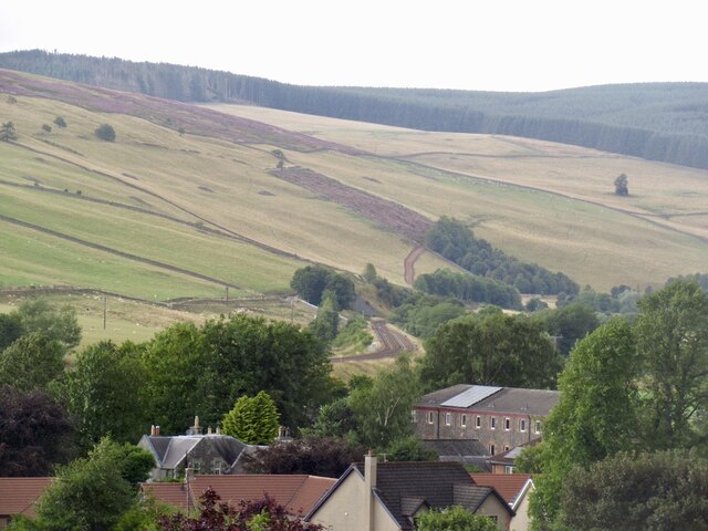
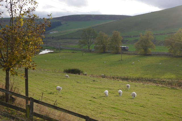
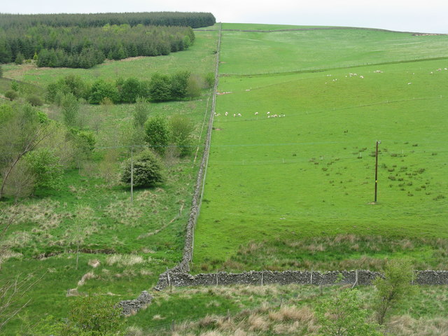
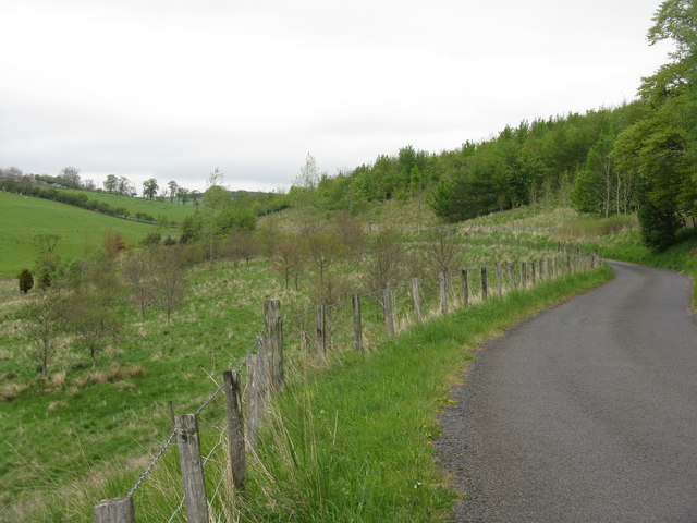
The Craigs Wood, located in Midlothian, Scotland, is a picturesque forest known for its natural beauty and diverse flora and fauna. Covering an area of approximately 300 acres, it is a popular destination for nature enthusiasts, hikers, and wildlife photographers.

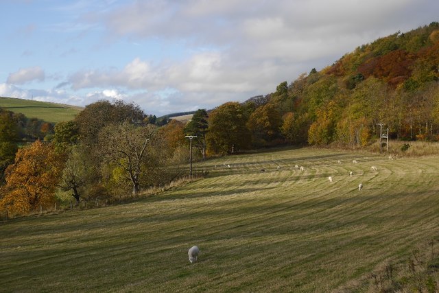
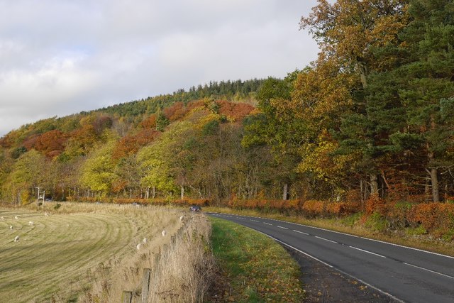
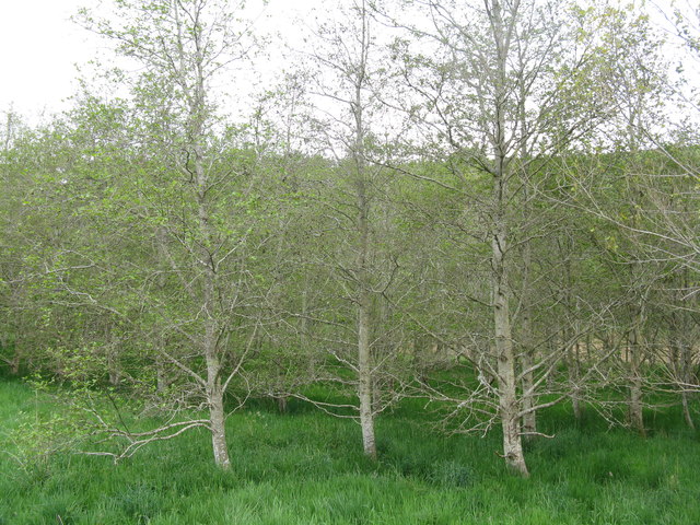
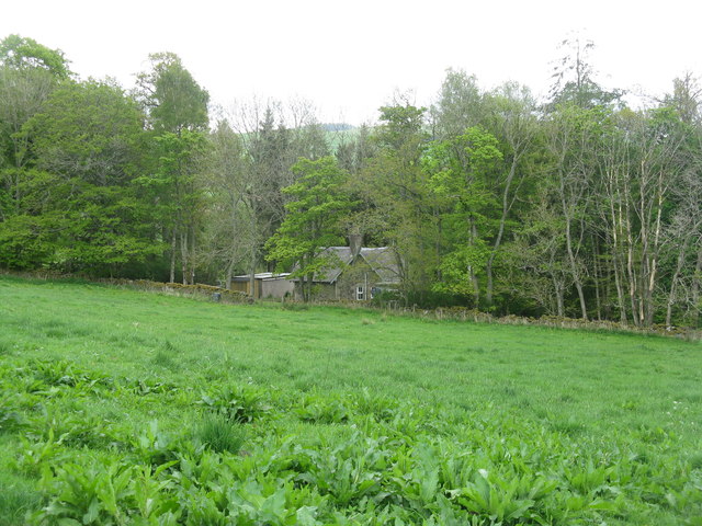
The wood is characterized by its dense canopy of tall trees, including oak, beech, and birch. The intertwined branches create a serene and enchanting atmosphere, making it a perfect place for peaceful walks and relaxation. The forest floor is adorned with a carpet of wildflowers, ferns, and moss, adding to its ethereal charm.

Several well-maintained trails wind through the wood, offering visitors the opportunity to explore its various nooks and crannies. The paths are generally easy to navigate, although some areas may be more challenging, providing a diverse experience for both casual strollers and more experienced hikers.

Wildlife thrives in The Craigs Wood, with a rich variety of bird species making it a haven for birdwatchers. Visitors may spot woodpeckers, owls, and various songbirds amidst the branches, while rabbits, squirrels, and deer can be seen foraging on the forest floor.

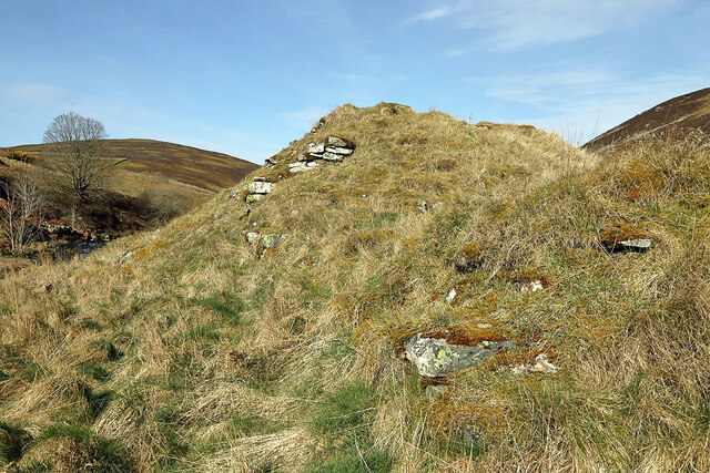
The Craigs Wood is not only a natural habitat but also holds historical significance. Ruins of an ancient Roman fort can be found within the wood, adding an element of intrigue and mystery to the area.

Overall, The Craigs Wood in Midlothian is a captivating forest that offers a tranquil escape from urban life, providing visitors with a chance to immerse themselves in nature and explore its wonders.

If you have any feedback on the listing, please let us know in the comments section below.

The Craigs Wood Images

Images are sourced within 2km of 55.708711/-2.8847704 or Grid Reference NT4446. Thanks to Geograph Open Source API. All images are credited.

The remains of Ewes Castle There is not much to see of this ruined tower house by the Lugate Water. My previous visit was in 2007 <a href="https://www.geograph.org.uk/photo/410068">NT4344 : Ewes Castle</a>.
The remains of Ewes Castle
There is not much to see of this ruined tower house by the Lugate Water. My previous visit was in 2007 NT4344 : Ewes Castle.
Road from Mitchelston
Woodland, Cathpair Former farmland.
Woodland, Cathpair
Former farmland.
Road, Cathpair
Road, Cathpair
Craigend View towards Stow.
Craigend
View towards Stow.
Craigend by Stow A novelty visiting the village by this road which is a dead en for motors, but there are pathways through the maze of electric fences from Oxton and Lauder.
Craigend by Stow
A novelty visiting the village by this road which is a dead en for motors, but there are pathways through the maze of electric fences from Oxton and Lauder.
Borders Railway leaving Stow View northwards to the end of the passing loop.
Borders Railway leaving Stow
View northwards to the end of the passing loop.
Closed tea room, Stow
A7, Stow
A7, Stow
Field by Torquhan Mown for silage a few weeks earlier.
Field by Torquhan
Mown for silage a few weeks earlier.
A7 Torquhan A layby has developed here from a muddy tractor pull in in 2008.
A7 Torquhan
A layby has developed here from a muddy tractor pull in in 2008.
Borders Railway Taken soon after the reopening of the northern bit of the Waverley Line. The train is bound for Tweedbank, hopefully a temporary terminus.
Borders Railway
Taken soon after the reopening of the northern bit of the Waverley Line. The train is bound for Tweedbank, hopefully a temporary terminus.
Royal Scot on the Borders Railway This steam special is heading for Tweedbank and will be hauled back to Edinburgh by a vintage diesel as there is no passing loop or turntable at the Tweedbank terminus. The line at this location near Stow is very close to the A7 road. The vertical fence posts clearly show the camber of the line at this section of the line.
Royal Scot on the Borders Railway
This steam special is heading for Tweedbank and will be hauled back to Edinburgh by a vintage diesel as there is no passing loop or turntable at the Tweedbank terminus. The line at this location near Stow is very close to the A7 road. The vertical fence posts clearly show the camber of the line at this section of the line.
Royal Scot on the Borders Railway The steam special is approaching Watherston near Stow as it makes its way to Tweedbank Station.
Royal Scot on the Borders Railway
The steam special is approaching Watherston near Stow as it makes its way to Tweedbank Station.
Alders by the Cockholm Burn at Cathpair The whole of the upper part of the Cockholm Burn valley has a lot of newly planted woodland - this is less recent, but still quite new.
Alders by the Cockholm Burn at Cathpair
The whole of the upper part of the Cockholm Burn valley has a lot of newly planted woodland - this is less recent, but still quite new.
Lodge in the trees At the entrance to Cathpair house.
Lodge in the trees
At the entrance to Cathpair house.
The slopes of Carsinker Law Looking across the valley of the Cockholm Burn, with pasture and recent reforestation.
The slopes of Carsinker Law
Looking across the valley of the Cockholm Burn, with pasture and recent reforestation.
The road to Mitchelston A dead-end road, up the valley of the Cockholm Burn, from Killochyett, ending after 3.5km at Mitchelston farm.
The road to Mitchelston
A dead-end road, up the valley of the Cockholm Burn, from Killochyett, ending after 3.5km at Mitchelston farm.
Show me another place!

The Craigs Wood is located at Grid Ref: NT4446 (Lat: 55.708711, Lng: -2.8847704)

Unitary Authority: The Scottish Borders

Police Authority: The Lothians and Scottish Borders

What 3 Words

///historic.sinkhole.pitchers. Near Lauder, Scottish Borders

Nearby Locations

The Craigs Wood

Related Wikis

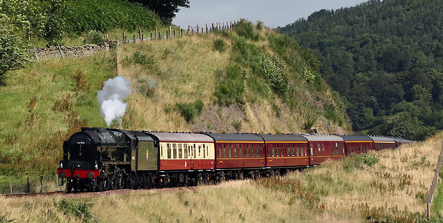
Stow railway station

Stow is a railway station on the Borders Railway, which runs between Edinburgh Waverley and Tweedbank. The station, situated 26 miles 45 chains (43 km...

Stow of Wedale

Stow of Wedale, or more often Stow, is a village in the Scottish Borders area of Scotland (historically Midlothian), 7 miles (11 kilometres) north of...

Stow of Wedale Town Hall

Stow of Wedale Town Hall is a municipal building in Earlston Road, Stow of Wedale, Scottish Borders, Scotland. The structure, which serves as a community...

Allanshaugh

Allanshaugh is a fermtoun in the Scottish Borders area of Scotland. == See also == List of places in the Scottish Borders List of places in Scotland...

Nearby Amenities

Located within 500m of 55.708711,-2.8847704
Created By: Merkaartor 0.12
Lat/Long: 55.7062664/-2.8864431
Noexit: yes
Lat/Long: 55.7071041/-2.8901988
Power: pole
Lat/Long: 55.7125091/-2.8866111
Power: pole
Lat/Long: 55.7116775/-2.8868885
Power: pole
Lat/Long: 55.7108545/-2.887171
Power: pole
Lat/Long: 55.710205/-2.8866722
Power: pole
Lat/Long: 55.7093217/-2.8867893
Power: pole
Lat/Long: 55.7084126/-2.8868911
Power: pole
Lat/Long: 55.7079968/-2.8874637
Power: pole
Lat/Long: 55.7075881/-2.8880414
Power: pole
Lat/Long: 55.7081846/-2.889062
Power: pole
Lat/Long: 55.7085488/-2.8896728
Power: pole
Lat/Long: 55.7091439/-2.8908919
Power: pole
Lat/Long: 55.7097261/-2.8920169
Power: pole
Lat/Long: 55.7059943/-2.8897187
Power: pole
Lat/Long: 55.7054479/-2.8900852
The data included in this document is from www.openstreetmap.org. The data is made available under ODbL.

Have you been to The Craigs Wood?

Leave your review of The Craigs Wood below (or comments, questions and feedback).