How Cleuch

Wood, Forest in Selkirkshire

Scotland

How Cleuch

Rough grazing Hill pasture above Wester Alemoor.
Rough grazing Credit: Richard Webb

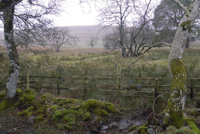
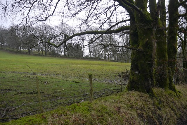
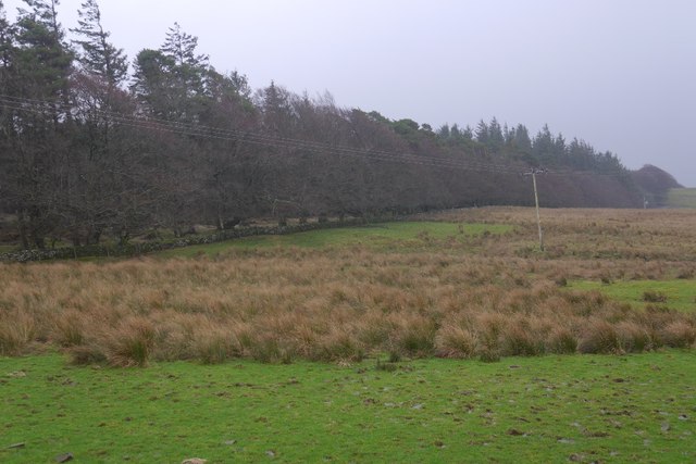
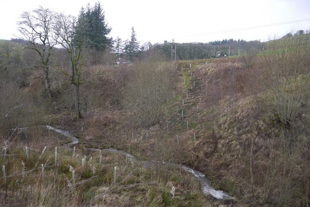
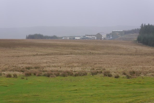
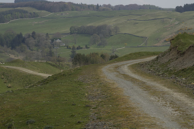
Cleuch, located in Selkirkshire, is an idyllic wooded area that offers a stunning natural landscape to visitors. Nestled in the Scottish Borders region, Cleuch is renowned for its picturesque woodlands and beautiful forests.

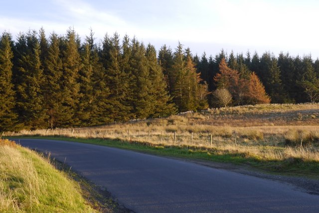
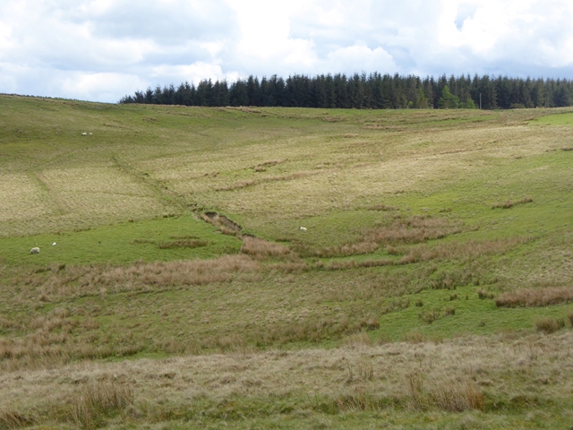
The wooded area of Cleuch is characterized by its diverse range of native tree species, including oak, birch, and pine. These trees create a dense and lush canopy, providing a serene and peaceful environment for nature enthusiasts and hikers alike. The forest floor is carpeted with an array of wildflowers, adding bursts of color to the landscape during the spring and summer months.

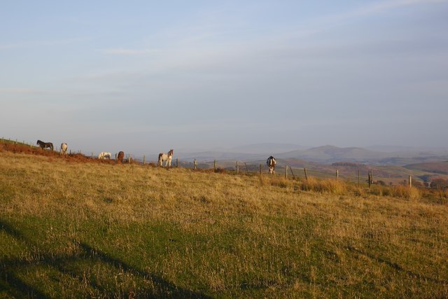
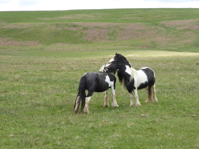
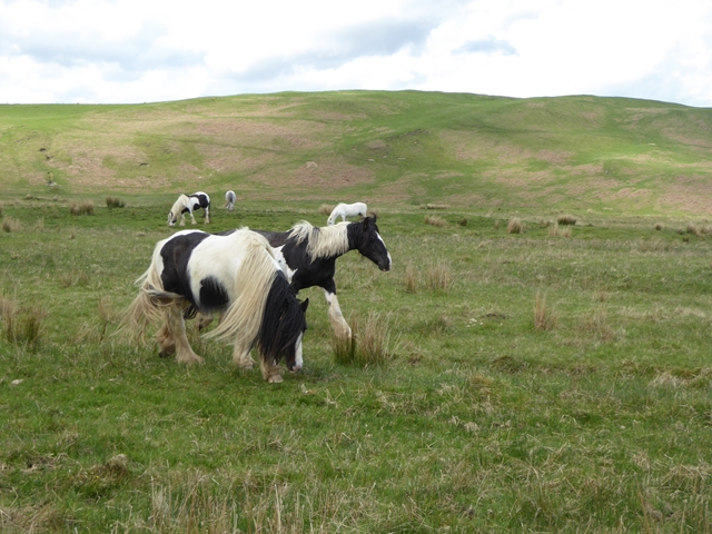
Cleuch is home to several walking trails and hiking routes, allowing visitors to explore its natural beauty at their own pace. These trails offer varying levels of difficulty, catering to both seasoned hikers and casual walkers. The paths wind through the forest, offering glimpses of wildlife such as deer, squirrels, and a variety of bird species.

The woodlands of Cleuch also provide a habitat for an abundance of plant and animal species. It is a designated Site of Special Scientific Interest (SSSI), highlighting its ecological importance and biodiversity. Rare and protected species, such as the red squirrel and the great spotted woodpecker, can be spotted within the forest.

Cleuch is an ideal destination for those seeking tranquility and a connection with nature. Its enchanting woodlands, scenic trails, and diverse wildlife make it a must-visit location for outdoor enthusiasts and nature lovers.

If you have any feedback on the listing, please let us know in the comments section below.

How Cleuch Images

Images are sourced within 2km of 55.416905/-2.9109818 or Grid Reference NT4214. Thanks to Geograph Open Source API. All images are credited.

Rough grazing Hill pasture above Wester Alemoor.
Rough grazing
Hill pasture above Wester Alemoor.
Parkend Plantation B711 passes a small conifer block.
Parkend Plantation
B711 passes a small conifer block.
Firestane Hill signpost Path signed from the B711.
Firestane Hill signpost
Path signed from the B711.
Ordnance Survey Flush Bracket G490 This can be found on the parapet wall of the road bridge at Howcleuch.
For more detail see : <span class="nowrap"><a title="http://www.bench-marks.org.uk/bm13078" rel="nofollow ugc noopener" href="http://www.bench-marks.org.uk/bm13078">Link</a><img style="margin-left:2px;" alt="External link" title="External link - shift click to open in new window" src="https://s1.geograph.org.uk/img/external.png" width="10" height="10"/></span>
Ordnance Survey Flush Bracket G490
This can be found on the parapet wall of the road bridge at Howcleuch. For more detail see : LinkExternal link
Road (B711) and Bridge at Howcleuchshiel Looking eastward.
Road (B711) and Bridge at Howcleuchshiel
Looking eastward.
Wet woodland, Roberton Scattered trees in marshy ground beside the road to Ashkirk.
Wet woodland, Roberton
Scattered trees in marshy ground beside the road to Ashkirk.
Field, Howcleuchshiel
A damp pasture, Borthwickshiels
Glen Burn, Roberton
Glen Burn, Roberton
Waterworks, Borthwickshiels
Hillside above the Alemoor Reservoir The Parkhead Plantation can be seen at the top of the hill.
Hillside above the Alemoor Reservoir
The Parkhead Plantation can be seen at the top of the hill.
Just good friends Two horses on the hillside above Roberton.
Just good friends
Two horses on the hillside above Roberton.
Horses on the hillside above Roberton
The entrance to Parkhill Farm Parkhill Farm seems to be mainly pastoral, with a large number of sheep and some cattle. The cattle were all close to the farm buildings, whereas the sheep were scattered over several fields on the hillside.
The entrance to Parkhill Farm
Parkhill Farm seems to be mainly pastoral, with a large number of sheep and some cattle. The cattle were all close to the farm buildings, whereas the sheep were scattered over several fields on the hillside.
Parkhill Farm buildings The barn, half full of bales, with other buildings in the background.
Parkhill Farm buildings
The barn, half full of bales, with other buildings in the background.
Moorland and fields of Parkhill farm It is not clear where the land for Parkhill ends but I think this grassland and moorland is part of that far,
Moorland and fields of Parkhill farm
It is not clear where the land for Parkhill ends but I think this grassland and moorland is part of that far,
The track forks The track is part of the Reivers Way and if you go straight ahead you will get to Roberton.
The track forks
The track is part of the Reivers Way and if you go straight ahead you will get to Roberton.
The Reivers Path This path is well maintained. It has a stone surface and is good for walking and is also used by cyclists.
The Reivers Path
This path is well maintained. It has a stone surface and is good for walking and is also used by cyclists.
Show me another place!

How Cleuch is located at Grid Ref: NT4214 (Lat: 55.416905, Lng: -2.9109818)

Unitary Authority: The Scottish Borders

Police Authority: The Lothians and Scottish Borders

What 3 Words

///voltage.disprove.lashed. Near Hawick, Scottish Borders

Nearby Locations

How Cleuch

Related Wikis

Roberton, Scottish Borders

Roberton is a small village in the Scottish Borders area of Scotland, on the B711 and near to the A7, 5 miles (8 kilometres) from Hawick, 22 mi (35 km...

Burnfoot, Roberton

Burnfoot (Scottish Gaelic: Bun na h-Aibhne) is a hamlet in the Scottish Borders area of Scotland, close to Roberton, by the Borthwick Water. The nearest...

Harden Castle

Harden Castle is a 16th century tower house, about 3.5 miles (5.6 km) west of Hawick, Scottish Borders. It is alternatively known as Harden House or Harden...

Alemoor Loch

Alemoor Loch, also known as Alemoor Reservoir, is a small reservoir in the Scottish Borders area of Scotland. It is situated on the Ale Water, 10 kilometres...

Newmill-on-Teviot

Newmill-on-Teviot, commonly called Newmill, is a hamlet in the Scottish Borders, 7 kilometres (4.3 mi) south of Hawick on the River Teviot. The remains...

Branxholme Castle

Branxholme Castle is a five-storey tower at Branxholme, about 3 miles south-west of Hawick in the Borders region of Scotland. == History == The present...

Branxholme

Branxholme is a hamlet in the Scottish Borders area of Scotland, overlooking the River Teviot, three miles southwest of Hawick, on the A7 road to Langholm...

Borthwick Water

The Borthwick Water (Border Scots: Borthwick Witter) is a river in the Scottish Borders area of Scotland, and a tributary of the River Teviot. The Aithouse...

Nearby Amenities

Located within 500m of 55.416905,-2.9109818
Telephone
Booth: K6
Covered: booth
Source: survey
Lat/Long: 55.414831/-2.9111439
Power: pole
Lat/Long: 55.4203586/-2.9074554
Power: pole
Lat/Long: 55.4202124/-2.9084693
Power: pole
Lat/Long: 55.420048/-2.9097138
Power: pole
Lat/Long: 55.4198562/-2.9110603
Power: pole
Lat/Long: 55.4196522/-2.9123531
Power: pole
Lat/Long: 55.4191011/-2.912396
Power: pole
Lat/Long: 55.4177297/-2.9187323
Power: pole
Lat/Long: 55.4182588/-2.9177615
Power: pole
Lat/Long: 55.4185321/-2.9172594
Power: pole
Lat/Long: 55.418801/-2.916456
Power: pole
Lat/Long: 55.4189603/-2.915408
Power: pole
Lat/Long: 55.4194148/-2.9143626
Power: pole
Lat/Long: 55.4195055/-2.9136004
Power: pole
Lat/Long: 55.4203107/-2.9129283
Power: pole
Lat/Long: 55.4207155/-2.913312
Power: pole
Lat/Long: 55.417828/-2.9169208
Power: pole
Lat/Long: 55.4177272/-2.9167431
Power: pole
Lat/Long: 55.4173457/-2.9160118
Power: pole
Lat/Long: 55.416897/-2.9151518
Power: pole
Lat/Long: 55.4165214/-2.9144385
Power: pole
Lat/Long: 55.4160625/-2.9135785
Power: pole
Lat/Long: 55.4156065/-2.912685
Power: pole
Lat/Long: 55.4152308/-2.9119563
Power: pole
Lat/Long: 55.4148976/-2.9113177
Power: pole
Lat/Long: 55.4146096/-2.9107615
Power: pole
Lat/Long: 55.4140308/-2.9112404
Power: pole
Lat/Long: 55.4134754/-2.9116988
Power: pole
Lat/Long: 55.4128527/-2.9122498
The data included in this document is from www.openstreetmap.org. The data is made available under ODbL.

Have you been to How Cleuch?

Leave your review of How Cleuch below (or comments, questions and feedback).