Back Braes

Wood, Forest in East Lothian

Scotland

Back Braes

Railway path, Ormiston The site of Ormiston Station, land here has been put to good use as a garden.
Railway path, Ormiston Credit: Richard Webb

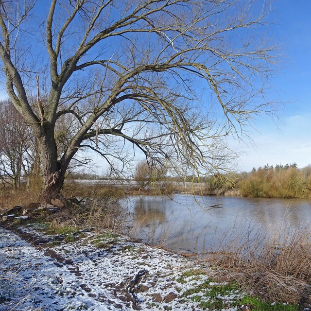
Back Braes is a picturesque woodland area located in East Lothian, Scotland. It is known for its dense forest and stunning natural beauty, making it a popular destination for nature lovers and outdoor enthusiasts. The area spans across a vast expanse of land, providing ample space for exploration and recreational activities.

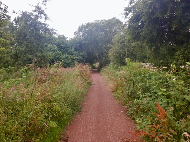
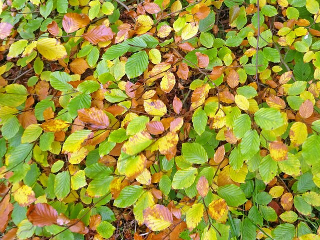
The woodland consists mainly of native tree species, such as oak, birch, and beech, which create a vibrant and diverse ecosystem. The foliage is particularly enchanting during the autumn months when the leaves display a kaleidoscope of colors, attracting visitors from far and wide.

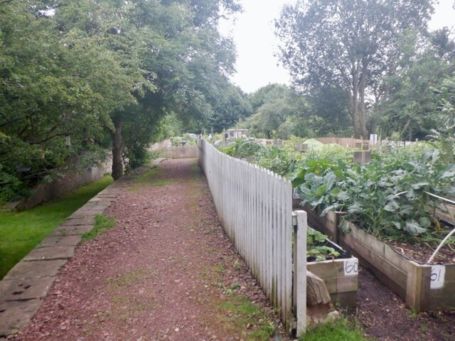
Back Braes offers a network of well-maintained trails and paths, making it easy for visitors to navigate through the forest. These trails cater to a range of fitness levels, from leisurely strolls to more challenging hikes, ensuring that there is something for everyone. Along the way, visitors may encounter various wildlife species, including deer, squirrels, and a wide variety of birds.

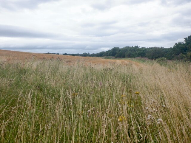
The woodland also features several picnic areas and viewpoints, allowing visitors to relax and enjoy the peaceful surroundings. From these vantage points, one can admire panoramic views of the surrounding countryside, with rolling hills and distant coastal vistas adding to the charm of the area.

Back Braes is a place where visitors can escape the hustle and bustle of everyday life and immerse themselves in the tranquility of nature. Whether it be a leisurely walk, a family picnic, or a photography expedition, this woodland sanctuary offers a serene and captivating experience for all who visit.

If you have any feedback on the listing, please let us know in the comments section below.
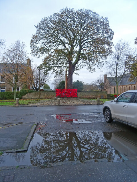
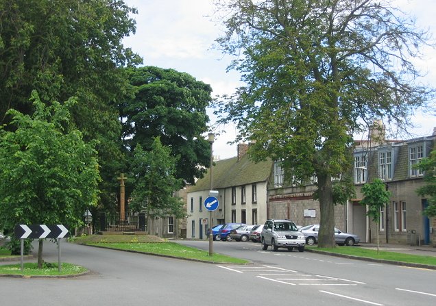
Back Braes Images

Images are sourced within 2km of 55.900998/-2.9440006 or Grid Reference NT4167. Thanks to Geograph Open Source API. All images are credited.

Railway path, Ormiston The site of Ormiston Station, land here has been put to good use as a garden.
Railway path, Ormiston
The site of Ormiston Station, land here has been put to good use as a garden.
Wheat field, Ormiston
Ormiston Station The site of Ormiston Station, land here has been put to good use as a garden.
Ormiston Station
The site of Ormiston Station, land here has been put to good use as a garden.
Autumn Palette A palette of greens, browns, yellows on this beech tree show that autumn is well under way.
Almost exactly a year since this more general view in the same location was taken:-
<a title="https://www.geograph.org.uk/photo/6661199" href="https://www.geograph.org.uk/photo/6661199">Link</a>
Autumn Palette
A palette of greens, browns, yellows on this beech tree show that autumn is well under way. Almost exactly a year since this more general view in the same location was taken:- Link
Fallen Remembered Poignant silhouette of soldier on the door of Ormiston Parish Church. Taken on remembrance day not long before 11am.
Fallen Remembered
Poignant silhouette of soldier on the door of Ormiston Parish Church. Taken on remembrance day not long before 11am.
Winter Willow The remaining venerable and glorious Willow near Ormiston on the Winton Estate with a dusting of late winter snow on the ground. You can just about make out the remains of the other Willow blown down by gales in late summer 2020.
Clearer picture of the cut trunk seen here:-
<a title="https://www.geograph.org.uk/photo/6683953" href="https://www.geograph.org.uk/photo/6683953">Link</a>
Winter Willow
The remaining venerable and glorious Willow near Ormiston on the Winton Estate with a dusting of late winter snow on the ground. You can just about make out the remains of the other Willow blown down by gales in late summer 2020. Clearer picture of the cut trunk seen here:- Link
Bellyford Burn After the hottest day in Scotland since records began it is slightly cooler but still too hot to be in the sun. A walk beside the Bellyford Burn on the trackbed of the former Gifford and Garvald Railway means there is water for the dog and shade for me. Here the Bellyford Burn runs through a culvert beside the old railway bridge north of Ormiston.
Bellyford Burn
After the hottest day in Scotland since records began it is slightly cooler but still too hot to be in the sun. A walk beside the Bellyford Burn on the trackbed of the former Gifford and Garvald Railway means there is water for the dog and shade for me. Here the Bellyford Burn runs through a culvert beside the old railway bridge north of Ormiston.
Limeylands Road, Ormiston Ormiston is expanding here.
Limeylands Road, Ormiston
Ormiston is expanding here.
Wildflower Crescent Wildflowers replaced by a biggish housing development, Ormiston.
Wildflower Crescent
Wildflowers replaced by a biggish housing development, Ormiston.
Scrub off Limeylands Road Presumably awaiting development and probably a legacy of the coalfield - some of the land once was used as a railway siding.
Scrub off Limeylands Road
Presumably awaiting development and probably a legacy of the coalfield - some of the land once was used as a railway siding.
Juniper Avenue New houses, Ormiston.
Juniper Avenue
New houses, Ormiston.
The current edge of Ormiston Limeylands Road, where a mineral railway once crossed.
The current edge of Ormiston
Limeylands Road, where a mineral railway once crossed.
Temporary road, The Murrays Work on the power line.
Temporary road, The Murrays
Work on the power line.
Power lines, The Murrays A complex arrangement of power lines one currently being refurbished.
Power lines, The Murrays
A complex arrangement of power lines one currently being refurbished.
Ormiston Mains
Ormiston Mains
Road, Templehall Today's road closure turned out to be a false alarm. Appears that they got the chipseal down with time to spare.
Road, Templehall
Today's road closure turned out to be a false alarm. Appears that they got the chipseal down with time to spare.
Ormiston Cross Ormiston Cross with remembrance poppies round the outside. A magnificent Sycamore is partly reflected in some of the flood waters after 24 hours plus of heavy rain.
Ormiston Cross
Ormiston Cross with remembrance poppies round the outside. A magnificent Sycamore is partly reflected in some of the flood waters after 24 hours plus of heavy rain.
Colliery site, Ormiston Wetland on what was once sidings and pithead buildings.
Colliery site, Ormiston
Wetland on what was once sidings and pithead buildings.
Show me another place!

Back Braes is located at Grid Ref: NT4167 (Lat: 55.900998, Lng: -2.9440006)

Unitary Authority: East Lothian

Police Authority: The Lothians and Scottish Borders

What 3 Words

///cocktail.airbase.posting. Near Ormiston, East Lothian

Nearby Locations

Back Braes Glen Wood

Related Wikis

Ormiston Castle

Ormiston Castle is a ruined 16th-century tower house, about 4 miles (6.4 km) east of Dalkeith, East Lothian, Scotland, and north of Ormiston Mains.It was...

Ormiston Primrose F.C.

Ormiston Primrose Football Club is a senior football club based in Ormiston, East Lothian, currently competing in the East of Scotland League Second Division...

Ormiston

Ormiston is a village in East Lothian, Scotland, near Tranent, Humbie, Pencaitland and Cranston, located on the north bank of the River Tyne at an elevation...

Ormiston railway station, Scotland

Ormiston railway station served the village of Ormiston, East Lothian, Scotland, from 1872 to 1933 on the Macmerry Branch. == History == The station was...

Nearby Amenities

Located within 500m of 55.900998,-2.9440006
Grave Yard
Ormiston Church Graveyard (Site of)
Lat/Long: 55.8972855/-2.9430541
Ormiston Church
Historic: ruins
Source: https://canmore.org.uk/site/54722/ormiston-hall-st-giles-church-and-churchyard
Lat/Long: 55.8977455/-2.9429036
Ormiston Hall
Historic: ruins
Source: NLS-OS-NatGrid-12500-1940-60-singles
Url: https://canmore.org.uk/site/54722/ormiston-hall-st-giles-church-and-churchyard
Lat/Long: 55.8989755/-2.9414611
Power: pole
Lat/Long: 55.8989918/-2.9502154
Power: pole
Lat/Long: 55.8995876/-2.9493298
Power: pole
Lat/Long: 55.9001717/-2.9484422
Power: pole
Lat/Long: 55.9007605/-2.947565
Power: pole
Lat/Long: 55.9013609/-2.9466836
Power: pole
Lat/Long: 55.9009602/-2.9450437
Power: pole
Lat/Long: 55.9012686/-2.9465481
Power: pole
Lat/Long: 55.9018399/-2.9474087
Power: pole
Lat/Long: 55.9024484/-2.9483651
Power: pole
Lat/Long: 55.9030757/-2.9497132
Power: pole
Lat/Long: 55.9038513/-2.9496466
Power: pole
Lat/Long: 55.9029185/-2.9419737
Power: pole
Lat/Long: 55.902714/-2.9412485
Power: pole
Lat/Long: 55.9024956/-2.9405588
Power: pole
Lat/Long: 55.9033857/-2.9391919
Power: pole
Lat/Long: 55.9039627/-2.9387877
The data included in this document is from www.openstreetmap.org. The data is made available under ODbL.

Have you been to Back Braes?

Leave your review of Back Braes below (or comments, questions and feedback).