Bar Wood

Wood, Forest in Dumfriesshire

Scotland

Bar Wood

A7 north of Langholm - evening light
A7 north of Langholm - evening light Credit: Peter Moore

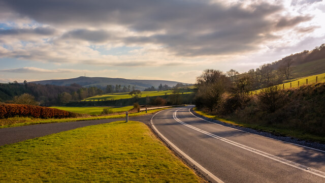
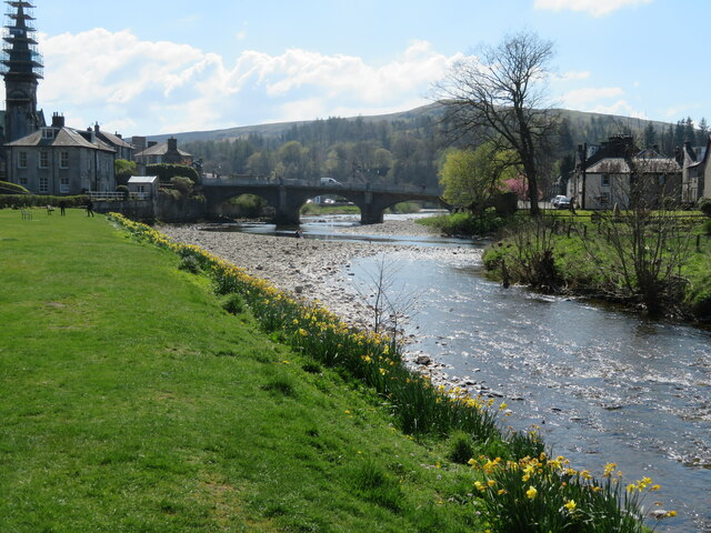
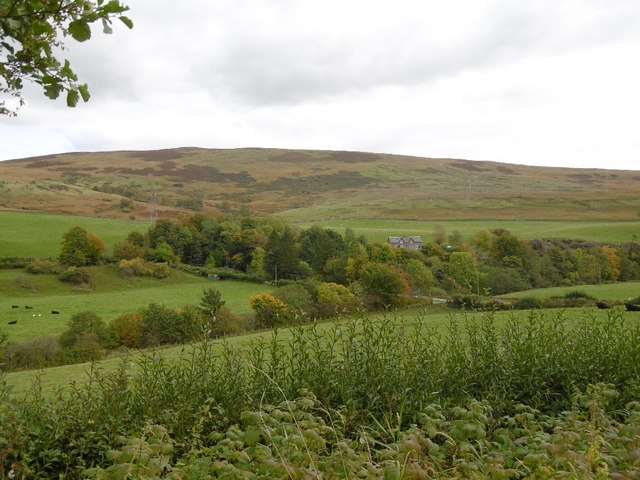
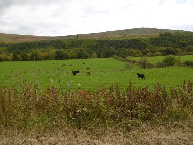
Bar Wood is a picturesque forest situated in Dumfriesshire, Scotland. Covering an area of approximately 100 hectares, it is located on the outskirts of the small village of Wood. The wood is known for its tranquil and untouched beauty, attracting nature enthusiasts and hikers alike.

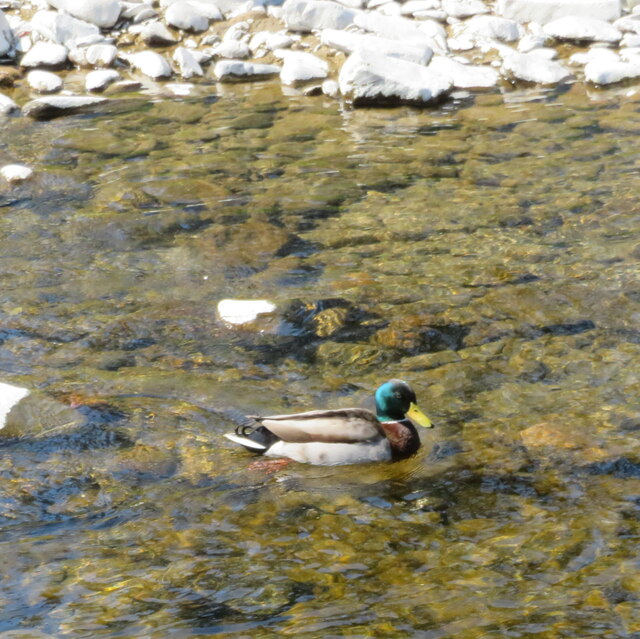
The forest is predominantly composed of native broadleaf trees such as oak, birch, and beech, creating a diverse and vibrant ecosystem. The canopy provides a habitat for a wide range of bird species, including woodpeckers, owls, and songbirds. Visitors may also spot various mammals, such as red squirrels, deer, and foxes, as they wander through the woodland.

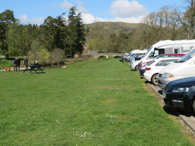
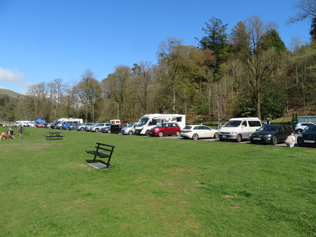
Bar Wood offers a network of well-maintained walking trails, allowing visitors to explore its natural wonders at their own pace. These trails wind through the forest, leading to charming viewpoints, cascading streams, and hidden clearings. The peaceful atmosphere and stunning scenery make it an ideal destination for those seeking solitude and a connection with nature.

The forest is managed by a local conservation trust, which strives to protect and preserve the delicate balance of its ecosystem. They organize educational programs and guided walks, aiming to raise awareness about the importance of sustainable forest management and the diverse wildlife that calls Bar Wood its home.

Bar Wood is a hidden gem in Dumfriesshire, offering an escape from the hustle and bustle of everyday life. Its rustic charm and natural beauty make it a must-visit destination for anyone seeking a tranquil retreat in the heart of Scotland.

If you have any feedback on the listing, please let us know in the comments section below.
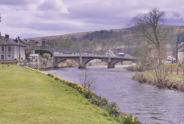
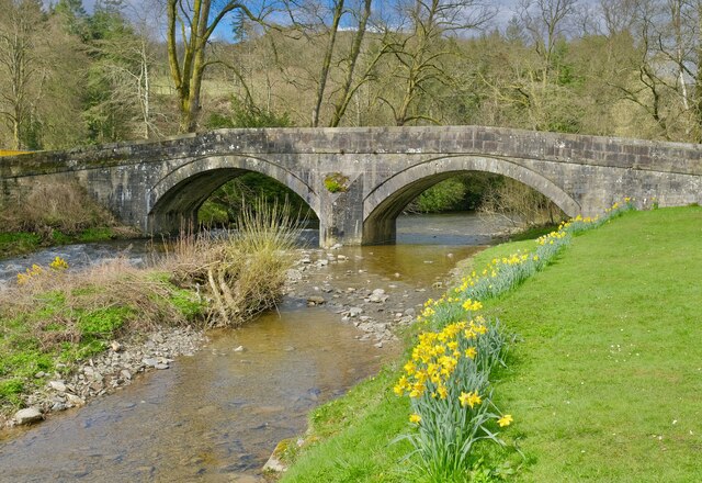
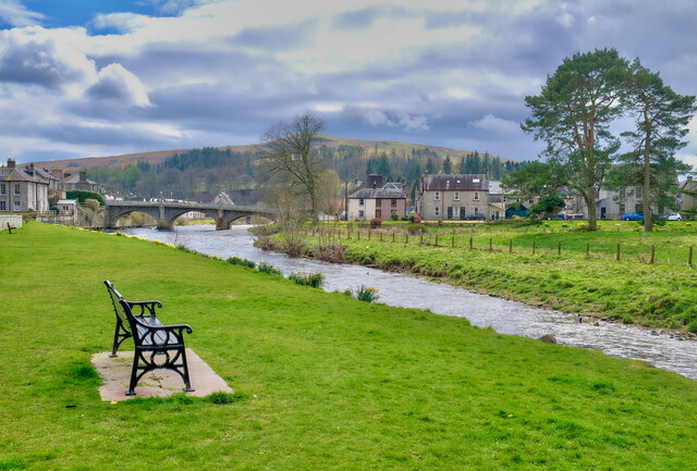
Bar Wood Images

Images are sourced within 2km of 55.156413/-2.9983978 or Grid Reference NY3685. Thanks to Geograph Open Source API. All images are credited.

A7 north of Langholm - evening light
Spire, bridge and tree in Langholm
Car park and picnic place at Langholm A handy stop on the A7 by the Ewes Water, just before it joins the River Esk.
Car park and picnic place at Langholm
A handy stop on the A7 by the Ewes Water, just before it joins the River Esk.
Drake Mallard at Langholm A male Anas platyrhynchos on the Ewes Water.
Drake Mallard at Langholm
A male Anas platyrhynchos on the Ewes Water.
The confluence of the River Esk and Ewes Water The River Esk comes in from the right, by the gravel spit, and the Ewes Water, in the foreground, loses its identity as it flows under the Townhead Bridge as part of the Esk.
The confluence of the River Esk and Ewes Water
The River Esk comes in from the right, by the gravel spit, and the Ewes Water, in the foreground, loses its identity as it flows under the Townhead Bridge as part of the Esk.
Car park at Langholm Conveniently situated on the A7 between the Ewes Water and Bar Wood.
Car park at Langholm
Conveniently situated on the A7 between the Ewes Water and Bar Wood.
Kirk Wynd View Taken from the top of Kirk Wynd looking over the town of Langholm.
Kirk Wynd View
Taken from the top of Kirk Wynd looking over the town of Langholm.
Whitshiels Cafe, Langholm
At Langholm Bridge over the river Esk
At Langholm
Bridge over the river Esk
Ewes Bridge Langholm
Ewes Bridge
Langholm
The River Esk Langholm
The River Esk
Langholm
Moorland dropping into Whitshiels Bog and Ewes Water valley
Footsburn, Ewesdale
Footsburn, Ewesdale
Cattle, Ewesdale The Malcolm Monument on the skyline: Langholm is approaching.
Cattle, Ewesdale
The Malcolm Monument on the skyline: Langholm is approaching.
Milntown Home of Langholm RFC.
Milntown
Home of Langholm RFC.
Langholm approaching The latest edition of Langholm's relativistic road sign.  Please allow the scenery to pass at 13.4ms^-1 or less. Thank you.
Langholm approaching
The latest edition of Langholm's relativistic road sign. Please allow the scenery to pass at 13.4ms^-1 or less. Thank you.
Eskdale Hotel, Langholm
Pelosis Corner Cafe My spell checker keeps throwing in an apostrophe which is probably correct. Centre of Langholm.
Pelosis Corner Cafe
My spell checker keeps throwing in an apostrophe which is probably correct. Centre of Langholm.
Show me another place!

Bar Wood is located at Grid Ref: NY3685 (Lat: 55.156413, Lng: -2.9983978)

Unitary Authority: Dumfries and Galloway

Police Authority: Dumfries and Galloway

What 3 Words

///embers.trim.beakers. Near Langholm, Dumfries & Galloway

Nearby Locations

Bar Wood

Related Wikis

Langholm Academy

Langholm Academy is a non-denominational, co-educational six-year comprehensive secondary school in Langholm, Scotland. Currently, the school has 240 pupils...
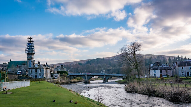
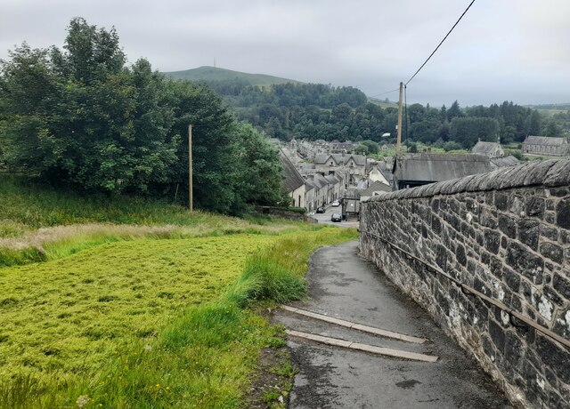
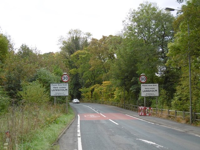
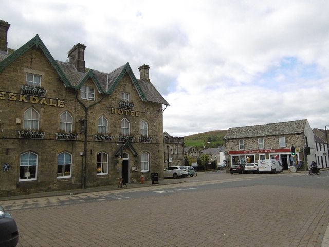
Langholm

Langholm , also known colloquially as the "Muckle Toon", is a burgh in Dumfries and Galloway, southern Scotland. Langholm lies between four hills in the...

Thomas Hope Hospital

Thomas Hope Hospital is a health facility in Strand Street, Langholm, Dumfries and Galloway, Scotland. It is managed by NHS Dumfries and Galloway. ��2...

Langholm Town Hall

Langholm Town Hall is a municipal building in the High Street in Langholm, Dumfries and Galloway, Scotland. The structure, which is used as a community...

Battle of Arkinholm

The Battle of Arkinholm was fought on 1 May 1455, at Arkinholm near Langholm in Scotland, during the reign of King James II of Scotland. Although a small...

Langholm railway station

Langholm railway station served the burgh of Langholm, Dumfries and Galloway, Scotland from 1864 to 1967 on the Border Union Railway. == History == The...

Duchess Bridge

The Duchess Bridge is a cast iron footbridge over the River Esk in Dumfries and Galloway, Scotland. It was built for Charles Montagu-Scott, 4th Duke of...

Wauchope Castle

Wauchope Castle was a castle located at Wauchope, in Dumfries and Galloway, Scotland. The castle was a stronghold of the Lindsay family. It was the caput...

Nearby Amenities

Located within 500m of 55.156413,-2.9983978
Bus Stop
Langholm Park
Bus: yes
Naptan AtcoCode: 680000217501
Naptan Bearing: S
Naptan CommonName: Park
Naptan Indicator: opp Entrance
Naptan NaptanCode: 34237567
Naptan Street: High Street
Public Transport: platform
Ref: 680000217501
Source: NaPTAN
Lat/Long: 55.1527286/-3.0002277
Bus Stop
Park
Naptan AtcoCode: 680000217502
Naptan Bearing: N
Naptan CommonName: Park
Naptan Indicator: At Entrance
Naptan Landmark: Thomas Telford Road
Naptan NaptanCode: 34238958
Naptan Street: High Street
Naptan Verified: no
Shelter: no
Source: naptan_import
Lat/Long: 55.1534682/-3.0002338
Bus Stop
Rugby Club
Naptan AtcoCode: 680000653111
Naptan Bearing: N
Naptan BusStopType: CUS
Naptan CommonName: Rugby Club
Naptan Indicator: at Cafe
Naptan Landmark: Rugby Club
Naptan NaptanCode: 34237568
Naptan Notes: none
Naptan Street: A7
Naptan Verified: no
Public Transport: platform
Source: naptan_import
Lat/Long: 55.1590754/-2.9969996
Bus Stop
Rugby Club
Bus: yes
Naptan AtcoCode: 680000653222
Naptan Bearing: S
Naptan CommonName: Rugby Club
Naptan Indicator: opp Cafe
Naptan NaptanCode: 34237569
Naptan Street: A7
Public Transport: platform
Ref: 680000653222
Source: NaPTAN
Lat/Long: 55.1589553/-2.9969295
Toilets
Source: Bing
Toilets Disposal: flush
Unisex: yes
Lat/Long: 55.1537375/-3.0002666
Langholm
Whitewater: put_in
Lat/Long: 55.1542863/-3.000983
Addr Housenumber: 9
Addr Street: High Street
Lat/Long: 55.1523287/-3.0002077
Addr Housenumber: 11
Addr Street: High Street
Entrance: main
Lat/Long: 55.1522095/-3.0003299
Addr Housenumber: 10
Addr Street: High Street
Entrance: main
Lat/Long: 55.1521025/-3.0005112
Langholm Castle
Historic: fort
Lat/Long: 55.1547241/-3.0031765
Information: guidepost
Tourism: information
Lat/Long: 55.1554157/-3.0007166
Tourism: artwork
Lat/Long: 55.1580502/-2.9975302
Defibrillator
Emergency: defibrillator
Indoor: no
Lat/Long: 55.15312/-3.0036907
Power: pole
Lat/Long: 55.1564792/-2.9993653
Power: pole
Lat/Long: 55.1557671/-2.9975062
Power: pole
Lat/Long: 55.1558018/-2.9958994
Power: pole
Lat/Long: 55.1558215/-2.9949879
Power: pole
Lat/Long: 55.1558657/-2.9933193
Power: pole
Lat/Long: 55.155901/-2.9916353
Power: pole
Lat/Long: 55.1559216/-2.9909169
Power: pole
Lat/Long: 55.1560643/-2.9957321
Power: pole
Lat/Long: 55.1569058/-2.9951836
Power: pole
Lat/Long: 55.157431/-2.9946969
Power: pole
Lat/Long: 55.1579297/-2.9942412
Power: pole
Lat/Long: 55.1575884/-2.9986701
Power: pole
Lat/Long: 55.1580606/-2.9984151
Power: pole
Lat/Long: 55.1586549/-2.9980881
Power: pole
Lat/Long: 55.1593434/-2.9976221
Power: pole
Lat/Long: 55.1597067/-2.9969243
Power: pole
Lat/Long: 55.160504/-2.9955647
Rugby Club
Bus: yes
Public Transport: stop_position
Lat/Long: 55.1589969/-2.9969917
The data included in this document is from www.openstreetmap.org. The data is made available under ODbL.

Have you been to Bar Wood?

Leave your review of Bar Wood below (or comments, questions and feedback).