Black Bog Wood

Wood, Forest in Midlothian

Scotland

Black Bog Wood

Dubious doorway, Currie House Beyond is an extended garden, the danger however is obvious.
Dubious doorway, Currie House Credit: Richard Webb

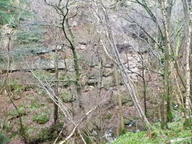
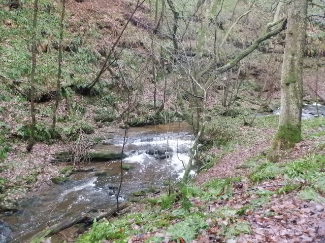
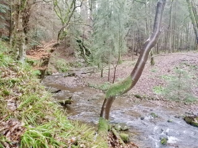
Black Bog Wood is a stunning forest located in Midlothian, Scotland. Covering an area of approximately 50 hectares, this woodland is known for its unique and diverse ecosystem. The forest is situated within a low-lying, boggy area, hence its name.

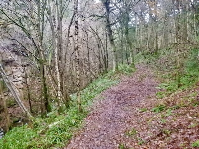
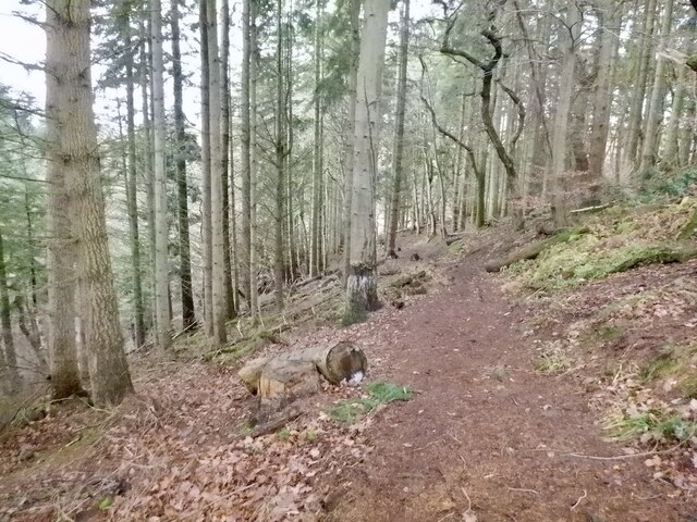
The dominant tree species in Black Bog Wood is the Scots pine, which provides a picturesque backdrop with its tall, straight trunks and thick canopy. These pines are interspersed with birch, oak, and rowan trees, adding to the richness and diversity of the woodland. The forest floor is carpeted with a variety of mosses, ferns, and wildflowers, creating a lush undergrowth.

Black Bog Wood is home to a wide range of wildlife. The forest provides an ideal habitat for numerous bird species, including woodpeckers, owls, and various songbirds. Red squirrels can often be spotted darting through the trees, while roe deer can be observed grazing in the quieter areas of the woodland. The boggy terrain also supports a variety of amphibians, such as frogs and newts.

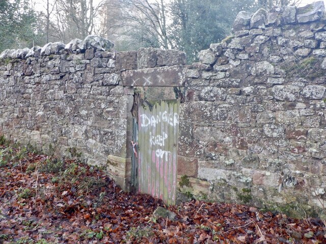
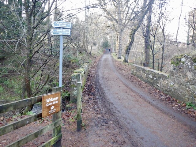
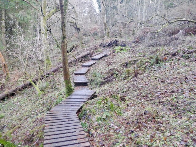
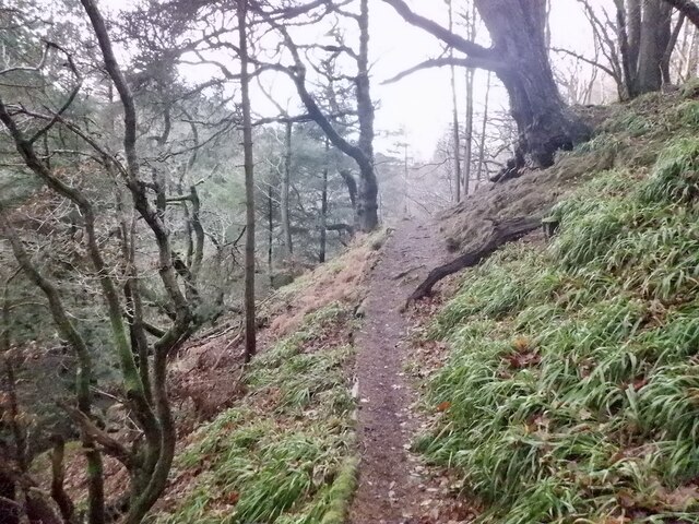
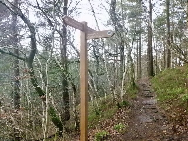
Visitors to Black Bog Wood can explore the forest via several well-maintained walking trails. These trails offer breathtaking views of the surrounding landscape and provide opportunities for nature photography and birdwatching. The forest is also a popular destination for nature enthusiasts and researchers studying the diverse flora and fauna of the region.

In summary, Black Bog Wood in Midlothian is a captivating forest, offering a rich tapestry of plant and animal life. Its tranquil ambiance and picturesque scenery make it a must-visit destination for nature lovers and outdoor enthusiasts.

If you have any feedback on the listing, please let us know in the comments section below.

Black Bog Wood Images

Images are sourced within 2km of 55.824991/-3.0280356 or Grid Reference NT3559. Thanks to Geograph Open Source API. All images are credited.

Dubious doorway, Currie House Beyond is an extended garden, the danger however is obvious.
Dubious doorway, Currie House
Beyond is an extended garden, the danger however is obvious.
Currie Bridge Crossing Middleton South Burn / Gore Water by Borthwick Castle. There are two path entrances here which form a 2km loop of high quality woodland and gorge scenery.
Currie Bridge
Crossing Middleton South Burn / Gore Water by Borthwick Castle. There are two path entrances here which form a 2km loop of high quality woodland and gorge scenery.
Path, Currie Wood The rougher south side of the loop in Currie Wood.
Path, Currie Wood
The rougher south side of the loop in Currie Wood.
Path, Currie Wood There is a fair bit of high quality non slip decking over wet areas in the southern side of the wood.
Path, Currie Wood
There is a fair bit of high quality non slip decking over wet areas in the southern side of the wood.
Crag, Currie Wood North side of the gorge.
Crag, Currie Wood
North side of the gorge.
Path, Currie Wood A good quality path loops around the Woodland Trust maintained gorge.
Path, Currie Wood
A good quality path loops around the Woodland Trust maintained gorge.
Middleton South Burn In Currie Wood
Middleton South Burn
In Currie Wood
Path, Currie Wood The path on the north side is more exposed and narrower than the south side of the burn, but well surfaced and very enjoyable.
Path, Currie Wood
The path on the north side is more exposed and narrower than the south side of the burn, but well surfaced and very enjoyable.
Signpost, Currie Wood A path to Crichton leaves the Woodland Trust's loop of the dean.
Signpost, Currie Wood
A path to Crichton leaves the Woodland Trust's loop of the dean.
Currie Wood Some conifers have been felled here to protect older shaded oaks. The conifers were planted in the early 1960s by the Forestry Commission and the Woodland Trust who now manage the wood are trying to restore the native woodland.
Currie Wood
Some conifers have been felled here to protect older shaded oaks. The conifers were planted in the early 1960s by the Forestry Commission and the Woodland Trust who now manage the wood are trying to restore the native woodland.
Middleton South Burn In Currie Wood
Middleton South Burn
In Currie Wood
A7 towards Gorebridge
West from Borthwick Bank Looking to Borthwick Castle with the valley of the Gore Water beyond and the Pentland Hills on the horizon.
West from Borthwick Bank
Looking to Borthwick Castle with the valley of the Gore Water beyond and the Pentland Hills on the horizon.
Halkerston farm buildings
Cemex - Temple Quarry Part of Middleton Lime Works. An aerial view of this site is at <a href="https://www.geograph.org.uk/photo/2107527">NT3558 : Middleton lime works and quarry</a>.
Cemex - Temple Quarry
Part of Middleton Lime Works. An aerial view of this site is at NT3558 : Middleton lime works and quarry.
Fields at Haughhead Looking across to Catcune House.
Fields at Haughhead
Looking across to Catcune House.
Path in The Cleuch at North Middleton This was the A7 Edinburgh-Carlisle trunk route until replaced by road improvements. Note the cat's-eye in the left foreground. This cleuch can be seen in the top left of the aerial view <a href="https://www.geograph.org.uk/photo/2107527">NT3558 : Middleton lime works and quarry</a>.
Path in The Cleuch at North Middleton
This was the A7 Edinburgh-Carlisle trunk route until replaced by road improvements. Note the cat's-eye in the left foreground. This cleuch can be seen in the top left of the aerial view NT3558 : Middleton lime works and quarry.
Borthwick Farm And bridge over the Gore Water. Other views for comparison, 4 and 6 years earlier, are <a href="https://www.geograph.org.uk/photo/608186">NT3659 : Borthwick Farm and the bridge over Gore Water</a> and <a href="https://www.geograph.org.uk/photo/105951">NT3659 : Borthwick village</a>.
Borthwick Farm
And bridge over the Gore Water. Other views for comparison, 4 and 6 years earlier, are NT3659 : Borthwick Farm and the bridge over Gore Water and NT3659 : Borthwick village.
Show me another place!

Black Bog Wood is located at Grid Ref: NT3559 (Lat: 55.824991, Lng: -3.0280356)

Unitary Authority: Midlothian

Police Authority: The Lothians and Scottish Borders

What 3 Words

///memo.strongly.dorms. Near Gorebridge, Midlothian

Related Wikis

North Middleton, Midlothian

North Middleton is a village in the civil parish of Borthwick, Midlothian, Scotland. Outlying hamlets include Borthwick and Middleton. == References... ==

Fushiebridge railway station

Fushiebridge railway station served the area of Fushiebridge, Gorebridge, from 1847 to 1959 on the Waverley Route. == History == The station opened on...

Catcune Castle

Catcune Castle was a castle around 1 mile (1.6 km) south of Gorebridge, north of the Gore Water, in Midlothian, Scotland. == History == This was originally...

Borthwick

Borthwick is a hamlet, parish and stream in Midlothian, Scotland. The parish includes the 15th century Borthwick Castle, which is to the east of the village...

Borthwick Castle

Borthwick Castle is one of the largest and best-preserved surviving medieval Scottish fortifications. It is located twelve miles (19 km) south-east of...

Arniston, Midlothian

Arniston is a village in Midlothian, Scotland. == People from Arniston == The plant collector, David Bowman, was born in Arniston in 1838. == See also... ==

Birkenside, Midlothian

Birkenside is a village, adjacent to the A7 road, at the south of Gorebridge in Midlothian, Scotland. == See also == List of places in Midlothian List...

Gorebridge railway station

Gorebridge is a railway station on the Borders Railway, which runs between Edinburgh Waverley and Tweedbank. The station, situated 11 miles 77 chains...

Nearby Amenities

Located within 500m of 55.824991,-3.0280356
Power: pole
Lat/Long: 55.8277929/-3.0312602
Power: pole
Lat/Long: 55.8286426/-3.0298558
Material: wood
Power: pole
Lat/Long: 55.8286929/-3.0305267
Power: pole
Lat/Long: 55.8292956/-3.0300329
Power: pole
Lat/Long: 55.8250077/-3.0314115
Power: pole
Lat/Long: 55.8245111/-3.0309205
Power: pole
Lat/Long: 55.8237678/-3.0302746
Power: pole
Lat/Long: 55.8230386/-3.0296057
Power: pole
Lat/Long: 55.8223023/-3.0289327
Power: pole
Lat/Long: 55.8257599/-3.0320436
Power: pole
Lat/Long: 55.8265336/-3.0313664
Power: pole
Lat/Long: 55.8272639/-3.030733
Power: pole
Lat/Long: 55.8215263/-3.0283347
Power: pole
Lat/Long: 55.8208368/-3.0278075
Power: pole
Lat/Long: 55.821243/-3.0295099
Power: pole
Lat/Long: 55.820955/-3.0306934
Power: pole
Lat/Long: 55.8283055/-3.0318144
Material: wood
Power: pole
Lat/Long: 55.828441/-3.030732
Power: pole
Lat/Long: 55.826001/-3.0209761
Power: pole
Lat/Long: 55.8260678/-3.0222534
Power: pole
Lat/Long: 55.8261228/-3.023537
Power: pole
Lat/Long: 55.8261942/-3.0247664
Power: pole
Lat/Long: 55.826248/-3.026052
Power: pole
Lat/Long: 55.8263042/-3.0273126
Power: pole
Lat/Long: 55.8263615/-3.0285566
Power: pole
Lat/Long: 55.826447/-3.0298714
Generator Method: photovoltaic
Generator Output Hot Water: yes
Generator Source: solar
Generator Type: solar_photovoltaic_panel
Power: generator
Lat/Long: 55.8208821/-3.024821
Generator Method: photovoltaic
Generator Output Hot Water: yes
Generator Source: solar
Generator Type: solar_photovoltaic_panel
Power: generator
Lat/Long: 55.821533/-3.0239305
Addr City: Gorebridge
Addr Housename: Catcune Farm
Addr Postcode: EH23 4QQ
Lat/Long: 55.8283342/-3.029081
The data included in this document is from www.openstreetmap.org. The data is made available under ODbL.

Have you been to Black Bog Wood?

Leave your review of Black Bog Wood below (or comments, questions and feedback).