Benbught Wood

Wood, Forest in Midlothian

Scotland

Benbught Wood

Tesco Superstore, Eskbank
Tesco Superstore, Eskbank Credit: Mike Pennington

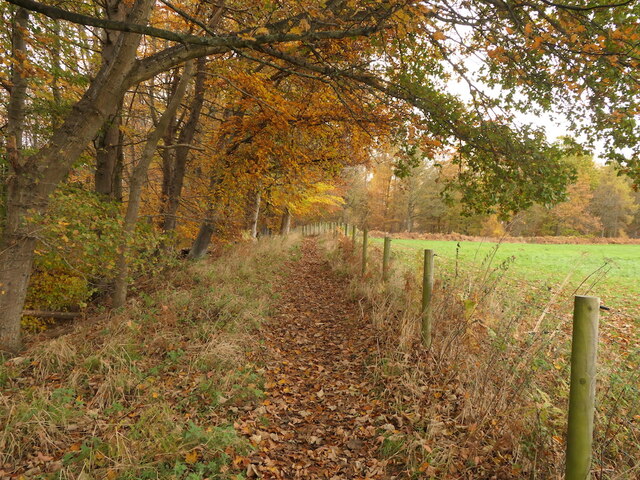
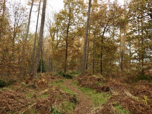
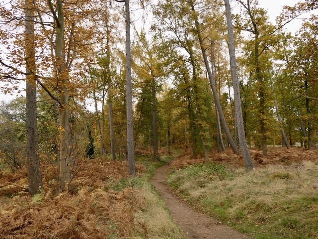
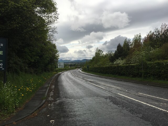
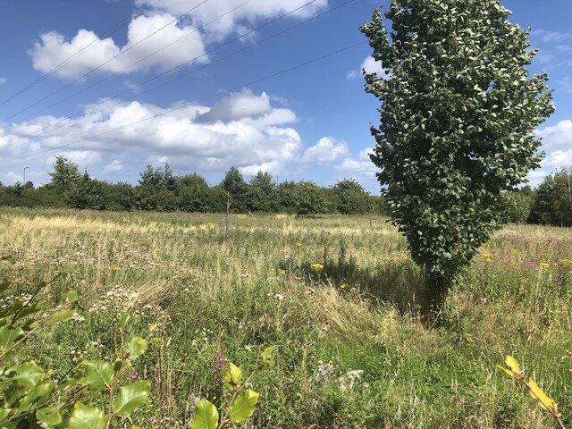
Benbught Wood is a picturesque woodland located in Midlothian, Scotland. Covering an area of approximately 20 hectares, the wood is nestled in the rolling hills of the Pentland Regional Park. It is a popular destination for nature enthusiasts, hikers, and birdwatchers alike.

The woodland is predominantly composed of native broadleaf trees, including oak, birch, and rowan. The dense canopy provides a haven for a diverse range of flora and fauna. Bluebells carpet the forest floor in spring, creating a breathtaking display of color and scent.

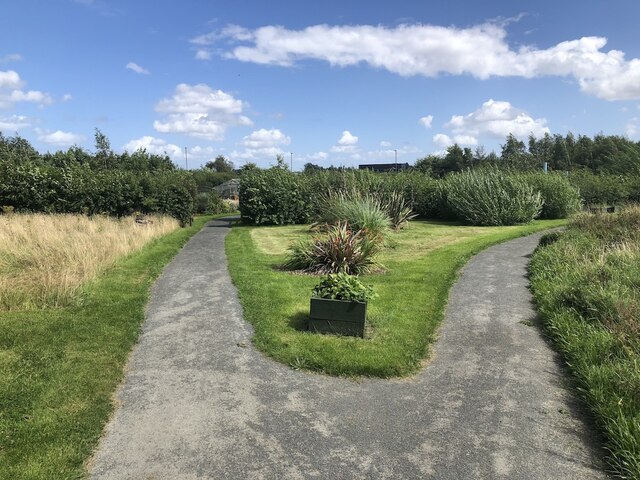
Trails wind their way through the wood, offering visitors the opportunity to explore its tranquil beauty. These paths are well-maintained and suitable for walkers of all abilities. Along the way, one may encounter various wildlife species such as red squirrels, woodpeckers, and roe deer.

Benbught Wood is also home to a rich variety of birdlife. Birdwatchers can spot species such as great spotted woodpeckers, tawny owls, and goldcrests. The wood's diverse ecosystem attracts a wide range of bird species throughout the year, making it a prime location for ornithological enthusiasts.

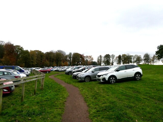
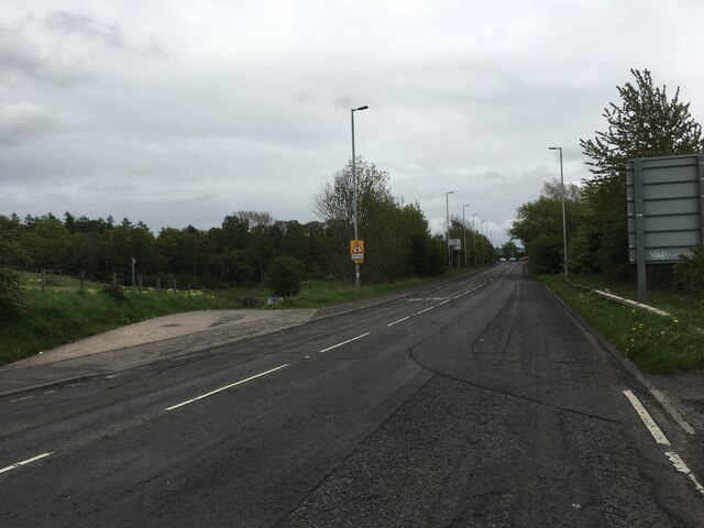
The wood is easily accessible, with several parking areas nearby. It is a popular spot for family outings and picnics due to its peaceful atmosphere and stunning natural surroundings. Whether one is seeking a leisurely stroll or a more challenging hike, Benbught Wood offers a delightful escape into nature.

If you have any feedback on the listing, please let us know in the comments section below.

Benbught Wood Images

Images are sourced within 2km of 55.887646/-3.0660326 or Grid Reference NT3366. Thanks to Geograph Open Source API. All images are credited.

Tesco Superstore, Eskbank
Path, Dalkeith Park Between the woodland along the North Esk and a field.
Path, Dalkeith Park
Between the woodland along the North Esk and a field.
Path, Dalkeith Park
Path, Dalkeith Park
Woodland, Dalkeith Park
Car park, Dalkeith Park With so many commercial activities taking place here the park has become very busy. As a result attempts have been made to close off parts of the woodland. This is part of a very pronounced trend in the area with constructive methods being used to keep people off land yet staying within the law. Tactics elsewhere have included closing off historic monuments due to crimes that may not have actually happened, closing car parks as well as just pushing your luck with non compliant signage.
Car park, Dalkeith Park
With so many commercial activities taking place here the park has become very busy. As a result attempts have been made to close off parts of the woodland. This is part of a very pronounced trend in the area with constructive methods being used to keep people off land yet staying within the law. Tactics elsewhere have included closing off historic monuments due to crimes that may not have actually happened, closing car parks as well as just pushing your luck with non compliant signage.
Penicuik to Musselburgh Path Passing the hospital with a building site ahead.
Penicuik to Musselburgh Path
Passing the hospital with a building site ahead.
Building site Ground between Eskbank and Bonnyrigg is being filled in.
Building site
Ground between Eskbank and Bonnyrigg is being filled in.
Empty field It will soon be built upon.
Empty field
It will soon be built upon.
New houses, Bonnyrigg Ground between Eskbank and Bonnyrigg is being filled in.
New houses, Bonnyrigg
Ground between Eskbank and Bonnyrigg is being filled in.
St Johns Church, Dalkeith
Jarnac Court, Dalkeith
Dalkeith from the air Dalkeith suburbs expanding towards the east.
Dalkeith from the air
Dalkeith suburbs expanding towards the east.
Dalkeith High Street
A6106 towards Dalkeith
Paths, Midlothian Community Hospital Garden Taken after being turned away from a much delayed appointment due to double booking. Back to the end of the queue I go.
Paths, Midlothian Community Hospital Garden
Taken after being turned away from a much delayed appointment due to double booking. Back to the end of the queue I go.
Unused land, Eskbank Beside the A7 and Midlothian Community Hospital.
Unused land, Eskbank
Beside the A7 and Midlothian Community Hospital.
Dolly 1 and Dolly 2 Sheep by  Maria Campbell and the Dalkeith Arts Committee at the Community Hospital. Celebrating one of Midlothian Council Area's most famous daughters, the first cloned mammal.
Dolly 1 and Dolly 2
Sheep by Maria Campbell and the Dalkeith Arts Committee at the Community Hospital. Celebrating one of Midlothian Council Area's most famous daughters, the first cloned mammal.
Show me another place!

Benbught Wood is located at Grid Ref: NT3366 (Lat: 55.887646, Lng: -3.0660326)

Unitary Authority: Midlothian

Police Authority: The Lothians and Scottish Borders

What 3 Words

///accompany.curbed.accompany. Near Dalkeith, Midlothian

Nearby Locations

Lothian Glen Benbught Wood

Related Wikis

Dalkeith Thistle F.C.

Dalkeith Thistle Football Club are a Scottish football club from the town of Dalkeith, Midlothian. Formed in 1892, the team plays in the East of Scotland...

Newbattle Abbey

Newbattle Abbey (Scottish Gaelic: Abaid a' Bhatail Nuaidh) was a Cistercian monastery near the village of Newbattle in Midlothian, Scotland, which subsequently...

Municipal Buildings, Dalkeith

The Municipal Buildings are based in Buccleuch Street in Dalkeith, Scotland. The structure, which served as the meeting place of Dalkeith Burgh Council...

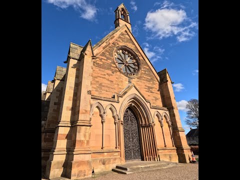
St David's Church, Dalkeith

St David's Church is a Roman Catholic Parish church in Dalkeith, Midlothian. It was founded in 1854 by Cecil Chetwynd Kerr, Marchioness of Lothian. It...

Midlothian

Midlothian (; Scottish Gaelic: Meadhan Lodainn) is a historic county, registration county, lieutenancy area and one of 32 council areas of Scotland used...

Dalkeith railway station

Dalkeith railway station served the town of Dalkeith, Scotland, from 1838 to 1964 on the Dalkeith branch of the Edinburgh and Dalkeith Railway. == History... ==

Corn Exchange, Dalkeith

The Corn Exchange is a commercial building in the High Street, Dalkeith, Midlothian, Scotland. The structure, which is now used as a museum, is a Category...

Dalkeith

Dalkeith ( dal-KEETH; Scottish Gaelic: Dail Cheith, pronounced [t̪al ˈçe]) is a town in Midlothian, Scotland, on the River Esk. It was granted a burgh...

Related Videos

Walking Around Dalkeith Palace and Church: Exploring Scotland's Rich History

Join us on a virtual walking tour of Dalkeith Palace and Church, two magnificent landmarks that embody Scotland's rich history ...

November Trekker Walk 2023

Info on our November Trekker Walk, route and some bits n bobs of history along the way.

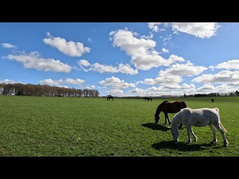
Walking somewhere in Dalkeith : Horses, Sky, Clouds, Sheep and Cows.

Join me on a peaceful walk around the beautiful Dalkeith farm, where we'll encounter horses grazing, the vast sky above with ...

[4k] 🏴󠁧󠁢󠁳󠁣󠁴󠁿EP3 Dalkeith Country Park, The Kitchen | Park Walk | Scotland Getaway | @walkxtravel

Previous Episodes: [4k] 󠁧󠁢󠁳󠁣󠁴󠁿EP2 Holyrood Park, Edinburgh | Park Walk | Scotland Getaway ...

Nearby Amenities

Located within 500m of 55.887646,-3.0660326
Source: www.npemap.org.uk
Uk Postcode Centroid: EH22
Lat/Long: 55.8866682/-3.0701558
Traffic Calming: table
Lat/Long: 55.8877972/-3.0724047
Traffic Calming: table
Lat/Long: 55.8873949/-3.0714357
Mini Roundabout
Direction: clockwise
Source: Bing
Lat/Long: 55.8853591/-3.0716407
Traffic Calming: table
Lat/Long: 55.8872317/-3.0710517
Barrier: kissing_gate
Lat/Long: 55.886631/-3.0697939
Crossing
Crossing: uncontrolled
Kerb: flush
Lat/Long: 55.887346/-3.0715012
Barrier: entrance
Lat/Long: 55.8919937/-3.0666232
Crossing
Crossing: traffic_signals
Crossing Ref: toucan
Kerb: lowered
Note: Cyclists directed to dismount, even though it is a toucan. There's only a footway on the opposite (north west) side of the road.
Tactile Paving: yes
Lat/Long: 55.888598/-3.07181
Office: government
Lat/Long: 55.8915151/-3.0697021
Bench
Backrest: yes
Material: wood
Lat/Long: 55.8921013/-3.0667707
Barrier: cycle_barrier
Bicycle: dismount
Foot: yes
Lat/Long: 55.8879496/-3.0616205
Golf: pin
Lat/Long: 55.8890313/-3.0592176
Golf: pin
Lat/Long: 55.8885207/-3.0624162
Golf: pin
Lat/Long: 55.8900136/-3.0658923
Golf: pin
Lat/Long: 55.8879728/-3.0688903
Golf: pin
Lat/Long: 55.884675/-3.0602986
Golf: pin
Lat/Long: 55.887482/-3.0602825
Golf: pin
Lat/Long: 55.8893893/-3.0651507
Addr City: Dalkeith
Addr Housenumber: 16
Addr Street: Abbey Road
Lat/Long: 55.8871837/-3.0740005
Addr City: Dalkeith
Addr Housenumber: 15
Addr Street: Abbey Road
Lat/Long: 55.8872884/-3.0738436
Addr City: Dalkeith
Addr Housenumber: 14
Addr Street: Abbey Road
Lat/Long: 55.8873871/-3.0737706
Addr City: Dalkeith
Addr Housenumber: 13
Addr Street: Abbey Road
Lat/Long: 55.887502/-3.0736036
Addr City: Dalkeith
Addr Housenumber: 12
Addr Street: Abbey Road
Lat/Long: 55.8875587/-3.0734678
Addr City: Dalkeith
Addr Housenumber: 11
Addr Street: Abbey Road
Lat/Long: 55.8876513/-3.0734125
Addr City: Dalkeith
Addr Housenumber: 10
Addr Street: Abbey Road
Lat/Long: 55.8877619/-3.0732635
Addr City: Dalkeith
Addr Housenumber: 9
Addr Street: Abbey Road
Lat/Long: 55.8877997/-3.0731237
Addr City: Dalkeith
Addr Housenumber: 8
Addr Street: Abbey Road
Lat/Long: 55.887825/-3.0730939
Addr City: Dalkeith
Addr Housenumber: 7
Addr Street: Abbey Road
Lat/Long: 55.8879239/-3.07297
Addr City: Dalkeith
Addr Housenumber: 6
Addr Street: Abbey Road
Lat/Long: 55.8879813/-3.0728956
Addr City: Dalkeith
Addr Housenumber: 5
Addr Street: Abbey Road
Lat/Long: 55.8880888/-3.0727585
Addr City: Dalkeith
Addr Housenumber: 4
Addr Street: Abbey Road
Lat/Long: 55.8881506/-3.072677
Give Way
Direction: backward
Lat/Long: 55.8877765/-3.0724316
Give Way
Direction: forward
Lat/Long: 55.8878204/-3.0723723
Addr City: Dalkeith
Addr Housenumber: 3
Addr Street: Abbey Road
Lat/Long: 55.8882569/-3.0725379
Addr City: Dalkeith
Addr Housenumber: 2
Addr Street: Abbey Road
Lat/Long: 55.888422/-3.0723174
Addr City: Dalkeith
Addr Housenumber: 1
Addr Street: Abbey Road
Lat/Long: 55.8886038/-3.0720471
Addr City: Dalkeith
Addr Housenumber: 13
Addr Street: St Davids Terrace
Lat/Long: 55.8866907/-3.0735207
Addr City: Dalkeith
Addr Housenumber: 12
Addr Street: St Davids Terrace
Lat/Long: 55.886987/-3.0733795
Addr City: Dalkeith
Addr Housenumber: 11
Addr Street: St Davids Terrace
Lat/Long: 55.8870817/-3.0732277
Addr City: Dalkeith
Addr Housenumber: 10
Addr Street: St Davids Terrace
Lat/Long: 55.8872064/-3.0730167
Addr City: Dalkeith
Addr Housenumber: 9
Addr Street: St Davids Terrace
Lat/Long: 55.8872658/-3.072933
Addr City: Dalkeith
Addr Housenumber: 8
Addr Street: St Davids Terrace
Lat/Long: 55.8874087/-3.0727575
Addr City: Dalkeith
Addr Housenumber: 7
Addr Street: St Davids Terrace
Lat/Long: 55.8874896/-3.0726432
Addr City: Dalkeith
Addr Housenumber: 6
Addr Street: St Davids Terrace
Lat/Long: 55.8876255/-3.0724479
Addr City: Dalkeith
Addr Housenumber: 5
Addr Street: St Davids Terrace
Lat/Long: 55.8878552/-3.0721335
Addr City: Dalkeith
Addr Housenumber: 4
Addr Street: St Davids Terrace
Lat/Long: 55.8879722/-3.0719473
Addr City: Dalkeith
Addr Housenumber: 3
Addr Street: St Davids Terrace
Lat/Long: 55.8881075/-3.0717841
Addr City: Dalkeith
Addr Housenumber: 2
Addr Street: St Davids Terrace
Lat/Long: 55.888174/-3.0716946
Addr City: Dalkeith
Addr Housenumber: 1
Addr Street: St Davids Terrace
Lat/Long: 55.8883135/-3.0715375
Crossing
Crossing: uncontrolled
Kerb: flush
Lat/Long: 55.8872863/-3.0709778
Give Way
Direction: backward
Lat/Long: 55.8872676/-3.0710031
Give Way
Direction: forward
Lat/Long: 55.8873664/-3.0714739
Addr City: Dalkeith
Addr Housenumber: 7
Addr Street: St Davids Avenue
Lat/Long: 55.8873843/-3.071117
Addr City: Dalkeith
Addr Housenumber: 5
Addr Street: St Davids Avenue
Lat/Long: 55.8874794/-3.0713151
Addr City: Dalkeith
Addr Housenumber: 3
Addr Street: St Davids Avenue
Lat/Long: 55.8875427/-3.0714696
Addr City: Dalkeith
Addr Housenumber: 1
Addr Street: St Davids Avenue
Lat/Long: 55.8876472/-3.0717392
Addr City: Dalkeith
Addr Housenumber: 2
Addr Street: St Davids Avenue
Lat/Long: 55.8874796/-3.071971
Addr City: Dalkeith
Addr Housenumber: 4
Addr Street: St Davids Avenue
Lat/Long: 55.8873697/-3.0717085
Addr City: Dalkeith
Addr Housenumber: 6
Addr Street: St Davids Avenue
Lat/Long: 55.8872398/-3.0713898
Addr City: Dalkeith
Addr Housenumber: 8
Addr Street: St Davids Avenue
Lat/Long: 55.8871049/-3.0711106
Addr City: Dalkeith
Addr Housenumber: 13
Addr Street: St Davids Avenue
Lat/Long: 55.8870337/-3.0702151
Addr City: Dalkeith
Addr Housenumber: 26
Addr Street: St Davids Avenue
Lat/Long: 55.8864524/-3.070587
Addr City: Dalkeith
Addr Housenumber: 28
Addr Street: St Davids Avenue
Lat/Long: 55.8864995/-3.0705271
Addr City: Dalkeith
Addr Housenumber: 24
Addr Street: St Davids Avenue
Lat/Long: 55.8864101/-3.0710827
Addr City: Dalkeith
Addr Housenumber: 20
Addr Street: St Davids Avenue
Lat/Long: 55.8864822/-3.0708275
Addr City: Dalkeith
Addr Housenumber: 22
Addr Street: St Davids Avenue
Lat/Long: 55.8864434/-3.0708767
Addr City: Dalkeith
Addr Housenumber: 11
Addr Street: St Davids Avenue
Lat/Long: 55.8871182/-3.070473
Addr City: Dalkeith
Addr Housenumber: 10
Addr Street: St Davids Avenue
Lat/Long: 55.8870425/-3.0709324
Addr City: Dalkeith
Addr Housenumber: 9
Addr Street: St Davids Avenue
Lat/Long: 55.8872199/-3.0707328
Addr City: Dalkeith
Addr Housenumber: 12
Addr Street: St Davids Avenue
Lat/Long: 55.886929/-3.0708455
Addr City: Dalkeith
Addr Housenumber: 14
Addr Street: St Davids Avenue
Lat/Long: 55.8868335/-3.0704914
Addr City: Dalkeith
Addr Housenumber: 16
Addr Street: St Davids Avenue
Lat/Long: 55.8867217/-3.0705214
Addr City: Dalkeith
Addr Housenumber: 18
Addr Street: St Davids Avenue
Lat/Long: 55.8866883/-3.0705672
Addr City: Dalkeith
Addr Housenumber: 30
Addr Street: St Davids Avenue
Lat/Long: 55.8865307/-3.0702863
Bus Stop
Newbattle Cemetery
Bench: no
Bin: no
Bus: yes
Naptan AtcoCode: 6280301113
Naptan Bearing: SE
Naptan CommonName: Newbattle Cemetery
Naptan Indicator: opp
Naptan NaptanCode: 64324675
Naptan Street: Newbattle Road
Naptan Verified: no
Passenger Information Display: no
Public Transport: platform
Ref: 6280301113
Shelter: no
Source: NaPTAN
Lat/Long: 55.8861552/-3.0736018
Crossing
Lat/Long: 55.8888747/-3.0714255
The data included in this document is from www.openstreetmap.org. The data is made available under ODbL.

Have you been to Benbught Wood?

Leave your review of Benbught Wood below (or comments, questions and feedback).