Curling Pond Strip

Wood, Forest in Fife

Scotland

Curling Pond Strip

The Pitlessie Road The Pitlessie Road heading west towards Ladybank near The Common.
The Pitlessie Road Credit: Scott Cormie

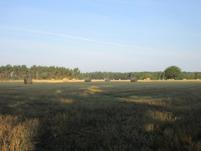
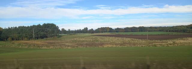
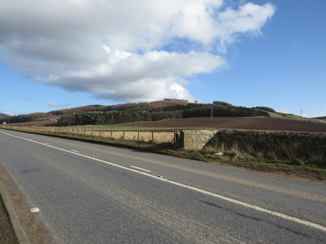
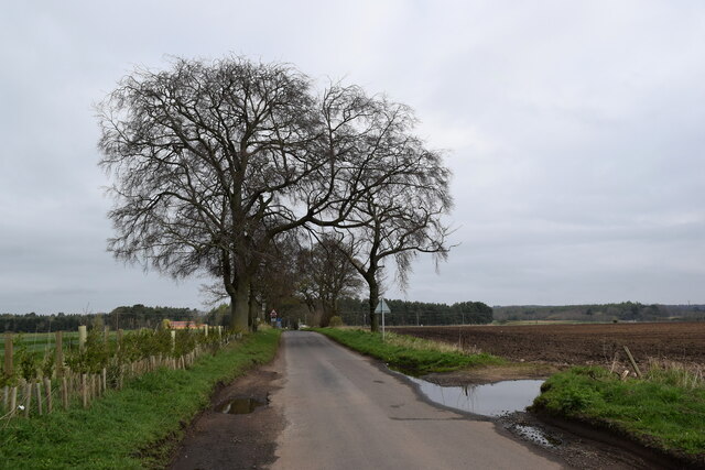
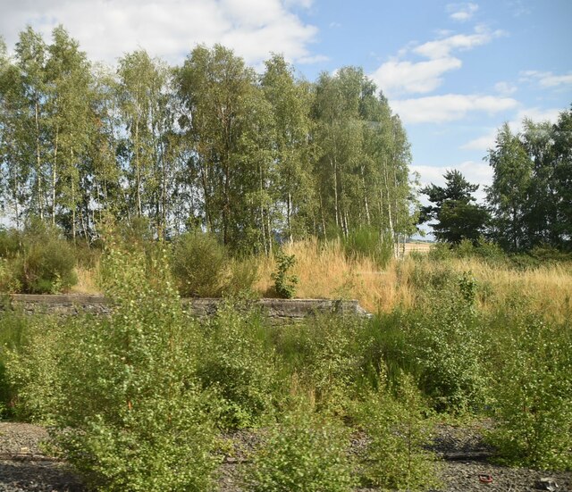
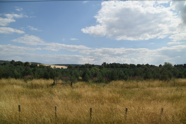
Curling Pond Strip, located in Fife, Scotland, is a picturesque wooded area that is home to a beautiful forest. Spanning over a vast expanse of land, this area is known for its serene and tranquil ambiance, offering a perfect escape from the hustle and bustle of everyday life.

The wood in Curling Pond Strip is predominantly composed of native Scottish tree species, including oak, birch, and pine. These trees create a dense canopy, providing shade and shelter for a diverse range of wildlife. Visitors to the forest are greeted with a rich tapestry of colors throughout the seasons, from the vibrant greens of spring and summer to the warm hues of autumn.

One of the prominent features of Curling Pond Strip is its namesake curling pond, a man-made water body that freezes during the winter months, providing a perfect surface for the traditional Scottish sport of curling. This frozen pond attracts enthusiasts from far and wide, who come to enjoy the sport amidst the stunning natural backdrop.

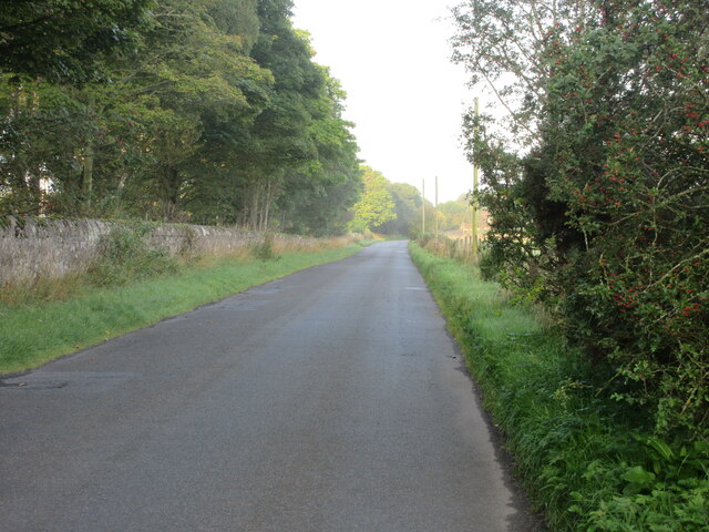
The forest also offers several walking trails, allowing visitors to explore its beauty at their own pace. These well-maintained paths wind through the trees, revealing hidden clearings, babbling brooks, and occasional glimpses of wildlife. Birdwatchers will find ample opportunities to spot various avian species, including woodpeckers, owls, and songbirds.

Curling Pond Strip, with its idyllic setting and diverse ecosystem, serves as a haven for nature lovers, photographers, and outdoor enthusiasts. Whether one seeks a peaceful stroll, an adrenaline-filled game of curling, or simply a moment of solitude in nature, this wood in Fife provides an ideal retreat.

If you have any feedback on the listing, please let us know in the comments section below.

Curling Pond Strip Images

Images are sourced within 2km of 56.278819/-3.0811084 or Grid Reference NO3310. Thanks to Geograph Open Source API. All images are credited.

The Pitlessie Road The Pitlessie Road heading west towards Ladybank near The Common.
The Pitlessie Road
The Pitlessie Road heading west towards Ladybank near The Common.
Bales in the Howe of Fife Bales scattered around a harvested field north of Jennystown.
Bales in the Howe of Fife
Bales scattered around a harvested field north of Jennystown.
Fields at Ballomill, Ladybank
Benchmark on wall near Cults Mill Ordnance Survey benchmark on wall on A914 near Cults Mill. Database entry: <span class="nowrap"><a title="https://www.bench-marks.org.uk/bm163969" rel="nofollow ugc noopener" href="https://www.bench-marks.org.uk/bm163969">Link</a><img style="margin-left:2px;" alt="External link" title="External link - shift click to open in new window" src="https://s1.geograph.org.uk/img/external.png" width="10" height="10"/></span>
Benchmark on wall near Cults Mill
Ordnance Survey benchmark on wall on A914 near Cults Mill. Database entry: LinkExternal link
A914 near Cults Lady Mary's Wood in the background.
A914 near Cults
Lady Mary's Wood in the background.
Level Crossing near Hospital Mill
Walk through the woods The mixed woodland to the west of Springfield is called The Moor.
Walk through the woods
The mixed woodland to the west of Springfield is called The Moor.
View towards Peterhead Farm
Trig point by the tracks Not every trig point is up a mountain...    Ballomill trig point (TP0996) in the classic concrete 'Hotine pillar' design (<span class="nowrap"><a title="https://en.wikipedia.org/wiki/Martin_Hotine" rel="nofollow ugc noopener" href="https://en.wikipedia.org/wiki/Martin_Hotine">Link</a><img style="margin-left:2px;" alt="External link" title="External link - shift click to open in new window" src="https://s1.geograph.org.uk/img/external.png" width="10" height="10"/></span> ) sits at an elevation of 41 metres and had "third order" status according to the trigpointing.uk web site.    The X50 sign behind it is a 50 mph 'wrong direction special speed restriction board': if a train is running 'wrong line' (in the opposite direction to normal, i.e., away from the photographer) on the track nearest to the fence, the sign warns of the need to slow down for a level crossing about 1 km ahead.
Trig point by the tracks
Not every trig point is up a mountain... Ballomill trig point (TP0996) in the classic concrete 'Hotine pillar' design (LinkExternal link ) sits at an elevation of 41 metres and had "third order" status according to the trigpointing.uk web site. The X50 sign behind it is a 50 mph 'wrong direction special speed restriction board': if a train is running 'wrong line' (in the opposite direction to normal, i.e., away from the photographer) on the track nearest to the fence, the sign warns of the need to slow down for a level crossing about 1 km ahead.
Battery boxes Critical rail infrastructure such as signals and level crossings must be 'fail safe' in the event of a power failure and this array of battery cabinets is associated with the adjacent automatic half-barrier crossing.
Battery boxes
Critical rail infrastructure such as signals and level crossings must be 'fail safe' in the event of a power failure and this array of battery cabinets is associated with the adjacent automatic half-barrier crossing.
AHB crossing Automatic half-barrier crossing where the main line between Edinburgh and Dundee crosses the minor road from Pitlessie to Bow of Fife.
AHB crossing
Automatic half-barrier crossing where the main line between Edinburgh and Dundee crosses the minor road from Pitlessie to Bow of Fife.
Minor road to Bow of Fife An AHB crossing can just be seen in the distance.   The weather was very gloomy...
Minor road to Bow of Fife
An AHB crossing can just be seen in the distance. The weather was very gloomy...
Gateposts of Crawford Priory C-listed: LB2574 <span class="nowrap"><a title="https://portal.historicenvironment.scot/designation/LB2574" rel="nofollow ugc noopener" href="https://portal.historicenvironment.scot/designation/LB2574">Link</a><img style="margin-left:2px;" alt="External link" title="External link - shift click to open in new window" src="https://s1.geograph.org.uk/img/external.png" width="10" height="10"/></span> .
Gateposts of Crawford Priory
C-listed: LB2574 LinkExternal link .
West lodge for Crawford Priory
Barns at Cults Mill Farm
Ruin of Crawford Priory Apparently never a priory but a country house built in Gothic style and B-listed: LB2567
<span class="nowrap"><a title="https://portal.historicenvironment.scot/designation/LB2567" rel="nofollow ugc noopener" href="https://portal.historicenvironment.scot/designation/LB2567">Link</a><img style="margin-left:2px;" alt="External link" title="External link - shift click to open in new window" src="https://s1.geograph.org.uk/img/external.png" width="10" height="10"/></span> . Compare the picture taken 19 years earlier (in much better weather) by Peter Gordon: <a title="https://www.geograph.org.uk/photo/253413" href="https://www.geograph.org.uk/photo/253413">Link</a> .
Ruin of Crawford Priory
Apparently never a priory but a country house built in Gothic style and B-listed: LB2567 LinkExternal link . Compare the picture taken 19 years earlier (in much better weather) by Peter Gordon: Link .
Near Gravelpit Wood
Near Gravelpit Wood
Near Pitlessie Common
Show me another place!

Curling Pond Strip is located at Grid Ref: NO3310 (Lat: 56.278819, Lng: -3.0811084)

Unitary Authority: Fife

Police Authority: Fife

What 3 Words

///cuddling.fruitcake.rams. Near Ladybank, Fife

Nearby Locations

Curling Pond Strip

Related Wikis

Pitlessie

Pitlessie is a small village in Cults, Fife, Scotland. It is roughly 4+1⁄2 miles (7 km) southwest of the nearest large town, Cupar, and 23 miles (37 kilometres...

Priestfield House

Priestfield House was a Victorian Country House near Cults, Fife, Scotland. == History == The estate, originally an outlying property of Crawford Priory...

Springfield, Fife

Springfield is a village that lies at the edge of the Howe of Fife, to the south-west of the town of Cupar, Fife, Scotland. The origin of the community...

Balmalcolm

Balmalcolm is a small village in the Kettle parish of Fife, Scotland. Encompassed by the low-lying Howe of Fife, the village is roughly 5+1⁄2 miles (9...

Nearby Amenities

Located within 500m of 56.278819,-3.0811084
Barrier: bollard
Lat/Long: 56.2751845/-3.0771676
Post Box
Brand: Royal Mail
Brand Wikidata: Q638098
Brand Wikipedia: en:Royal Mail
Collection Times: Mo-Fr 09:00; Sa 07:00
Operator: Royal Mail
Operator Wikidata: Q638098
Post Box Design: LB3426
Post Box Mounting: pier
Post Box Type: lamp
Ref: KY15 327D
Royal Cypher: scottish_crown
Source: survey
Lat/Long: 56.2748951/-3.0789431
Power: pole
Lat/Long: 56.2823848/-3.0852366
Power: pole
Lat/Long: 56.2815016/-3.0852887
Power: pole
Lat/Long: 56.2809759/-3.0856722
Power: pole
Lat/Long: 56.2804463/-3.0862428
Pitlessie
Place: village
Population: 325
Wikidata: Q3905839
Wikipedia: en:Pitlessie
Lat/Long: 56.2754275/-3.0773494
Generator Method: photovoltaic
Generator Output Electricity: yes
Generator Source: solar
Generator Type: solar_photovoltaic_panel
Power: generator
Lat/Long: 56.2751318/-3.0818554
Generator Method: photovoltaic
Generator Output Electricity: yes
Generator Source: solar
Generator Type: solar_photovoltaic_panel
Power: generator
Lat/Long: 56.2746835/-3.080675
Generator Method: photovoltaic
Generator Output Electricity: yes
Generator Source: solar
Generator Type: solar_photovoltaic_panel
Power: generator
Lat/Long: 56.2752282/-3.0802317
Playground: swing
Lat/Long: 56.2743927/-3.0810542
Playground: climbingframe
Lat/Long: 56.2743235/-3.0812312
Grit Bin
Access: yes
Material: plastic
Operator: Fife Council
Lat/Long: 56.2753807/-3.0771215
Historic: memorial
Material: stone
Memorial: war_memorial
Lat/Long: 56.2746377/-3.0794029
Entrance: yes
Lat/Long: 56.2746267/-3.0791119
Entrance: yes
Lat/Long: 56.2746231/-3.0793075
Man Made: water_well
Lat/Long: 56.2745554/-3.0810489
Bench
Lat/Long: 56.2747096/-3.0822405
Bench
Lat/Long: 56.2747193/-3.0823328
Waste Basket
Lat/Long: 56.2747182/-3.0823988
Board Type: notice
Information: board
Operator: Cults Community Council
Tourism: information
Lat/Long: 56.2751867/-3.0765421
Defibrillator
Defibrillator Location: External wall, LHS of main entrance.
Emergency: defibrillator
Indoor: no
Operator: Cults Community Council
Lat/Long: 56.2746269/-3.0792958
Power: pole
Lat/Long: 56.2785947/-3.0770691
Power: pole
Lat/Long: 56.2784235/-3.0770745
Power: pole
Lat/Long: 56.2780197/-3.0771981
Power: pole
Lat/Long: 56.2775515/-3.0773491
Power: pole
Lat/Long: 56.2771301/-3.0774869
Power: pole
Lat/Long: 56.2766783/-3.0775897
Power: pole
Lat/Long: 56.2764227/-3.0775569
Power: pole
Lat/Long: 56.2759776/-3.0774092
Power: pole
Lat/Long: 56.2764786/-3.0771642
The data included in this document is from www.openstreetmap.org. The data is made available under ODbL.

Have you been to Curling Pond Strip?

Leave your review of Curling Pond Strip below (or comments, questions and feedback).