North Moor

Wood, Forest in Fife

Scotland

North Moor

Byresloan A vicious looking cumulonimbus behind Byresloan.
Byresloan Credit: Richard Webb

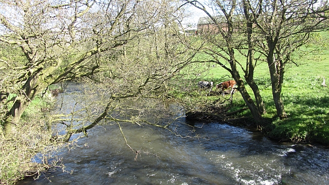
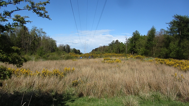
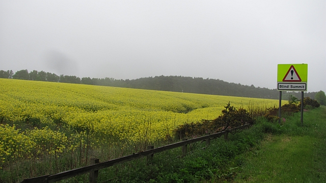
North Moor is a picturesque wood located in the region of Fife, Scotland. This enchanting forest spans across a vast area, offering visitors a serene and natural environment to explore. It is nestled amidst rolling hills and lush green landscapes, providing a tranquil escape from the bustling city life.

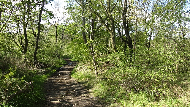
The wood is characterized by its diverse range of flora and fauna, which thrive in the fertile soil and mild climate of the region. Tall, majestic trees, including oak, beech, and pine, dominate the forest, creating a dense canopy that filters sunlight and casts beautiful shadows on the forest floor. The forest floor is covered with a thick carpet of moss, ferns, and wildflowers, painting a vibrant and colorful picture during the blooming seasons.

North Moor is also home to a variety of wildlife, making it a popular spot for nature enthusiasts and birdwatchers. Squirrels scamper through the treetops, while deer can occasionally be spotted grazing in the clearings. The forest is teeming with birdlife, with species such as woodpeckers, owls, and songbirds filling the air with their melodious calls.

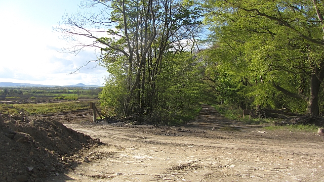
For those seeking outdoor activities, North Moor offers an extensive network of trails and paths that wind through the wood. Hikers and cyclists can enjoy the fresh air and panoramic views as they explore the wood's many hidden gems. There are also picnic areas and viewpoints strategically placed throughout the forest, allowing visitors to soak in the beauty of the natural surroundings.

Overall, North Moor in Fife is a captivating wood that showcases the best of Scotland's natural beauty. Its rich biodiversity and tranquil atmosphere make it a haven for nature lovers and a must-visit destination for anyone seeking a peaceful escape in the heart of nature.

If you have any feedback on the listing, please let us know in the comments section below.

North Moor Images

Images are sourced within 2km of 56.173745/-3.0916827 or Grid Reference NT3298. Thanks to Geograph Open Source API. All images are credited.

Byresloan A vicious looking cumulonimbus behind Byresloan.
Byresloan
A vicious looking cumulonimbus behind Byresloan.
Arable land, Balfour A long view towards Largo Law.
Arable land, Balfour
A long view towards Largo Law.
Oilseed rape, Balgonie A view of the Lomond Hills from the east.
Oilseed rape, Balgonie
A view of the Lomond Hills from the east.
River Ore Downstream view from a footbridge at Tullybreck.
River Ore
Downstream view from a footbridge at Tullybreck.
Wemyss Wood A ride carrying power lines.
Wemyss Wood
A ride carrying power lines.
Open cast Admin block for an opencast site. The path from Tullybreck still goes.
Open cast
Admin block for an opencast site. The path from Tullybreck still goes.
New Bridge Strips A track, Queen Mary's Road, runs down through the strip wood towards the now rather old looking New Bridge (known as the Barrel Bridge). This was probably a road once. On the left some large scale ground works are in progress for either construction or open cast coal mining. On the right are existing open cast workings.
New Bridge Strips
A track, Queen Mary's Road, runs down through the strip wood towards the now rather old looking New Bridge (known as the Barrel Bridge). This was probably a road once. On the left some large scale ground works are in progress for either construction or open cast coal mining. On the right are existing open cast workings.
New Bridge Strips Queen Mary's Road approaches the Barrel Bridge over the Ore.  The road runs through a strip wood and usefully crosses an area of open cast mining.
New Bridge Strips
Queen Mary's Road approaches the Barrel Bridge over the Ore. The road runs through a strip wood and usefully crosses an area of open cast mining.
Oilseed rape, Standing Stane Road Farmland amongst the woods along the very busy and extremely unpleasant Standing Stane Road (A915).
Oilseed rape, Standing Stane Road
Farmland amongst the woods along the very busy and extremely unpleasant Standing Stane Road (A915).
Arable land, Woodbank Cereal crops and strip woods, typical of inland of Wemyss.
Arable land, Woodbank
Cereal crops and strip woods, typical of inland of Wemyss.
Track, Wemyss Signposted for East Wemyss this track had had its mud restored by a night of rainfall. It runs between an arable field and Standingstone Park Plantation.
Track, Wemyss
Signposted for East Wemyss this track had had its mud restored by a night of rainfall. It runs between an arable field and Standingstone Park Plantation.
Polytunnels, Woodbank The soft fruit season has come round again and of course it was cold and wet.
Polytunnels, Woodbank
The soft fruit season has come round again and of course it was cold and wet.
The Lochty Burn  Forming the northern edge of Thornton Junction Golf Course.
The Lochty Burn
Forming the northern edge of Thornton Junction Golf Course.
Balfour Mains The farm buildings appear to have been abandoned since <a href="https://www.geograph.org.uk/photo/406497">NT3299 : Cattle</a> was taken.
Balfour Mains
The farm buildings appear to have been abandoned since NT3299 : Cattle was taken.
Abandoned farm Derelict buildings at Balfour Mains Farm.
Abandoned farm
Derelict buildings at Balfour Mains Farm.
Ripening wheat An arable field near Balfour Mains farm with Largo Law in the distance.
Ripening wheat
An arable field near Balfour Mains farm with Largo Law in the distance.
The living and the dead Trees, and what's left of one, alongside the track leading from East Wemyss to Standing Stone Road (aka A915) east of Kirkcaldy.
The living and the dead
Trees, and what's left of one, alongside the track leading from East Wemyss to Standing Stone Road (aka A915) east of Kirkcaldy.
Field of wheat With Largo Law in the background.
Field of wheat
With Largo Law in the background.
Show me another place!

North Moor is located at Grid Ref: NT3298 (Lat: 56.173745, Lng: -3.0916827)

Unitary Authority: Fife

Police Authority: Fife

What 3 Words

///airbase.rocks.vague. Near East Wemyss, Fife

Nearby Locations

Woodbank Strip North Moor

Related Wikis

Kirkcaldy (district)

Kirkcaldy (Scottish Gaelic: Dùn Phàrlain, Scots: Dunfaurlin) was a local government district in the Fife region of Scotland from 1975 to 1996. The district...

Milton of Balgonie

Milton of Balgonie () is a small village in central Fife, Scotland. It is situated 2 miles (3.2 km) east of Glenrothes between the nearby villages of Markinch...

Wemyss, Fife

Wemyss ( WEEMZ) is a civil parish on the south coast of Fife, Scotland, lying on the Firth of Forth. It is bounded on the north-east by the parish of...

West Wemyss railway station

West Wemyss railway station served the village of West Wemyss , Fife, Scotland, from 1881 to 1949 on the Wemyss and Buckhaven Railway. == History == The...

Nearby Amenities

Located within 500m of 56.173745,-3.0916827
Power: tower
Lat/Long: 56.1759331/-3.0884233
Power: tower
Lat/Long: 56.1732375/-3.0970485
Power: tower
Lat/Long: 56.1746095/-3.0926587
Barrier: chain
Lat/Long: 56.172451/-3.09015
Generator Method: wind_turbine
Generator Output Electricity: 2 MW
Generator Source: wind
Generator Type: horizontal_axis
Power: generator
Lat/Long: 56.1717252/-3.0902249
The data included in this document is from www.openstreetmap.org. The data is made available under ODbL.

Have you been to North Moor?

Leave your review of North Moor below (or comments, questions and feedback).