Dalhousie Burn Plantation

Wood, Forest in Midlothian

Scotland

Dalhousie Burn Plantation

Danger! The tar changed colour! Because the Heras did not block the road many people braved the hazardous colour.  (A section was resurfaced and the signs had not been fully removed)
Danger! Credit: Richard Webb

Dalhousie Burn Plantation is a picturesque woodland located in Midlothian, Scotland. Spanning over a vast area, this enchanting plantation is nestled amidst the rolling hills, providing a tranquil escape from the hustle and bustle of city life.

The plantation is primarily composed of a diverse range of trees, including oak, beech, and birch, which create a dense and lush forest canopy. The rich biodiversity of the woodland is home to numerous species of birds, mammals, and insects, making it a haven for nature enthusiasts and wildlife lovers.

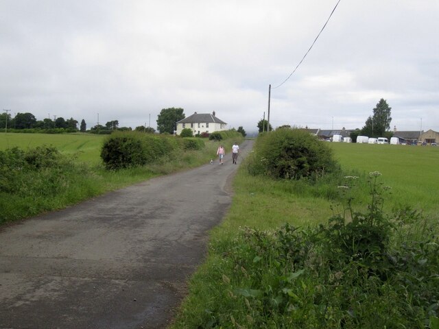
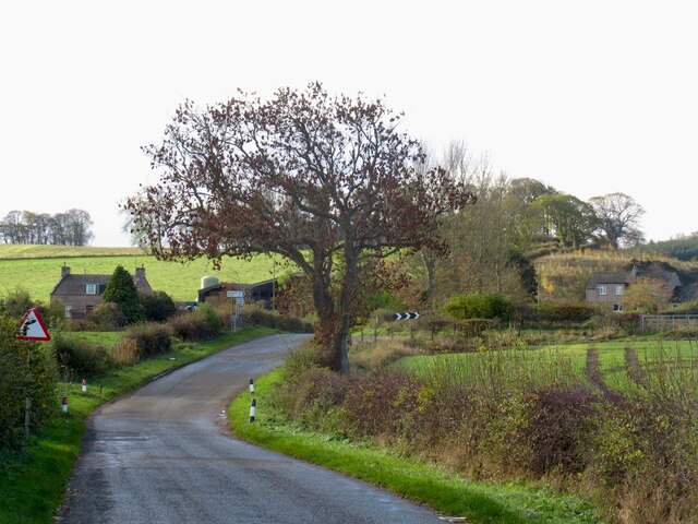
Traversing through Dalhousie Burn Plantation, one can explore a network of well-maintained paths and trails that wind their way through the woods. These paths offer breathtaking views of the surrounding landscape and provide an opportunity for visitors to immerse themselves in the natural beauty of the area.

The plantation also features the Dalhousie Burn, a small stream that meanders through the woodland, adding to its charm and tranquility. The babbling sound of the water along with the rustling leaves creates a soothing ambiance, further enhancing the experience of being in this idyllic setting.

Dalhousie Burn Plantation is a popular destination for outdoor activities such as walking, jogging, and cycling. It offers a serene environment for those seeking relaxation and a chance to reconnect with nature. Whether it's a leisurely stroll or an adventurous hike, this plantation provides a delightful escape into the heart of the Scottish countryside.

If you have any feedback on the listing, please let us know in the comments section below.

Dalhousie Burn Plantation Images

Images are sourced within 2km of 55.851018/-3.1072144 or Grid Reference NT3062. Thanks to Geograph Open Source API. All images are credited.

Danger! The tar changed colour! Because the Heras did not block the road many people braved the hazardous colour.  (A section was resurfaced and the signs had not been fully removed)
Danger!
The tar changed colour! Because the Heras did not block the road many people braved the hazardous colour. (A section was resurfaced and the signs had not been fully removed)
Castell Maynes Crescent New houses by the rails to trails path, Bonnyrigg.
Castell Maynes Crescent
New houses by the rails to trails path, Bonnyrigg.
Penicuik to Musselburgh Path Passing Castell Maynes Crescent.
Penicuik to Musselburgh Path
Passing Castell Maynes Crescent.
Field, Dalhousie Chesters For how much longer? There are boreholes and it is within a bypass.
Field, Dalhousie Chesters
For how much longer? There are boreholes and it is within a bypass.
Penicuik to Musselburgh Path
Road from Dalhousie Chesters Agricultural, but within a bypass and there have been cores bored here.
Road from Dalhousie Chesters
Agricultural, but within a bypass and there have been cores bored here.
Road, Dalhousie Chesters
Mown grass An unusual November silage crop
Mown grass
An unusual November silage crop
Sika Deer Being chased by large dogs through a recently mown field.
Sika Deer
Being chased by large dogs through a recently mown field.
Track by Shiel Bridge
Road to Capielaw Linked by a path over Shiel Bridge to Rosewell.
Road to Capielaw
Linked by a path over Shiel Bridge to Rosewell.
Winter cereals, Capilaw The signposted track shown on the 1:25,000 map was rather too overgrown to follow and there was no unplanted headland in the field so I went back to Capielaw.
Winter cereals, Capilaw
The signposted track shown on the 1:25,000 map was rather too overgrown to follow and there was no unplanted headland in the field so I went back to Capielaw.
Road from Capielaw
Road from Capielaw
Between Parduvine and Stonefieldhill
Burn near Dalhousie
Burn near Dalhousie
Dalhousie Castle. 13th Century, now a luxury hotel.
Dalhousie Castle.
13th Century, now a luxury hotel.
Dalhousie As well as the barley fields that occupy most of the square, the picture also shows a glimpse of a small industrial estate built in an area marked by the OS as a sawmill. Gradually the Midlothian coalfield settlements merge into barley fields. As  you travel south, the land rises and the barley in turn is replaced by grazing.
Dalhousie
As well as the barley fields that occupy most of the square, the picture also shows a glimpse of a small industrial estate built in an area marked by the OS as a sawmill. Gradually the Midlothian coalfield settlements merge into barley fields. As you travel south, the land rises and the barley in turn is replaced by grazing.
Oak lined road The road south from the coalfield to Carrington is a refuge for many mature oaks (Quercus rubor). As well as this wide but quiet road, the square has a few small woods and a lot of barley.
Oak lined road
The road south from the coalfield to Carrington is a refuge for many mature oaks (Quercus rubor). As well as this wide but quiet road, the square has a few small woods and a lot of barley.
Show me another place!

Dalhousie Burn Plantation is located at Grid Ref: NT3062 (Lat: 55.851018, Lng: -3.1072144)

Unitary Authority: Midlothian

Police Authority: The Lothians and Scottish Borders

What 3 Words

///whizzing.blaze.simply. Near Rosewell, Midlothian

Related Wikis

Whitehill Welfare F.C.

Whitehill Welfare Football Club is a football club based in the village of Rosewell, Midlothian, Scotland. They are members of the East of Scotland Football...

Rosewell, Midlothian

Rosewell is a former mining village in Midlothian, Scotland, east of Roslin and south-west of Bonnyrigg. The village is in the civil parish of Lasswade...
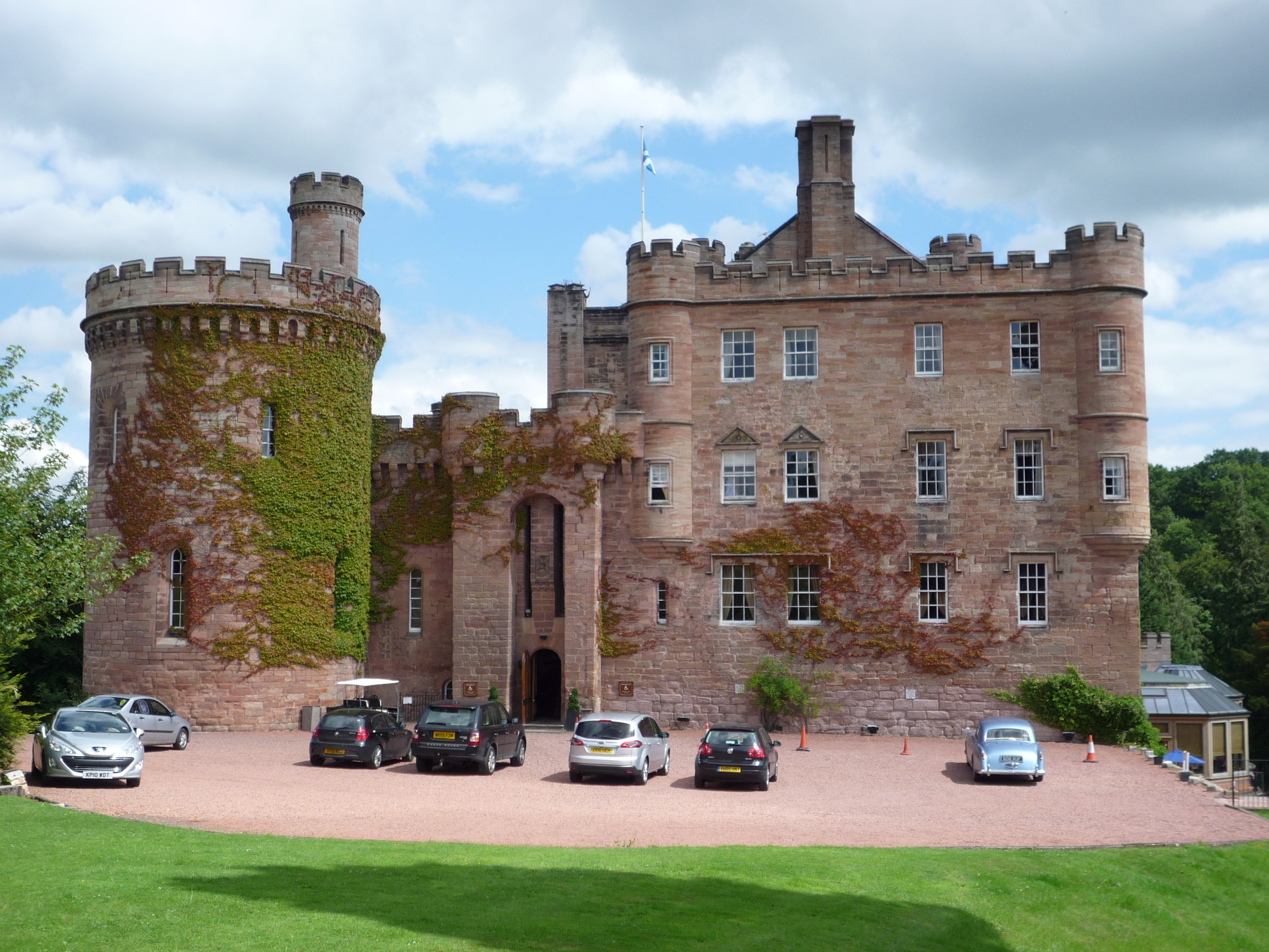
Dalhousie Castle

Dalhousie Castle is a castle in Cockpen, Midlothian, Scotland. Dalhousie Castle is situated near the town of Bonnyrigg, 8 miles (13 km) south of Edinburgh...

Rosewell and Hawthornden railway station

Rosewell and Hawthornden railway station served the village of Rosewell, Midlothian, Scotland from 1855 to 1962 on the Peebles Railway. == History == The...

Nearby Amenities

Located within 500m of 55.851018,-3.1072144
Barrier: bollard
Lat/Long: 55.849069/-3.113812
Fixme: continue
Lat/Long: 55.851475/-3.1126285
Fixme: continue
Lat/Long: 55.8494664/-3.1106061
Fixme: continue
Lat/Long: 55.8501199/-3.1109762
The data included in this document is from www.openstreetmap.org. The data is made available under ODbL.

Have you been to Dalhousie Burn Plantation?

Leave your review of Dalhousie Burn Plantation below (or comments, questions and feedback).