Drum Wood

Wood, Forest in Midlothian

Scotland

Drum Wood

Road, Edmonstone Near the site of Edmonstone House. Construction work has commenced on building houses on the southern part of the estate.
The house was demolished in the 1960s after having become a ruin around the time of World War II. The estate was once going to become a park similar to Cammo and trees were planted. Others had different ideas and eventually the planners allowed it to become housing.
Road, Edmonstone Credit: Richard Webb

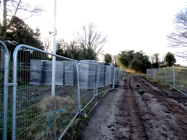
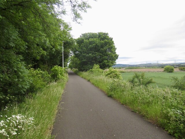
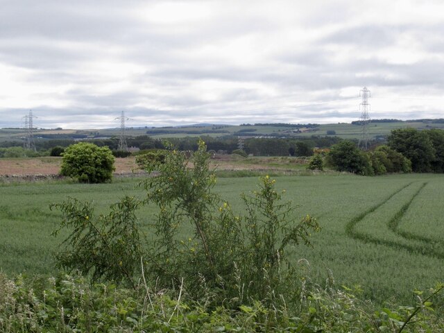
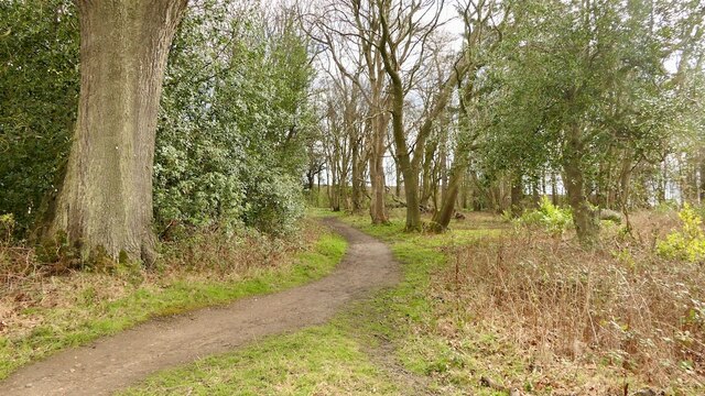
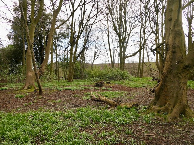
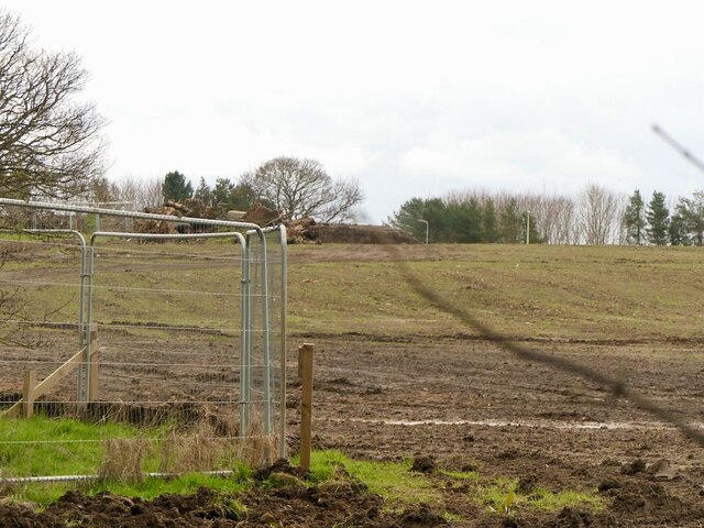
Drum Wood, located in Midlothian, Scotland, is a picturesque forest that covers an area of approximately 100 acres. It is a popular destination for nature enthusiasts, hikers, and wildlife lovers due to its unique features and diverse ecosystem.

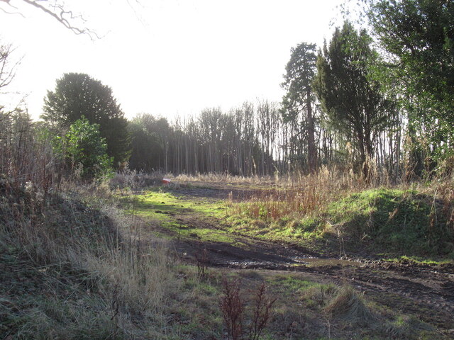
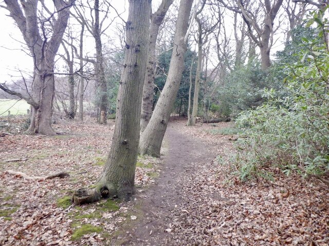
The woodland is predominantly composed of native broadleaf trees, including oak, birch, and ash, which create a dense and vibrant canopy. This provides a rich habitat for a variety of wildlife species, such as red squirrels, roe deer, and numerous bird species. The forest floor is covered in a lush carpet of ferns, mosses, and wildflowers, adding to the overall beauty and tranquility of the area.

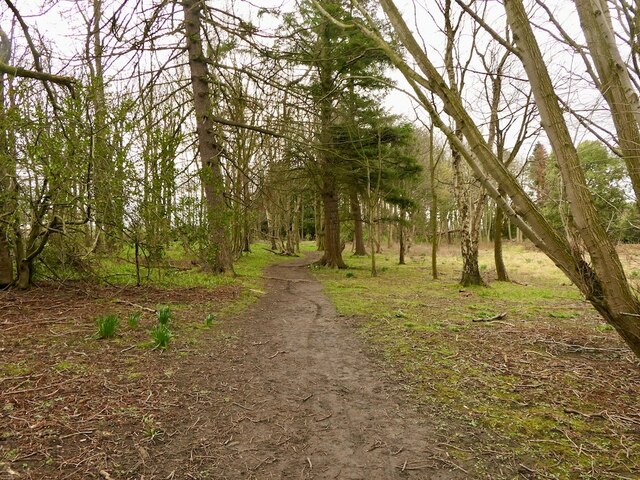
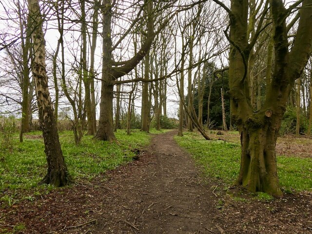
Several well-maintained trails and paths crisscross Drum Wood, offering visitors the opportunity to explore its natural wonders. These paths lead to hidden corners, open clearings, and scenic viewpoints, allowing for a truly immersive experience in the heart of nature.

In addition to its natural beauty, Drum Wood also holds historical significance. It is believed to have been a hunting ground for ancient Scottish clans, with remnants of stone circles and burial mounds found within its boundaries. These archaeological features provide a glimpse into the rich cultural heritage of the area.

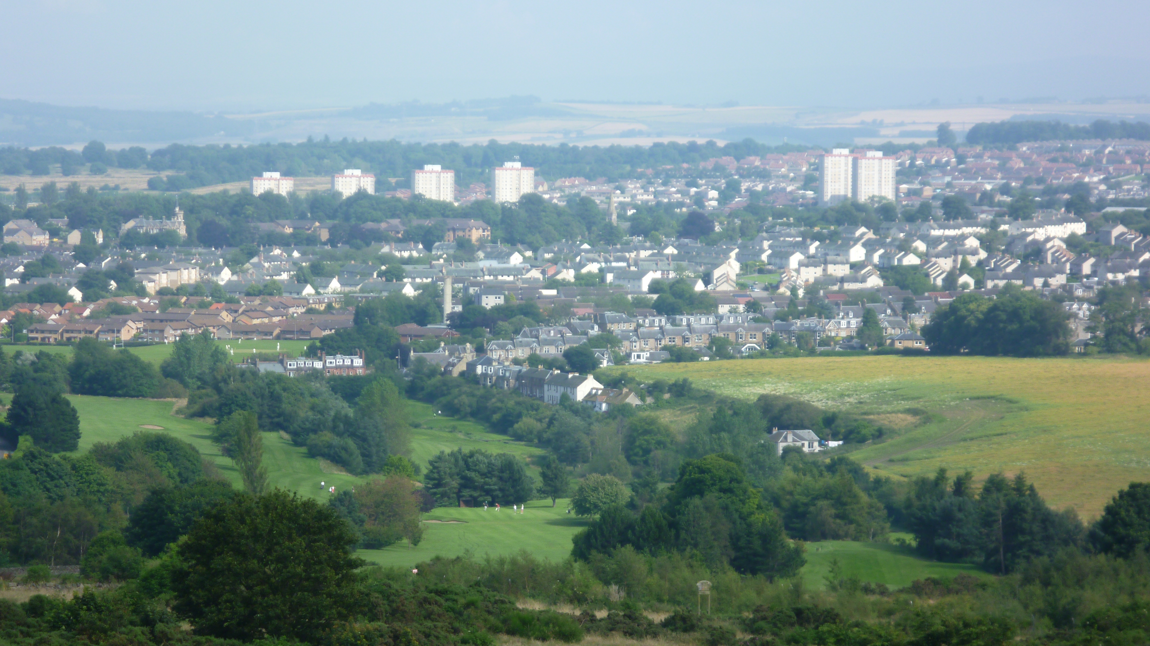
Drum Wood is easily accessible, with ample parking and facilities for visitors. It offers a peaceful retreat from the bustling city life, providing a serene environment to reconnect with nature and enjoy the wonders of the Scottish countryside.

If you have any feedback on the listing, please let us know in the comments section below.

Drum Wood Images

Images are sourced within 2km of 55.909695/-3.1217961 or Grid Reference NT2969. Thanks to Geograph Open Source API. All images are credited.

Road, Edmonstone Near the site of Edmonstone House. Construction work has commenced on building houses on the southern part of the estate.
The house was demolished in the 1960s after having become a ruin around the time of World War II. The estate was once going to become a park similar to Cammo and trees were planted. Others had different ideas and eventually the planners allowed it to become housing.
Road, Edmonstone
Near the site of Edmonstone House. Construction work has commenced on building houses on the southern part of the estate. The house was demolished in the 1960s after having become a ruin around the time of World War II. The estate was once going to become a park similar to Cammo and trees were planted. Others had different ideas and eventually the planners allowed it to become housing.
Site of Edmonstone House Edmonstone was a long established estate with a house here since the 13th century. The last house (18th century) became ruined around the time of the Second World War and was demolished like many old Edinburgh periphery big houses in the 1960s. The estate was once destined to become a park, but developers had other ideas and over a 20 years campaign got permission to build houses here. Some went into the walled garden and surrounds a few years ago and construction has commenced between here, the Wisp and Old Dalkeith Road.
Alternative names include Edmonstoun, Edmonstown, Edmonston
Site of Edmonstone House
Edmonstone was a long established estate with a house here since the 13th century. The last house (18th century) became ruined around the time of the Second World War and was demolished like many old Edinburgh periphery big houses in the 1960s. The estate was once destined to become a park, but developers had other ideas and over a 20 years campaign got permission to build houses here. Some went into the walled garden and surrounds a few years ago and construction has commenced between here, the Wisp and Old Dalkeith Road. Alternative names include Edmonstoun, Edmonstown, Edmonston
Danderhall Village sign At the western edge of the village, where Edmonstone Road meets The Wisp, it is one of three village signs organised by the Danderhall and District Gardeners, an active volunteer group in the ex-mining mining area, launched in April 2021 <a href="https://www.geograph.org.uk/photo/7201292">NT3069 : Danderhall Village sign - detail</a>, <span class="nowrap"><a title="https://www.midlothianview.com/news/danderhall-guerrilla-gardeners-launch/#:~:text=Danderhall%20and%20District%20Guerrilla%20Gardeners,agreement%20with%20the%20local%20authority" rel="nofollow ugc noopener" href="https://www.midlothianview.com/news/danderhall-guerrilla-gardeners-launch/#:~:text=Danderhall%20and%20District%20Guerrilla%20Gardeners,agreement%20with%20the%20local%20authority">Link</a><img style="margin-left:2px;" alt="External link" title="External link - shift click to open in new window" src="https://s1.geograph.org.uk/img/external.png" width="10" height="10"/></span>.
Danderhall Village sign
At the western edge of the village, where Edmonstone Road meets The Wisp, it is one of three village signs organised by the Danderhall and District Gardeners, an active volunteer group in the ex-mining mining area, launched in April 2021 NT3069 : Danderhall Village sign - detail, LinkExternal link.
Danderhall Village sign - detail Information about the local guerilla gardeners' sign for the village <a href="https://www.geograph.org.uk/photo/7201287">NT3069 : Danderhall Village sign</a>.
Danderhall Village sign - detail
Information about the local guerilla gardeners' sign for the village NT3069 : Danderhall Village sign.
Fire damaged house, Danderhall This house, at the corner of The Wisp and Edmonstone Road [3 Toscana Court, according to the map] seems to have suffered from a serious fire, but I have not been able find any details. It appears undamaged on Google Street View imagery of March 2021.
Fire damaged house, Danderhall
This house, at the corner of The Wisp and Edmonstone Road [3 Toscana Court, according to the map] seems to have suffered from a serious fire, but I have not been able find any details. It appears undamaged on Google Street View imagery of March 2021.
Unhelpful yellow notice at Danderhall 'Closing existing right of way for three years' raises questions!
Who put it there? It does not look like an official council notice.
How long has it been there - when was the start date?
Closed until when? it was there in March 2012 - Street View Google.
Which Right-of-Way exactly?
Unhelpful yellow notice at Danderhall
'Closing existing right of way for three years' raises questions! Who put it there? It does not look like an official council notice. How long has it been there - when was the start date? Closed until when? it was there in March 2012 - Street View Google. Which Right-of-Way exactly?
Rails to trails, Drum The mineral line from Bilston Colliery is now a path
Rails to trails, Drum
The mineral line from Bilston Colliery is now a path
Wheat field between Drum and Todhills
Park and ride, Shawfair Gave it a go after a visit to the bank in Dalkeith - takes ages to get into town.
Park and ride, Shawfair
Gave it a go after a visit to the bank in Dalkeith - takes ages to get into town.
Stripwood near Melville Cottages
Powerlines south of Drum Farmland within the City Bypass - ie doomed.
Powerlines south of Drum
Farmland within the City Bypass - ie doomed.
Bus stop, Gilmerton Road
Roadworks, Gilmerton Road
Path, Edmonstone Policies Through a small wood and restricted to it. Immediately to the south there is a building site.
Path, Edmonstone Policies
Through a small wood and restricted to it. Immediately to the south there is a building site.
Policy woodland, Edmonstone The field in the background is being built upon.
Policy woodland, Edmonstone
The field in the background is being built upon.
Path, Edmonstone As usual here, there was a pest on a motorbike about.
Path, Edmonstone
As usual here, there was a pest on a motorbike about.
Policy woodland, Edmonstone East of the site of the house. There is a building site to the left.
Policy woodland, Edmonstone
East of the site of the house. There is a building site to the left.
Edmonstone policies Once attractive parkland between the house site and The Wisp (a road whose lights can be seen in the background), this is now a building site.
Edmonstone policies
Once attractive parkland between the house site and The Wisp (a road whose lights can be seen in the background), this is now a building site.
Show me another place!

Drum Wood is located at Grid Ref: NT2969 (Lat: 55.909695, Lng: -3.1217961)

Unitary Authority: City of Edinburgh

Police Authority: Edinburgh

What 3 Words

///cult.rank.pinch. Near Danderhall, Midlothian

Related Wikis

The Drum, Edinburgh

The Drum is an 18th-century country house and estate on the outskirts of Edinburgh, Scotland. Located between the Gilmerton and Danderhall areas, The Drum...

Ferniehill

Ferniehill is a residential neighbourhood of Edinburgh, the capital of Scotland. Primarily a low-density (bunglaows and terraced houses) 1960s council...

Fernieside

Fernieside is a neighbourhood on the southern edge of the city of Edinburgh, Scotland, four miles (6.5 km) southeast of the city centre. It is very close...

Gilmerton

Gilmerton (Scottish Gaelic: Baile GhilleMhoire, IPA:[ˈpaləˈʝiːʎəˈvɔɾʲə]) is a suburb of Edinburgh, about 4 miles (6.4 km) southeast of the city centre...
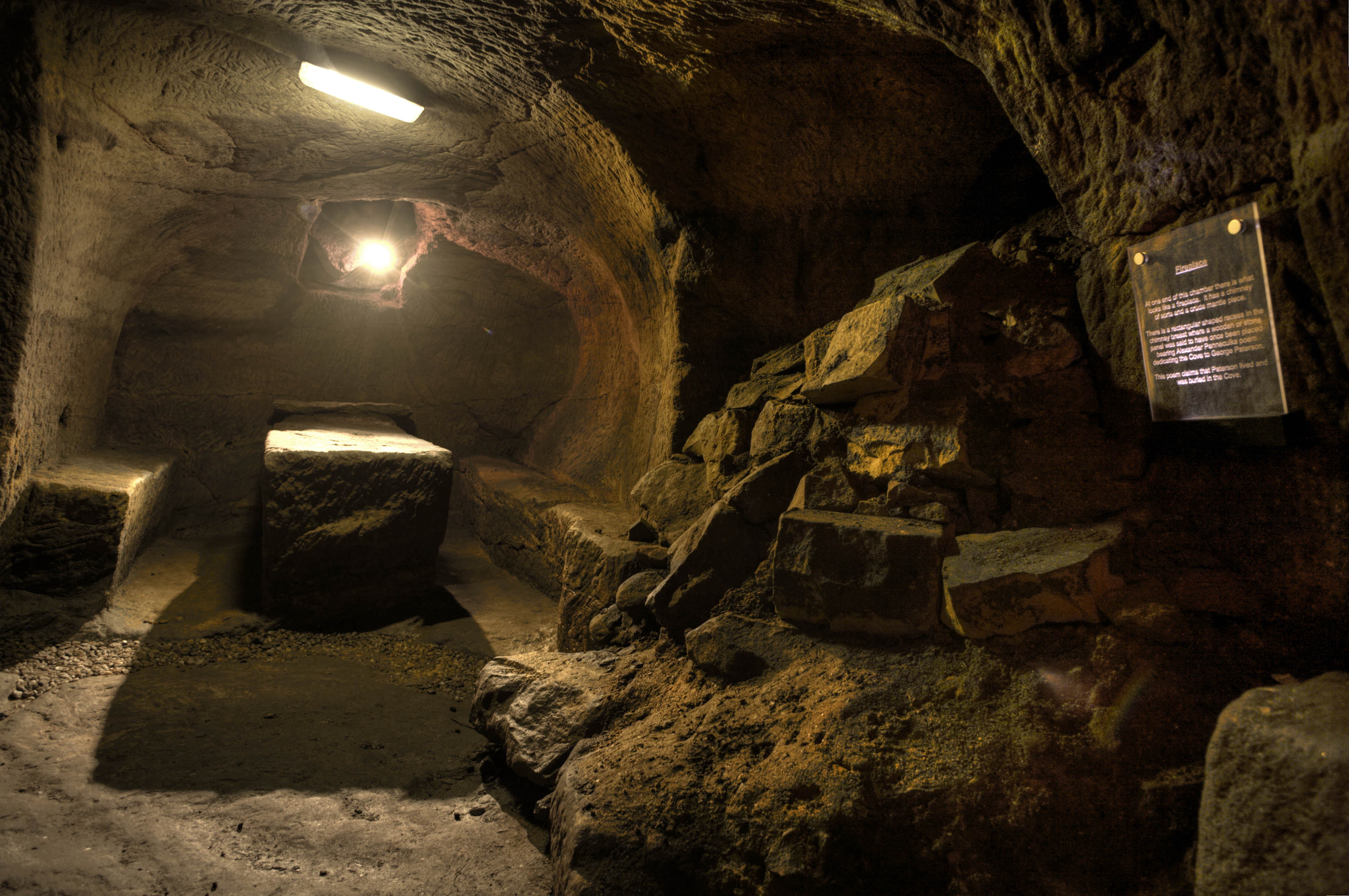
Gilmerton Cove

Gilmerton Cove is a series of underground passageways and chambers hand-carved from sandstone located beneath the streets of Gilmerton, an ex-mining village...

Moredun

Moredun is a district in the south-east of Edinburgh, the capital of Scotland. It is east of Liberton, while Craigour is situated just to its north.The...
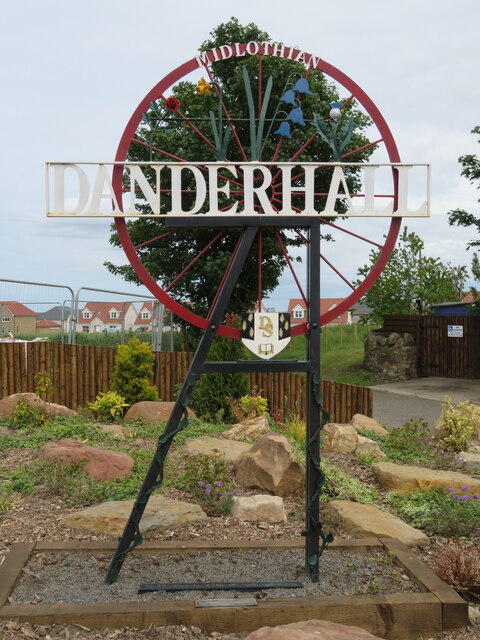
Danderhall

Danderhall is a village in Midlothian, Scotland, just outside Edinburgh but inside the Edinburgh City Bypass. == Overview == The village includes a large...

Gilmerton railway station

Gilmerton railway station served the suburb of Gilmerton, historically in Edinburghshire and Midlothian, Scotland, from 1874 to 1959 on the Edinburgh,...

Nearby Amenities

Located within 500m of 55.909695,-3.1217961
Traffic Signals
Source: survey
Lat/Long: 55.9132314/-3.125425
Traffic Signals
Lat/Long: 55.9133485/-3.1176467
Give Way
Lat/Long: 55.9120554/-3.1271081
Crossing
Button Operated: yes
Crossing: traffic_signals
Crossing Island: no
Tactile Paving: yes
Traffic Signals Sound: no
Traffic Signals Vibration: yes
Lat/Long: 55.9134707/-3.1175365
Turning Circle
Lat/Long: 55.9091721/-3.1265696
Bus Stop
Moredun Park Road
Naptan AtcoCode: 6200209500
Naptan Bearing: E
Naptan CommonName: Moredun Park Road
Naptan Indicator: At 123
Naptan Landmark: Old Dalkeith Road
Naptan NaptanCode: 36237395
Naptan PlusbusZoneRef: EDINBUR
Naptan Street: Ferniehill Road
Naptan Verified: no
Public Transport: platform
Source: naptan_import
Lat/Long: 55.9124487/-3.1266841
Bus Stop
Moredun Park Road
Bench: yes
Bin: no
Naptan AtcoCode: 6200239125
Naptan Bearing: W
Naptan CommonName: Moredun Park Road
Naptan Indicator: Opp 123-125
Naptan Landmark: Moredun Park Road
Naptan NaptanCode: 36235264
Naptan PlusbusZoneRef: EDINBUR
Naptan Street: Ferniehill Drive
Naptan Verified: no
Passenger Information Display: no
Public Transport: platform
Shelter: yes
Source: naptan_import
Lat/Long: 55.9124056/-3.1264908
Bus Stop
Ferniehill Street
Naptan AtcoCode: 6200239130
Naptan Bearing: W
Naptan CommonName: Ferniehill Street
Naptan Indicator: At 46-48
Naptan Landmark: Ferniehill Street
Naptan NaptanCode: 36235265
Naptan PlusbusZoneRef: EDINBUR
Naptan Street: Ferniehill Drive
Naptan Verified: no
Public Transport: platform
Source: naptan_import
Lat/Long: 55.9081402/-3.1291187
Post Box
Operator: Royal Mail
Post Box Type: pillar
Ref: EH17 308
Royal Cypher: scottish_crown
Source: drive-by survey
Lat/Long: 55.9086202/-3.1287014
Bus Stop
The Wisp
Bench: yes
Bin: yes
Bus: yes
Naptan AdministrativeAreaCode: 130
Naptan Area Name: Midlothian
Naptan AtcoAreaCode: 628
Naptan AtcoCode: 6280327310
Naptan Bearing: W
Naptan CommonName: The Wisp
Naptan Indicator: opp
Naptan Landmark: Drumbank House
Naptan LocalityName: Danderhall
Naptan NaptanCode: 64323597
Naptan NptgLocalityCode: ES000997
Naptan SourceLocalityType: Lo
Naptan StopAreaCode: 628G327310
Naptan StopAreaType: GPBS
Naptan StopArea Name: The Wisp
Naptan Street: Old Dalkeith Road
Naptan Verified: yes
Public Transport: platform
Shelter: yes
Source: NaPTAN + Survey
Lat/Long: 55.9132017/-3.1168176
Addr City: Edinburgh
Addr Housenumber: 604
Addr Street: Old Dalkeith Road
Lat/Long: 55.9129214/-3.1195971
Communication Gsm: yes
Communication Lte: yes
Communication Mobile Phone: yes
Communication Nr: yes
Man Made: tower
Tower Type: communication
Lat/Long: 55.9120973/-3.1200353
Waste Basket
Lat/Long: 55.9081702/-3.1290819
Waste Basket
Lat/Long: 55.9124521/-3.1264521
Traffic Calming: hump
Lat/Long: 55.9122786/-3.1276676
Addr City: Edinburgh
Addr Housenumber: 23
Addr Street: Ferniehill Grove
Lat/Long: 55.9105298/-3.1277387
Addr City: Edinburgh
Addr Housenumber: 72
Addr Street: Ferniehill Gardens
Lat/Long: 55.9098668/-3.1272799
Access: no
Barrier: fence
Foot: no
Lat/Long: 55.9132778/-3.1251343
Barrier: cycle_barrier
Bicycle: no
Foot: yes
Horse: no
Motor Vehicle: no
Lat/Long: 55.9129886/-3.1246458
Addr City: Edinburgh
Addr Housenumber: 545
Addr Street: Old Dalkeith Road
Lat/Long: 55.9132375/-3.1250886
Cycleway: asl
Lat/Long: 55.9131651/-3.1255674
Cycleway: asl
Lat/Long: 55.9130945/-3.1252217
Cycleway: asl
Lat/Long: 55.9133449/-3.1255978
Crossing
Crossing: uncontrolled
Crossing Island: yes
Kerb: lowered
Tactile Paving: no
Lat/Long: 55.9121501/-3.1269092
Addr City: Edinburgh
Addr Housenumber: 135
Addr Street: Ferniehill Road
Lat/Long: 55.9129279/-3.1262105
Addr City: Edinburgh
Addr Housenumber: 137
Addr Street: Ferniehill Road
Lat/Long: 55.913007/-3.1261247
Addr City: Edinburgh
Addr Housenumber: 139
Addr Street: Ferniehill Road
Lat/Long: 55.9131039/-3.1261157
Addr City: Edinburgh
Addr Housenumber: 141
Addr Street: Ferniehill Road
Lat/Long: 55.9131847/-3.1260118
Addr City: Edinburgh
Addr Housenumber: 542
Addr Street: Old Dalkeith Road
Lat/Long: 55.9133679/-3.1260764
Addr City: Edinburgh
Addr Housenumber: 540
Addr Street: Old Dalkeith Road
Lat/Long: 55.9134342/-3.1261857
Crossing
Crossing: traffic_signals
Crossing Island: yes
Kerb: lowered
Tactile Paving: yes
Lat/Long: 55.9133006/-3.1255345
Traffic Signals
Crossing: traffic_signals
Crossing Island: yes
Kerb: lowered
Tactile Paving: yes
Lat/Long: 55.9131854/-3.1256989
Addr City: Edinburgh
Addr Housenumber: 151
Addr Street: Moredun Park Road
Lat/Long: 55.9124368/-3.127814
Addr City: Edinburgh
Addr Housenumber: 153
Addr Street: Moredun Park Road
Lat/Long: 55.9124069/-3.1276626
Addr City: Edinburgh
Addr Housenumber: 157
Addr Street: Moredun Park Road
Lat/Long: 55.9122778/-3.127339
Addr City: Edinburgh
Addr Housenumber: 155
Addr Street: Moredun Park Road
Lat/Long: 55.9123412/-3.1274923
Addr City: Edinburgh
Addr Housenumber: 168
Addr Street: Moredun Park Road
Lat/Long: 55.9120978/-3.1275513
Addr City: Edinburgh
Addr Housenumber: 166
Addr Street: Moredun Park Road
Lat/Long: 55.9121627/-3.1277112
Addr City: Edinburgh
Addr Housenumber: 164
Addr Street: Moredun Park Road
Lat/Long: 55.9122084/-3.1278376
Addr City: Edinburgh
Addr Housenumber: 162
Addr Street: Moredun Park Road
Lat/Long: 55.912256/-3.1279815
Addr City: Edinburgh
Addr Housenumber: 160
Addr Street: Moredun Park Road
Lat/Long: 55.9122931/-3.1281483
Addr City: Edinburgh
Addr Housenumber: 2
Addr Street: Fernieside Grove
Lat/Long: 55.9126006/-3.1279248
Addr City: Edinburgh
Addr Housenumber: 18
Addr Street: Fernieside Grove
Lat/Long: 55.9130134/-3.1270158
Addr City: Edinburgh
Addr Housenumber: 20
Addr Street: Fernieside Grove
Lat/Long: 55.9130278/-3.1268523
Addr City: Edinburgh
Addr Housenumber: 22
Addr Street: Fernieside Grove
Lat/Long: 55.9131066/-3.126736
Addr City: Edinburgh
Addr Housenumber: 24
Addr Street: Fernieside Grove
Lat/Long: 55.9131969/-3.1267576
Waste Basket
Lat/Long: 55.9091235/-3.1268312
Addr City: Edinburgh
Addr Housenumber: 80
Addr Street: Fernieside Crescent
Lat/Long: 55.9116123/-3.1289533
Addr City: Edinburgh
Addr Housenumber: 82
Addr Street: Fernieside Crescent
Lat/Long: 55.9116386/-3.128811
Addr City: Edinburgh
Addr Housenumber: 84
Addr Street: Fernieside Crescent
Lat/Long: 55.9116438/-3.1287718
Addr City: Edinburgh
Addr Housenumber: 86
Addr Street: Fernieside Crescent
Lat/Long: 55.9116522/-3.1286321
Addr City: Edinburgh
Addr Housenumber: 88
Addr Street: Fernieside Crescent
Lat/Long: 55.9117518/-3.1285264
Addr City: Edinburgh
Addr Housenumber: 90
Addr Street: Fernieside Crescent
Lat/Long: 55.9117686/-3.1283876
Addr City: Edinburgh
Addr Housenumber: 92
Addr Street: Fernieside Crescent
Lat/Long: 55.9118428/-3.1282947
Addr City: Edinburgh
Addr Housenumber: 94
Addr Street: Fernieside Crescent
Lat/Long: 55.911942/-3.1283351
Addr City: Edinburgh
Addr Housenumber: 96
Addr Street: Fernieside Crescent
Lat/Long: 55.9119857/-3.1284673
Addr City: Edinburgh
Addr Housenumber: 98
Addr Street: Fernieside Crescent
Lat/Long: 55.9119677/-3.128617
Addr City: Edinburgh
Addr Housenumber: 107
Addr Street: Ferniehill Road
Lat/Long: 55.9115993/-3.1279434
Addr City: Edinburgh
Addr Housenumber: 109
Addr Street: Ferniehill Road
Lat/Long: 55.9116672/-3.1278543
Addr City: Edinburgh
Addr Housenumber: 111
Addr Street: Ferniehill Road
Lat/Long: 55.9117437/-3.1277445
Addr City: Edinburgh
Addr Housenumber: 113
Addr Street: Ferniehill Road
Lat/Long: 55.9117968/-3.1276917
Addr City: Edinburgh
Addr Housenumber: 115
Addr Street: Ferniehill Road
Lat/Long: 55.9118874/-3.1275739
Addr City: Edinburgh
Addr Housenumber: 117
Addr Street: Ferniehill Road
Lat/Long: 55.9119372/-3.1274957
Addr City: Edinburgh
Addr Housenumber: 119
Addr Street: Ferniehill Road
Lat/Long: 55.9123045/-3.1270299
Addr City: Edinburgh
Addr Housenumber: 121
Addr Street: Ferniehill Road
Lat/Long: 55.9123885/-3.126902
Addr City: Edinburgh
Addr Housenumber: 123
Addr Street: Ferniehill Road
Lat/Long: 55.9125057/-3.1268047
Addr City: Edinburgh
Addr Housenumber: 125
Addr Street: Ferniehill Road
Lat/Long: 55.9125636/-3.1267316
Give Way
Lat/Long: 55.9114912/-3.1272948
Addr City: Edinburgh
Addr Housenumber: 127
Addr Street: Ferniehill Road
Lat/Long: 55.9126418/-3.1265927
Addr City: Edinburgh
Addr Housenumber: 129
Addr Street: Ferniehill Road
Lat/Long: 55.9127266/-3.1264846
Addr City: Edinburgh
Addr Housenumber: 131
Addr Street: Ferniehill Road
Lat/Long: 55.9127859/-3.1264037
Addr City: Edinburgh
Addr Housenumber: 133
Addr Street: Ferniehill Road
Lat/Long: 55.9128697/-3.1262987
Addr City: Edinburgh
Addr Housenumber: 2
Addr Street: Edwards Wynd
Lat/Long: 55.9060273/-3.1258828
Addr City: Edinburgh
Addr Housenumber: 4
Addr Street: Edwards Wynd
Lat/Long: 55.9061175/-3.125826
Addr City: Edinburgh
Addr Housenumber: 6
Addr Street: Edwards Wynd
Lat/Long: 55.9062326/-3.1257274
Addr City: Edinburgh
Addr Housenumber: 10
Addr Street: Edwards Wynd
Lat/Long: 55.9064124/-3.1255979
Addr City: Edinburgh
Addr Housenumber: 12
Addr Street: Edwards Wynd
Lat/Long: 55.9064943/-3.1255571
Addr City: Edinburgh
Addr Housenumber: 1
Addr Street: Edwards Wynd
Lat/Long: 55.9062663/-3.1260662
Addr City: Edinburgh
Addr Housenumber: 3
Addr Street: Edwards Wynd
Lat/Long: 55.9063715/-3.1259984
Addr City: Edinburgh
Addr Housenumber: 5
Addr Street: Edwards Wynd
Lat/Long: 55.9064508/-3.1259468
Addr City: Edinburgh
Addr Housenumber: 9
Addr Street: Edwards Wynd
Lat/Long: 55.9066254/-3.1258152
Addr City: Edinburgh
Addr Housenumber: 11
Addr Street: Edwards Wynd
Lat/Long: 55.9067039/-3.1257658
Addr City: Edinburgh
Addr Housenumber: 13
Addr Street: Edwards Wynd
Lat/Long: 55.906789/-3.1257145
Addr City: Edinburgh
Addr Housenumber: 15
Addr Street: Edwards Wynd
Lat/Long: 55.9068909/-3.1256304
Addr City: Edinburgh
Addr Housenumber: 17
Addr Street: Edwards Wynd
Lat/Long: 55.9071262/-3.1257775
Addr City: Edinburgh
Addr Housenumber: 19
Addr Street: Edwards Wynd
Lat/Long: 55.9070687/-3.1255956
Addr City: Edinburgh
Addr Housenumber: 21
Addr Street: Edwards Wynd
Lat/Long: 55.9070326/-3.1254232
Addr City: Edinburgh
Addr Housenumber: 23
Addr Street: Edwards Wynd
Lat/Long: 55.9067869/-3.125329
Addr City: Edinburgh
Addr Housenumber: 25
Addr Street: Edwards Wynd
Lat/Long: 55.9067377/-3.12515
Addr City: Edinburgh
Addr Housenumber: 16
Addr Street: Edwards Wynd
Lat/Long: 55.9064667/-3.1251885
Addr City: Edinburgh
Addr Housenumber: 18
Addr Street: Edwards Wynd
Lat/Long: 55.906447/-3.1250934
Addr City: Edinburgh
Addr Housenumber: 20
Addr Street: Edwards Wynd
Lat/Long: 55.9063753/-3.1249545
Addr City: Edinburgh
Addr Housenumber: 22
Addr Street: Edwards Wynd
Lat/Long: 55.9063608/-3.1248848
Addr City: Edinburgh
Addr Housenumber: 29
Addr Street: Edwards Wynd
Lat/Long: 55.9065576/-3.1248702
Addr City: Edinburgh
Addr Housenumber: 31
Addr Street: Edwards Wynd
Lat/Long: 55.9065242/-3.1247274
Addr City: Edinburgh
Addr Housenumber: 35
Addr Street: Edwards Wynd
Lat/Long: 55.9064527/-3.1243881
Addr City: Edinburgh
Addr Housenumber: 37
Addr Street: Edwards Wynd
Lat/Long: 55.9062675/-3.1243815
Addr City: Edinburgh
Addr Housenumber: 41
Addr Street: Edwards Wynd
Lat/Long: 55.9060896/-3.1245014
Addr City: Edinburgh
Addr Housenumber: 43
Addr Street: Edwards Wynd
Lat/Long: 55.9059907/-3.1245791
Addr City: Edinburgh
Addr Housenumber: 45
Addr Street: Edwards Wynd
Lat/Long: 55.9058909/-3.1246589
Addr City: Edinburgh
Addr Housenumber: 47
Addr Street: Edwards Wynd
Lat/Long: 55.905851/-3.1246871
Addr City: Edinburgh
Addr Housenumber: 14
Addr Street: Edwards Wynd
Lat/Long: 55.9066039/-3.1255037
Addr City: Edinburgh
Addr Housenumber: 7
Addr Street: Edwards Wynd
Lat/Long: 55.9065363/-3.1258662
Addr City: Edinburgh
Addr Housenumber: 8
Addr Street: Edwards Wynd
Lat/Long: 55.9063304/-3.1256664
Addr City: Edinburgh
Addr Housenumber: 27
Addr Street: Edwards Wynd
Lat/Long: 55.9066552/-3.1250197
Addr City: Edinburgh
Addr Housenumber: 33
Addr Street: Edwards Wynd
Lat/Long: 55.906495/-3.124566
Addr City: Edinburgh
Addr Housenumber: 24
Addr Street: Edwards Wynd
Lat/Long: 55.9063131/-3.1247192
Addr City: Edinburgh
Addr Housenumber: 39
Addr Street: Edwards Wynd
Lat/Long: 55.9061748/-3.1244621
Addr City: Edinburgh
Addr Housenumber: 26
Addr Street: Edwards Wynd
Lat/Long: 55.9061099/-3.1248457
Addr City: Edinburgh
Addr Housenumber: 28
Addr Street: Edwards Wynd
Lat/Long: 55.9060214/-3.1248949
Addr City: Edinburgh
Addr Housenumber: 30
Addr Street: Edwards Wynd
Lat/Long: 55.9058815/-3.124984
Addr City: Edinburgh
Addr Housenumber: 32
Addr Street: Edwards Wynd
Lat/Long: 55.9058045/-3.1250328
Addr City: Edinburgh
Addr Housenumber: 34
Addr Street: Edwards Wynd
Lat/Long: 55.905718/-3.1250698
Addr City: Edinburgh
Addr Housenumber: 49
Addr Street: Edwards Wynd
Lat/Long: 55.9057499/-3.124723
Addr City: Edinburgh
Addr Housenumber: 51
Addr Street: Edwards Wynd
Lat/Long: 55.9056691/-3.1247791
Addr City: Edinburgh
Addr Housenumber: 53
Addr Street: Edwards Wynd
Lat/Long: 55.9055729/-3.1248429
Crossing
Button Operated: yes
Crossing: traffic_signals
Kerb: lowered
Tactile Paving: yes
Traffic Signals Sound: no
Traffic Signals Vibration: yes
Lat/Long: 55.913327/-3.1173952
Crossing
Crossing: traffic_signals
Lat/Long: 55.9133282/-3.1178979
Barrier: entrance
Bicycle: yes
Foot: yes
Motor Vehicle: no
Wheelchair: limited
Lat/Long: 55.9135837/-3.1251415
Mercat Cross
Access: yes
Historic: monument
Lat/Long: 55.9067906/-3.1197517
The data included in this document is from www.openstreetmap.org. The data is made available under ODbL.

Have you been to Drum Wood?

Leave your review of Drum Wood below (or comments, questions and feedback).