Binn Plantations

Wood, Forest in Perthshire

Scotland

Binn Plantations

Blacklaw Hill Trig Pillar Looking westwards on the summit area of Blacklaw Hill to the triangulation pillar, with the Zoe Matheson memorial seat to the right.
Blacklaw Hill Trig Pillar Credit: Scott Cormie

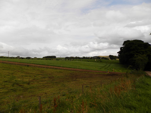
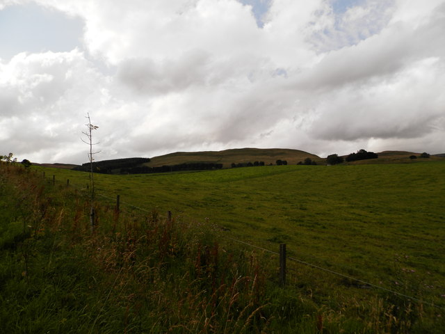
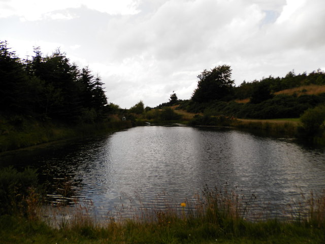
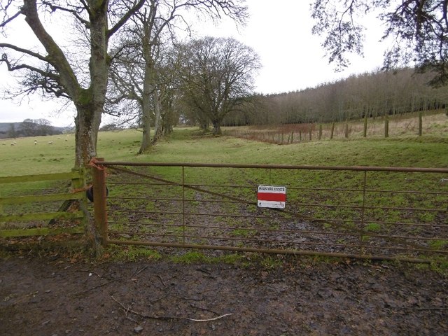
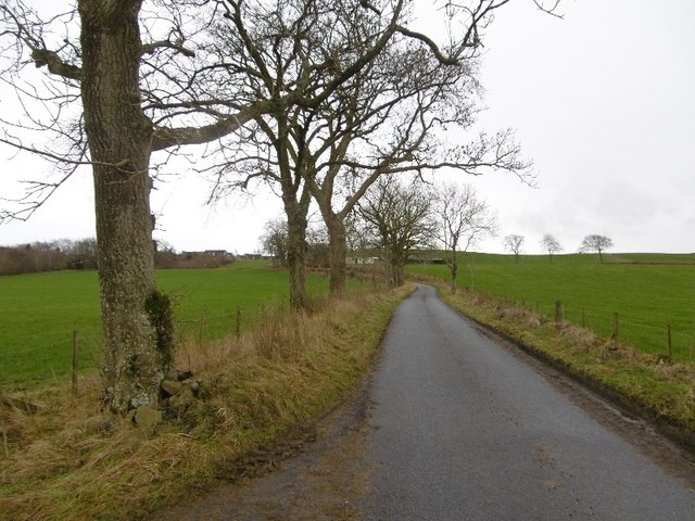
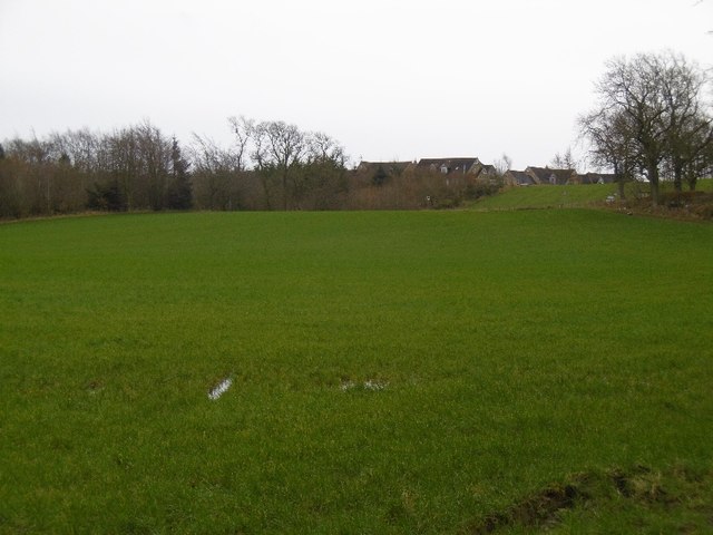
Binn Plantations is a sprawling woodland located in the heart of Perthshire, Scotland. Covering an expansive area, it stretches over several hundred hectares and is renowned for its lush greenery, diverse flora, and tranquil atmosphere. The plantation is situated approximately 10 miles northwest of the city of Perth and is easily accessible by road.

The woodland is predominantly composed of a mix of coniferous and deciduous trees, including Scots pine, oak, birch, and spruce, creating a rich tapestry of colors throughout the seasons. The abundance of wildlife, such as red squirrels, roe deer, and a variety of bird species, adds to the natural beauty and allure of this enchanting forest.

Binn Plantations offers a range of recreational activities for visitors to enjoy. There are numerous walking trails, allowing visitors to explore the woodland at their own pace and immerse themselves in the serene surroundings. The pathways are well-maintained and signposted, ensuring a safe and pleasant experience for all.

In addition to walking, Binn Plantations also caters to those who enjoy cycling and horse riding. The forest trails provide an ideal setting for both activities, with designated routes available for riders of all levels. The plantation also offers facilities for picnicking and camping, allowing visitors to fully embrace the natural splendor of the area.

Overall, Binn Plantations in Perthshire is a haven for nature enthusiasts, providing a peaceful retreat from the hustle and bustle of everyday life. Its scenic beauty, diverse wildlife, and range of recreational activities make it an ideal destination for individuals and families seeking solace in the great outdoors.

If you have any feedback on the listing, please let us know in the comments section below.

Binn Plantations Images

Images are sourced within 2km of 56.49757/-3.1520575 or Grid Reference NO2934. Thanks to Geograph Open Source API. All images are credited.

Blacklaw Hill Trig Pillar Looking westwards on the summit area of Blacklaw Hill to the triangulation pillar, with the Zoe Matheson memorial seat to the right.
Blacklaw Hill Trig Pillar
Looking westwards on the summit area of Blacklaw Hill to the triangulation pillar, with the Zoe Matheson memorial seat to the right.
Farmland near the village of Lundie
Upland farming near Lundie
Children's pond at Ledyatt
Woodland, Redmyre Mature conifers in a landscape dominated by younger woodlands.
Woodland, Redmyre
Mature conifers in a landscape dominated by younger woodlands.
Come on England  - you could do this The red band on the sign is the deletion of a keep out sign.  More advanced nations have laws against them, but we must never ever be complacent. 

A scattering of ancient beeches suggest there was once a tree lined strip here, old maps show a 2 acre elongated enclosure between the gate and Redmyre.
Come on England - you could do this
The red band on the sign is the deletion of a keep out sign. More advanced nations have laws against them, but we must never ever be complacent. A scattering of ancient beeches suggest there was once a tree lined strip here, old maps show a 2 acre elongated enclosure between the gate and Redmyre.
Old beech, Redmyre Once there was a line of beeches either side of a road here, possibly a pair of hedges.  Old maps show a long 2 acre (0.8 Ha) strip here. Redmyre Wood beyond has a chequered history. 1950s 1:25,000 maps show no woodland here, but there was a substantial wood here on the 25" map of 1900.
Old beech, Redmyre
Once there was a line of beeches either side of a road here, possibly a pair of hedges. Old maps show a long 2 acre (0.8 Ha) strip here. Redmyre Wood beyond has a chequered history. 1950s 1:25,000 maps show no woodland here, but there was a substantial wood here on the 25" map of 1900.
Road, Redmyre A local described a route with dense gorse in the area calling it the Priest's Road.  Later the route which is waymarked on Redmyre land, does become an attractive single track path through gorse and broom, before passing through a Forestry Commission plantation.  Well worth walking/riding.
Road, Redmyre
A local described a route with dense gorse in the area calling it the Priest's Road. Later the route which is waymarked on Redmyre land, does become an attractive single track path through gorse and broom, before passing through a Forestry Commission plantation. Well worth walking/riding.
Please respect nature Non compliant signage - more obvious keep out signs have been painted over.  You may like to put Redmyre Perthshire into a search engine and learn a little more about respecting nature.

This twee goml sign with its pretty picture is generic. I have seen them littering the place in Northumberland too. (Sadly they are still legal there).
Please respect nature
Non compliant signage - more obvious keep out signs have been painted over. You may like to put Redmyre Perthshire into a search engine and learn a little more about respecting nature. This twee goml sign with its pretty picture is generic. I have seen them littering the place in Northumberland too. (Sadly they are still legal there).
Woodland, Redmyre An older bit of woodland at Redmyre. Most of the trees elsewhere are much younger.
Woodland, Redmyre
An older bit of woodland at Redmyre. Most of the trees elsewhere are much younger.
Arable land, Binn Land west of here was also farmland until recently, it is now forested.  Dundee is in the background.
Arable land, Binn
Land west of here was also farmland until recently, it is now forested. Dundee is in the background.
Binn Arable land east of the new Redmyre woodlands.
Binn
Arable land east of the new Redmyre woodlands.
Field, Redmyre A normal field, not rough grazing as mapped at 1:25,000.
Field, Redmyre
A normal field, not rough grazing as mapped at 1:25,000.
Priest's Road There is still a way through the gorse and broom on a very attractive path through mixed woodland, mostly young but with some older trees.
Priest's Road
There is still a way through the gorse and broom on a very attractive path through mixed woodland, mostly young but with some older trees.
Priest's Road The path was obviously wider here once, but is now largely covered in gorse and broom.  It is however unobstructed and has gates which can be opened.
Priest's Road
The path was obviously wider here once, but is now largely covered in gorse and broom. It is however unobstructed and has gates which can be opened.
Wetland near Redmyre Marshy rough grazing next to the woodlands.
Wetland near Redmyre
Marshy rough grazing next to the woodlands.
Yellow road, Ledyatt Road out of Lundie towards the main road to Dundee.
Yellow road, Ledyatt
Road out of Lundie towards the main road to Dundee.
Field by Ledyatt Piperdam houses on the skyline.
Field by Ledyatt
Piperdam houses on the skyline.
Show me another place!

Binn Plantations is located at Grid Ref: NO2934 (Lat: 56.49757, Lng: -3.1520575)

Unitary Authority: Angus

Police Authority: Tayside

What 3 Words

///foot.gravest.doghouse. Near Longforgan, Perth & Kinross

Nearby Locations

Binn Plantations

Related Wikis

Sidlaws

The Sidlaws are a range of hills in the counties of Perthshire and Angus in Scotland that extend for 30 miles (45 km) from Kinnoull Hill, near Perth, northeast...

Lundie

Lundie is a parish and small settlement in Angus, Scotland, 10 miles (16 km) northwest of Dundee, situated at the head of the Dighty valley in the Sidlaws...

Lundie Kirk

Lundie Kirk was the parish church of Lundie, Angus, in Scotland from the 12th century until 2017. The church was constructed in Romanesque style in the...

Knapp, Perthshire

Knapp is a hamlet in Perth and Kinross, Scotland. It is located to the northeast of Inchture, about 9.7 miles (15.6 km) by road west of the city centre...

Nearby Amenities

Located within 500m of 56.49757,-3.1520575
Power: tower
Lat/Long: 56.5017523/-3.149675
Blacklaw Hill
Ele: 284
Natural: peak
Lat/Long: 56.4968889/-3.1561106
The data included in this document is from www.openstreetmap.org. The data is made available under ODbL.

Have you been to Binn Plantations?

Leave your review of Binn Plantations below (or comments, questions and feedback).