Tofthill Plantation

Wood, Forest in Fife

Scotland

Tofthill Plantation

Path to Markinch by Star The path to Markinch runs to the left of the fence line straight over this small rise to Markinch just over and down the other side. Fields starting to grow green in the warm Spring sunshine.
Path to Markinch by Star Credit: Jim Bain

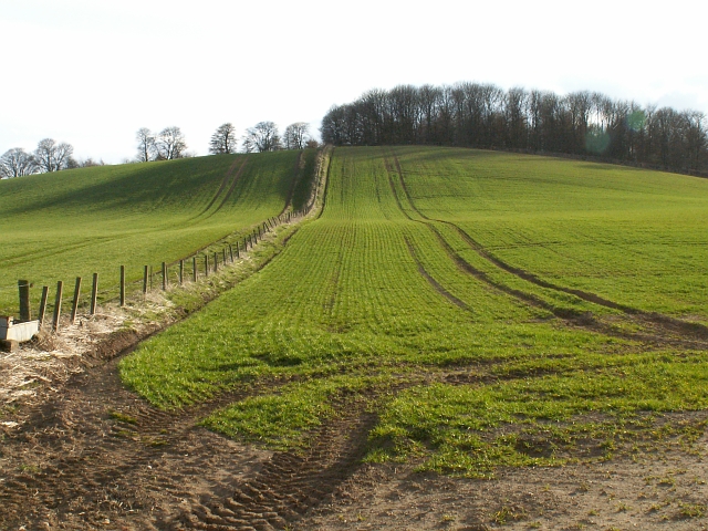
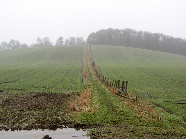
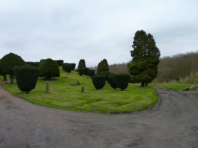
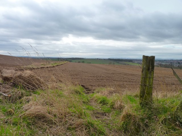
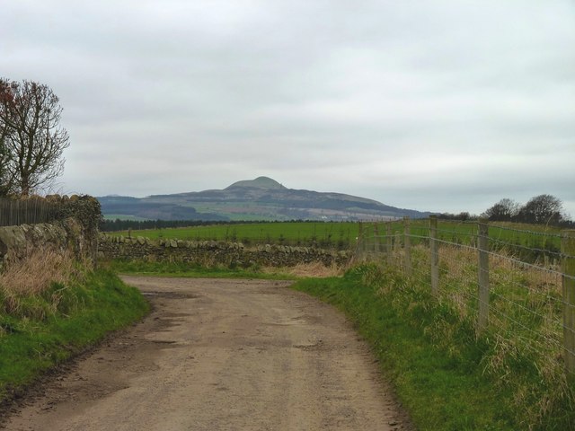
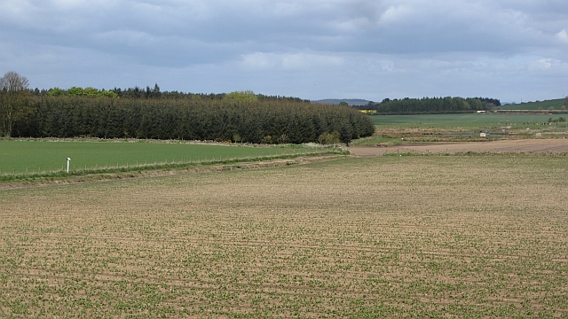
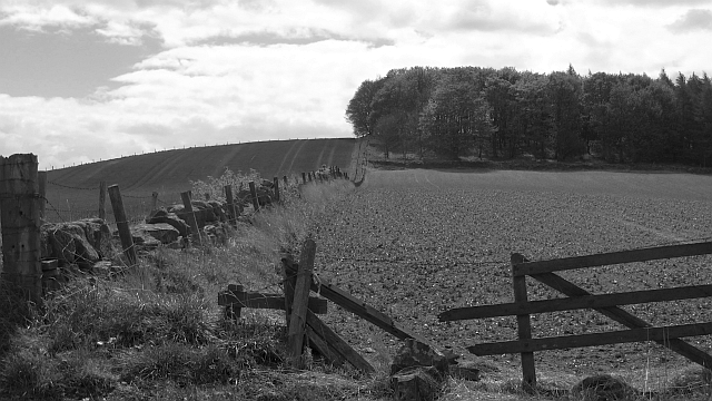
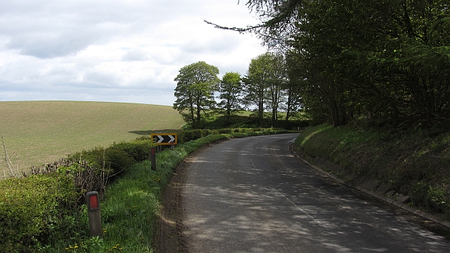
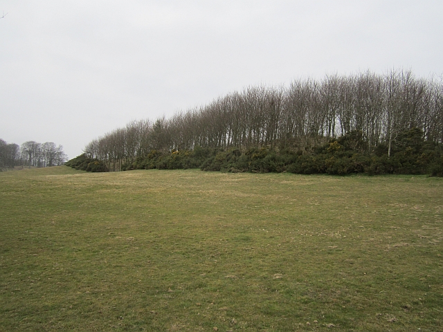
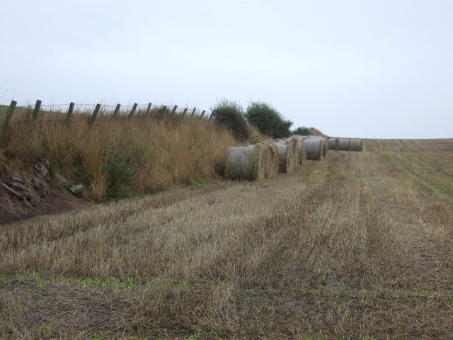
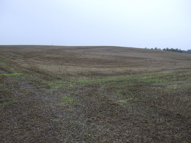
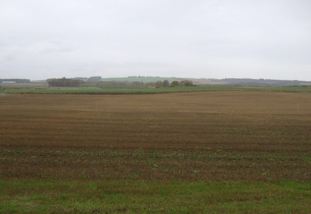
Tofthill Plantation is a picturesque woodland located in Fife, Scotland. Situated near the village of Saline, the plantation covers an area of approximately 100 acres and is renowned for its diverse flora and fauna. The plantation is easily accessible, with multiple walking trails allowing visitors to explore its serene beauty.

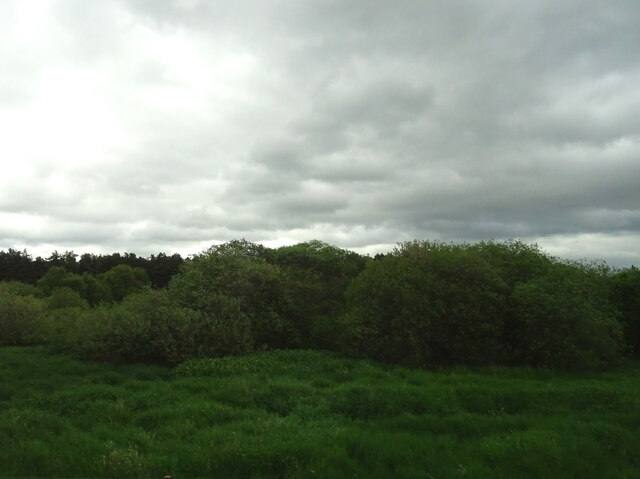
The woodland is predominantly composed of native broadleaf trees, including oak, birch, and beech, which provide a rich habitat for a variety of wildlife. Throughout the year, visitors can witness a stunning display of seasonal colors, with vibrant hues adorning the trees during autumn.

Tofthill Plantation is a haven for nature enthusiasts, attracting a wide range of bird species, such as woodpeckers, thrushes, and owls. The plantation also hosts an array of small mammals, including squirrels, rabbits, and foxes.

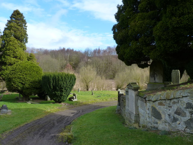
The woodland features well-maintained paths, making it an ideal location for walkers, joggers, and cyclists. These paths wind through the plantation, offering visitors the opportunity to immerse themselves in the tranquility of nature. Additionally, the plantation provides excellent picnic spots with benches strategically placed for visitors to rest and enjoy the surroundings.

Tofthill Plantation is a cherished local resource, offering a peaceful retreat for those seeking respite from the hustle and bustle of everyday life. With its stunning landscapes, diverse wildlife, and well-maintained trails, it provides an idyllic setting for individuals to reconnect with nature and enjoy the beauty of the Scottish countryside.

If you have any feedback on the listing, please let us know in the comments section below.

Tofthill Plantation Images

Images are sourced within 2km of 56.216805/-3.149844 or Grid Reference NO2803. Thanks to Geograph Open Source API. All images are credited.

Path to Markinch by Star The path to Markinch runs to the left of the fence line straight over this small rise to Markinch just over and down the other side. Fields starting to grow green in the warm Spring sunshine.
Path to Markinch by Star
The path to Markinch runs to the left of the fence line straight over this small rise to Markinch just over and down the other side. Fields starting to grow green in the warm Spring sunshine.
Solid arch A substantially constructed bridge carrying the Markinch to Perth railway over a very minor road, near Northhall.
Solid arch
A substantially constructed bridge carrying the Markinch to Perth railway over a very minor road, near Northhall.
Icy road The tops of the Lomond Hills were catching the early sun but this stretch of minor road was still in shadow and frozen.
Icy road
The tops of the Lomond Hills were catching the early sun but this stretch of minor road was still in shadow and frozen.
Cuinin Hill A path climbs modest Cuinin Hill, which is quite prominent when viewed from East Lothian.
Cuinin Hill
A path climbs modest Cuinin Hill, which is quite prominent when viewed from East Lothian.
Old cemetery Lots of yew trees and fallen headstones.
Old cemetery
Lots of yew trees and fallen headstones.
Ploughed field Looking south from near Cuinin Hill.
Ploughed field
Looking south from near Cuinin Hill.
Bend in the farm road Close to Broomfield Farm, with East Lomond in the distance.
Bend in the farm road
Close to Broomfield Farm, with East Lomond in the distance.
Arable land, Star A newly germinating crop, possibly beans.
Arable land, Star
A newly germinating crop, possibly beans.
Cuinin Hill This modest hill shows up as quite a landmark from the Firth of Forth, thanks to the wood on the top. The land on the slopes is arable, probably beans this year.
Cuinin Hill
This modest hill shows up as quite a landmark from the Firth of Forth, thanks to the wood on the top. The land on the slopes is arable, probably beans this year.
Minor road, Star From Markinch to Star of Markinch.
Minor road, Star
From Markinch to Star of Markinch.
Field, Kirkforthar At the end of a short public road.
Field, Kirkforthar
At the end of a short public road.
Farmland and bank near Whitehill Plantation
Farmland near Whitehill Plantation
Farmland west of Star
Corner of old cemetery Burial ground on the outskirts of the town.
Corner of old cemetery
Burial ground on the outskirts of the town.
Lochmuir Wood
Lochmuir Wood
Railway bridge and A914 near Muirhead There is an Ordnance Survey benchmark on this bridge. See <a href="https://www.geograph.org.uk/photo/6778513">NO2805 : Benchmark on Muirhead Railway Bridge</a>
Railway bridge and A914 near Muirhead
There is an Ordnance Survey benchmark on this bridge. See NO2805 : Benchmark on Muirhead Railway Bridge
Northall Cemetery, Markinch This cemetery was opened in 1853 and was in use for less than 50 years (until St Drostans Cemetery was opened in 1900). Northall Cemetery is dominated by a central hillock (which may be an ancient burial mound) with graves both on the hill and at lower elevations within the cemetery on both sides of the access track. Its location is believed to be the 'Dalginch' mentioned in ancient documents. Dalginch was a 'Moot Hill' - a place where legal disputes were settled, proclamations were read and judgements were passed.
Northall Cemetery, Markinch
This cemetery was opened in 1853 and was in use for less than 50 years (until St Drostans Cemetery was opened in 1900). Northall Cemetery is dominated by a central hillock (which may be an ancient burial mound) with graves both on the hill and at lower elevations within the cemetery on both sides of the access track. Its location is believed to be the 'Dalginch' mentioned in ancient documents. Dalginch was a 'Moot Hill' - a place where legal disputes were settled, proclamations were read and judgements were passed.
Show me another place!

Tofthill Plantation is located at Grid Ref: NO2803 (Lat: 56.216805, Lng: -3.149844)

Unitary Authority: Fife

Police Authority: Fife

What 3 Words

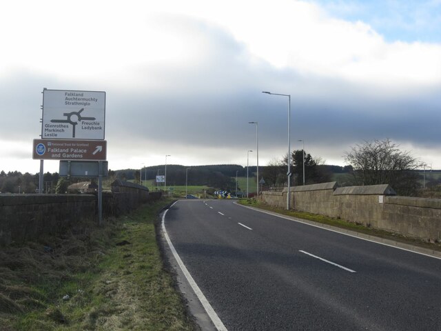
///approve.compiler.unstable. Near Markinch, Fife

Related Wikis

Balbirnie Stone Circle

Balbirnie Stone Circle is an archaeological site, a stone circle on the north-eastern edge of Glenrothes, in Fife, Scotland. The site was in use from the...

Balfarg

Balfarg is a prehistoric monument complex in Glenrothes, Fife, Scotland. It is protected as a scheduled monument. With the development of Glenrothes new...
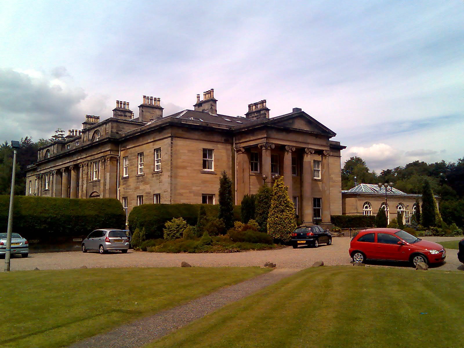
Balbirnie House

Balbirnie House is an early 19th-century country house in Glenrothes, in central Fife, Scotland. The present house was completed in 1817 as a rebuild of...

Pitcoudie

Pitcoudie is a housing area in North Glenrothes in the Kingdom of Fife, Scotland - comprising 396 terraced and semi-detached houses. Traditionally, a pitcoudie...

Pitcairn House

Pitcairn House is a ruined 17th century laird's house, located in the modern Collydean residential area of Glenrothes, in Fife, Scotland. Pitcairn House...

Markinch

Markinch (, (Scottish Gaelic: Marc Innis) is both a village and a parish in the heart of Fife, Scotland. According to an estimate taken in 2008, the village...

Markinch railway station

Markinch railway station is a railway station in Markinch, Fife, Scotland, which serves the Glenrothes, Leslie and Levenmouth areas of Fife. The station...

Kingdom FM

Kingdom FM is an Independent Local Radio station serving Fife. It is owned and operated by DC Thomson Media and broadcasts from studios at Elizabeth House...

Related Videos

Walking The Fife Coastal Path Stage 1 Kincardine To Limekilns

Today Explore With Lloydi Takes you On an epic Adventure as we attempt to walk the 117 mile long distance walk in Scotland ...

Fife Coastal Walk Day 2 - Crail to St. Andrews #Short #Scotland #Fife #travel #hiking

A short clip from my second day on the Fife Coastal Walk; this leg took me from the town of Crail to the university town of St.

Fife Walking Trail - Riverside Route

To download the GPS for this walk, please visit our blog page: https://discoveringscotland.com/riverside-park-walk/

Nearby Amenities

Located within 500m of 56.216805,-3.149844
Traffic Signals
Lat/Long: 56.2167104/-3.1536067
Traffic Signals
Lat/Long: 56.2171318/-3.1533146
Crossing
Crossing: unmarked
Crossing Island: no
Kerb: lowered
Tactile Paving: no
Lat/Long: 56.2161762/-3.1526668
Traffic Signals
Lat/Long: 56.2180319/-3.1534771
Post Box
Collection Times: Mo-Fr 16:00; Sa 12:00
Operator: Royal Mail
Ref: KY7 110
Source: Survey Feb 2014
Lat/Long: 56.2136264/-3.1537605
Barrier: stile
Bicycle: dismount
Foot: yes
Lat/Long: 56.2157341/-3.1542885
Traffic Signals
Lat/Long: 56.2169692/-3.1529822
Traffic Signals
Lat/Long: 56.2175855/-3.1536312
Bus Stop
Gateside Cottage
Bench: no
Bin: no
Bus: yes
Lit: yes
Naptan AtcoCode: 6500K0649
Naptan Bearing: S
Naptan CommonName: Gateside Cottages
Naptan Indicator: opp
Naptan NaptanCode: 34342324
Naptan Street: A92 ( T )
Public Transport: platform
Shelter: no
Tactile Paving: no
Lat/Long: 56.2203421/-3.1542789
Balbirnie stone circle (original site)
Description: Moved in 1970s to SE during road widening
Historic: archaeological_site
Source: OS 25" 1905
Lat/Long: 56.2146384/-3.154261
Balfarg Riding School
Barrier: bollard
Lat/Long: 56.2155271/-3.1545341
Balbirnie Stone Circle (modern)
Historic: stone
Natural: stone
Lat/Long: 56.2137843/-3.1528958
Historic: stone
Natural: stone
Lat/Long: 56.2138704/-3.1527895
Historic: stone
Natural: stone
Lat/Long: 56.2138926/-3.1528416
Historic: stone
Natural: stone
Lat/Long: 56.2137978/-3.1527824
Historic: stone
Natural: stone
Lat/Long: 56.2137835/-3.152838
Historic: stone
Natural: stone
Lat/Long: 56.2138724/-3.1529592
Historic: stone
Natural: stone
Lat/Long: 56.2138938/-3.1529065
Historic: stone
Natural: stone
Lat/Long: 56.2138343/-3.1527689
Balfarg Riding School
Barrier: bollard
Lat/Long: 56.215528/-3.1545032
Barrier: bollard
Lat/Long: 56.2155167/-3.1546298
Barrier: bollard
Source: https://theurbanprehistorian.wordpress.com/2015/01/
Lat/Long: 56.215555/-3.1545339
Balfarg Riding School
Barrier: bollard
Lat/Long: 56.215583/-3.1545326
Barrier: bollard
Lat/Long: 56.2155566/-3.1545022
Barrier: bollard
Lat/Long: 56.2155832/-3.1545059
Historic: stone
Natural: stone
Lat/Long: 56.213818/-3.1528943
Barrier: bollard
Lat/Long: 56.2154667/-3.1545101
Barrier: bollard
Lat/Long: 56.2154657/-3.1545313
Barrier: bollard
Lat/Long: 56.215467/-3.1545516
Barrier: bollard
Lat/Long: 56.2154747/-3.1544757
Barrier: bollard
Lat/Long: 56.2154824/-3.1544605
Barrier: bollard
Lat/Long: 56.2154698/-3.154491
Barrier: bollard
Lat/Long: 56.2154744/-3.1545834
Barrier: bollard
Lat/Long: 56.2154818/-3.1545927
Barrier: bollard
Lat/Long: 56.2154893/-3.1544539
Barrier: bollard
Lat/Long: 56.2154702/-3.1545713
Barrier: bollard
Lat/Long: 56.2156401/-3.1546059
Barrier: bollard
Lat/Long: 56.2156212/-3.1546092
Barrier: bollard
Lat/Long: 56.2155853/-3.1546104
Barrier: bollard
Lat/Long: 56.2155687/-3.1546094
Barrier: bollard
Lat/Long: 56.2156702/-3.1545851
Barrier: bollard
Lat/Long: 56.2156764/-3.1545577
Barrier: bollard
Lat/Long: 56.2156761/-3.1545291
Barrier: bollard
Lat/Long: 56.2156764/-3.1545052
Barrier: bollard
Lat/Long: 56.2156741/-3.1544878
Barrier: bollard
Lat/Long: 56.2156675/-3.1544696
Barrier: bollard
Lat/Long: 56.21566/-3.1544564
Barrier: bollard
Lat/Long: 56.2156571/-3.154602
Barrier: bollard
Lat/Long: 56.2156443/-3.1544503
Barrier: bollard
Lat/Long: 56.2156224/-3.1544468
Barrier: bollard
Lat/Long: 56.2156055/-3.1544443
Barrier: bollard
Lat/Long: 56.21559/-3.1544426
Barrier: bollard
Lat/Long: 56.2155567/-3.1544419
Barrier: bollard
Lat/Long: 56.2155511/-3.1546075
Barrier: bollard
Lat/Long: 56.2155389/-3.1544435
Barrier: bollard
Lat/Long: 56.2155363/-3.154605
Barrier: bollard
Lat/Long: 56.2155733/-3.1544419
Barrier: bollard
Lat/Long: 56.2155199/-3.1546022
Barrier: bollard
Lat/Long: 56.2155231/-3.1544448
Barrier: bollard
Lat/Long: 56.2155037/-3.1545994
Barrier: bollard
Lat/Long: 56.2155045/-3.1544498
Barrier: bollard
Lat/Long: 56.2154905/-3.1545972
Barrier: bollard
Lat/Long: 56.2156053/-3.1546102
Barrier: stile
Material: wood
Stile: stepover
Lat/Long: 56.2157667/-3.1542483
Generator Method: photovoltaic
Generator Output Electricity: yes
Generator Source: solar
Generator Type: solar_photovoltaic_panel
Location: roof
Power: generator
Lat/Long: 56.2145279/-3.1553856
Generator Method: photovoltaic
Generator Output Electricity: yes
Generator Source: solar
Generator Type: solar_photovoltaic_panel
Location: roof
Power: generator
Lat/Long: 56.2143993/-3.1555257
Generator Method: photovoltaic
Generator Output Electricity: yes
Generator Source: solar
Generator Type: solar_photovoltaic_panel
Location: roof
Power: generator
Lat/Long: 56.2143801/-3.1555671
Generator Method: photovoltaic
Generator Output Electricity: yes
Generator Source: solar
Generator Type: solar_photovoltaic_panel
Location: roof
Power: generator
Lat/Long: 56.2148128/-3.1565738
Generator Method: photovoltaic
Generator Output Electricity: yes
Generator Source: solar
Generator Type: solar_photovoltaic_panel
Location: roof
Power: generator
Lat/Long: 56.2149276/-3.1570539
Generator Method: photovoltaic
Generator Output Electricity: yes
Generator Source: solar
Generator Type: solar_photovoltaic_panel
Location: roof
Power: generator
Lat/Long: 56.2153065/-3.15718
Generator Method: photovoltaic
Generator Output Electricity: yes
Generator Source: solar
Generator Type: solar_photovoltaic_panel
Location: roof
Power: generator
Lat/Long: 56.2153795/-3.15718
Generator Method: photovoltaic
Generator Output Electricity: yes
Generator Source: solar
Generator Type: solar_photovoltaic_panel
Location: roof
Power: generator
Lat/Long: 56.2158195/-3.1575957
Generator Method: photovoltaic
Generator Output Electricity: yes
Generator Source: solar
Generator Type: solar_photovoltaic_panel
Location: roof
Power: generator
Lat/Long: 56.2158688/-3.1574965
Generator Method: photovoltaic
Generator Output Electricity: yes
Generator Source: solar
Generator Type: solar_photovoltaic_panel
Location: roof
Power: generator
Lat/Long: 56.2160179/-3.1545514
Generator Method: photovoltaic
Generator Output Electricity: yes
Generator Source: solar
Generator Type: solar_photovoltaic_panel
Location: roof
Power: generator
Lat/Long: 56.2166995/-3.1555063
Generator Method: photovoltaic
Generator Output Electricity: yes
Generator Source: solar
Generator Type: solar_photovoltaic_panel
Location: roof
Power: generator
Lat/Long: 56.2166697/-3.1554392
Crossing
Crossing: traffic_signals
Crossing Island: yes
Tactile Paving: yes
Lat/Long: 56.2178867/-3.1540067
Communication Mobile Phone: yes
Man Made: mast
Tower Type: communication
Lat/Long: 56.2170457/-3.1529183
Crossing
Button Operated: yes
Crossing: traffic_signals
Tactile Paving: yes
Traffic Signals Sound: no
Traffic Signals Vibration: yes
Lat/Long: 56.2168007/-3.1533528
Crossing
Button Operated: yes
Crossing: traffic_signals
Tactile Paving: yes
Traffic Signals Sound: no
Traffic Signals Vibration: yes
Lat/Long: 56.2167575/-3.1535995
Crossing
Crossing: traffic_signals
Crossing Island: yes
Tactile Paving: yes
Lat/Long: 56.2178031/-3.1540829
Traffic Signals
Lat/Long: 56.2178835/-3.1540832
Crossing
Crossing: unmarked
Tactile Paving: yes
Lat/Long: 56.220283/-3.154586
Crossing
Crossing: unmarked
Tactile Paving: yes
Lat/Long: 56.2199816/-3.1543075
The data included in this document is from www.openstreetmap.org. The data is made available under ODbL.

Have you been to Tofthill Plantation?

Leave your review of Tofthill Plantation below (or comments, questions and feedback).