Glentress Forest

Wood, Forest in Peeblesshire

Scotland

Glentress Forest

Summit of Leithen Door Hill Clumps of rushes on the grassy summit with the forest edge on Dunslair Heights in view across Peebles Rig.
Summit of Leithen Door Hill Credit: Jim Barton

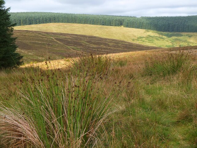
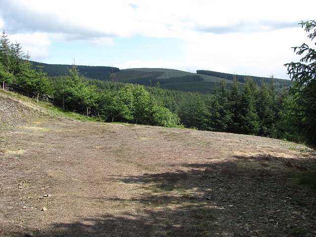
Glentress Forest, located in Peeblesshire, Scotland, is a sprawling woodland renowned for its natural beauty and outdoor recreational activities. Covering an expansive area of approximately 2,000 hectares, this enchanting forest is part of the larger Tweed Valley Forest Park.

The forest is predominantly composed of a mixture of coniferous and deciduous trees, including Douglas fir, spruce, pine, and oak. These trees create a picturesque landscape, with their lush foliage providing a rich habitat for a diverse range of flora and fauna.

Glentress Forest is a haven for outdoor enthusiasts and adventure seekers. It is home to an extensive network of trails that cater to various abilities and interests. Mountain bikers flock to the forest to experience the world-class mountain biking trails, which cater to all skill levels, from beginners to seasoned professionals. The exhilarating trails offer a mix of challenging climbs, thrilling descents, and breathtaking views of the surrounding countryside.

Aside from mountain biking, Glentress Forest offers a host of other activities. Hiking and walking trails provide opportunities for visitors to explore the forest on foot, immersing themselves in its tranquil ambiance. For those seeking a more adrenaline-fueled experience, there are also opportunities for zip-lining and tree-top adventures.

Glentress Forest is not only a destination for outdoor activities but also a place of relaxation and tranquility. Picnic spots and viewpoints throughout the forest allow visitors to take in the stunning scenery and unwind amidst nature's beauty.

In summary, Glentress Forest in Peeblesshire is a captivating woodland that offers a wide range of recreational activities, making it an ideal destination for nature lovers, adventure enthusiasts, and those seeking a peaceful escape from the hustle and bustle of everyday life.

If you have any feedback on the listing, please let us know in the comments section below.

Glentress Forest Images

Images are sourced within 2km of 55.667161/-3.1426199 or Grid Reference NT2842. Thanks to Geograph Open Source API. All images are credited.

Summit of Leithen Door Hill Clumps of rushes on the grassy summit with the forest edge on Dunslair Heights in view across Peebles Rig.
Summit of Leithen Door Hill
Clumps of rushes on the grassy summit with the forest edge on Dunslair Heights in view across Peebles Rig.
Lee Pen in view, Leithen Door Hill On a post-New-Year walk from Peebles to Innerleithen, with the final summit of Lee Pen now in sight.
Lee Pen in view, Leithen Door Hill
On a post-New-Year walk from Peebles to Innerleithen, with the final summit of Lee Pen now in sight.
Descending the steep side of Leithen Door Walkers descending the eastern side of this deep pass on the ridge on a post-New-Year walk from Peebles to Innerleithen.
Descending the steep side of Leithen Door
Walkers descending the eastern side of this deep pass on the ridge on a post-New-Year walk from Peebles to Innerleithen.
Across Leithen Door A 70m deep notch in the ridge on the south side of the valley of the Leithen Water.
Across Leithen Door
A 70m deep notch in the ridge on the south side of the valley of the Leithen Water.
Descending to Leithen Door Leithen Door is a 70m deep notch in the ridge bounding Glentress Forest. Walkers on the high level route between Peebles and Innerleithen have no option but to buckle to, descend and re-ascend.
Descending to Leithen Door
Leithen Door is a 70m deep notch in the ridge bounding Glentress Forest. Walkers on the high level route between Peebles and Innerleithen have no option but to buckle to, descend and re-ascend.
The pass of Leithen Door
Black route, Glentress The hard mountain bike trail doubles as a waymarked footpath up Black Law here. A very handy escape route from the forest for walkers, but both parties must keep a lookout.
Black route, Glentress
The hard mountain bike trail doubles as a waymarked footpath up Black Law here. A very handy escape route from the forest for walkers, but both parties must keep a lookout.
Forest edge above Leithen Door At the top of the stiff climb out of the pass of Leithen Door, looking back to the pointed summit of Lee Pen.
Forest edge above Leithen Door
At the top of the stiff climb out of the pass of Leithen Door, looking back to the pointed summit of Lee Pen.
Pond in Glentress The lower of two ponds created by damming the Glentress Burn. Viewed from a very similar spot to that chosen by Iain Thompson <a href="https://www.geograph.org.uk/photo/151372">NS2840 : Africa House</a> 5 years earlier. Almost 3 weeks later in the season, and much greener.
Pond in Glentress
The lower of two ponds created by damming the Glentress Burn. Viewed from a very similar spot to that chosen by Iain Thompson NS2840 : Africa House 5 years earlier. Almost 3 weeks later in the season, and much greener.
Pond on the Glentress Burn Created by damming the burn, this is the upper pond, and the square structure is an outlet to the lower pond.
Pond on the Glentress Burn
Created by damming the burn, this is the upper pond, and the square structure is an outlet to the lower pond.
Parting of the Ways in Glentress Tracks in the forest, a Forestry Commission estate and part of the 7stanes recreational facility which is particularly popular, and especially noted for its mountain biking trails. The left track heads to the Buzzard's Nest car park, further up and into the forest. The right hand trail is not for vehicles, and continues up the course of the Glentress Burn.
Parting of the Ways in Glentress
Tracks in the forest, a Forestry Commission estate and part of the 7stanes recreational facility which is particularly popular, and especially noted for its mountain biking trails. The left track heads to the Buzzard's Nest car park, further up and into the forest. The right hand trail is not for vehicles, and continues up the course of the Glentress Burn.
7stanes signposts Trail signs at Glentress, part of the extensive trail system signage at Glentress, one of the Forestry Commission's '7stanes' mountain biking facilities in the Borders.
7stanes signposts
Trail signs at Glentress, part of the extensive trail system signage at Glentress, one of the Forestry Commission's '7stanes' mountain biking facilities in the Borders.
Forest Research 267 A marker firmly planted in the forest floor at Glentress, and made more easily locatable from a distance by the adjacent pole. It presumably marks a plot or transect that is being studied - I know not what.
Forest Research 267
A marker firmly planted in the forest floor at Glentress, and made more easily locatable from a distance by the adjacent pole. It presumably marks a plot or transect that is being studied - I know not what.
Road end (private) The roads in the private and Forestry Commission managed bits of Glentress Forest do not meet - but there is a gap in the trees where the shortest of paths takes you on to the next road over the boundary. It's like a spark across a gap, a huge "potential" builds up when forest roads are close to each other and paths form along the easiest route between them.
Road end (private)
The roads in the private and Forestry Commission managed bits of Glentress Forest do not meet - but there is a gap in the trees where the shortest of paths takes you on to the next road over the boundary. It's like a spark across a gap, a huge "potential" builds up when forest roads are close to each other and paths form along the easiest route between them.
Road end  (FC) The roads in the private and Forestry Commission managed bits of Glentress Forest do not meet - but there is a gap in the trees where the shortest of paths takes you on to the next road over the boundary. It's like a spark across a gap, a huge "potential" builds up when forest roads are close to each other and paths form along the easiest route between them.
Road end (FC)
The roads in the private and Forestry Commission managed bits of Glentress Forest do not meet - but there is a gap in the trees where the shortest of paths takes you on to the next road over the boundary. It's like a spark across a gap, a huge "potential" builds up when forest roads are close to each other and paths form along the easiest route between them.
Logging road, Glentress Forest The flanks of Tower Rig.
Logging road, Glentress Forest
The flanks of Tower Rig.
Path, Tower Rig Path in Glentress Forest.
Path, Tower Rig
Path in Glentress Forest.
Path, Tower Rig A well used path (the black mountain bike route uses it as an ascent route), on Tower Rig in Glentress Forest.
Path, Tower Rig
A well used path (the black mountain bike route uses it as an ascent route), on Tower Rig in Glentress Forest.
Show me another place!

Glentress Forest is located at Grid Ref: NT2842 (Lat: 55.667161, Lng: -3.1426199)

Unitary Authority: The Scottish Borders

Police Authority: The Lothians and Scottish Borders

What 3 Words

///offstage.blissful.pausing. Near Peebles, Scottish Borders

Related Wikis

Glentress Forest

Glentress Forest is located near Peebles in the Scottish Borders, about 30 miles south of Edinburgh. Part of the Tweed Valley Forest Park along with Traquair...

Peebles Hydro

Peebles Hydro is an early 20th century hotel and spa resort in Peebles, in the historic county of Peebles-shire in the Scottish Borders. It is one of...
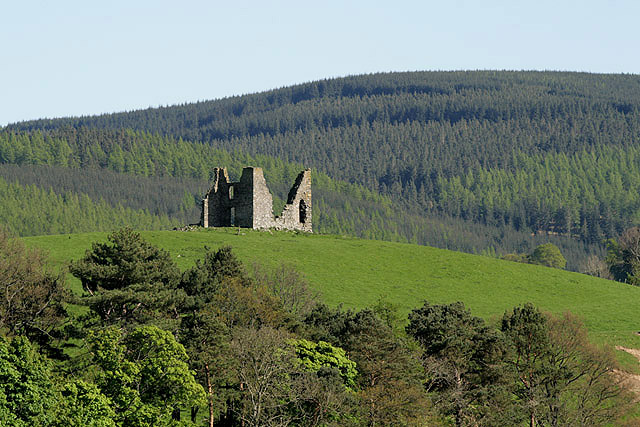
Horsburgh Castle

Horsburgh Castle, also known as Horsbrugh Castle or Horsbrugh Tower, is a ruined tower house castle by the River Tweed, on the A72 road from Peebles to...

Venlaw

Venlaw Castle, also known as Smithfield Castle, lies north of Peebles on the Edinburgh Road in the Borders of Scotland. Since 1949, it has been operated...

Nearby Amenities

Located within 500m of 55.667161,-3.1426199
Tourism: picnic_site
Lat/Long: 55.6697661/-3.1395402
Ele: 510
Natural: peak
Lat/Long: 55.6704764/-3.1404104
Tourism: picnic_site
Lat/Long: 55.6692785/-3.1361359
Ford: yes
Lat/Long: 55.6691145/-3.1490252
Ford: yes
Lat/Long: 55.6676773/-3.150516
The data included in this document is from www.openstreetmap.org. The data is made available under ODbL.

Have you been to Glentress Forest?

Leave your review of Glentress Forest below (or comments, questions and feedback).