Bog Wood

Wood, Forest in Midlothian

Scotland

Bog Wood

Parking area, Gladhouse Reservoir A rather muddy lay-by near Gladhouse Reservoir on the access road to Moorfoot farm, with the escarpment of the Moorfoot Hills beyond.
Parking area, Gladhouse Reservoir Credit: Jim Barton

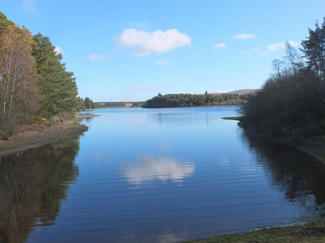
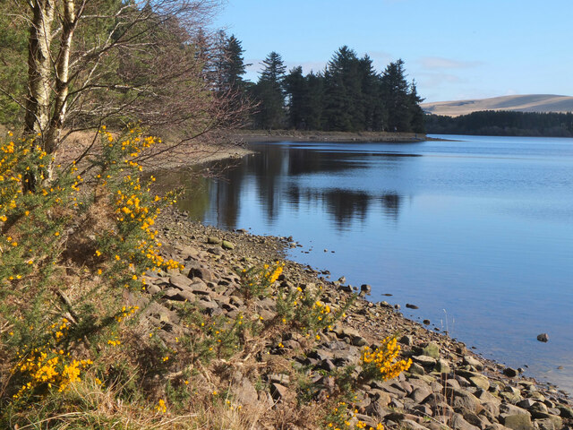
Bog Wood is a picturesque area located in Midlothian, Scotland. Covering an area of approximately 100 hectares, it is a dense forest that offers a tranquil escape from the bustling city life. The wood is known for its unique landscape, characterized by a combination of wetlands, marshes, and ancient trees.

The wood takes its name from the boggy terrain found throughout the area. This wet environment provides a habitat for a diverse range of flora and fauna. Visitors can expect to see a variety of bird species, including herons, woodpeckers, and owls, as well as small mammals such as badgers and foxes.

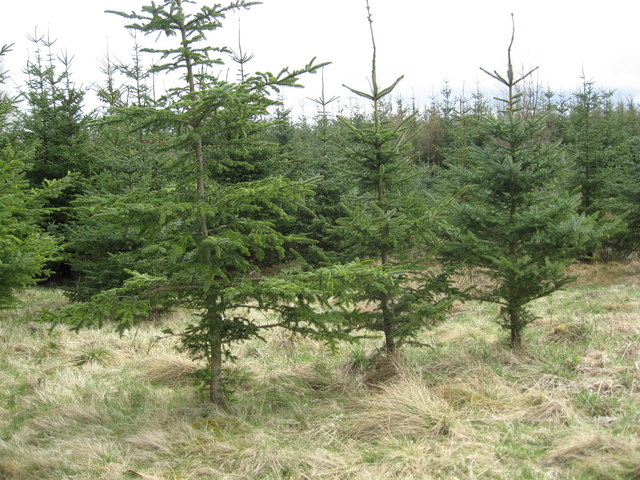
The ancient trees in Bog Wood are one of its most notable features. Many of these trees have been growing for centuries and have a majestic presence. Oak, birch, and beech trees dominate the wood, creating a dense canopy that filters sunlight and creates a soothing atmosphere.

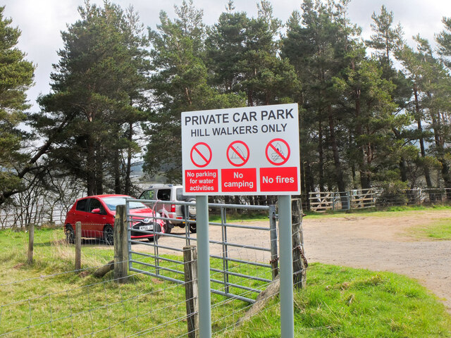
There are several walking trails that wind through Bog Wood, allowing visitors to explore the area at their own pace. These trails offer stunning views of the surrounding landscape and provide opportunities for nature observation and photography. The wood is also a popular spot for picnics and family outings, with designated areas for relaxation and recreation.

Bog Wood is easily accessible by car or public transportation, making it a popular destination for both locals and tourists alike. Its natural beauty and peaceful ambiance make it a perfect retreat for nature lovers and those seeking a break from the hustle and bustle of everyday life.

If you have any feedback on the listing, please let us know in the comments section below.

Bog Wood Images

Images are sourced within 2km of 55.766753/-3.1500584 or Grid Reference NT2753. Thanks to Geograph Open Source API. All images are credited.

Parking area, Gladhouse Reservoir A rather muddy lay-by near Gladhouse Reservoir on the access road to Moorfoot farm, with the escarpment of the Moorfoot Hills beyond.
Parking area, Gladhouse Reservoir
A rather muddy lay-by near Gladhouse Reservoir on the access road to Moorfoot farm, with the escarpment of the Moorfoot Hills beyond.
Aqueduct for Gladhouse Reservoir A straight concrete-lined channel taking water to the west end of the reservoir.
Aqueduct for Gladhouse Reservoir
A straight concrete-lined channel taking water to the west end of the reservoir.
Aqueduct for Gladhouse Reservoir (2) Further downstream along the channel shown in <a href="https://www.geograph.org.uk/photo/7112091">NT2853 : Aqueduct for Gladhouse Reservoir</a>.
Aqueduct for Gladhouse Reservoir (2)
Further downstream along the channel shown in NT2853 : Aqueduct for Gladhouse Reservoir.
Bay at the west end of Gladhouse Reservoir A tranquil bay surrounded by woodland.
Bay at the west end of Gladhouse Reservoir
A tranquil bay surrounded by woodland.
Shoreline at Gladhouse Reservoir The NW shoreline of this reservoir, completed in 1879 as a water supply for Edinburgh - see <span class="nowrap"><a title="https://en.wikipedia.org/wiki/Gladhouse_Reservoir" rel="nofollow ugc noopener" href="https://en.wikipedia.org/wiki/Gladhouse_Reservoir">Link</a><img style="margin-left:2px;" alt="External link" title="External link - shift click to open in new window" src="https://s1.geograph.org.uk/img/external.png" width="10" height="10"/></span> for more details.
Shoreline at Gladhouse Reservoir
The NW shoreline of this reservoir, completed in 1879 as a water supply for Edinburgh - see LinkExternal link for more details.
Stubble field near Gladhouse Reservoir A field near Moorfoot farm.
Stubble field near Gladhouse Reservoir
A field near Moorfoot farm.
Car park sign, Gladhouse Reservoir The only car park on the access road to Moorfoot farm. Over the years, car parking provision around the reservoir has decreased - see <a href="https://www.geograph.org.uk/photo/1713001">NT3054 : Gladhouse Reservoir from closed car park</a> and <a href="https://www.geograph.org.uk/photo/7113022">NT3054 : Blocked lay-by, Gladhouse Reservoir</a>. At least walkers are allowed here! The sign is fairly recent.
Car park sign, Gladhouse Reservoir
The only car park on the access road to Moorfoot farm. Over the years, car parking provision around the reservoir has decreased - see NT3054 : Gladhouse Reservoir from closed car park and NT3054 : Blocked lay-by, Gladhouse Reservoir. At least walkers are allowed here! The sign is fairly recent.
Tweeddale Burn Wood Tweeddale Burn Wood, a small narrow strip of native woodland.
Tweeddale Burn Wood
Tweeddale Burn Wood, a small narrow strip of native woodland.
Road beside Gladhouse Reservoir
Sheep near Gladhouse Reservoir
Plantation near Gladhouse Reservoir
South end of Gladhouse Reservoir
Minor road towards Temple
Young conifers in Gladhouse Plantation
Sheep grazing at Toxsidehill Farm The Pentland Hills in the distance.
Sheep grazing at Toxsidehill Farm
The Pentland Hills in the distance.
Sheep and lamb at Toxside Hill farm The Moorfoot Hills in the background.
Sheep and lamb at Toxside Hill farm
The Moorfoot Hills in the background.
The road leading to Moorfoot Farm Aptly named since the Moorfoot Hills loom close behind.
The road leading to Moorfoot Farm
Aptly named since the Moorfoot Hills loom close behind.
Rough grazing beside Gladhouse Reservoir
Show me another place!

Bog Wood is located at Grid Ref: NT2753 (Lat: 55.766753, Lng: -3.1500584)

Unitary Authority: Midlothian

Police Authority: The Lothians and Scottish Borders

What 3 Words

///jets.shuttered.joins. Near Penicuik, Midlothian

Related Wikis

Gladhouse Reservoir

Gladhouse Reservoir, formerly known as Moorfoot Loch, is a reservoir in Midlothian, Scotland, five miles (8 km) south of Penicuik. It is the most southerly...

Earlyvale Gate railway station

Earlyvale Gate railway station served the Dundas family residence in Earlyvale, Scottish Borders, Scotland for 8 months (June 1856 - February 1857) on...

Northshield Rings

Northshield Rings is a prehistoric site, a hillfort near the village of Eddleston and about 6 miles (10 km) north of Peebles, in the Scottish Borders,...

Leadburn railway station

Leadburn railway station served the hamlet of Leadburn, Midlothian, Scotland from 1855 to 1962 on the Peebles Railway. == History == The station opened...

Wellington School, Midlothian

Wellington School, Midlothian, Scotland was a residential school for boys, owned by the City of Edinburgh Council and operated by the Council's Children...

Edgelaw Reservoir

Edgelaw Reservoir is an artificial reservoir in Midlothian, Scotland, UK, four miles west of Temple. It was created in 1880 by James Leslie and his son...

Moorfoot Hills

The Moorfoot Hills are a range of hills south of Edinburgh in east central Scotland, one of the ranges which collectively form the Southern Uplands....

Blackhope Scar

Blackhope Scar is a hill in the Moorfoot Hills range, part of the Southern Uplands of Scotland. It lies to the northeast of the town of Peebles and is...

Related Videos

Wild swimming at Gladhouse Reservoir

Wild swimming lover, Jojo Fraser, gets a mojo injection at Gladhouse Reservoir in Scotland.

What happens when I try to create my own route plan - Gladhouse Loop

How hard can it be to create your own route? In this video, I attempt a route I created on Komoot from Gladhouse Reservoir in ...

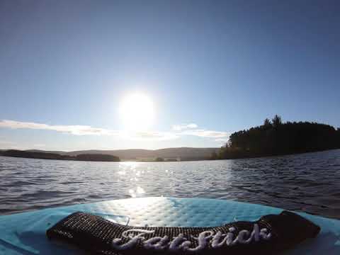
SUP around Gladhouse Resevoir

Beautiful October morning paddling around the resevoir.

Nearby Amenities

Located within 500m of 55.766753,-3.1500584
Power: pole
Lat/Long: 55.7625955/-3.1476152
Power: pole
Lat/Long: 55.7633741/-3.1473738
Power: pole
Lat/Long: 55.7640924/-3.1478727
Power: pole
Lat/Long: 55.7647926/-3.1483394
Power: pole
Lat/Long: 55.7655079/-3.1488329
Power: pole
Lat/Long: 55.7662442/-3.1493855
Power: pole
Lat/Long: 55.7675328/-3.1502438
Power: pole
Lat/Long: 55.7690025/-3.1512791
Power: pole
Lat/Long: 55.7697569/-3.1518048
Power: pole
Lat/Long: 55.7704449/-3.1523037
Power: pole
Lat/Long: 55.7637574/-3.1464833
Power: pole
Lat/Long: 55.7626407/-3.1473094
Power: pole
Lat/Long: 55.7634013/-3.1470788
Power: pole
Lat/Long: 55.7641709/-3.1475669
Power: pole
Lat/Long: 55.7649194/-3.1481516
Power: pole
Lat/Long: 55.7656708/-3.1486452
Power: pole
Lat/Long: 55.7665008/-3.1492084
Power: pole
Lat/Long: 55.7675208/-3.1499273
Power: pole
Lat/Long: 55.7682481/-3.150394
Power: pole
Lat/Long: 55.7690568/-3.150968
Power: pole
Lat/Long: 55.7698625/-3.151601
Power: pole
Lat/Long: 55.7705626/-3.1520784
Power: pole
Lat/Long: 55.7624633/-3.1496028
Power: pole
Lat/Long: 55.7628912/-3.1485839
Power: pole
Lat/Long: 55.7632605/-3.1477191
The data included in this document is from www.openstreetmap.org. The data is made available under ODbL.

Have you been to Bog Wood?

Leave your review of Bog Wood below (or comments, questions and feedback).