Alveston

Settlement in Gloucestershire

England

Alveston

Fingerpost over a village pump At the bottom of the High St, Thornbury. The location is also called  "The Plain". This fingerpost hangs over a village pump within a horseshoe of iron railings. Context (reverse) view see <a href="https://www.geograph.org.uk/photo/7020690">ST6390 : Village Pump & fingerpost, High Street</a>

Inscription: To Gloucester ☛

Milestone Society National ID: GL_ST6390
Fingerpost over a village pump Credit: Mr Red

Alveston is a small village located in the county of Gloucestershire, England. Situated just north of the market town of Thornbury, it lies approximately 14 miles north of the city of Bristol. Alveston is a picturesque village with a population of around 3,000 residents.

The village is renowned for its historic charm, with many buildings dating back several centuries. The centerpiece of Alveston is St. Helen's Church, a Grade I listed building that dates back to the 12th century. This beautiful church is a significant landmark and attracts visitors from near and far.

Alveston offers a range of amenities to its residents, including a primary school, a post office, and a selection of local shops and businesses. The village is also home to several pubs and restaurants, providing options for dining out or socializing with friends.

For those seeking outdoor activities, Alveston is surrounded by stunning countryside, with plenty of footpaths and trails to explore. The Severn Way, a long-distance footpath that follows the course of the River Severn, passes through the village, offering opportunities for scenic walks and hikes.

Transport links in Alveston are excellent, with easy access to the M4 and M5 motorways, making commuting to nearby cities such as Bristol and Gloucester convenient. The village is also served by regular bus services, providing connections to surrounding towns and villages.

Overall, Alveston is a charming and well-connected village, offering a peaceful and idyllic setting for its residents, while still providing easy access to urban amenities and transport links.

If you have any feedback on the listing, please let us know in the comments section below.
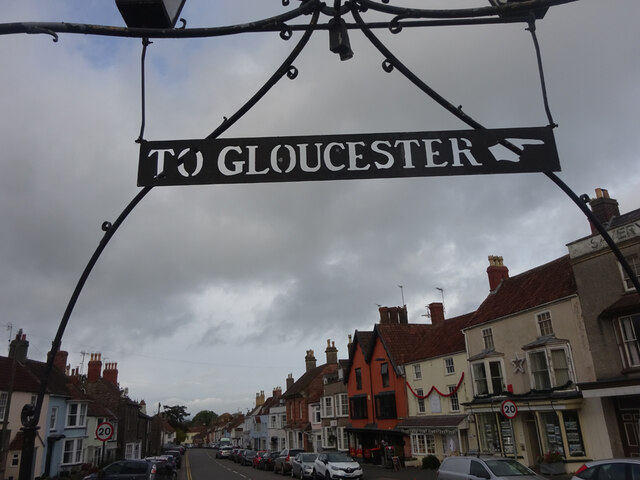
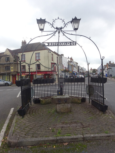
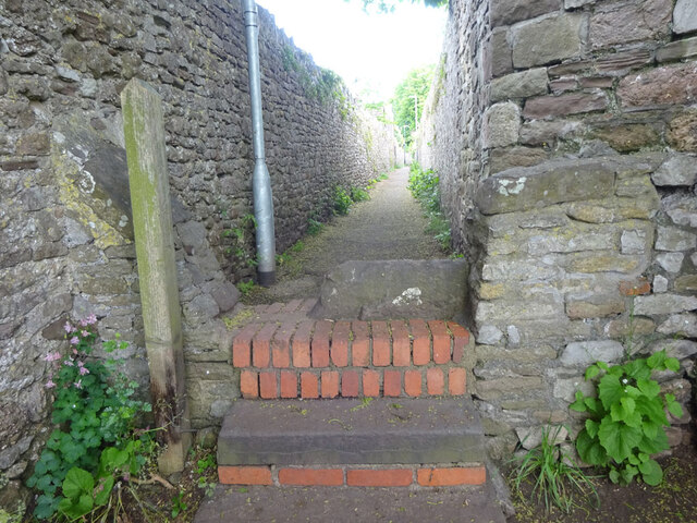
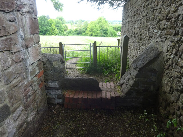
Alveston Images

Images are sourced within 2km of 51.591878/-2.5247 or Grid Reference ST6388. Thanks to Geograph Open Source API. All images are credited.

Fingerpost over a village pump At the bottom of the High St, Thornbury. The location is also called  "The Plain". This fingerpost hangs over a village pump within a horseshoe of iron railings. Context (reverse) view see <a href="https://www.geograph.org.uk/photo/7020690">ST6390 : Village Pump & fingerpost, High Street</a>

Inscription: To Gloucester ☛

Milestone Society National ID: GL_ST6390
Fingerpost over a village pump
At the bottom of the High St, Thornbury. The location is also called "The Plain". This fingerpost hangs over a village pump within a horseshoe of iron railings. Context (reverse) view see ST6390 : Village Pump & fingerpost, High Street Inscription: To Gloucester ☛ Milestone Society National ID: GL_ST6390
Village Pump & fingerpost, High Street Bottom of the High Street, Thornbury. The location is also called  "The Plain". Surrounded by railings in a horseshoe pattern, with a fingerpost sign hanging above. Twin, old fashioned style lamps above. Obverse view of fingerpost see <a href="https://www.geograph.org.uk/photo/7020649">ST6390 : Fingerpost over a village pump</a>

Inscription: To Gloucester ☛

Milestone Society National ID: GL_ST6390
Village Pump & fingerpost, High Street
Bottom of the High Street, Thornbury. The location is also called "The Plain". Surrounded by railings in a horseshoe pattern, with a fingerpost sign hanging above. Twin, old fashioned style lamps above. Obverse view of fingerpost see ST6390 : Fingerpost over a village pump Inscription: To Gloucester ☛ Milestone Society National ID: GL_ST6390
Stone Stile, Thornbury From Castle Street on Gloucestershire walled footpath OTH/46 as it enters the field. This is looking into the path, the view looking out is <a href="https://www.geograph.org.uk/photo/7175500">ST6390 : Stone Stile, Thornbury</a>.
Stone Stile, Thornbury
From Castle Street on Gloucestershire walled footpath OTH/46 as it enters the field. This is looking into the path, the view looking out is ST6390 : Stone Stile, Thornbury.
Stone Stile, Thornbury From Castle Street on Gloucestershire walled footpath OTH/46 as it enters the field. This is looking from the path, the view looking back is <a href="https://www.geograph.org.uk/photo/7175499">ST6390 : Stone Stile, Thornbury</a>.
Stone Stile, Thornbury
From Castle Street on Gloucestershire walled footpath OTH/46 as it enters the field. This is looking from the path, the view looking back is ST6390 : Stone Stile, Thornbury.
Stone Stile, Thornbury On Gloucestershire footpath OTH/45 looking from the direction of Kington Lane and Hollow Meadow View.
The view looking back is <a href="https://www.geograph.org.uk/photo/7346341">ST6390 : Stone Stile, Thornbury</a>.
Stone Stile, Thornbury
On Gloucestershire footpath OTH/45 looking from the direction of Kington Lane and Hollow Meadow View. The view looking back is ST6390 : Stone Stile, Thornbury.
Stone Stile, Thornbury On Gloucestershire footpath OTH/45 looking in the direction of Kington Lane and Hollow Meadow View.
The view looking back is <a href="https://www.geograph.org.uk/photo/7346339">ST6390 : Stone Stile, Thornbury</a>.
Stone Stile, Thornbury
On Gloucestershire footpath OTH/45 looking in the direction of Kington Lane and Hollow Meadow View. The view looking back is ST6390 : Stone Stile, Thornbury.
Thornbury High Street Pedestrian friendly town centre (under construction).
Thornbury High Street
Pedestrian friendly town centre (under construction).
Raglan Place, Thornbury
Alveston church St Helens. 
Looking SW from position
Alveston church
St Helens. Looking SW from position
Dutch Barn on New Lane A side lane leading from a layby on the A38 near Alveston crosses a countryside footpath near this dutch barn, used for storing cattle fodder.
Dutch Barn on New Lane
A side lane leading from a layby on the A38 near Alveston crosses a countryside footpath near this dutch barn, used for storing cattle fodder.
Village in the Mist Small community on the section of Shellards Lane between the end of New Lane and the A38, on the outskirts of Alveston
Village in the Mist
Small community on the section of Shellards Lane between the end of New Lane and the A38, on the outskirts of Alveston
Thornbury Tunnel Southern portal of the 168yd, single track Thornbury Tunnel on the former Midland Railway line between Thornbury and Tytherington.  At the time the photograph was taken, the tunnel was open at both ends; it has now been infilled at the northern end and blocked by a concrete wall about 20yds in under the A38 at the southern end.
Thornbury Tunnel
Southern portal of the 168yd, single track Thornbury Tunnel on the former Midland Railway line between Thornbury and Tytherington. At the time the photograph was taken, the tunnel was open at both ends; it has now been infilled at the northern end and blocked by a concrete wall about 20yds in under the A38 at the southern end.
Malvern Drive A quiet suburban road in Thornbury, a dormitary town for Bristol.
Malvern Drive
A quiet suburban road in Thornbury, a dormitary town for Bristol.
Grovesend House Offices of consultant engineers, just off the A38 to the south of Thornbury.
Grovesend House
Offices of consultant engineers, just off the A38 to the south of Thornbury.
Ploughed field, at Gate Farm
Marlwood secondary school, Vattingstone Lane, Alveston
Track to White Cottage, Alveston Down
Stroud Common
Stroud Common
Show me another place!

Alveston is located at Grid Ref: ST6388 (Lat: 51.591878, Lng: -2.5247)

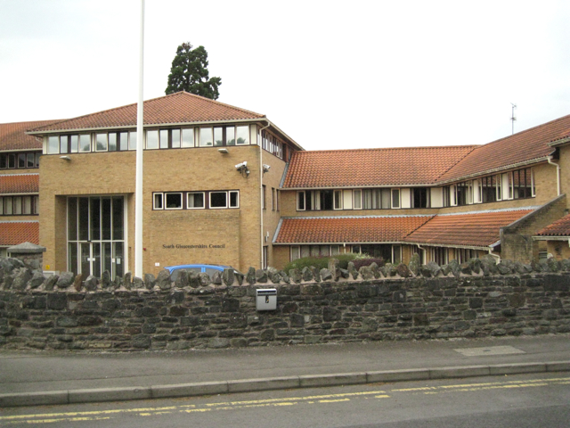
Unitary Authority: South Gloucestershire

Police Authority: Avon and Somerset

What 3 Words

///frozen.hips.breathing. Near Alveston, Gloucestershire

Nearby Locations

Alveston Down Alveston

Related Wikis

Alveston

Alveston is a village, civil parish and former royal manor in South Gloucestershire, England, inhabited in 2014 by about 3,000 people. The village lies...
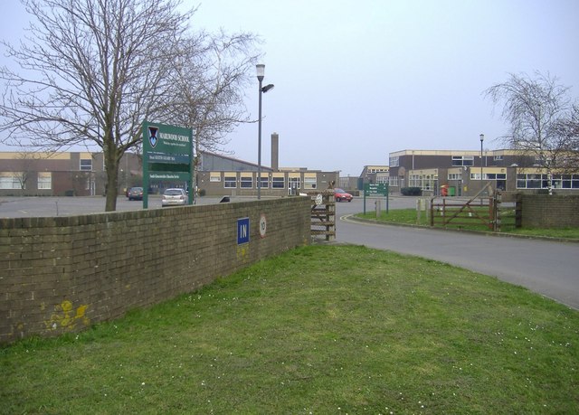
Marlwood School

Marlwood School (founded 1606) is a state-funded secondary school currently part of the CSET academy chain. Located at Alveston, South Gloucestershire...

Northavon

Northavon was a district in the English county of Avon from 1974 to 1996. The district was formed by the Local Government Act 1972 on 1 April 1974 as part...

Northavon (UK Parliament constituency)

Northavon was, from 1983 until 2010, a constituency represented in the House of Commons of the Parliament of the United Kingdom. It elected one Member...

Thornbury (Gloucestershire) railway station

Thornbury railway station served the town of Thornbury in Gloucestershire. The station was the terminus of a short 7.5-mile (12 km) branch from Yate on...

Thornbury Town F.C.

Thornbury Town Football Club is a football club located in Thornbury, South Gloucestershire, England. They are currently members of the Hellenic League...

Thornbury Town Hall

Thornbury Town Hall, is a municipal building in the High Street, Thornbury, Gloucestershire, England. The building, which is the meeting place of Thornbury...

Thornbury Rural District

Thornbury Rural District was a rural district council centred on Thornbury in the south of Gloucestershire. It was originally formed as a Poor Law Union...

Nearby Amenities

Located within 500m of 51.591878,-2.5247
Traffic Signals
Lat/Long: 51.5905262/-2.5267986
Traffic Signals
Button Operated: yes
Crossing: traffic_signals
Crossing Ref: puffin
Tactile Paving: yes
Traffic Signals Vibration: yes
Lat/Long: 51.5921929/-2.5288703
Removed Amenity: telephone
Lat/Long: 51.5922067/-2.5289957
Post Box
Collection Times: Mo-Fr 16:00; Sa 09:00
Operator: Royal Mail
Post Box Type: wall
Postal Code: BS35
Ref: BS35 262
Lat/Long: 51.590076/-2.526548
Bus Stop
Beanhill Crescent
Bench: no
Bin: no
Lit: no
Naptan AtcoCode: 0170SGB20666
Naptan Bearing: E
Naptan CommonName: Beanhill Crescent
Naptan Crossing: Thornbury Road
Naptan NaptanCode: sgldawj
Naptan Street: Down Road
Naptan Verified: no
Shelter: no
Source: naptan_import
Tactile Paving: no
Lat/Long: 51.5924722/-2.5300118
Bus Stop
Beanhill Crescent
Bench: no
Bin: no
Lit: no
Naptan AtcoCode: 0170SGB20667
Naptan Bearing: W
Naptan CommonName: Beanhill Crescent
Naptan Crossing: Thornbury Road
Naptan NaptanCode: sgldawm
Naptan Street: Down Road
Naptan Verified: no
Shelter: no
Source: naptan_import
Tactile Paving: no
Lat/Long: 51.5923647/-2.5299239
Bus Stop
Davids Lane
Bench: no
Bin: no
Lit: no
Naptan AtcoCode: 0170SGP90917
Naptan Bearing: N
Naptan CommonName: Davids Lane
Naptan NaptanCode: sgldgam
Naptan Street: Gloucester Road
Naptan Verified: no
Shelter: no
Source: naptan_import
Tactile Paving: no
Lat/Long: 51.5891384/-2.5275624
Bus Stop
Davids Lane
Bench: no
Bin: no
Lit: no
Naptan AtcoCode: 0170SGP90918
Naptan Bearing: S
Naptan CommonName: Davids Lane
Naptan Crossing: The Street
Naptan NaptanCode: sgldgaw
Naptan Street: Gloucester Road
Naptan Verified: no
Shelter: no
Source: naptan_import
Tactile Paving: no
Lat/Long: 51.5898696/-2.5269068
Bus Stop
The Ship
Bench: yes
Bin: no
Check Date Bin: 2023-04-16
Lit: no
Naptan AtcoCode: 0170SGP90919
Naptan Bearing: N
Naptan CommonName: The Ship
Naptan Crossing: The Mead
Naptan NaptanCode: sgldawp
Naptan Street: Thornbury Road
Naptan Verified: no
Shelter: yes
Source: naptan_import
Tactile Paving: no
Lat/Long: 51.5920364/-2.5289674
Bus Stop
The Ship
Bench: yes
Bin: yes
Lit: yes
Naptan AtcoCode: 0170SGP90922
Naptan Bearing: S
Naptan CommonName: The Ship
Naptan Crossing: Down Road
Naptan NaptanCode: sgldawt
Naptan Street: Thornbury Road
Naptan Verified: no
Shelter: yes
Source: naptan_import
Tactile Paving: no
Lat/Long: 51.5919352/-2.5286525
Power: pole
Source: Bing
Lat/Long: 51.5936092/-2.5193818
Note: double wooden power line poles
Power: pole
Source: Bing
Lat/Long: 51.5936174/-2.5191617
Power: pole
Source: Bing
Lat/Long: 51.5939621/-2.5207373
Note: double wooden power line poles
Power: pole
Source: Bing
Lat/Long: 51.5937124/-2.5191602
Power: pole
Source: Bing
Lat/Long: 51.5932188/-2.5178914
Power: tower
Source: Bing
Lat/Long: 51.5940696/-2.5207361
Note: double wooden power line poles
Power: pole
Source: Bing
Lat/Long: 51.593282/-2.5178585
Power: pole
Source: Bing
Lat/Long: 51.5923958/-2.5223461
Power: pole
Source: Bing
Lat/Long: 51.5929446/-2.5220206
Power: pole
Source: Bing
Lat/Long: 51.5934703/-2.5217094
Power: pole
Source: Bing
Lat/Long: 51.5939637/-2.521429
Power: pole
Source: Bing
Lat/Long: 51.5880159/-2.5264986
Power: pole
Source: Bing
Lat/Long: 51.5887102/-2.5256229
Power: pole
Source: Bing
Lat/Long: 51.5893968/-2.5247709
Power: pole
Source: Bing
Lat/Long: 51.590054/-2.5240429
Power: pole
Source: Bing
Lat/Long: 51.5906354/-2.5233954
Power: pole
Source: Bing
Lat/Long: 51.5912495/-2.5230268
Power: pole
Source: Bing
Lat/Long: 51.5918594/-2.5226599
Power: pole
Source: Bing
Lat/Long: 51.5950784/-2.5257448
Power: pole
Source: Bing
Lat/Long: 51.5951619/-2.5262805
Power: pole
Source: Bing
Lat/Long: 51.5951798/-2.5238812
Power: pole
Source: Bing
Lat/Long: 51.5955281/-2.5249601
Power: pole
Source: Bing
Lat/Long: 51.5957056/-2.5262182
Power: pole
Source: Bing
Lat/Long: 51.5958451/-2.5277421
Parking
Barrier: kissing_gate
Bicycle: no
Capacity: 6
Fee: no
Foot: yes
Lat/Long: 51.5934679/-2.5256355
Crossing
Check Date Crossing: 2023-10-26
Crossing: uncontrolled
Crossing Island: no
Crossing Ref: zebra
Tactile Paving: no
Lat/Long: 51.592404/-2.5298838
Barrier: kissing_gate
Bicycle: no
Foot: yes
Lat/Long: 51.5921972/-2.5228163
Waste Basket
Check Date: 2023-10-26
Lat/Long: 51.5925522/-2.5291607
Crossing
Crossing: uncontrolled
Crossing Ref: zebra
Tactile Paving: no
Lat/Long: 51.5911084/-2.5268139
Give Way
Direction: backward
Lat/Long: 51.5912666/-2.531352
Give Way
Direction: forward
Lat/Long: 51.5915276/-2.5314877
Give Way
Direction: backward
Lat/Long: 51.5923391/-2.5301196
Give Way
Direction: forward
Lat/Long: 51.5922796/-2.530667
Give Way
Direction: forward
Lat/Long: 51.5921759/-2.5316124
Give Way
Direction: forward
Lat/Long: 51.5924457/-2.5288188
Street Lamp
Lat/Long: 51.591788/-2.5287856
Street Lamp
Lat/Long: 51.5915165/-2.5284989
Street Lamp
Lat/Long: 51.5912735/-2.5281804
Street Lamp
Lat/Long: 51.5923344/-2.5289519
Street Lamp
Lat/Long: 51.5927009/-2.5286609
Street Lamp
Lat/Long: 51.5929855/-2.528476
Street Lamp
Lat/Long: 51.5906034/-2.5271373
Street Lamp
Lat/Long: 51.5897391/-2.5272683
Street Lamp
Lat/Long: 51.5894013/-2.5274223
Communication Mobile Phone: yes
Man Made: mast
Operator MCC: 234
Operator MNC: 20
Operator EnodeB: 12053
Tower Type: communication
Lat/Long: 51.5939217/-2.5310615
Direction: 170
Generator Method: photovoltaic
Generator Output Electricity: yes
Generator Solar Modules: 4
Generator Source: solar
Generator Type: solar_photovoltaic_panel
Location: roof
Power: generator
Lat/Long: 51.5884496/-2.529138
Direction: 160
Generator Method: photovoltaic
Generator Output Electricity: yes
Generator Solar Modules: 10
Generator Source: solar
Generator Type: solar_photovoltaic_panel
Location: roof
Power: generator
Lat/Long: 51.5895416/-2.5284872
Direction: 160
Generator Method: photovoltaic
Generator Output Electricity: yes
Generator Solar Modules: 16
Generator Source: solar
Generator Type: solar_photovoltaic_panel
Location: roof
Power: generator
Lat/Long: 51.5898895/-2.5286284
Direction: 160
Generator Method: photovoltaic
Generator Output Electricity: yes
Generator Source: solar
Generator Type: solar_photovoltaic_panel
Location: roof
Power: generator
Lat/Long: 51.5896453/-2.5281421
Direction: 240
Generator Method: photovoltaic
Generator Output Electricity: yes
Generator Solar Modules: 8
Generator Source: solar
Generator Type: solar_photovoltaic_panel
Location: roof
Power: generator
Lat/Long: 51.5902422/-2.5284854
Direction: 60
Generator Method: photovoltaic
Generator Output Electricity: yes
Generator Solar Modules: 8
Generator Source: solar
Generator Type: solar_photovoltaic_panel
Location: roof
Power: generator
Lat/Long: 51.5902693/-2.5283982
Direction: 230
Generator Method: photovoltaic
Generator Output Electricity: yes
Generator Solar Modules: 16
Generator Source: solar
Generator Type: solar_photovoltaic_panel
Location: roof
Power: generator
Lat/Long: 51.5910451/-2.5283325
Direction: 260
Generator Method: photovoltaic
Generator Output Electricity: yes
Generator Source: solar
Generator Type: solar_photovoltaic_panel
Location: roof
Power: generator
Lat/Long: 51.5908726/-2.5302454
Direction: 190
Generator Method: photovoltaic
Generator Output Electricity: yes
Generator Solar Modules: 7
Generator Source: solar
Generator Type: solar_photovoltaic_panel
Location: roof
Power: generator
Lat/Long: 51.5911134/-2.5302709
Direction: 100
Generator Method: photovoltaic
Generator Output Electricity: yes
Generator Solar Modules: 10
Generator Source: solar
Generator Type: solar_photovoltaic_panel
Location: roof
Power: generator
Lat/Long: 51.59114/-2.5303487
Direction: 190
Generator Method: photovoltaic
Generator Output Electricity: yes
Generator Solar Modules: 8
Generator Source: solar
Generator Type: solar_photovoltaic_panel
Location: roof
Power: generator
Lat/Long: 51.5907106/-2.5311549
Direction: 190
Generator Method: photovoltaic
Generator Output Electricity: yes
Generator Solar Modules: 4
Generator Source: solar
Generator Type: solar_photovoltaic_panel
Location: roof
Power: generator
Lat/Long: 51.590716/-2.5312274
Direction: 180
Generator Method: photovoltaic
Generator Output Electricity: yes
Generator Solar Modules: 9
Generator Source: solar
Generator Type: solar_photovoltaic_panel
Location: roof
Power: generator
Lat/Long: 51.5907828/-2.531709
Direction: 90
Generator Method: photovoltaic
Generator Output Electricity: yes
Generator Solar Modules: 6
Generator Source: solar
Generator Type: solar_photovoltaic_panel
Location: roof
Power: generator
Lat/Long: 51.590846/-2.5317126
Direction: 120
Generator Method: photovoltaic
Generator Output Electricity: yes
Generator Solar Modules: 12
Generator Source: solar
Generator Type: solar_photovoltaic_panel
Location: roof
Power: generator
Lat/Long: 51.5913966/-2.5307233
Direction: 165
Generator Method: photovoltaic
Generator Output Electricity: yes
Generator Solar Modules: 6
Generator Source: solar
Generator Type: solar_photovoltaic_panel
Location: roof
Power: generator
Lat/Long: 51.5926652/-2.5292283
Direction: 165
Generator Method: photovoltaic
Generator Output Electricity: yes
Generator Solar Modules: 7
Generator Source: solar
Generator Type: solar_photovoltaic_panel
Location: roof
Power: generator
Lat/Long: 51.5926829/-2.5290889
Direction: 165
Generator Method: photovoltaic
Generator Output Electricity: yes
Generator Solar Modules: 12
Generator Source: solar
Generator Type: solar_photovoltaic_panel
Location: roof
Power: generator
Lat/Long: 51.592625/-2.529149
Direction: 165
Generator Method: photovoltaic
Generator Output Electricity: yes
Generator Solar Modules: 14
Generator Source: solar
Generator Type: solar_photovoltaic_panel
Location: roof
Power: generator
Lat/Long: 51.5927308/-2.5289433
The data included in this document is from www.openstreetmap.org. The data is made available under ODbL.

Have you been to Alveston?

Leave your review of Alveston below (or comments, questions and feedback).