Capshard Wood

Wood, Forest in Fife

Scotland

Capshard Wood

Woodland at the lay-by With bird boxes and everything. This rather idyllic picture photo was taken during a short break on a lay by next to a busy road.
Woodland at the lay-by Credit: Aleks Scholz

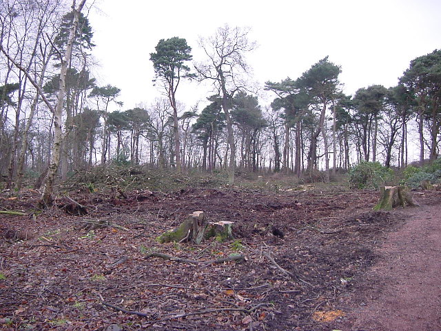
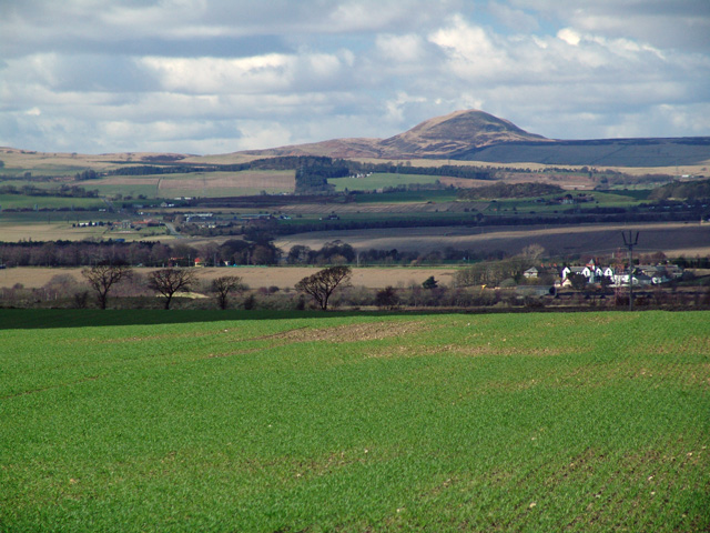
Capshard Wood is a picturesque forest located in the region of Fife, Scotland. Covering an area of approximately 100 acres, this woodland is known for its rich biodiversity and serene beauty. The wood is situated near the village of Falkland, about 20 miles north of Edinburgh.

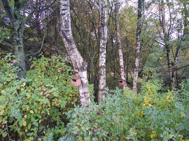
The forest is predominantly composed of native tree species, including oak, ash, beech, and birch, creating a diverse and thriving ecosystem. The dense canopy of the trees provides shelter and sustenance for a variety of wildlife, such as red squirrels, roe deer, and a plethora of bird species, making it a popular spot for nature enthusiasts and wildlife photographers.

A network of well-maintained footpaths and trails meanders through the wood, allowing visitors to explore its hidden gems. The paths lead to enchanting clearings, babbling brooks, and small ponds, adding to the charm and tranquility of the forest. The wood also boasts a diverse range of plant life, with bluebells, wild garlic, and ferns carpeting the forest floor during the spring and summer months.

Capshard Wood is not only a haven for wildlife and nature lovers but also a popular recreation spot for locals and tourists alike. Its natural beauty and peaceful ambiance make it an ideal location for walking, jogging, picnicking, and even camping. The forest is well-equipped with picnic areas and benches, ensuring visitors can relax and enjoy the serene surroundings.

In conclusion, Capshard Wood is a stunning forest in Fife, Scotland, offering a delightful escape into nature. With its diverse flora and fauna, well-maintained trails, and peaceful atmosphere, it promises a truly immersive experience for all who venture into its depths.

If you have any feedback on the listing, please let us know in the comments section below.

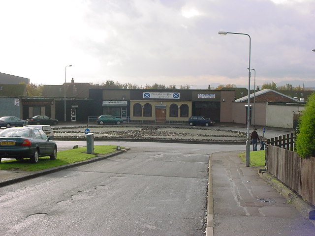
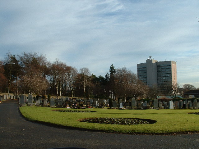
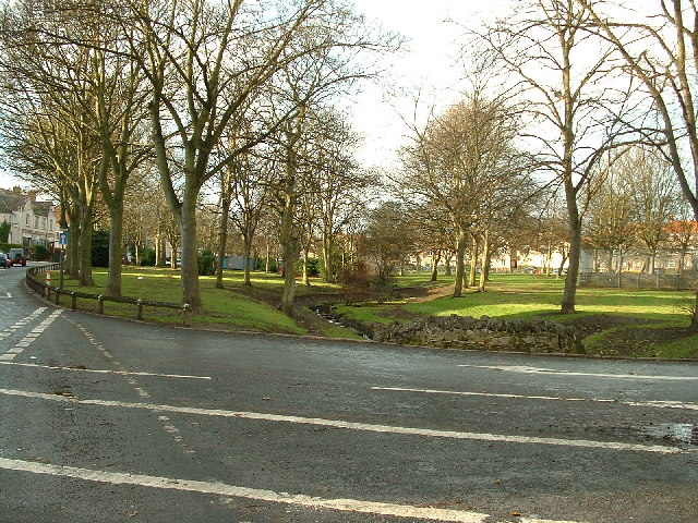
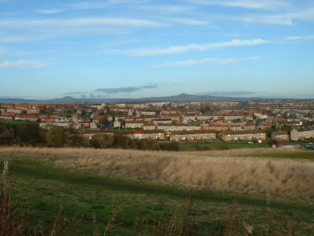
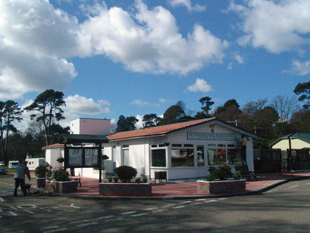
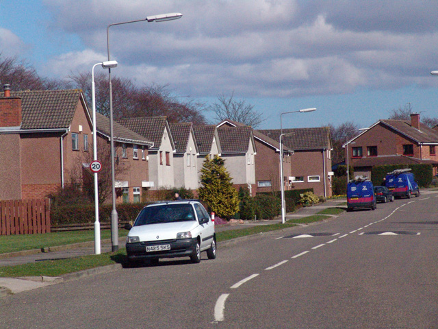
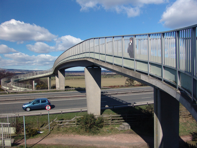
Capshard Wood Images

Images are sourced within 2km of 56.132589/-3.1734909 or Grid Reference NT2793. Thanks to Geograph Open Source API. All images are credited.

Woodland at the lay-by With bird boxes and everything. This rather idyllic picture photo was taken during a short break on a lay by next to a busy road.
Woodland at the lay-by
With bird boxes and everything. This rather idyllic picture photo was taken during a short break on a lay by next to a busy road.
Roundabout at Victoria Hospital The building itself straddles the boundary to the next square, but the roundabout and the short-term car park behind it are in this one.
Roundabout at Victoria Hospital
The building itself straddles the boundary to the next square, but the roundabout and the short-term car park behind it are in this one.
Houses in Kirkcaldy
Houses in Kirkcaldy
Chapel, Kirkcaldy Once this was Bogie Mains farm, that's when the pillar would have been built. It survived the big housing expansion on the north west of Kirkcaldy and now sits on its hill top just by a bus stop.
Chapel, Kirkcaldy
Once this was Bogie Mains farm, that's when the pillar would have been built. It survived the big housing expansion on the north west of Kirkcaldy and now sits on its hill top just by a bus stop.
Kirkcaldy. On the way back to Edinburgh, we found a Fair was operating at Kirkcaldy. I wasn't very interested in the event, it was too flipping cold for a start, but was most intrigued in these two Scammell "Tugs" (this image and the next one). These would be the modern-day equivalents of the old Showman's Engine, basically a Traction engine but with refinements like an electrical generator. I would be most intrigued to learn the age of these two machines.
Kirkcaldy.
On the way back to Edinburgh, we found a Fair was operating at Kirkcaldy. I wasn't very interested in the event, it was too flipping cold for a start, but was most intrigued in these two Scammell "Tugs" (this image and the next one). These would be the modern-day equivalents of the old Showman's Engine, basically a Traction engine but with refinements like an electrical generator. I would be most intrigued to learn the age of these two machines.
Kirkcaldy : Templehall Millennium Park A new community park created by  the efforts of the local community. On the site of Kirkcaldy High School part of the site was sold off for housing. The park includes a wildlife garden, a fruit garden (the trees in the picture are apple) and a play area with climbing structure.
Kirkcaldy : Templehall Millennium Park
A new community park created by the efforts of the local community. On the site of Kirkcaldy High School part of the site was sold off for housing. The park includes a wildlife garden, a fruit garden (the trees in the picture are apple) and a play area with climbing structure.
Kirkcaldy, Smeaton, Cedar Avenue Smeaton is a housing scheme in North Kirkcaldy. 
Smeaton is a deprived neighbour and is quite high in the Scottish Executive Multiple Index of Deprivation.
The streets are all named after trees, sadly no Cedars are growing on this street. Since the photo was taken work has been done to the roundabout. 
NT2893 also contains part of Dunnikier Park, Pannie Den Wood parts of Overton too.
Kirkcaldy, Smeaton, Cedar Avenue
Smeaton is a housing scheme in North Kirkcaldy. Smeaton is a deprived neighbour and is quite high in the Scottish Executive Multiple Index of Deprivation. The streets are all named after trees, sadly no Cedars are growing on this street. Since the photo was taken work has been done to the roundabout. NT2893 also contains part of Dunnikier Park, Pannie Den Wood parts of Overton too.
Kirkcaldy : Dunnikier Park : Garden Wood: after woodland management NT27954 covers the eastern part of Dunnikier Housing Estate and Dunnikier Park. This photograph was taken after felling. Text book woodland management was carried out here in Winter 2001. The rhododendrons were removed and sycamores too. Unfortunately it looks a bit devastated now but there is major regeneration of the woodland, and non native invasive species such as those mentioned have been removed, giving a chance for natives to come back.
Kirkcaldy : Dunnikier Park : Garden Wood: after woodland management
NT27954 covers the eastern part of Dunnikier Housing Estate and Dunnikier Park. This photograph was taken after felling. Text book woodland management was carried out here in Winter 2001. The rhododendrons were removed and sycamores too. Unfortunately it looks a bit devastated now but there is major regeneration of the woodland, and non native invasive species such as those mentioned have been removed, giving a chance for natives to come back.
Kirkcaldy : Hayfield Cemetery Photograph taken in Hayfield Cemetery looking towards Victoria Hospital and Middle den Wood
Kirkcaldy : Hayfield Cemetery
Photograph taken in Hayfield Cemetery looking towards Victoria Hospital and Middle den Wood
Kirkcaldy : Wilson Avenue Park This is a nice wee neighbourhood Park, dating back before 1940. Like all parks in need of some TLC. Has a burn running through it, most of this burn has been buried and no longer is visible.
Kirkcaldy : Wilson Avenue Park
This is a nice wee neighbourhood Park, dating back before 1940. Like all parks in need of some TLC. Has a burn running through it, most of this burn has been buried and no longer is visible.
Kirkcaldy: Rabbit Braes from Bennochy Road, looking over the big field at Rabbit Braes, to Templehall and the Lomond Hills in the background. Kirkcaldy like this part of Fife is a series of hill ridges, the underlying rock is old red sandstone. The fields here are remnant of the Bogie Mains Farm.
Kirkcaldy: Rabbit Braes
from Bennochy Road, looking over the big field at Rabbit Braes, to Templehall and the Lomond Hills in the background. Kirkcaldy like this part of Fife is a series of hill ridges, the underlying rock is old red sandstone. The fields here are remnant of the Bogie Mains Farm.
Dunnikier Caravan Park I think I must have arrived a bit early in the season as it appears there were only workmen on site and access was restricted.
Dunnikier Caravan Park
I think I must have arrived a bit early in the season as it appears there were only workmen on site and access was restricted.
Duddingston Drive Duddingston Drive on the Dunnikier estate. All the streets are named after golf courses.
Duddingston Drive
Duddingston Drive on the Dunnikier estate. All the streets are named after golf courses.
The A92 Footbridge over the A92.
The A92
Footbridge over the A92.
Fife Farmland
Fife Farmland
Commercial Units, Mitchelson Commercial units on the Mitchelson Industrial estate north of Sinclair Town Kirkcaldy
Commercial Units, Mitchelson
Commercial units on the Mitchelson Industrial estate north of Sinclair Town Kirkcaldy
Mitchelston Industrial Estate Commercial units on the Mitchelson Industrial estate north of Sinclair Town Kirkcaldy
Mitchelston Industrial Estate
Commercial units on the Mitchelson Industrial estate north of Sinclair Town Kirkcaldy
Carberry near Kirkcaldy Ready for the next batch of commercial units on the Mitchelson Industrial estate north of Sinclair Town Kirkcaldy
Carberry near Kirkcaldy
Ready for the next batch of commercial units on the Mitchelson Industrial estate north of Sinclair Town Kirkcaldy
Show me another place!

Capshard Wood is located at Grid Ref: NT2793 (Lat: 56.132589, Lng: -3.1734909)

Unitary Authority: Fife

Police Authority: Fife

What 3 Words

///waxes.tonality.offerings. Near Kirkcaldy, Fife

Related Wikis

Kirkcaldy High School

Kirkcaldy High School is a 6-year co-educational comprehensive state school in Kirkcaldy, Fife, Scotland. == History == The school was established in 1582...

Whyteman's Brae Hospital

Whyteman's Brae Hospital is a health facility in Whyteman's Brae, Kirkcaldy, Scotland. It is managed by NHS Fife. == History == The facility, which provides...

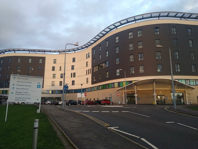
Victoria Hospital, Kirkcaldy

Victoria Hospital is a large hospital situated to the north of the town centre in Kirkcaldy, in Fife, Scotland. As one of two main hospitals in Fife, this...

A921 road

The A921 road is a road that connects Kirkcaldy with the M90 motorway in Fife, Scotland. Before 1990, the road was classed as the A92. == References ==

Battle of Raith

The Battle of Raith was the theory of E. W. B. Nicholson, librarian at the Bodleian Library, Oxford. He was aware of the poem Y Gododdin in the Book of...

Pathhead

Pathhead (Scots: Paithheid) is an area of Kirkcaldy, in Fife, Scotland. Pathhead was an independent village before it was incorporated into the Royal burgh...

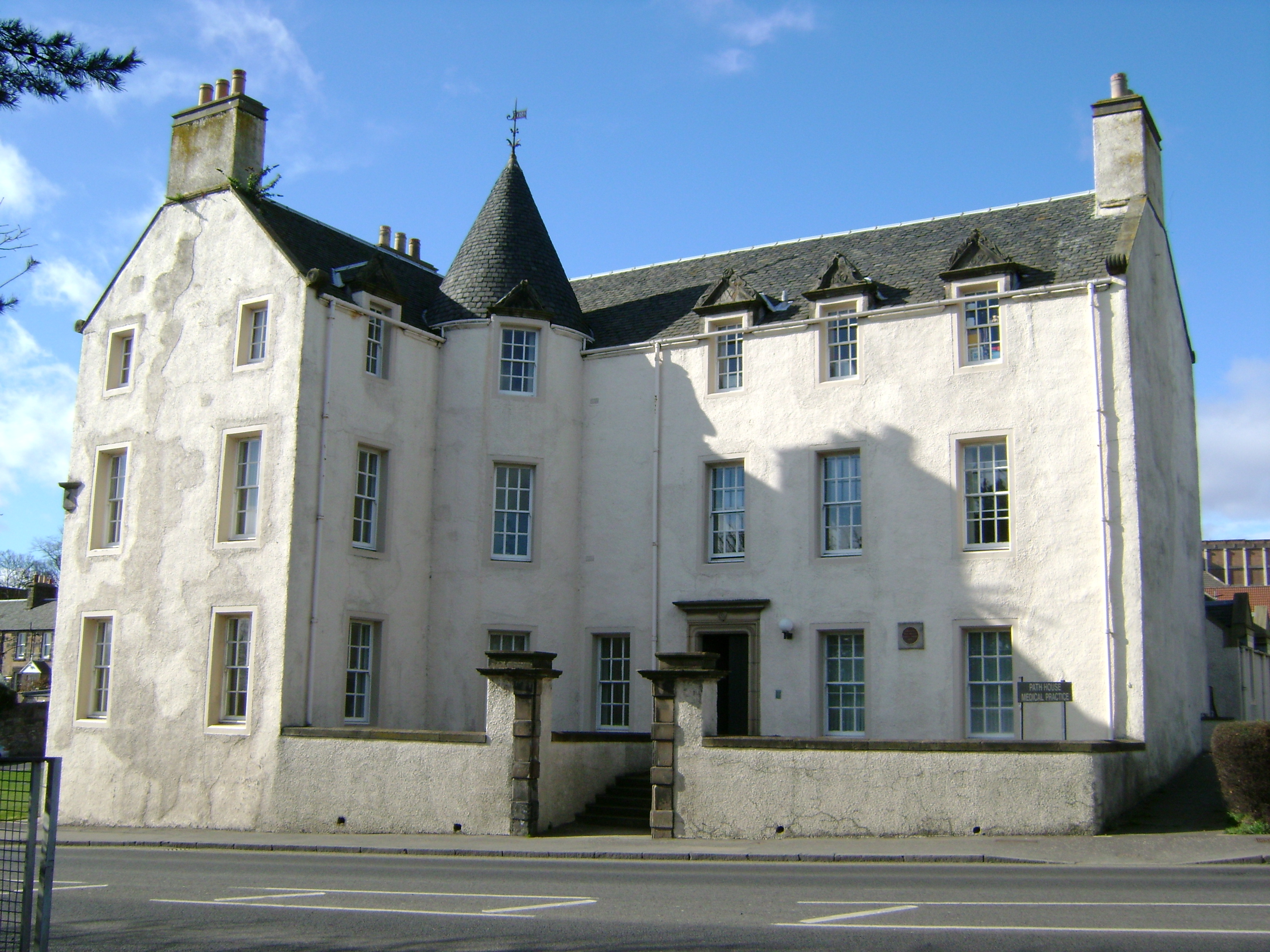
Path House, Kirkcaldy

Path House, formerly known as Dunnikier House, is a manor house in the Scottish town of Kirkcaldy in the Fife Council Area. It was listed by Historic Environment...

Sinclairtown railway station

Sinclairtown railway station served the suburb of Sinclairtown, Fife, Scotland from 1847 to 1969 on the Edinburgh and Northern Railway. == History == The...

Nearby Amenities

Located within 500m of 56.132589,-3.1734909
Traffic Signals
Source: survey
Lat/Long: 56.1326919/-3.1796256
Post Box
Post Box Type: lamp
Ref: KY2 401
Royal Cypher: scottish_crown
Source: survey
Lat/Long: 56.1293085/-3.1781724
Traffic Signals
Source: survey
Lat/Long: 56.13259/-3.1796559
Post Box
Collection Times: Mo-Fr 16:45; Sa 11:45
Operator: Royal Mail
Operator Wikidata: Q638098
Post Box Type: pillar
Ref: KY2 155
Royal Cypher: scottish_crown
Source: survey
Lat/Long: 56.1363216/-3.1778026
Post Box
Post Box Type: pillar
Ref: KY2 64
Source: survey
Lat/Long: 56.1342466/-3.1739562
Crossing
Bicycle: yes
Crossing: traffic_signals
Crossing Island: no
Crossing Ref: toucan
Tactile Paving: yes
Lat/Long: 56.1328179/-3.1795927
Barrier: bollard
Lat/Long: 56.1341364/-3.1795946
Crossing
Crossing: traffic_signals
Lat/Long: 56.1312991/-3.1671888
Crossing
Crossing: traffic_signals
Lat/Long: 56.1295857/-3.1731516
Crossing
Button Operated: yes
Crossing: traffic_signals
Crossing Island: no
Tactile Paving: yes
Lat/Long: 56.1315236/-3.1745995
Crossing
Bicycle: yes
Crossing: traffic_signals
Crossing Ref: toucan
Lat/Long: 56.1323194/-3.1761502
Crossing
Bicycle: yes
Crossing: traffic_signals
Crossing Ref: toucan
Lat/Long: 56.1322234/-3.1760109
Bus Stop
Capshard Wood
Bench: yes
Bus: yes
Naptan AtcoCode: 6500K0073
Naptan Bearing: NW
Naptan CommonName: Capshard Wood
Naptan Indicator: opp
Naptan Landmark: Capshard Wood
Naptan NaptanCode: 34327237
Naptan Street: Chapel Level
Public Transport: platform
Ref: 34327237
Shelter: yes
Lat/Long: 56.1322224/-3.1765911
The Co-operative Food
Addr City: Kirkcaldy
Addr Housenumber: 1-5
Addr Postcode: KY2 6HX
Addr Street: Ralston Drive
Brand: The Co-operative Food
Brand Wikidata: Q3277439
Brand Wikipedia: en:Co-op Food
Fhrs Id: 131215
Shop: convenience
Lat/Long: 56.1363105/-3.1779973
Bus Stop
Capshard Wood
Bench: yes
Bus: yes
Naptan AtcoCode: 6500K0072
Naptan Bearing: SE
Naptan CommonName: Capshard Wood
Naptan Indicator: adj
Naptan Landmark: Rosemount Avenue
Naptan NaptanCode: 34327275
Naptan Street: Chapel Level
Public Transport: platform
Ref: 34327275
Shelter: yes
Lat/Long: 56.1323424/-3.1755767
Crossing
Crossing: traffic_signals
Crossing Island: no
Tactile Paving: yes
Lat/Long: 56.1324863/-3.1742391
Crossing
Crossing: traffic_signals
Crossing Island: no
Tactile Paving: yes
Lat/Long: 56.1317882/-3.1727676
Crossing
Crossing: traffic_signals
Tactile Paving: yes
Lat/Long: 56.1327149/-3.179979
Crossing
Crossing: traffic_signals
Tactile Paving: yes
Lat/Long: 56.1326322/-3.1801099
Traffic Calming: cushion
Lat/Long: 56.1353296/-3.1745228
Shop: convenience
Lat/Long: 56.1295333/-3.17853
Car Wash
Lat/Long: 56.132733/-3.1772564
Generator Method: photovoltaic
Generator Output Electricity: yes
Generator Source: solar
Generator Type: solar_photovoltaic_panel
Power: generator
Lat/Long: 56.1339025/-3.1805359
Traffic Calming: cushion
Lat/Long: 56.1345862/-3.1787318
Generator Method: photovoltaic
Generator Output Electricity: yes
Generator Source: solar
Generator Type: solar_photovoltaic_panel
Power: generator
Lat/Long: 56.1349118/-3.1803944
Generator Method: photovoltaic
Generator Output Electricity: yes
Generator Source: solar
Generator Type: solar_photovoltaic_panel
Power: generator
Lat/Long: 56.13495/-3.1802108
Generator Method: photovoltaic
Generator Output Electricity: yes
Generator Source: solar
Generator Type: solar_photovoltaic_panel
Power: generator
Lat/Long: 56.1337144/-3.1739732
Generator Method: photovoltaic
Generator Output Electricity: yes
Generator Source: solar
Generator Type: solar_photovoltaic_panel
Power: generator
Lat/Long: 56.1337144/-3.1738898
Generator Method: photovoltaic
Generator Output Electricity: yes
Generator Source: solar
Generator Type: solar_photovoltaic_panel
Power: generator
Lat/Long: 56.1332114/-3.1743736
Generator Method: photovoltaic
Generator Output Electricity: yes
Generator Source: solar
Generator Type: solar_photovoltaic_panel
Power: generator
Lat/Long: 56.1332092/-3.1743127
Generator Method: photovoltaic
Generator Output Electricity: yes
Generator Source: solar
Generator Type: solar_photovoltaic_panel
Power: generator
Lat/Long: 56.1332753/-3.1763827
Generator Method: photovoltaic
Generator Output Electricity: yes
Generator Source: solar
Generator Type: solar_photovoltaic_panel
Power: generator
Lat/Long: 56.1332558/-3.1763337
Generator Method: photovoltaic
Generator Output Electricity: yes
Generator Source: solar
Generator Type: solar_photovoltaic_panel
Power: generator
Lat/Long: 56.1311967/-3.17771
Generator Method: photovoltaic
Generator Output Electricity: yes
Generator Source: solar
Generator Type: solar_photovoltaic_panel
Power: generator
Lat/Long: 56.1320717/-3.179302
Generator Method: photovoltaic
Generator Output Electricity: yes
Generator Source: solar
Generator Type: solar_photovoltaic_panel
Power: generator
Lat/Long: 56.1321139/-3.1792864
Traffic Calming: cushion
Lat/Long: 56.1362062/-3.1777145
Traffic Calming: cushion
Lat/Long: 56.1366879/-3.1761728
Bus Stop
Cumbrae Terrace
Bus: yes
Naptan AtcoCode: 6500K0076
Naptan Bearing: S
Naptan CommonName: Cumbrae Terrace
Naptan Indicator: opp
Naptan Landmark: Cumbrae Terrace
Naptan NaptanCode: 34326868
Naptan Street: Hendry Road
Public Transport: platform
Ref: 34326868
Shelter: yes
Lat/Long: 56.1293802/-3.1729322
Traffic Calming: cushion
Lat/Long: 56.1304295/-3.1779389
Traffic Calming: cushion
Lat/Long: 56.1308865/-3.178179
Traffic Calming: cushion
Lat/Long: 56.1299549/-3.1758463
Traffic Calming: cushion
Lat/Long: 56.1293034/-3.1765591
Generator Method: photovoltaic
Generator Output Electricity: yes
Generator Source: solar
Generator Type: solar_photovoltaic_panel
Power: generator
Lat/Long: 56.1302059/-3.1783031
Generator Method: photovoltaic
Generator Output Electricity: yes
Generator Source: solar
Generator Type: solar_photovoltaic_panel
Power: generator
Lat/Long: 56.1302293/-3.1782517
We Buy Any Car
Brand: We Buy Any Car
Brand Wikipedia: en:We Buy Any Car
Buy: only
Shop: car
Lat/Long: 56.1327412/-3.1774027
Traffic Calming: cushion
Lat/Long: 56.1337637/-3.1761518
Generator Method: photovoltaic
Generator Output Electricity: yes
Generator Source: solar
Generator Type: solar_photovoltaic_panel
Power: generator
Lat/Long: 56.1333788/-3.1792612
Bus Stop
Ailsa Grove
Naptan AtcoCode: 6500K1094
Naptan Bearing: S
Naptan CommonName: Ailsa Grove
Naptan Indicator: adj
Naptan Landmark: Ailsa Grove
Naptan NaptanCode: 34326949
Naptan Street: Harris Drive
Ref: 34326949
Shelter: yes
Lat/Long: 56.1308116/-3.1780873
Bus Stop
Cumbrae Terrace
Bus: yes
Naptan AtcoCode: 6500K0075
Naptan Bearing: N
Naptan CommonName: Cumbrae Terrace
Naptan Indicator: Adj
Naptan Landmark: Cumbrae Terrace
Naptan NaptanCode: 34326928
Naptan Street: Hendry Road
Public Transport: platform
Ref: 34326928
Shelter: no
Lat/Long: 56.1292853/-3.1731574
Bus Stop
Davaar Drive
Bus: yes
Naptan AtcoCode: 6500K1096
Naptan Bearing: E
Naptan CommonName: Davaar Drive
Naptan Indicator: adj 42
Naptan Landmark: House No 42
Naptan NaptanCode: 34327238
Naptan Street: Harris Drive
Naptan Verified: no
Public Transport: platform
Ref: 34327238
Lat/Long: 56.1322266/-3.180882
Bus Stop
Turnberry Drive
Bus: yes
Naptan AtcoCode: 6500K0011
Naptan Bearing: W
Naptan CommonName: Turnberry Drive
Naptan Indicator: adj 73
Naptan Landmark: House No 73
Naptan NaptanCode: 34327365
Naptan Street: Turnberry Drive
Naptan Verified: no
Public Transport: platform
Ref: 34327365
Lat/Long: 56.136635/-3.176237
Bus Stop
Muirfield Street
Bus: yes
Naptan AtcoCode: 6500K0014
Naptan Bearing: SE
Naptan CommonName: Muirfield Street
Naptan Indicator: Adj
Naptan Landmark: Muirfield Street
Naptan NaptanCode: 34327347
Naptan Street: Turnberry Drive
Naptan Verified: no
Public Transport: platform
Ref: 34327347
Lat/Long: 56.135207/-3.174295
Bus Stop
Barassie Drive
Bus: yes
Naptan AtcoCode: 6500K0017
Naptan Bearing: NE
Naptan CommonName: Barassie Drive
Naptan Indicator: Adj
Naptan Landmark: Barassie Drive
Naptan NaptanCode: 34327253
Naptan Street: Rosemount Avenue
Naptan Verified: no
Public Transport: platform
Ref: 34327253
Lat/Long: 56.133079/-3.175083
Bus Stop
Kilspindie Crescent
Bus: yes
Naptan AtcoCode: 6500K0015
Naptan Bearing: N
Naptan CommonName: Kilspindie Crescent
Naptan Indicator: Adj
Naptan Landmark: Kilspindie Crescent
Naptan NaptanCode: 34327352
Naptan Street: Turnberry Drive
Naptan Verified: no
Public Transport: platform
Ref: 34327352
Lat/Long: 56.135437/-3.174672
Bus Stop
Davaar Drive
Bus: yes
Naptan AtcoCode: 6500K1095
Naptan Bearing: W
Naptan CommonName: Davaar Drive
Naptan Indicator: opp
Naptan Landmark: Tiree Place
Naptan NaptanCode: 34327232
Naptan Street: Harris Drive
Naptan Verified: no
Public Transport: platform
Ref: 34327232
Lat/Long: 56.1320658/-3.1805187
Bus Stop
Rosemount Avenue
Bus: yes
Naptan AtcoCode: 6500K0016
Naptan Bearing: W
Naptan CommonName: Rosemount Avenue
Naptan Indicator: Opp 34
Naptan Landmark: House No 34
Naptan NaptanCode: 34327258
Naptan Street: Rosemount Avenue
Naptan Verified: no
Public Transport: platform
Ref: 34327258
Lat/Long: 56.132988/-3.174227
Traffic Calming: cushion
Lat/Long: 56.1297343/-3.1744886
The data included in this document is from www.openstreetmap.org. The data is made available under ODbL.

Have you been to Capshard Wood?

Leave your review of Capshard Wood below (or comments, questions and feedback).