Begg Moss Plantation

Wood, Forest in Fife

Scotland

Begg Moss Plantation

Electric vehicle charging point In the car park of the Spiral Weave, Kirkcaldy. This one also offers an airline for inflating tyres.
The vehicle with 'St Andrews Shuttle' on its side is an airport taxi.
Electric vehicle charging point Credit: Bill Kasman

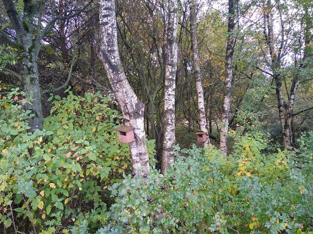
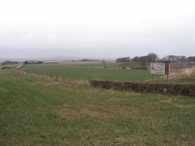
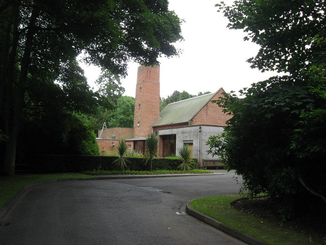
Begg Moss Plantation is a picturesque woodland located in the region of Fife, Scotland. Spread across an extensive area, the plantation encompasses a diverse range of flora and fauna, making it an ideal destination for nature enthusiasts and outdoor lovers.

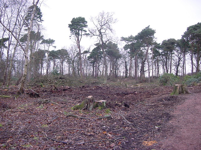
The plantation is primarily characterized by its dense forest cover, with towering trees that provide a canopy of shade and shelter. The woodland is home to a variety of tree species, including oak, beech, birch, and pine, creating a rich and vibrant tapestry of colors throughout the year.

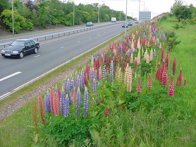
Begg Moss Plantation also boasts a thriving ecosystem, with numerous wildflowers, ferns, and mosses carpeting the forest floor. This natural undergrowth serves as a habitat for various small mammals, including squirrels, rabbits, and voles, as well as a wide array of bird species such as woodpeckers, owls, and thrushes.

Visitors to Begg Moss Plantation can enjoy a network of well-maintained trails that wind through the woodland, providing ample opportunities for walking, jogging, and wildlife spotting. The peaceful atmosphere and serene surroundings make it an ideal place for relaxation and rejuvenation.

In addition to its natural beauty, Begg Moss Plantation also has historical significance. The plantation is believed to have been established in the early 19th century and played a role in Fife's timber industry. Today, it stands as a testament to the region's rich heritage and offers a glimpse into the past.

If you have any feedback on the listing, please let us know in the comments section below.

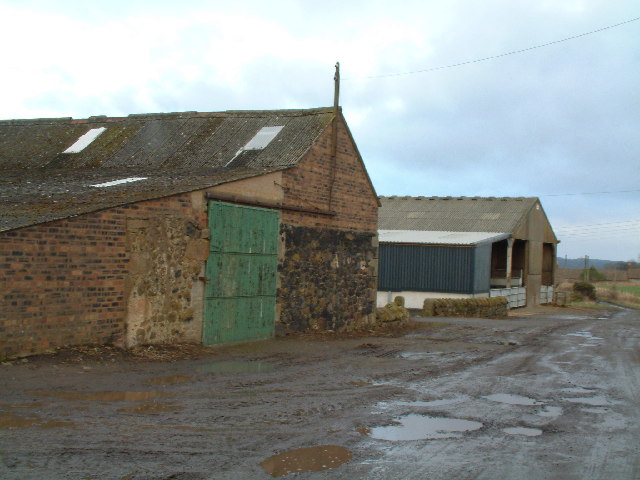
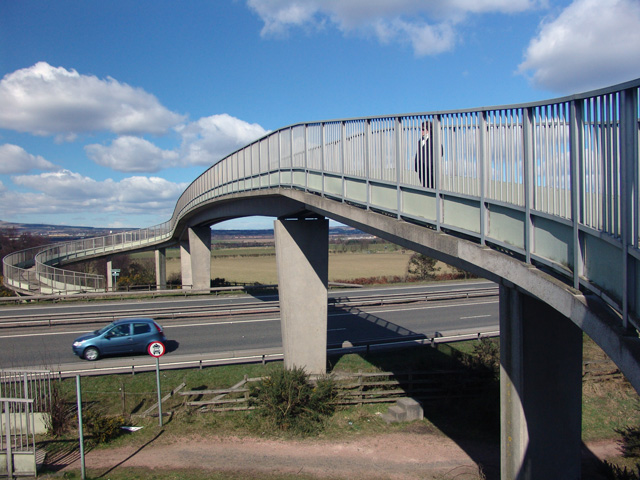
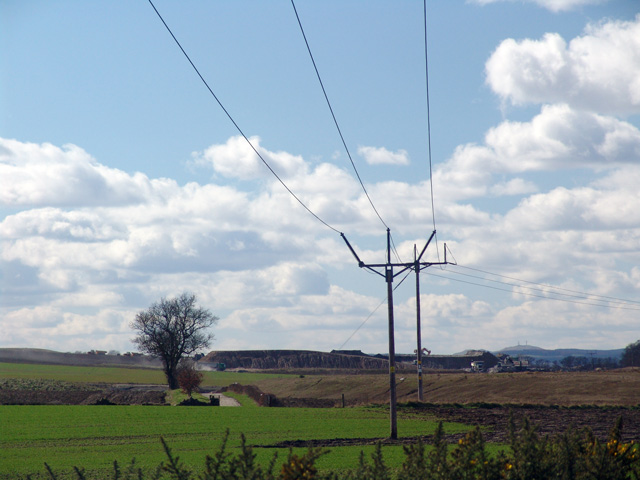
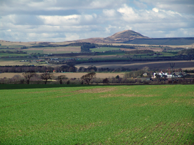
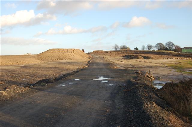
Begg Moss Plantation Images

Images are sourced within 2km of 56.141963/-3.1808095 or Grid Reference NT2694. Thanks to Geograph Open Source API. All images are credited.

Electric vehicle charging point In the car park of the Spiral Weave, Kirkcaldy. This one also offers an airline for inflating tyres.
The vehicle with 'St Andrews Shuttle' on its side is an airport taxi.
Electric vehicle charging point
In the car park of the Spiral Weave, Kirkcaldy. This one also offers an airline for inflating tyres. The vehicle with 'St Andrews Shuttle' on its side is an airport taxi.
Electric vehicle charging point In the car park of the Spiral Weave, Kirkcaldy. This one also offers an airline for inflating tyres.
Electric vehicle charging point
In the car park of the Spiral Weave, Kirkcaldy. This one also offers an airline for inflating tyres.
Woodland at the lay-by With bird boxes and everything. This rather idyllic picture photo was taken during a short break on a lay by next to a busy road.
Woodland at the lay-by
With bird boxes and everything. This rather idyllic picture photo was taken during a short break on a lay by next to a busy road.
Chapel, Kirkcaldy Once this was Bogie Mains farm, that's when the pillar would have been built. It survived the big housing expansion on the north west of Kirkcaldy and now sits on its hill top just by a bus stop.
Chapel, Kirkcaldy
Once this was Bogie Mains farm, that's when the pillar would have been built. It survived the big housing expansion on the north west of Kirkcaldy and now sits on its hill top just by a bus stop.
Kirkcaldy : Chapel : A910: Lupins flowering The second season of the lupins flowering. These were planted as part of the road dualling. They provide a burst of colour during June. It will be interesting to see how long they flower and if they naturalise.
Kirkcaldy : Chapel : A910: Lupins flowering
The second season of the lupins flowering. These were planted as part of the road dualling. They provide a burst of colour during June. It will be interesting to see how long they flower and if they naturalise.
Kirkcaldy : Templehall Millennium Park A new community park created by  the efforts of the local community. On the site of Kirkcaldy High School part of the site was sold off for housing. The park includes a wildlife garden, a fruit garden (the trees in the picture are apple) and a play area with climbing structure.
Kirkcaldy : Templehall Millennium Park
A new community park created by the efforts of the local community. On the site of Kirkcaldy High School part of the site was sold off for housing. The park includes a wildlife garden, a fruit garden (the trees in the picture are apple) and a play area with climbing structure.
Kirkcaldy : Dunnikier Park : Garden Wood: after woodland management NT27954 covers the eastern part of Dunnikier Housing Estate and Dunnikier Park. This photograph was taken after felling. Text book woodland management was carried out here in Winter 2001. The rhododendrons were removed and sycamores too. Unfortunately it looks a bit devastated now but there is major regeneration of the woodland, and non native invasive species such as those mentioned have been removed, giving a chance for natives to come back.
Kirkcaldy : Dunnikier Park : Garden Wood: after woodland management
NT27954 covers the eastern part of Dunnikier Housing Estate and Dunnikier Park. This photograph was taken after felling. Text book woodland management was carried out here in Winter 2001. The rhododendrons were removed and sycamores too. Unfortunately it looks a bit devastated now but there is major regeneration of the woodland, and non native invasive species such as those mentioned have been removed, giving a chance for natives to come back.
Kirkcaldy : Hayfield Cemetery Photograph taken in Hayfield Cemetery looking towards Victoria Hospital and Middle den Wood
Kirkcaldy : Hayfield Cemetery
Photograph taken in Hayfield Cemetery looking towards Victoria Hospital and Middle den Wood
Middle Balbeggie Farm
The Begg Farm OCCS Looking east from near Dothan Farm, The Begg Farm is not really a farm anymore but an open cast coal pit.  <span class="nowrap"><a title="http://www.ihbrown.com/CoalMining.aspx" rel="nofollow ugc noopener" href="http://www.ihbrown.com/CoalMining.aspx">Link</a><img style="margin-left:2px;" alt="External link" title="External link - shift click to open in new window" src="https://s1.geograph.org.uk/img/external.png" width="10" height="10"/></span>
The Begg Farm OCCS
Looking east from near Dothan Farm, The Begg Farm is not really a farm anymore but an open cast coal pit. LinkExternal link
Dunnikier Caravan Park I think I must have arrived a bit early in the season as it appears there were only workmen on site and access was restricted.
Dunnikier Caravan Park
I think I must have arrived a bit early in the season as it appears there were only workmen on site and access was restricted.
Duddingston Drive Duddingston Drive on the Dunnikier estate. All the streets are named after golf courses.
Duddingston Drive
Duddingston Drive on the Dunnikier estate. All the streets are named after golf courses.
The A92 Footbridge over the A92.
The A92
Footbridge over the A92.
Farmland Looking towards Fosterton Farm
Farmland
Looking towards Fosterton Farm
Fife Farmland
Fife Farmland
Carberry near Kirkcaldy Ready for the next batch of commercial units on the Mitchelson Industrial estate north of Sinclair Town Kirkcaldy
Carberry near Kirkcaldy
Ready for the next batch of commercial units on the Mitchelson Industrial estate north of Sinclair Town Kirkcaldy
Access road This is the access road to the extensive open cast coal mine which occupies most of this grid square. The Begg Farm is on the top right of the picture.<a href="https://www.geograph.org.uk/photo/142736">NT2494 : The Begg Farm OCCS</a>
Access road
This is the access road to the extensive open cast coal mine which occupies most of this grid square. The Begg Farm is on the top right of the picture.NT2494 : The Begg Farm OCCS
Kirkcaldy Crematorium
Show me another place!

Begg Moss Plantation is located at Grid Ref: NT2694 (Lat: 56.141963, Lng: -3.1808095)

Unitary Authority: Fife

Police Authority: Fife

What 3 Words

///unravel.solutions.holly. Near Kirkcaldy, Fife

Related Wikis

Kirkcaldy High School

Kirkcaldy High School is a 6-year co-educational comprehensive state school in Kirkcaldy, Fife, Scotland. == History == The school was established in 1582...

Whyteman's Brae Hospital

Whyteman's Brae Hospital is a health facility in Whyteman's Brae, Kirkcaldy, Scotland. It is managed by NHS Fife. == History == The facility, which provides...

Victoria Hospital, Kirkcaldy

Victoria Hospital is a large hospital situated to the north of the town centre in Kirkcaldy, in Fife, Scotland. As one of two main hospitals in Fife, this...

Thornton Junction TMD

Thornton Junction TMD was a traction maintenance depot located in Thornton, Fife, Scotland. The depot is situated on the Fife Circle Line and was near...

A921 road

The A921 road is a road that connects Kirkcaldy with the M90 motorway in Fife, Scotland. Before 1990, the road was classed as the A92. == References ==

Battle of Raith

The Battle of Raith was the theory of E. W. B. Nicholson, librarian at the Bodleian Library, Oxford. He was aware of the poem Y Gododdin in the Book of...

Fife Ice Arena

Fife Ice Arena, originally known as Kirkcaldy Ice Rink, opened in 1938. The Kirkcaldy Ice Rink was designed by architects Williamson & Hubbard. Fife Ice...

Sinclairtown railway station

Sinclairtown railway station served the suburb of Sinclairtown, Fife, Scotland from 1847 to 1969 on the Edinburgh and Northern Railway. == History == The...

Nearby Amenities

Located within 500m of 56.141963,-3.1808095
Turning Circle
Lat/Long: 56.1401691/-3.1773388
Parking
Access: yes
Fee: no
Parking: layby
Source: survey
Lat/Long: 56.1426914/-3.1861496
Power: pole
Lat/Long: 56.1440948/-3.1803965
Power: pole
Lat/Long: 56.1455233/-3.1760045
Power: pole
Lat/Long: 56.143685/-3.1819298
Power: pole
Lat/Long: 56.1437469/-3.1834044
Power: pole
Lat/Long: 56.143802/-3.1850236
Power: pole
Lat/Long: 56.1442365/-3.1865426
Man Made: tower
Tower Type: communication
Lat/Long: 56.1423529/-3.1875532
Material: wood
Power: pole
Lat/Long: 56.1423794/-3.1841231
Material: wood
Power: pole
Lat/Long: 56.1429283/-3.1741386
Power: pole
Lat/Long: 56.1415411/-3.185859
Power: pole
Lat/Long: 56.142013/-3.184882
Power: pole
Lat/Long: 56.1450525/-3.1774521
Power: pole
Lat/Long: 56.1446133/-3.1788023
Turning Circle
Lat/Long: 56.1403131/-3.178591
Power: pole
Lat/Long: 56.1416617/-3.1861087
Material: wood
Power: pole
Lat/Long: 56.1424748/-3.1842851
Material: wood
Power: pole
Lat/Long: 56.1427883/-3.1826506
Material: wood
Power: pole
Lat/Long: 56.1429665/-3.1814084
Material: wood
Power: pole
Lat/Long: 56.1430264/-3.1802455
Material: wood
Power: pole
Lat/Long: 56.1430888/-3.1790523
Material: wood
Power: pole
Lat/Long: 56.1431487/-3.1778451
Material: wood
Power: pole
Lat/Long: 56.1432163/-3.1766053
Material: wood
Power: pole
Lat/Long: 56.1432983/-3.1755218
Material: wood
Power: pole
Lat/Long: 56.1434036/-3.1743637
Material: wood
Power: pole
Lat/Long: 56.1434999/-3.1732382
Post Box
Collection Times: Mo-Fr 09:00; Sa 07:00
Operator: Royal Mail
Operator Wikidata: Q638098
Post Box Type: lamp
Ref: KY2 346D
Royal Cypher: scottish_crown
Lat/Long: 56.1394472/-3.1794667
Traffic Calming: cushion
Lat/Long: 56.138088/-3.1835297
Traffic Calming: cushion
Lat/Long: 56.1388086/-3.1821614
Generator Method: photovoltaic
Generator Output Electricity: yes
Generator Source: solar
Generator Type: solar_photovoltaic_panel
Power: generator
Lat/Long: 56.1376402/-3.1819707
Generator Method: photovoltaic
Generator Output Electricity: yes
Generator Source: solar
Generator Type: solar_photovoltaic_panel
Power: generator
Lat/Long: 56.138217/-3.1822791
Power: pole
Lat/Long: 56.1420553/-3.1852259
Power: pole
Lat/Long: 56.1394992/-3.1862049
Bus Stop
Duddingston Drive
Bus: yes
Naptan AtcoCode: 6500K0004
Naptan Bearing: NE
Naptan CommonName: Duddingston Drive
Naptan Indicator: o/s 119
Naptan Landmark: House No 119
Naptan NaptanCode: 34327458
Naptan Street: Duddingston Drive
Public Transport: platform
Ref: 34327458
Shelter: yes
Lat/Long: 56.1408791/-3.1839907
Bus Stop
Braehead Road
Bus: yes
Naptan AtcoCode: 6500K0003
Naptan Bearing: E
Naptan CommonName: Braehead Road
Naptan Indicator: Adj
Naptan Landmark: Braehead Road
Naptan NaptanCode: 34327463
Naptan Street: Duddingston Drive
Naptan Verified: no
Public Transport: platform
Ref: 34327463
Lat/Long: 56.141168/-3.182346
Bus Stop
Barnton Road
Bus: yes
Naptan AtcoCode: 6500K0006
Naptan Bearing: N
Naptan CommonName: Barnton Road
Naptan Indicator: Adj
Naptan Landmark: Barnton Road
Naptan NaptanCode: 34327425
Naptan Street: Barry Road
Naptan Verified: no
Public Transport: platform
Ref: 34327425
Lat/Long: 56.138633/-3.177746
Bus Stop
Powfoot Road
Bus: yes
Naptan AtcoCode: 6500K0002
Naptan Bearing: E
Naptan CommonName: Powfoot Road
Naptan Indicator: Adj
Naptan Landmark: Powfoot Road
Naptan NaptanCode: 34327459
Naptan Street: Duddingston Drive
Naptan Verified: no
Public Transport: platform
Ref: 34327459
Lat/Long: 56.140961/-3.179556
Bus Stop
Linn Place
Bus: yes
Naptan AtcoCode: 6500K0007
Naptan Bearing: E
Naptan CommonName: Linn Place
Naptan Indicator: Adj
Naptan Landmark: Linn Place
Naptan NaptanCode: 34327452
Naptan Street: Barry Road
Naptan Verified: no
Public Transport: platform
Ref: 34327452
Lat/Long: 56.139611/-3.175105
Bus Stop
Ralston Drive
Bus: yes
Naptan AtcoCode: 6500K0005
Naptan Bearing: SE
Naptan CommonName: Ralston Drive
Naptan Indicator: Southbound
Naptan Landmark: Barnton Road
Naptan NaptanCode: 34327397
Naptan Street: Duddingston Drive
Naptan Verified: no
Public Transport: platform
Ref: 34327397
Lat/Long: 56.138459/-3.18376
Bus Stop
Barry Road
Bus: yes
Naptan AtcoCode: 6500K0008
Naptan Bearing: W
Naptan CommonName: Barry Road
Naptan Indicator: Adj
Naptan Landmark: Barry Road
Naptan NaptanCode: 34327462
Naptan Street: Duddingston Drive
Naptan Verified: no
Public Transport: platform
Ref: 34327462
Lat/Long: 56.141043/-3.174778
The data included in this document is from www.openstreetmap.org. The data is made available under ODbL.

Have you been to Begg Moss Plantation?

Leave your review of Begg Moss Plantation below (or comments, questions and feedback).