Cameron Wood

Wood, Forest in Midlothian

Scotland

Cameron Wood

Midlothian Snowsports Centre Looking up the slopes and tows towards Caerketton Hill. Reportedly the longest artificial ski slope in Europe. <span class="nowrap"><a title="http://en.wikipedia.org/wiki/Midlothian_Snowsports_Centre" rel="nofollow ugc noopener" href="http://en.wikipedia.org/wiki/Midlothian_Snowsports_Centre">Link</a><img style="margin-left:2px;" alt="External link" title="External link - shift click to open in new window" src="https://s1.geograph.org.uk/img/external.png" width="10" height="10"/></span>
Midlothian Snowsports Centre Credit: M J Richardson

The requested URL returned error: 429 Too Many Requests

If you have any feedback on the listing, please let us know in the comments section below.

Cameron Wood Images

Images are sourced within 2km of 55.881248/-3.1821684 or Grid Reference NT2665. Thanks to Geograph Open Source API. All images are credited.
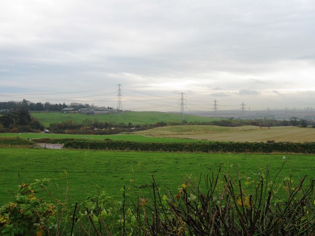
Midlothian Snowsports Centre Looking up the slopes and tows towards Caerketton Hill. Reportedly the longest artificial ski slope in Europe. <span class="nowrap"><a title="http://en.wikipedia.org/wiki/Midlothian_Snowsports_Centre" rel="nofollow ugc noopener" href="http://en.wikipedia.org/wiki/Midlothian_Snowsports_Centre">Link</a><img style="margin-left:2px;" alt="External link" title="External link - shift click to open in new window" src="https://s1.geograph.org.uk/img/external.png" width="10" height="10"/></span>
Midlothian Snowsports Centre
Looking up the slopes and tows towards Caerketton Hill. Reportedly the longest artificial ski slope in Europe. LinkExternal link
Welcome to Midlothian Snowsport Centre Looking up the slopes and tows from near the entrance to the cafe and centre buildings at the end of the main run.
Welcome to Midlothian Snowsport Centre
Looking up the slopes and tows from near the entrance to the cafe and centre buildings at the end of the main run.
Multiple Mobile Masts And other electrical support structures - at least 5 pylons are visible, as well as poles carrying lower tension cables. Looking towards the Lothianburn junction of the A720 [Edinburgh City Bypass] and A702 [Biggar Road] at Fairmilehead.
Multiple Mobile Masts
And other electrical support structures - at least 5 pylons are visible, as well as poles carrying lower tension cables. Looking towards the Lothianburn junction of the A720 [Edinburgh City Bypass] and A702 [Biggar Road] at Fairmilehead.
Lothianburn Golf Club house Looking east from the path from Swanston to Goldburn near Hillend.
Lothianburn Golf Club house
Looking east from the path from Swanston to Goldburn near Hillend.
Petrol Station Lothianburn
Hillend Ski Centre The artificial ski slopes at Caerketton Hill.
Hillend Ski Centre
The artificial ski slopes at Caerketton Hill.
Entrance and Car Park IKEA
Straiton Retail Park Although the map and some signs name this facility as the Peel Pentland Centre, it's popularly known as the Straiton Retail Park, confirmed in this photo.
Straiton Retail Park
Although the map and some signs name this facility as the Peel Pentland Centre, it's popularly known as the Straiton Retail Park, confirmed in this photo.
The A701 at Straiton Viewed from the pedestrian access to the new retail park, with the original roadside buildings in the background.
The A701 at Straiton
Viewed from the pedestrian access to the new retail park, with the original roadside buildings in the background.
Pedestrian Access to Straiton Retail Park Although these out-of-town shopping centres are heavily focused on private car access, they also cater for pedestrians arriving by bus.
Pedestrian Access to Straiton Retail Park
Although these out-of-town shopping centres are heavily focused on private car access, they also cater for pedestrians arriving by bus.
Fields east of the A702
The Burdiehouse Burn The spot where the burn runs under the Old Burdiehouse Road in the middle of the old village of Burdiehouse. The name is believed to be a corruption of Bordeaux House from the time when French ladies-in-waiting to Mary, Queen of Scots lived in the village while she resided at Craigmillar Castle in 1561.
The Burdiehouse Burn
The spot where the burn runs under the Old Burdiehouse Road in the middle of the old village of Burdiehouse. The name is believed to be a corruption of Bordeaux House from the time when French ladies-in-waiting to Mary, Queen of Scots lived in the village while she resided at Craigmillar Castle in 1561.
Sainsbury's at Straiton retail park One of several large stores in the area, including IKEA and a recently-opened Asda.
Sainsbury's at Straiton retail park
One of several large stores in the area, including IKEA and a recently-opened Asda.
Car park, Straiton retail park Part of the retail park on the S side of Edinburgh close to the City By-Pass.
Car park, Straiton retail park
Part of the retail park on the S side of Edinburgh close to the City By-Pass.
Retail perspective, Straiton The units at the far end of this block are being modernised.
Retail perspective, Straiton
The units at the far end of this block are being modernised.
Track to the Local Nature Reserve, Straiton Straiton Pond is a Local Nature Reserve on reclaimed industrial land next to the busy A720 Edinburgh City By-Pass. Here is one access point opposite McDonald's on the edge of the retail park.
Track to the Local Nature Reserve, Straiton
Straiton Pond is a Local Nature Reserve on reclaimed industrial land next to the busy A720 Edinburgh City By-Pass. Here is one access point opposite McDonald's on the edge of the retail park.
Rooks in flight above a grain store A noisy flock of rooks in the farmland near Loanhead with the grain silos at Edgefield beyond; an interesting contrast to the traffic around Straiton retail park just to the west.
Rooks in flight above a grain store
A noisy flock of rooks in the farmland near Loanhead with the grain silos at Edgefield beyond; an interesting contrast to the traffic around Straiton retail park just to the west.
Supermarket, Straiton Next to the Straiton retail park, but not easily accessible from the other sheds on foot.
Supermarket, Straiton
Next to the Straiton retail park, but not easily accessible from the other sheds on foot.
Show me another place!

Cameron Wood is located at Grid Ref: NT2665 (Lat: 55.881248, Lng: -3.1821684)

Unitary Authority: Midlothian

Police Authority: The Lothians and Scottish Borders

What 3 Words

///scout.glass.apples. Near Loanhead, Midlothian

Nearby Locations

Cameron Wood

Related Wikis

Old Pentland Cemetery

Old Pentland Cemetery is a cemetery in Old Pentland, near Loanhead in Midlothian, Scotland. A category B listed building, the cemetery dates back to the...

Hillend, Edinburgh

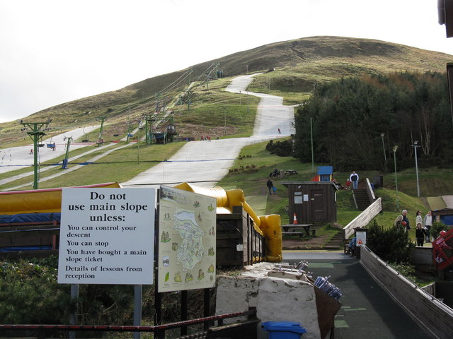
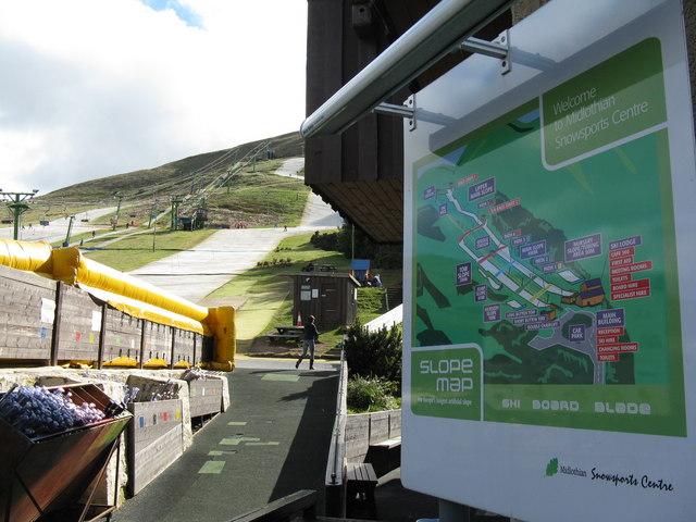
Hillend is a small hamlet in Midlothian, just outside the Scottish capital Edinburgh, best known for the Midlothian Snowsports Centre (formerly the Hillend...

Bilston, Midlothian

Bilston is a small village in Midlothian, Scotland. It is located on the edge of Edinburgh, just south of Loanhead on the A701. The Bilston Burn Site of...

Stewart Brewing

Stewart Brewing is an independent craft brewery based on the outskirts of Edinburgh in Loanhead, Midlothian, Scotland. It was established in 2004 by Steve...

Nearby Amenities

Located within 500m of 55.881248,-3.1821684
OLDPENTLAND5
Disused Man Made: petroleum_well
Ref GB Decc: LH/05-20
Source: DECC
Lat/Long: 55.8845556/-3.1779167
OLDPENTLAND4
Disused Man Made: petroleum_well
Ref GB Decc: LH/05-19
Source: DECC
Lat/Long: 55.8846111/-3.1791389
OLDPENTLAND8
Disused Man Made: petroleum_well
Ref GB Decc: LH/05-23
Source: DECC
Lat/Long: 55.8834722/-3.1789444
OLDPENTLAND6
Disused Man Made: petroleum_well
Ref GB Decc: LH/05-21
Source: DECC
Lat/Long: 55.8820556/-3.1786389
Disused Amenity: post_box
Note: Aperture blocked. Probably due to mud spray from road.
Lat/Long: 55.8826646/-3.1772911
Power: pole
Lat/Long: 55.877147/-3.1795869
Power: pole
Lat/Long: 55.8774375/-3.182365
Power: pole
Lat/Long: 55.8776697/-3.1829908
Power: pole
Lat/Long: 55.8776796/-3.1791402
Power: pole
Lat/Long: 55.8779236/-3.1800936
Power: pole
Lat/Long: 55.8780679/-3.1840608
Power: pole
Lat/Long: 55.8782574/-3.1797049
Power: pole
Lat/Long: 55.8783201/-3.1847687
Power: pole
Lat/Long: 55.8787278/-3.1806399
Power: pole
Lat/Long: 55.8788496/-3.1802697
Power: pole
Lat/Long: 55.8794573/-3.1811239
Power: pole
Lat/Long: 55.8794634/-3.1808794
Power: pole
Lat/Long: 55.8801773/-3.1810726
Power: pole
Lat/Long: 55.8802499/-3.1807606
Power: pole
Lat/Long: 55.8808901/-3.1810277
Power: pole
Lat/Long: 55.8810455/-3.1806259
Power: pole
Lat/Long: 55.8816028/-3.1810084
Power: pole
Lat/Long: 55.8817186/-3.1805103
Power: pole
Lat/Long: 55.8823408/-3.1809442
Power: pole
Lat/Long: 55.882399/-3.1804205
Power: pole
Lat/Long: 55.8830751/-3.1810854
Power: pole
Lat/Long: 55.8832222/-3.1802557
Power: pole
Lat/Long: 55.8837824/-3.1811945
Power: pole
Lat/Long: 55.8839831/-3.1801302
Power: pole
Lat/Long: 55.8842971/-3.1812683
Power: pole
Lat/Long: 55.8846739/-3.1800226
Power: pole
Lat/Long: 55.885287/-3.1814352
Old Pentland
Place: hamlet
Lat/Long: 55.8833937/-3.178555
Power: pole
Lat/Long: 55.8853752/-3.1798964
Cafe
Secret Herb Garden
Indoor Seating: yes
Outdoor Seating: no
Lat/Long: 55.884777/-3.1835331
Bench
Lat/Long: 55.885455/-3.1845967
Entrance: main
Lat/Long: 55.8845875/-3.1833851
Entrance: yes
Lat/Long: 55.8847378/-3.1833602
Entrance: yes
Lat/Long: 55.884798/-3.1834748
Power: pole
Lat/Long: 55.884353/-3.1864985
Power: pole
Lat/Long: 55.8850589/-3.1829229
The data included in this document is from www.openstreetmap.org. The data is made available under ODbL.

Have you been to Cameron Wood?

Leave your review of Cameron Wood below (or comments, questions and feedback).