Lady Blair Plantation

Wood, Forest in Peeblesshire

Scotland

Lady Blair Plantation

Replanting felled area, Bonnington Woodland here was felled last year and now replanting is taking place - compare with <a href="https://www.geograph.org.uk/photo/7529238">NT2539 : Felled plantation near The Cut, Peebles</a>.
Replanting felled area, Bonnington Credit: Jim Barton

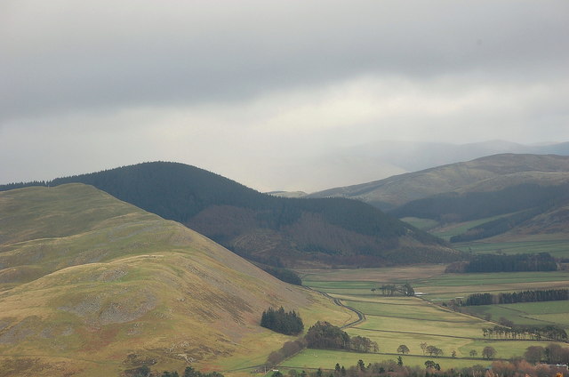
Lady Blair Plantation is a picturesque woodland area located in Peeblesshire, Scotland. Spanning over several acres, this enchanting forest is a haven for nature lovers and outdoor enthusiasts alike. The plantation is situated near the village of Innerleithen and is easily accessible by road.

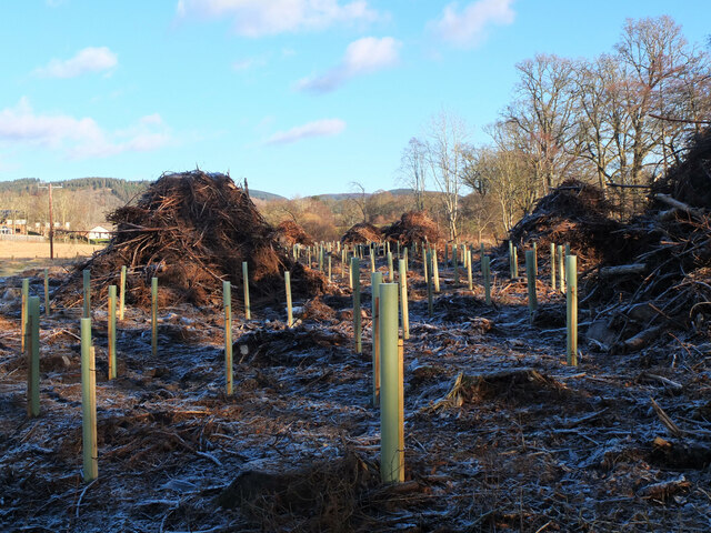
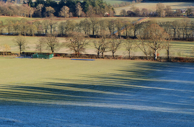
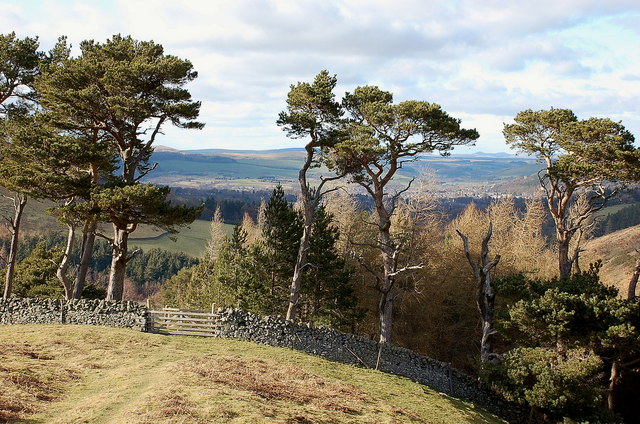
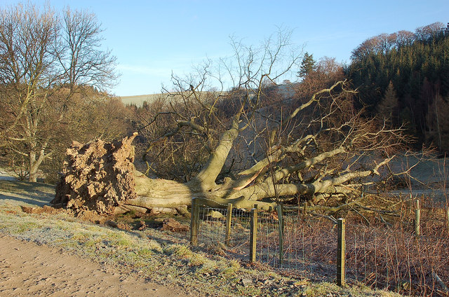
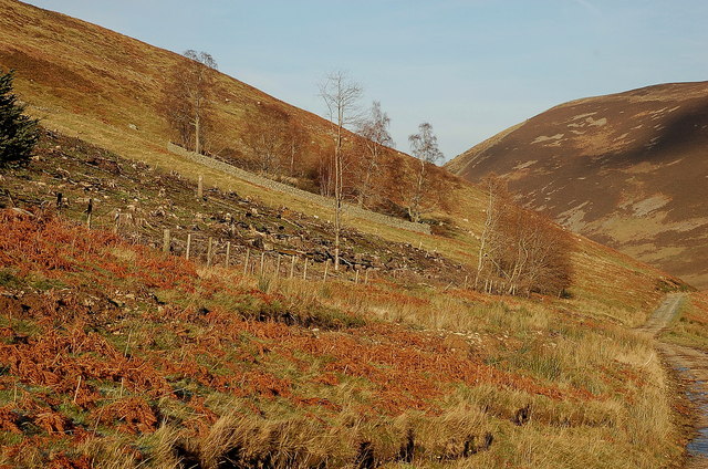
The woodland is predominantly composed of mature Scots pine trees, with a diverse understory of native flora. The tall, majestic pines create a tranquil atmosphere, providing a sense of serenity and solitude. Walking through the plantation, visitors can enjoy the soothing sounds of birdsong and the rustling of leaves underfoot.

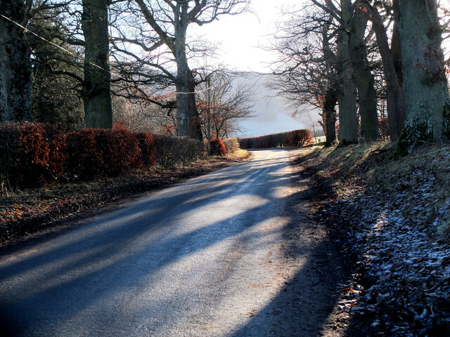
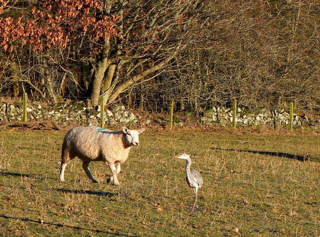
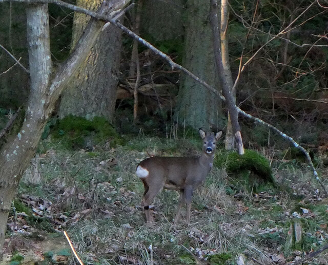
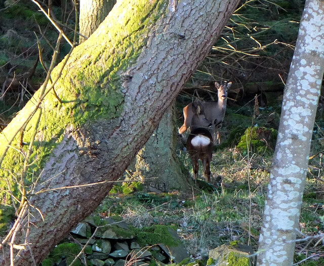
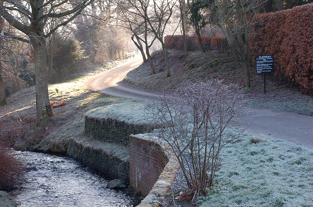
Lady Blair Plantation offers a network of well-maintained walking trails, allowing visitors to explore the area at their own pace. These paths wind their way through the forest, offering glimpses of stunning views and captivating landscapes. The plantation is also home to a variety of wildlife, including red squirrels, roe deer, and a wide range of bird species, making it a haven for wildlife enthusiasts and photographers.

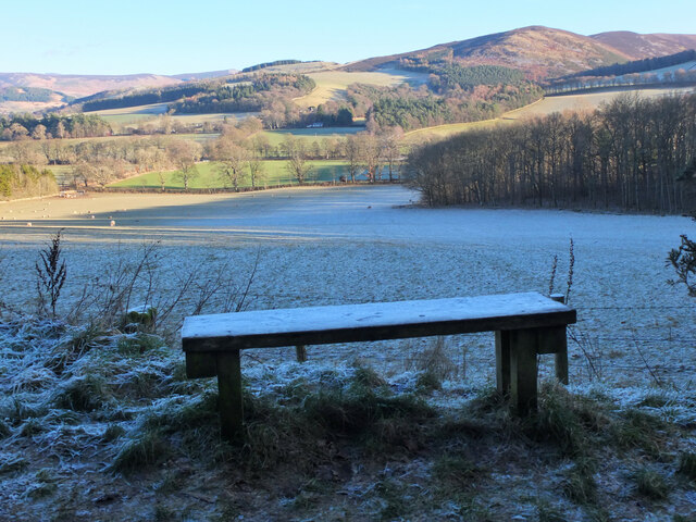
Additionally, the plantation offers picnic areas and benches, providing the perfect opportunity to sit back, relax, and immerse oneself in the natural beauty of the surroundings. The plantation is open to the public year-round, with no admission fee.

Lady Blair Plantation is not only a place of natural beauty but also holds historical significance. It was once part of the estate of Lady Blair, a prominent figure in the area during the 19th century. The plantation has been carefully preserved, ensuring that future generations can continue to enjoy its natural splendor.

If you have any feedback on the listing, please let us know in the comments section below.

Lady Blair Plantation Images

Images are sourced within 2km of 55.621595/-3.1813743 or Grid Reference NT2537. Thanks to Geograph Open Source API. All images are credited.

Replanting felled area, Bonnington Woodland here was felled last year and now replanting is taking place - compare with <a href="https://www.geograph.org.uk/photo/7529238">NT2539 : Felled plantation near The Cut, Peebles</a>.
Replanting felled area, Bonnington
Woodland here was felled last year and now replanting is taking place - compare with NT2539 : Felled plantation near The Cut, Peebles.
Tree shadows, Bonnington On the minor road around Cademuir to the Manor Valley.
Tree shadows, Bonnington
On the minor road around Cademuir to the Manor Valley.
Frosty viewpoint to Haystoun A bench on the track near Cademuir Forest car park in cold settled weather.
Frosty viewpoint to Haystoun
A bench on the track near Cademuir Forest car park in cold settled weather.
The sheep and the heron An inquisitive ewe taking a look at a heron in a pasture near Bonnington farm.
The sheep and the heron
An inquisitive ewe taking a look at a heron in a pasture near Bonnington farm.
Spiky tree shadows, Bonnington Long shadows from a strip of woodland bordering a field by the road between Peebles and Kirkton Manor.
Spiky tree shadows, Bonnington
Long shadows from a strip of woodland bordering a field by the road between Peebles and Kirkton Manor.
Roe deer, Cademuir Forest A roe deer not far from the track contouring the east edge of the woodland.
Roe deer, Cademuir Forest
A roe deer not far from the track contouring the east edge of the woodland.
Two roe deer, Cademuir Forest I spotted one deer by the track here <a href="https://www.geograph.org.uk/photo/7692276">NT2438 : Roe deer, Cademuir Forest</a>, then saw a second animal. They stayed long enough for a quick portrait.
Two roe deer, Cademuir Forest
I spotted one deer by the track here NT2438 : Roe deer, Cademuir Forest, then saw a second animal. They stayed long enough for a quick portrait.
Pine trees above Upper Newby Some eye-catching pines at the edge of a small plantation on the steep end of the ridge descending from Hundleshope Heights.
Pine trees above Upper Newby
Some eye-catching pines at the edge of a small plantation on the steep end of the ridge descending from Hundleshope Heights.
Cademuir from Whitelaw Hill A long-distance view from the ridge above the Manor Valley at Whitelaw Hill. The dry valley in view here on the S and E side of Cademuir, now farmland, is thought to have been the course of the Tweed in pre-glacial times, before the river became diverted through Neidpath gorge.
Cademuir from Whitelaw Hill
A long-distance view from the ridge above the Manor Valley at Whitelaw Hill. The dry valley in view here on the S and E side of Cademuir, now farmland, is thought to have been the course of the Tweed in pre-glacial times, before the river became diverted through Neidpath gorge.
Sunshine around the corner, Haystoun A frosty January morning in Haystoun Estate on the road to Glen Sax. For a closeup of the sign, please see <a href="https://www.geograph.org.uk/photo/2187833">NT2538 : Sign in Haystoun Estate</a>.
Sunshine around the corner, Haystoun
A frosty January morning in Haystoun Estate on the road to Glen Sax. For a closeup of the sign, please see NT2538 : Sign in Haystoun Estate.
Fallen tree, Newby Brought down in the gales either December last year or on 3rd January.
Fallen tree, Newby
Brought down in the gales either December last year or on 3rd January.
Corner of a felled plantation, Glen Sax The trees were harvested in September 2010, as shown in <a href="https://www.geograph.org.uk/photo/2062106">NT2736 : Cutting down a plantation in Glen Sax</a>. Beyond is a small walled plantation of deciduous trees.
Corner of a felled plantation, Glen Sax
The trees were harvested in September 2010, as shown in NT2736 : Cutting down a plantation in Glen Sax. Beyond is a small walled plantation of deciduous trees.
Information board, Cademuir Forest car park An information board that was put up a few months ago, though perhaps 'Infinite Adventure' is slightly overstating the attractions of forest walks in Tweeddale. An ominous detail in the map L of centre is the appearance of small '£' signs on the car park symbols.
Information board, Cademuir Forest car park
An information board that was put up a few months ago, though perhaps 'Infinite Adventure' is slightly overstating the attractions of forest walks in Tweeddale. An ominous detail in the map L of centre is the appearance of small '£' signs on the car park symbols.
Kailzie Hill Heather covered ridge with the famous drove road cutting across the face of the hill.
Kailzie Hill
Heather covered ridge with the famous drove road cutting across the face of the hill.
Road to Haystoun The road to Haystoun and Glensax runs between Hogbridge (left) and Crooknow Plantations.
Road to Haystoun
The road to Haystoun and Glensax runs between Hogbridge (left) and Crooknow Plantations.
Hog Bridge Road to Haystoun.
Hog Bridge
Road to Haystoun.
Loch at Haystoun The Haystoun burn has been dammed to make a "garden pond". There are a pair of swans on the island.
Loch at Haystoun
The Haystoun burn has been dammed to make a "garden pond". There are a pair of swans on the island.
Road up Glen Sax The hedge on the left has been backed up with barbed wire to prevent unwelcome visitors eating the gardens of Haystoun House.  Slightly less agile herbivores inhabit the field (cattle).
Road up Glen Sax
The hedge on the left has been backed up with barbed wire to prevent unwelcome visitors eating the gardens of Haystoun House. Slightly less agile herbivores inhabit the field (cattle).
Show me another place!

Lady Blair Plantation is located at Grid Ref: NT2537 (Lat: 55.621595, Lng: -3.1813743)

Unitary Authority: The Scottish Borders

Police Authority: The Lothians and Scottish Borders

What 3 Words

///eventful.gravitate.sour. Near Peebles, Scottish Borders

Nearby Locations

Lady Blair Plantation

Related Wikis

John Buchan Way

The John Buchan Way is a walking route from Peebles to Broughton in the Scottish Borders, a distance of approximately 22 km (13 miles). The route is waymarked...

Peebles High School, Peeblesshire

Peebles High School is a state run comprehensive school for girls and boys aged 12–18 located in Peebles in the Scottish Borders. It was originally named...

Kailzie Gardens

Kailzie Gardens is a walled garden near Kirkburn in the Scottish Borders area of Scotland, in the Tweed valley, four km east of Peebles, off the B7062...

Whitestone Park

Whitestone Park is a sports ground in Peebles, Scottish Borders, Scotland, used for football and cricket. It has been the home ground of Peebles Rovers...

Have you been to Lady Blair Plantation?

Leave your review of Lady Blair Plantation below (or comments, questions and feedback).